Wandering Lindsays
Not all who wander are lost....but we probably are!
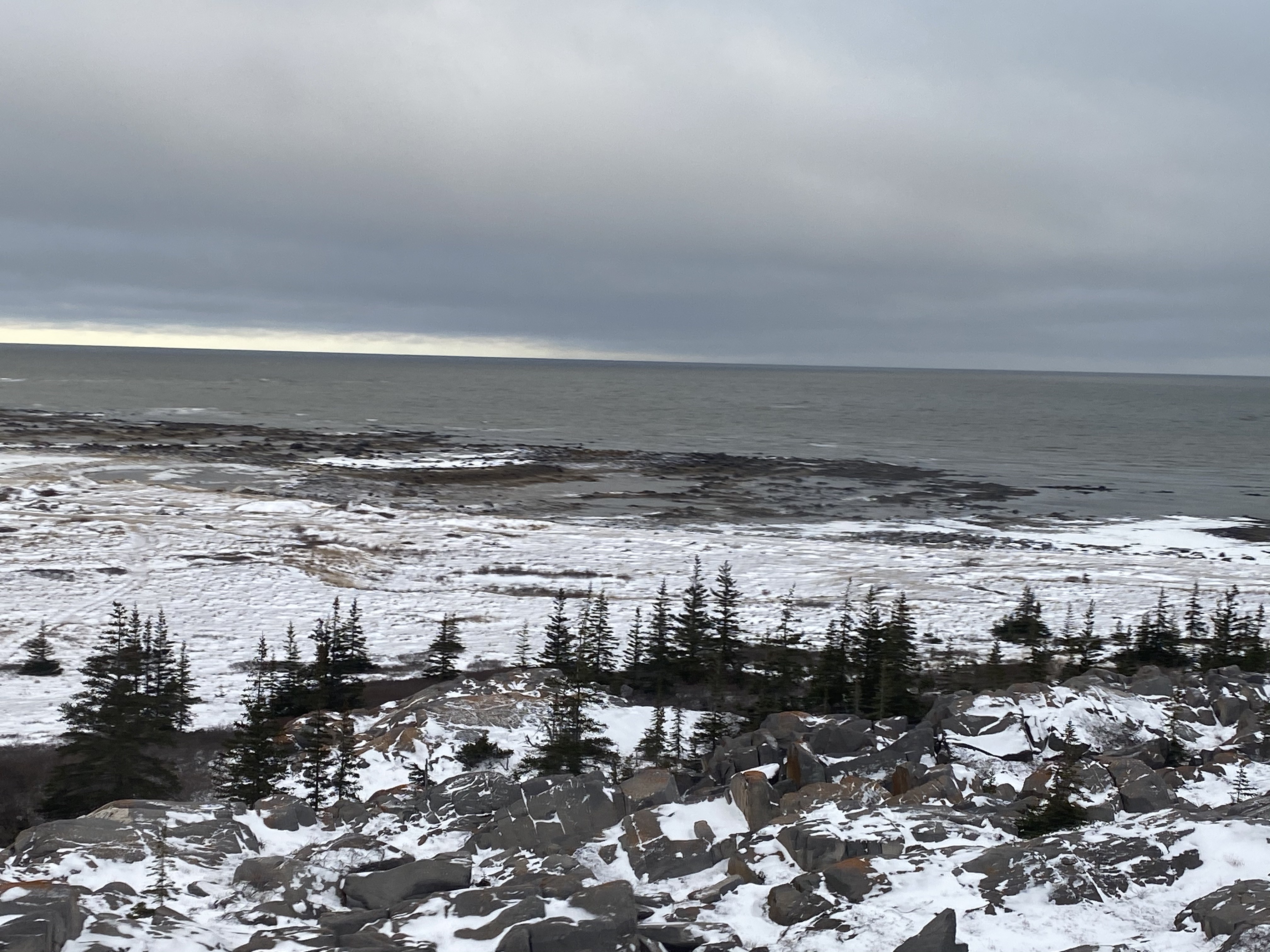
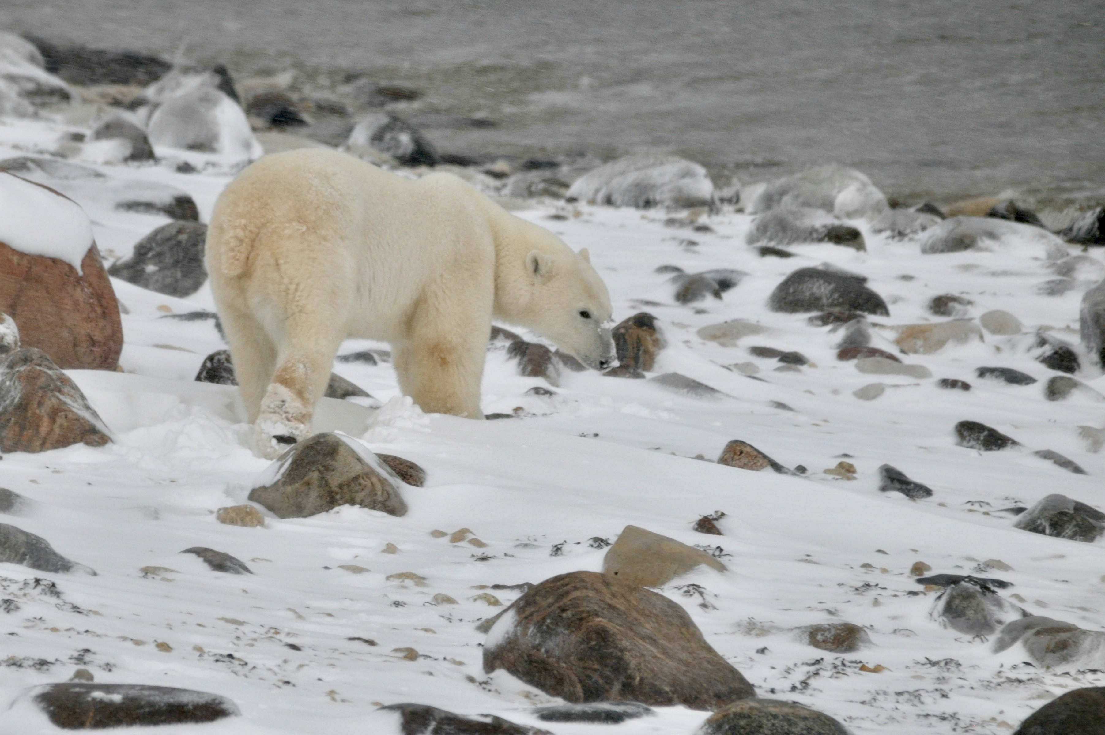
Churchill Manitoba is known as the polar bear capital of the world. In October and November, many bears congregate on the shores of Hudson Bay, waiting for the ice to form on the bay. Once it does, the bears make their way out to hunt for their favourite meal – seal! The seals are excellent swimmers – much better than the bears – but the bears are smarter. They park themselves at a seal’s breathing hole on the ice and wait for the unsuspecting seal to pop up for air. When it does, it is lights out for the seal!
By October, the bears on land have been going without food for the past few months, while the bay is ice free. They have been using up their massive stores of fat to keep themselves over the summer until they can hunt again. Understandably, they are pacing and waiting rather impatiently for the ice to form. Once they can access the seals, they will hunt, feast and start to replenish their fat stores, hopefully enough to keep them over next summer when the cycle starts all over again.
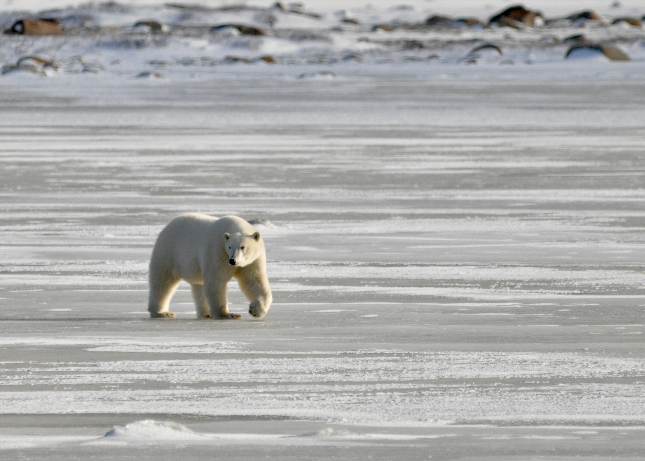
We had the opportunity to make a short trip to Churchill to do a little polar bear spotting ourselves! Frontiers North Adventures partnered with the Assiniboine Park Conservancy to charter small groups to Churchill. We boarded the plane from Winnipeg in the wee hours of the morning and flew to Churchill, where we hopped aboard an awaiting Tundra Buggy. These are pretty cool machines designed to drive over the tundra and provide a safe viewing platform from which to observe the bears.
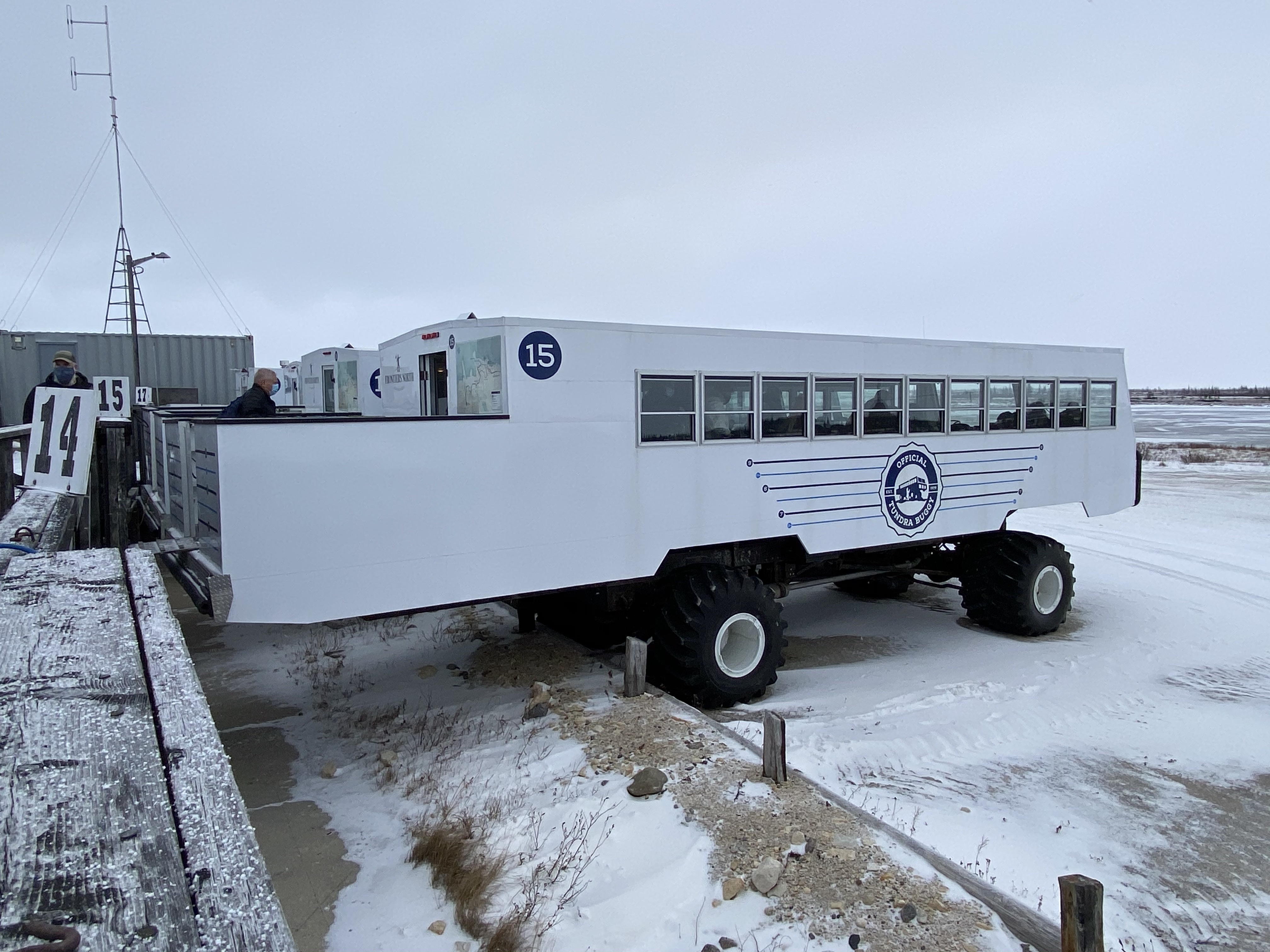
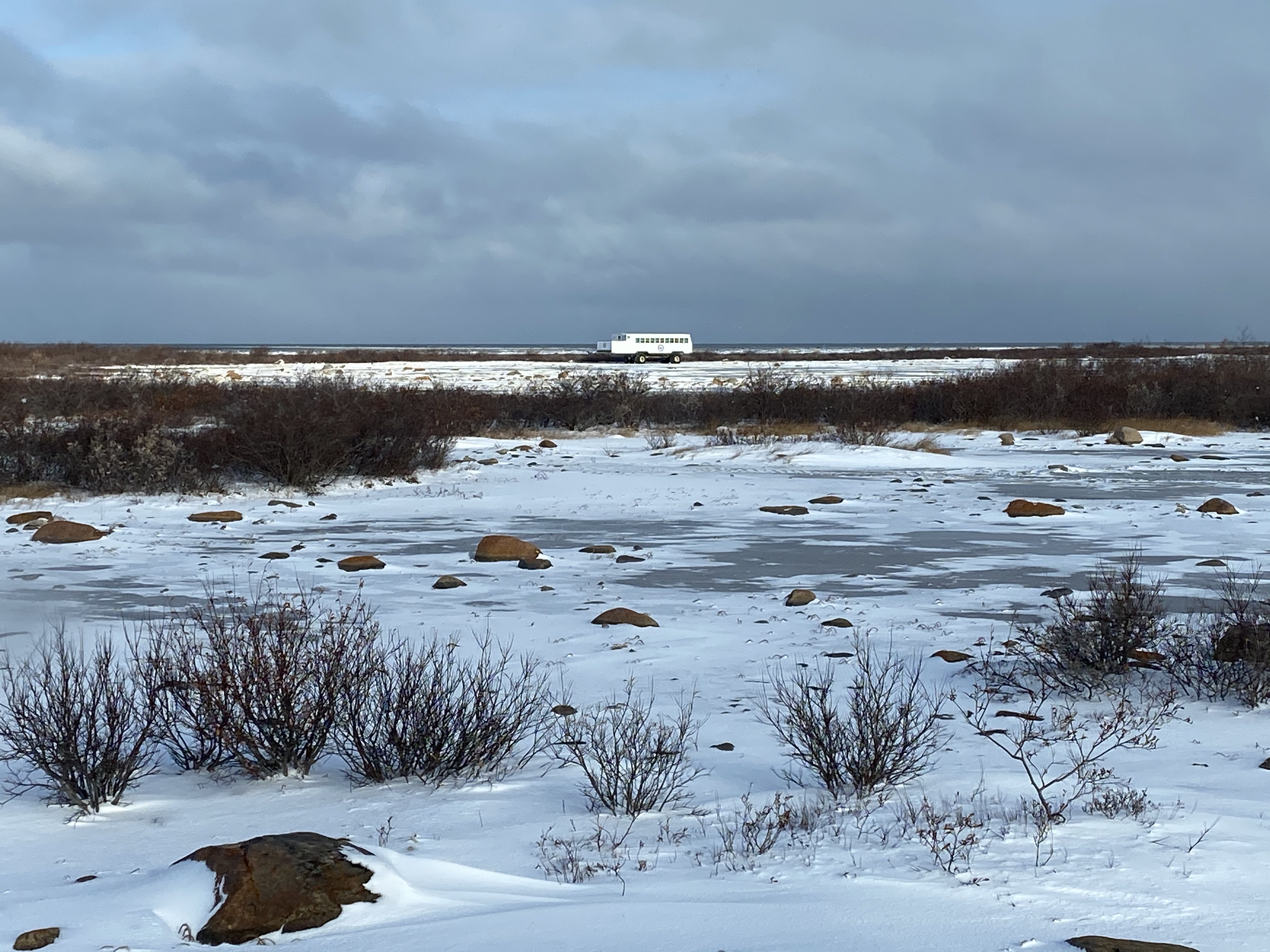
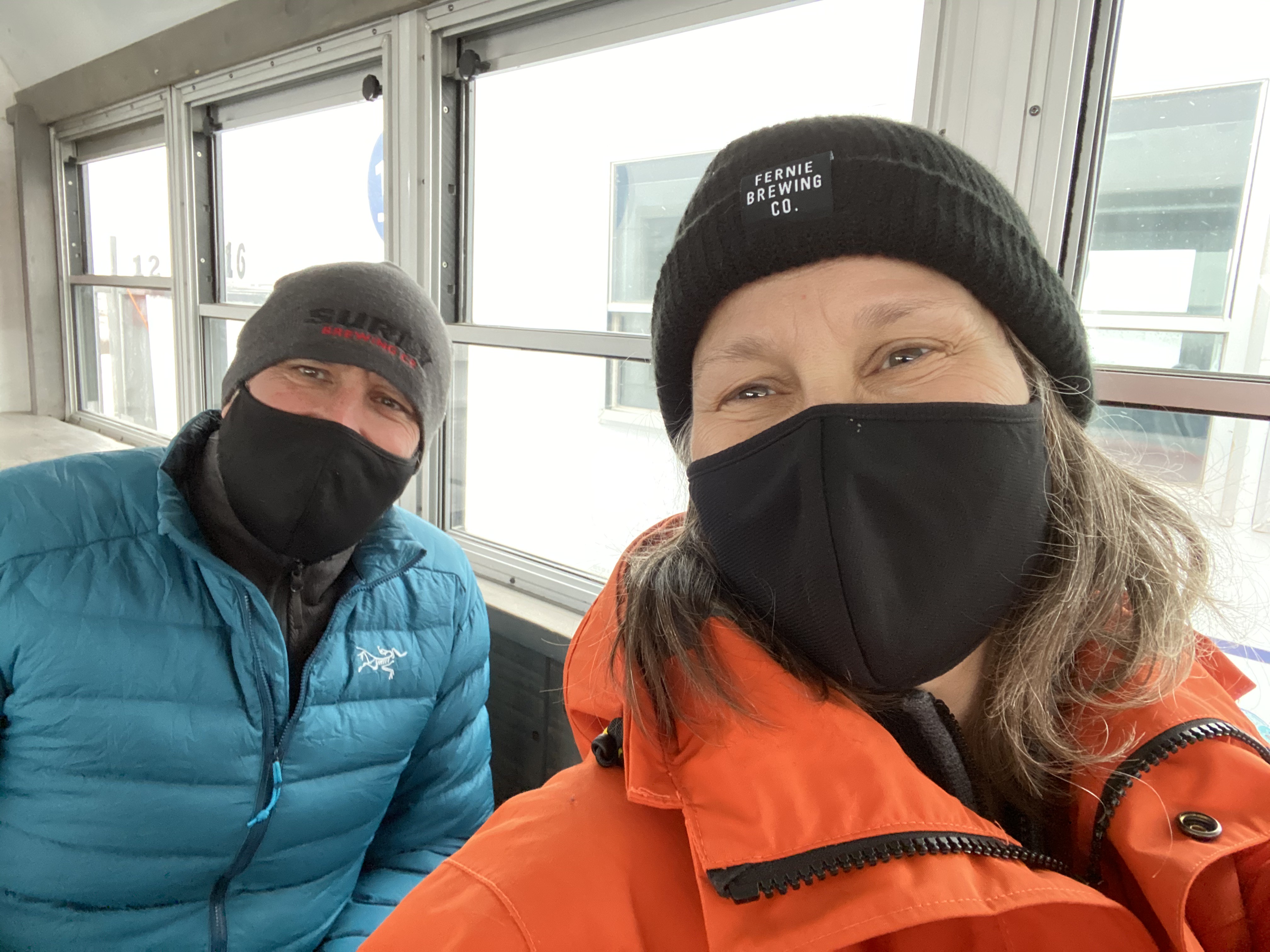
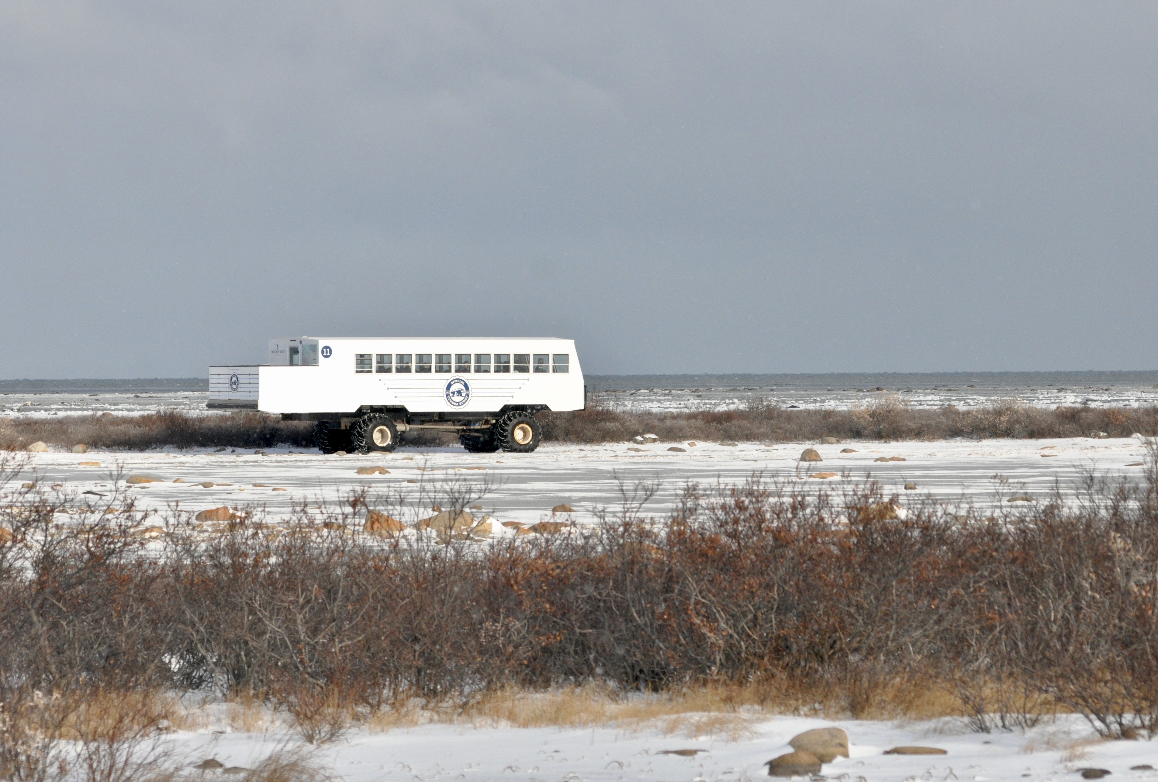
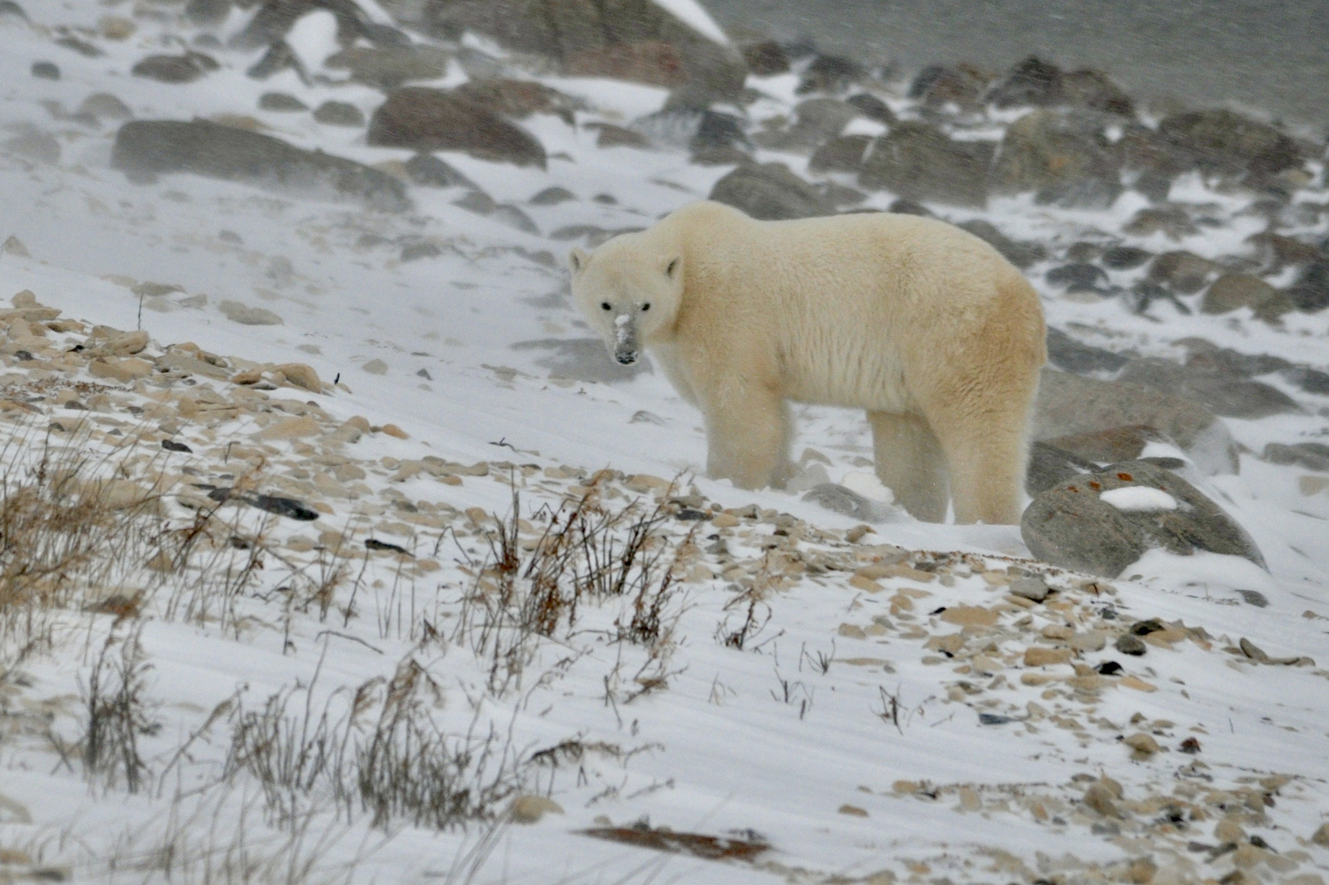
Tundra Buggy 15 was our home for the rest of the day. Hangry polar bears are dangerous creatures and they can easily camouflage themselves in the snow and hide behind the scrub willow so we were not allowed to get out of the buggy once underway. Fortunately the tundra buggies were warm and well-equipped so there was no need to leave.
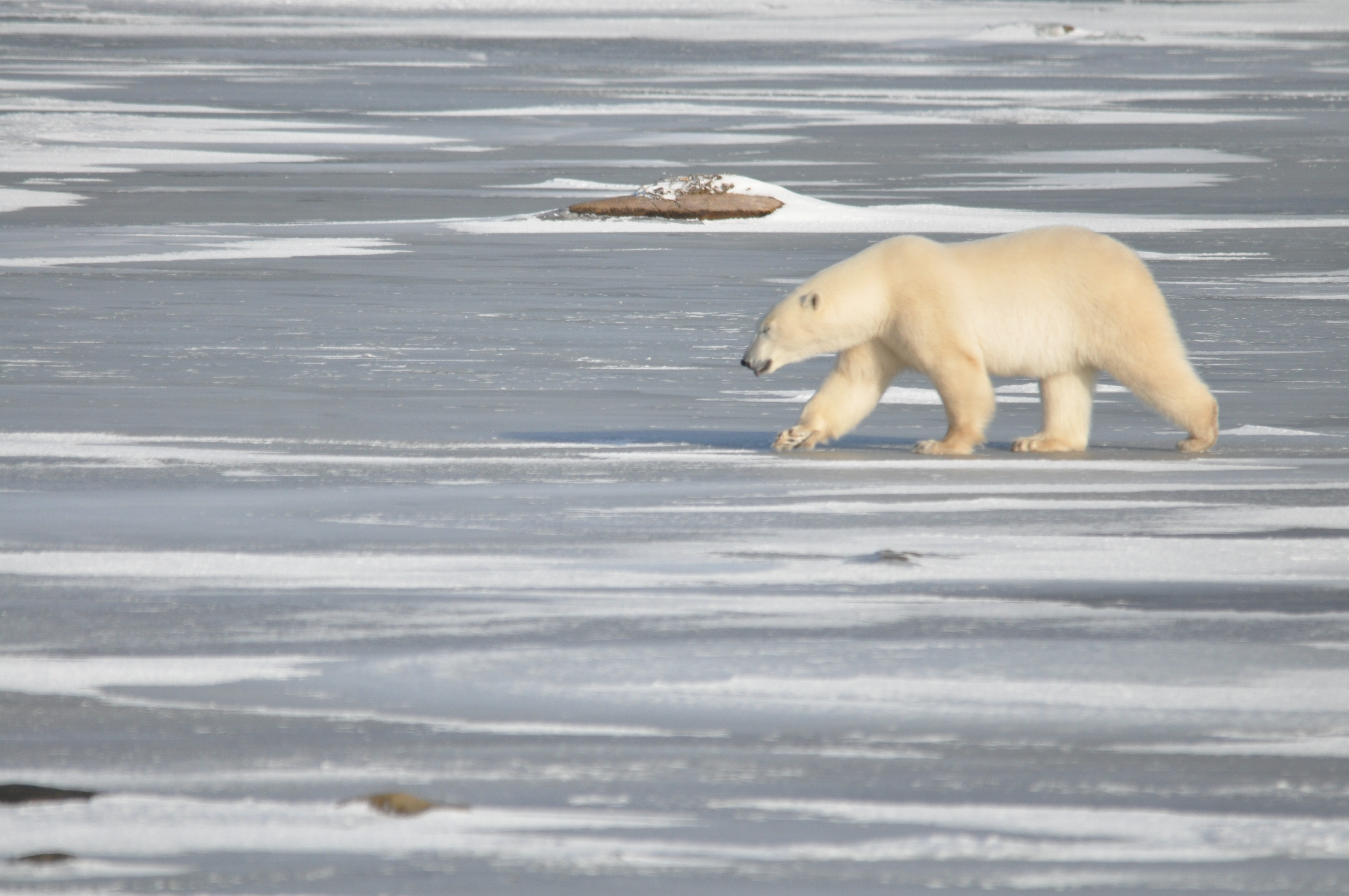
Our morning of bear spotting started out a bit slow, yielding a couple of sightings but the bears were quite far away and not very active. Just before lunch though, we were able park and watch a bear walk along side of the buggy on his slow meander across the tundra. It didn’t seem to care much if we were there or not…I guess as the apex predator, they have little to fear.
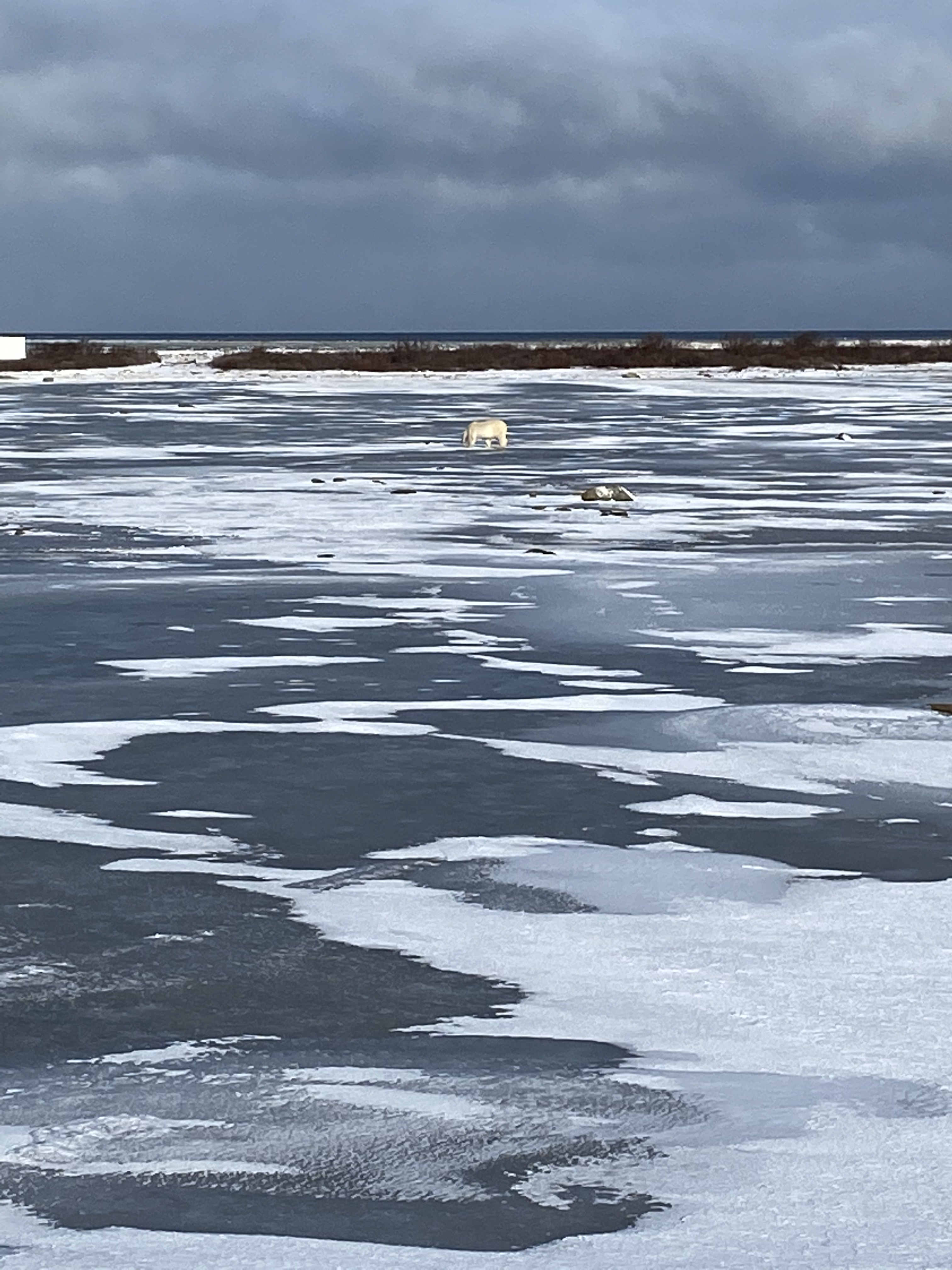

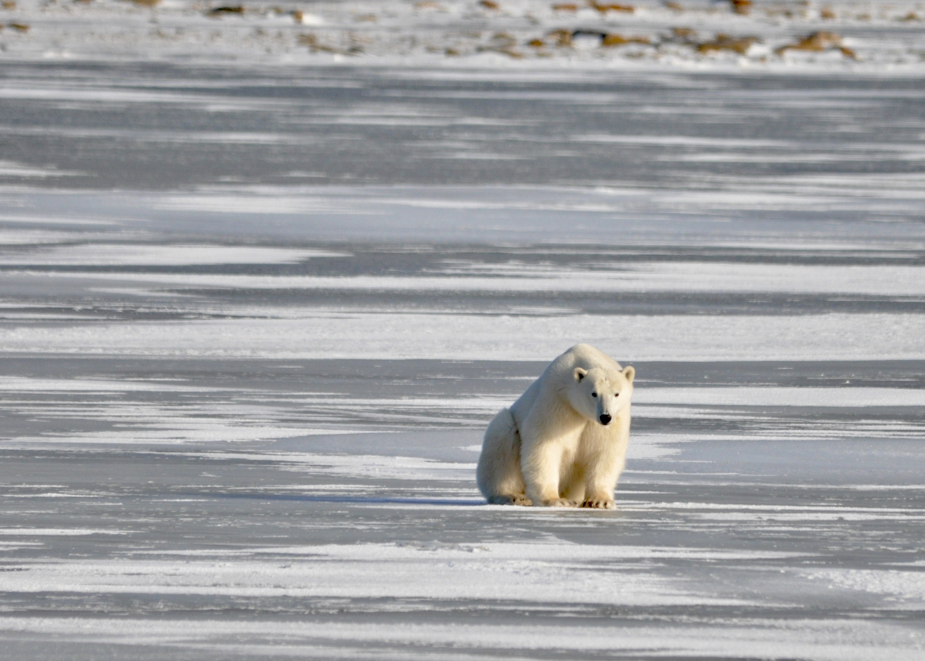
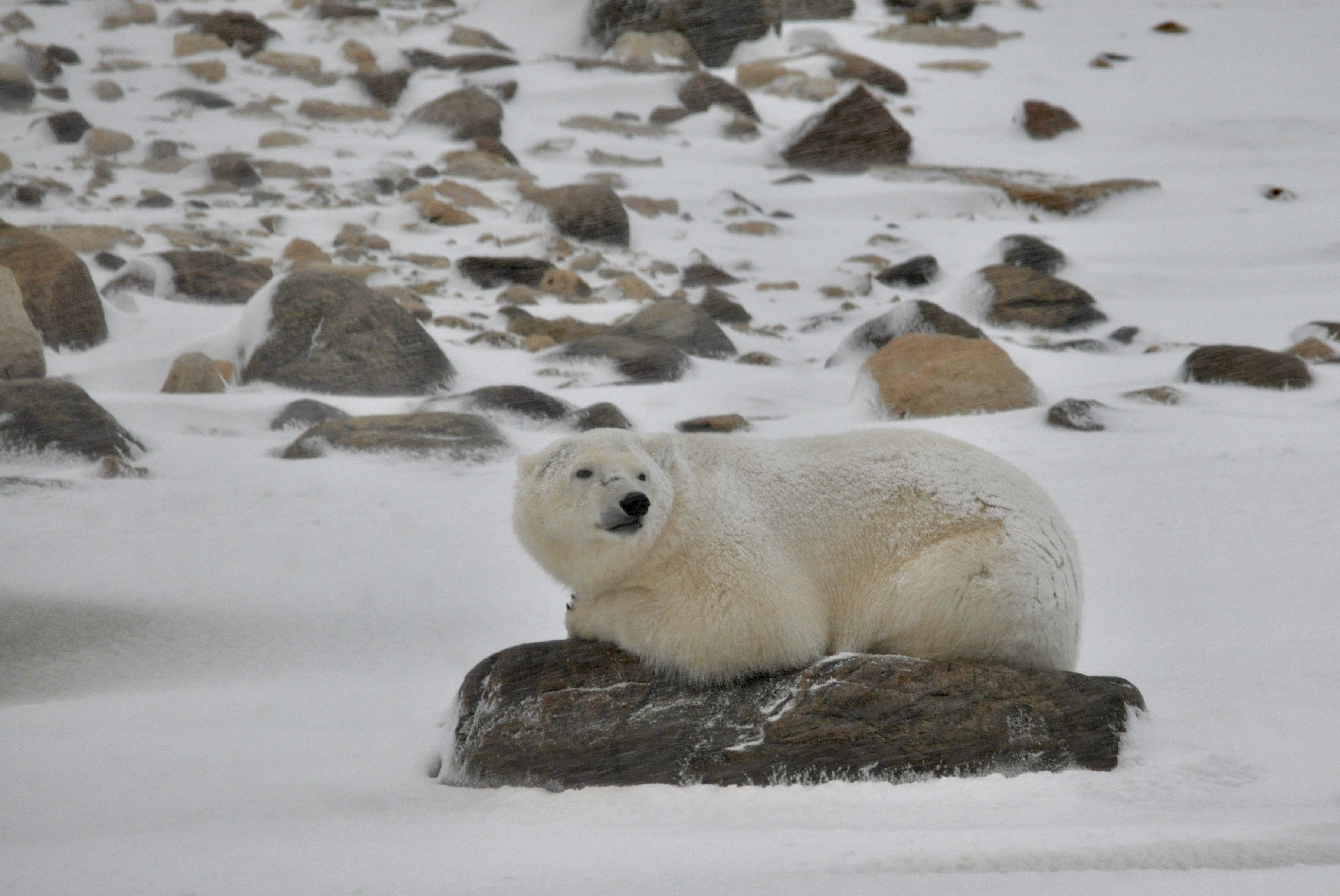
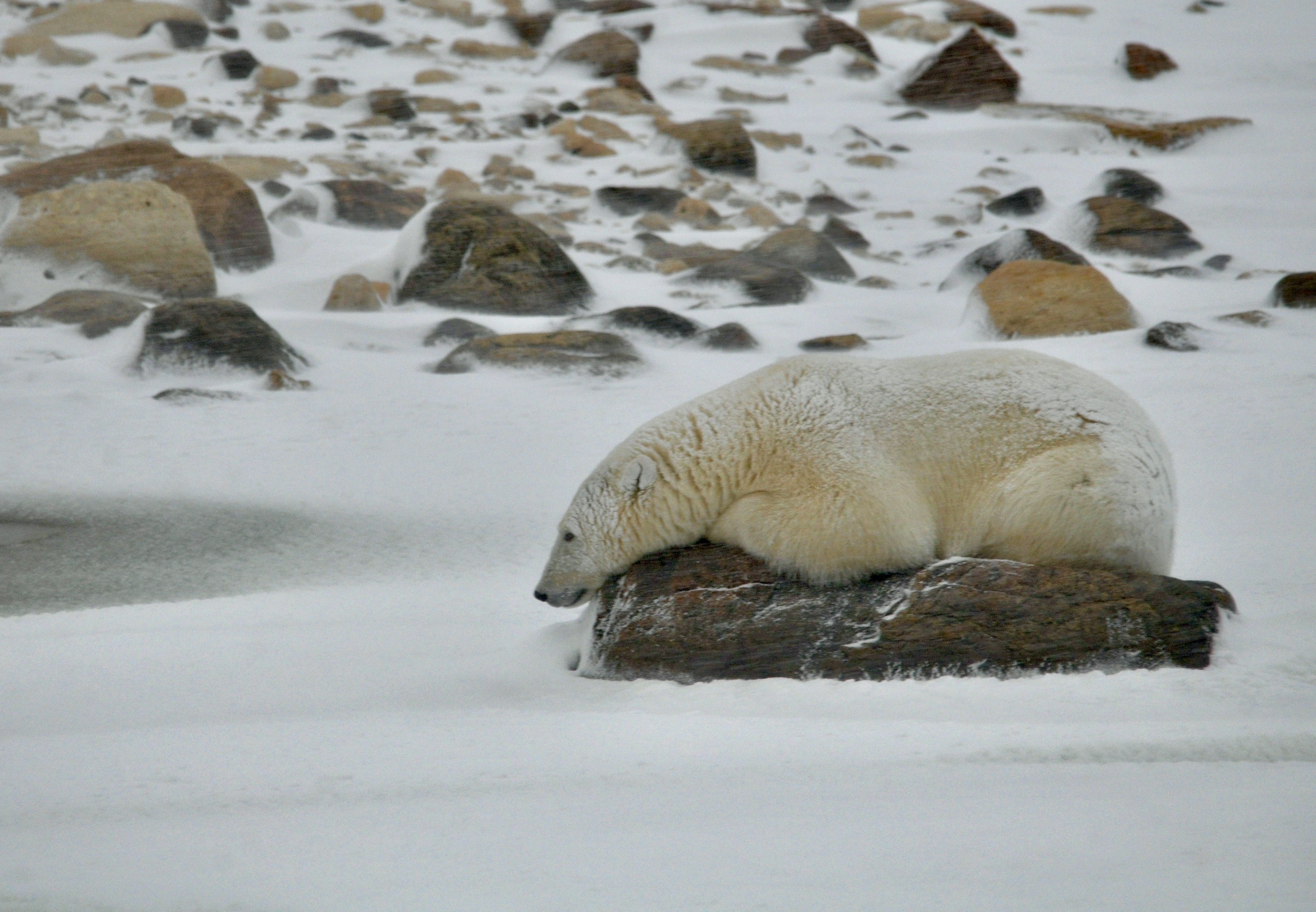
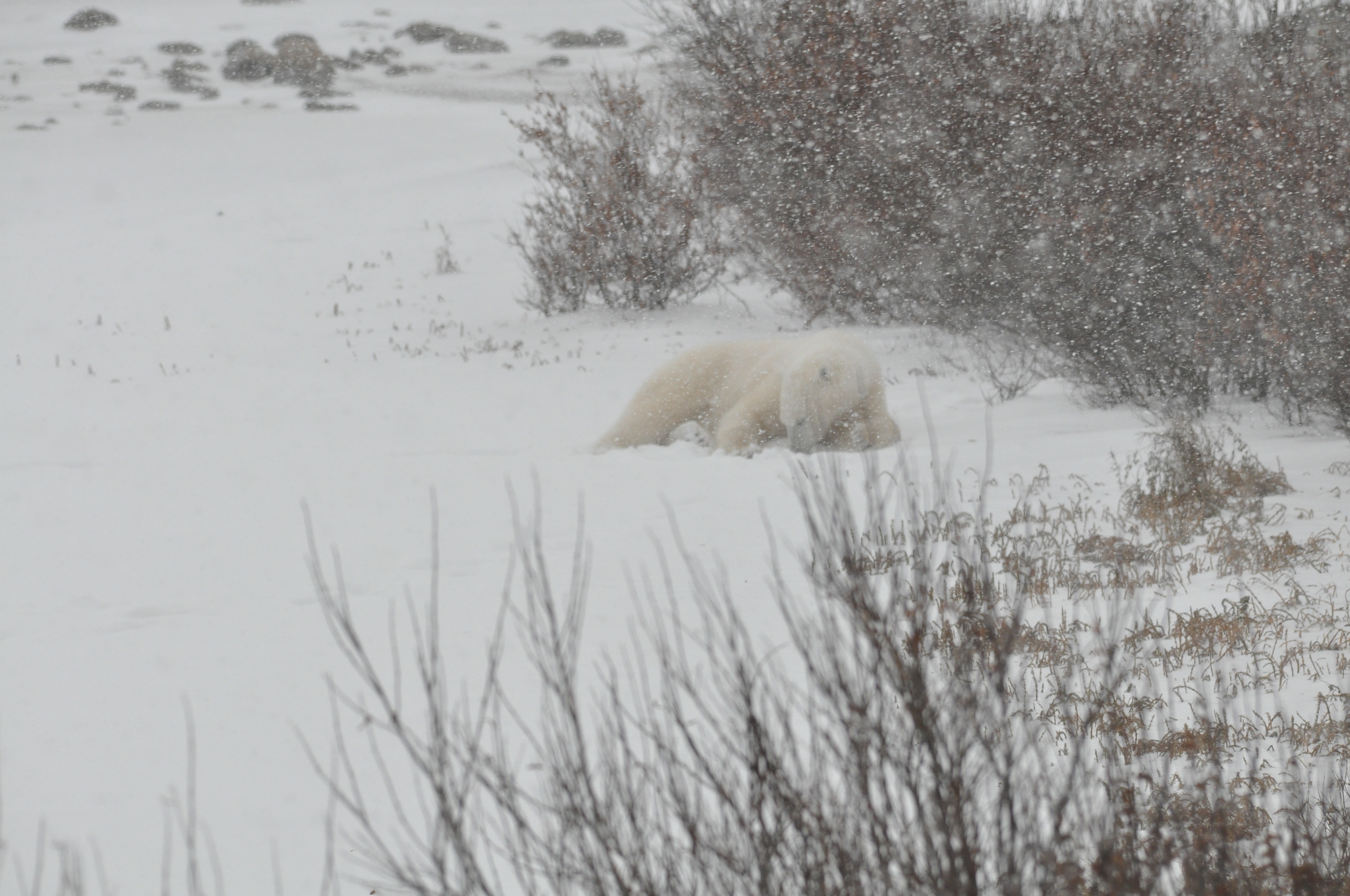
After lunch things started to heat up – at least for bear sightings! We saw another eight or so individuals, doing bear things like digging in the snow, walking on the tundra or taking a bear-nap on a rock. One of the scientists accompanying us from the Assiniboine Park Conservancy pulled out a thermal camera and aimed it at one bear who was napping on a rock. We expected to see lots of colour showing the heat coming off of the bear. Surprisingly though, we saw next to nothing on the image. The bears are so well adapted to living on the ice and their fur insulates them so well that they lose very little body heat to the environment. Mother nature truly is amazing!
Our day went almost perfectly. We had one minor glitch when we lost steering on our tundra buggy. Apparently bears have been known to snack on some of the hoses and lines on the under side of the buggies and it seems ours had been recently targeted! Fortunately the company mechanic was not far away to he and his companion buggied over to us and had it fixed in no time. In the meantime, we were entertained by a bear in the distance and the armed guard who was watching it to make sure it didn’t approach the buggy while the mechanic was doing his thing.
At sundown, we headed back to the airport for our flight to Winnipeg. It was a bit of a whirlwind trip but seeing the bears in their natural environment was amazing and so worth it!
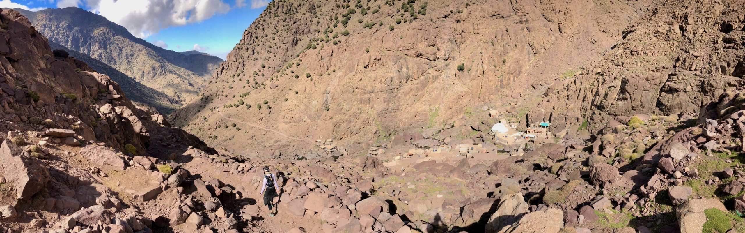
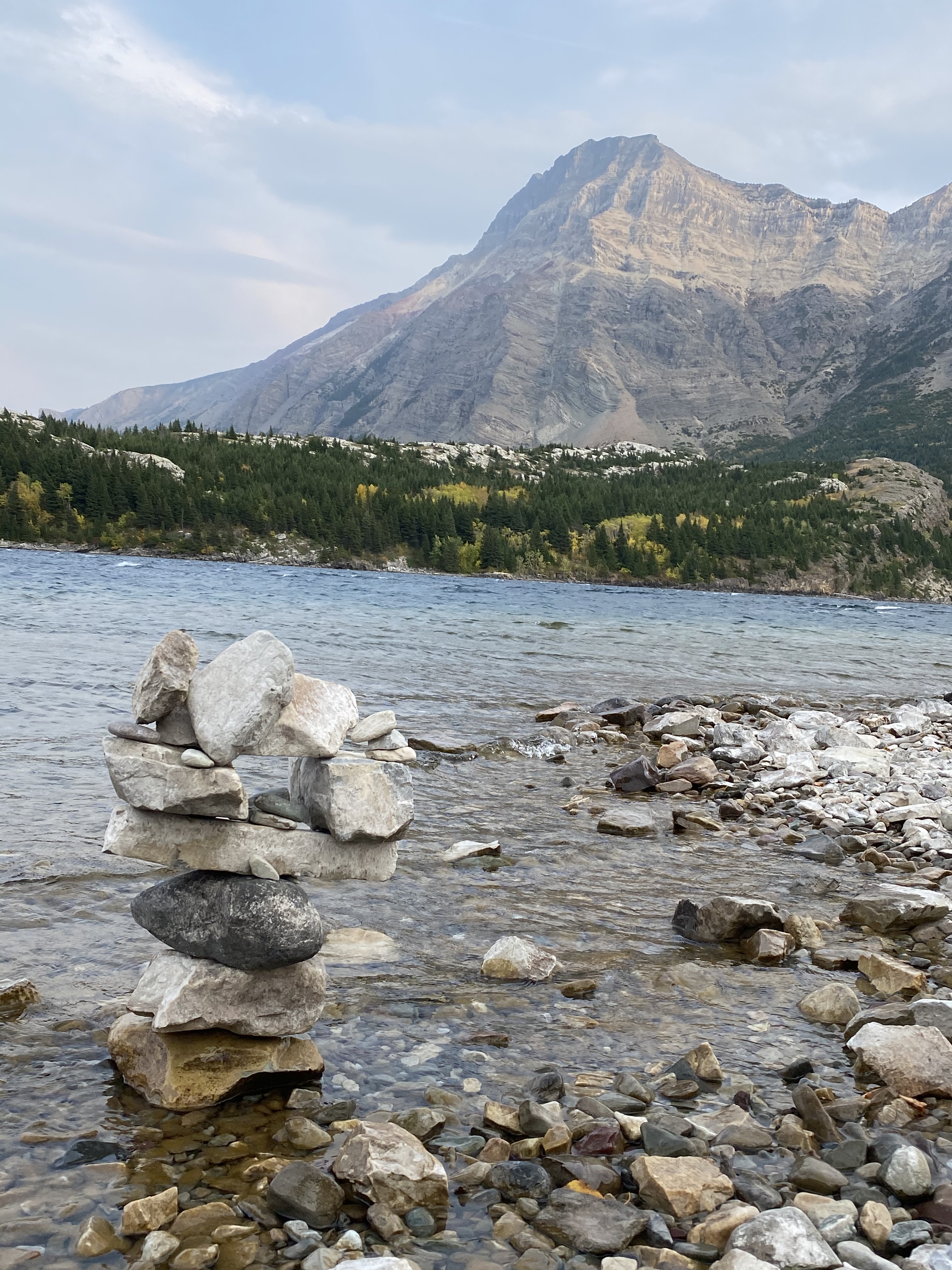
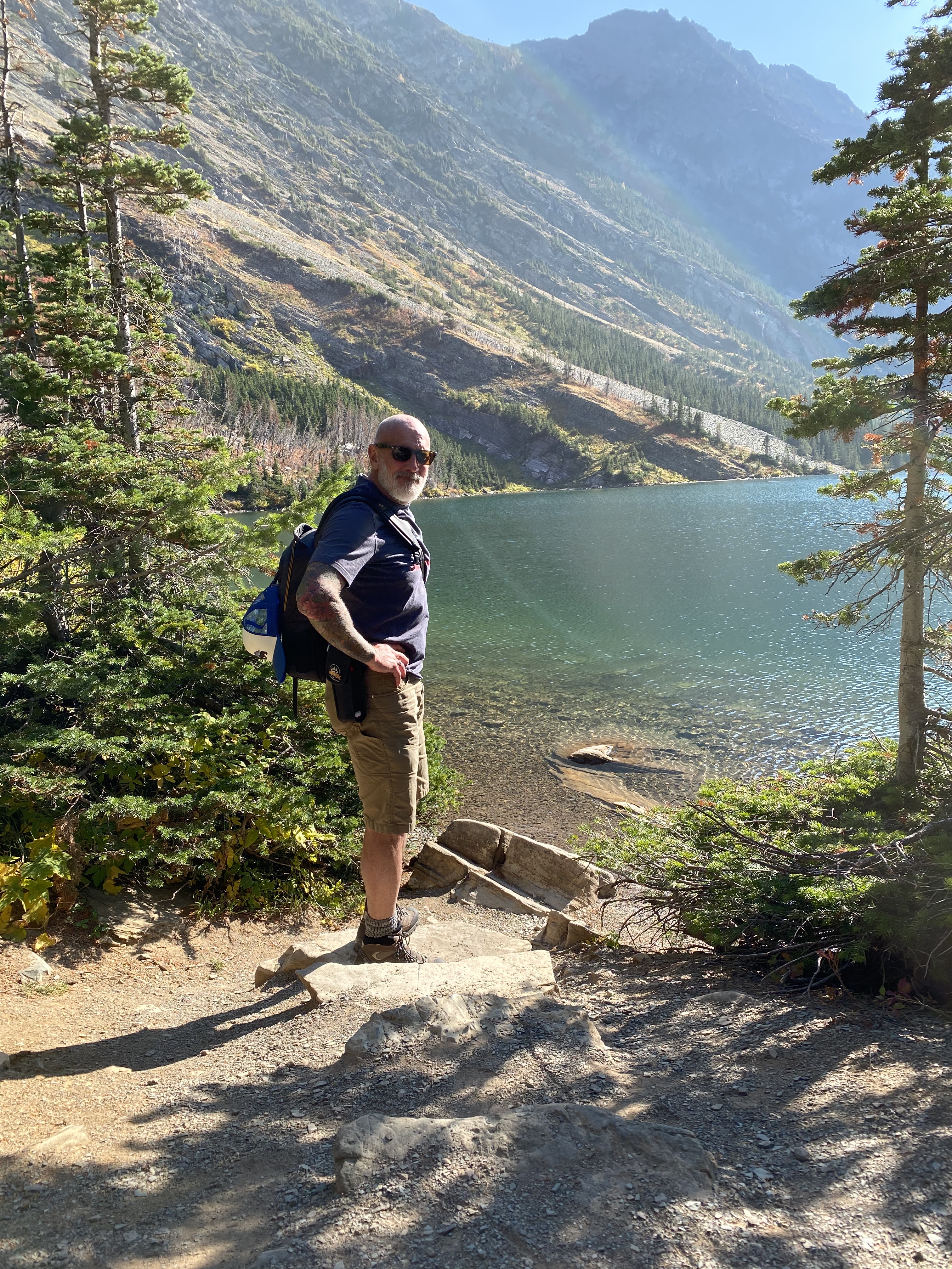
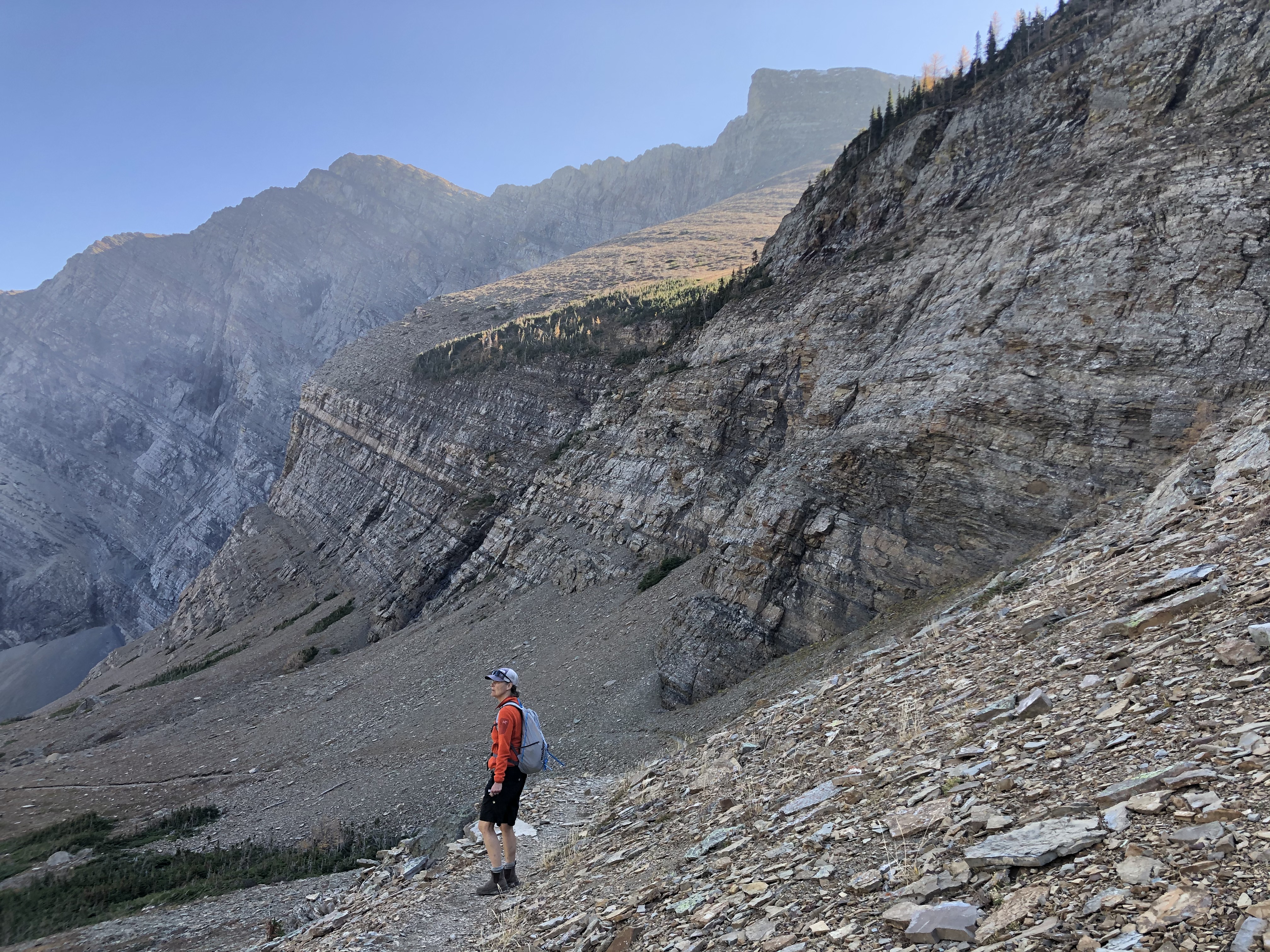
We arrived in Waterton Lakes National Park at the beginning of October to do a little fall hiking. Waterton Lakes is located in the mountainous tri-border area between BC, Alberta and the United States. South of the border, the park joins with Glacier National Park to create a pretty amazing and expansive opportunity for outdoor adventure! Last year at this time, the park was already under several feet of snow….this year it was beautiful and sunny with daytime highs of 20 degrees! Park services were starting to shut down for the winter and with school back in session, we didn’t think we would have any issue finding a spot to camp. We were sadly mistaken! Apparently many folks were out to enjoy the last bit of summer-like weather in Southern Alberta. Our first night in the park was actually spent in a parking lot with a dozen or so other campers as the campsites were all full! Fortunately we got up early and beat the crowd to snag a proper campsite for the next couple of nights. Didn’t really matter though – seeing the lakeshore from our back window was cool wherever we parked!
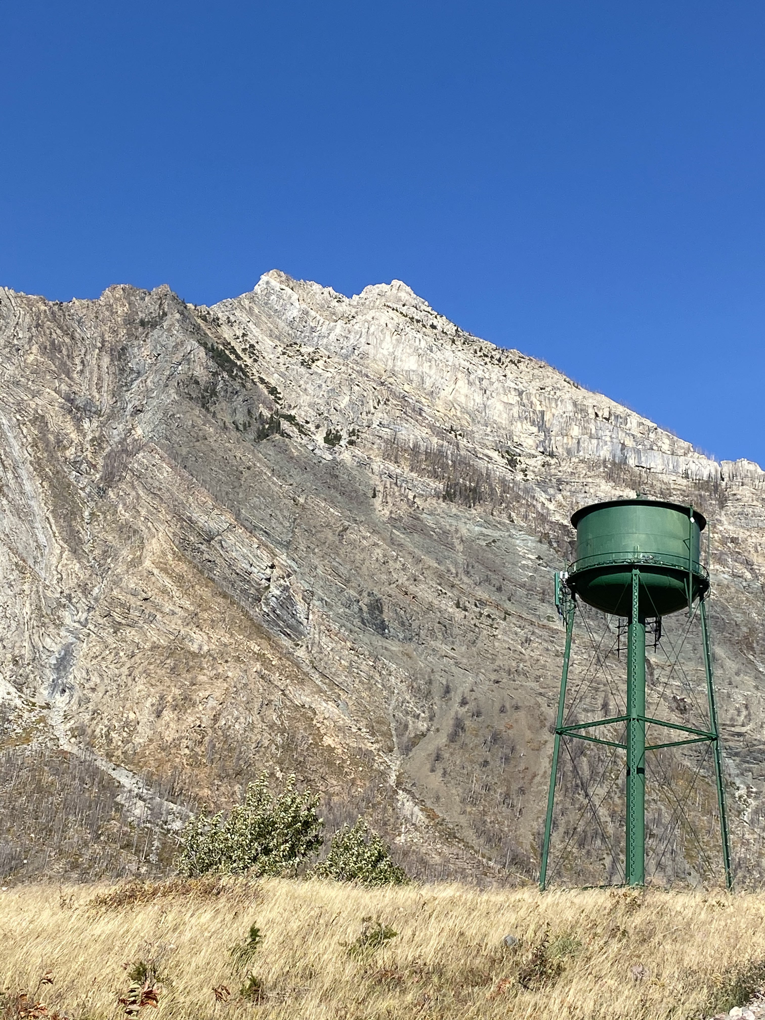
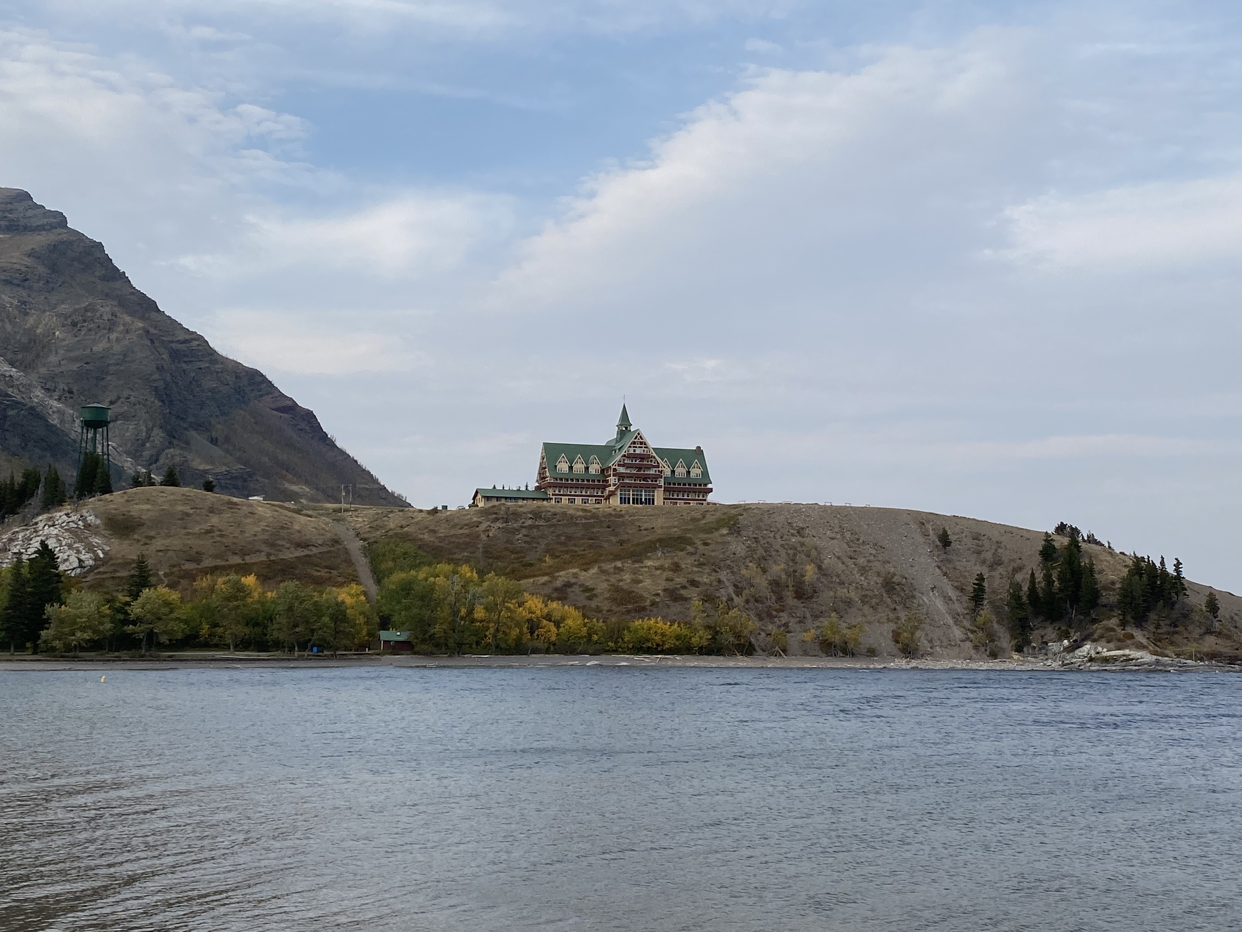
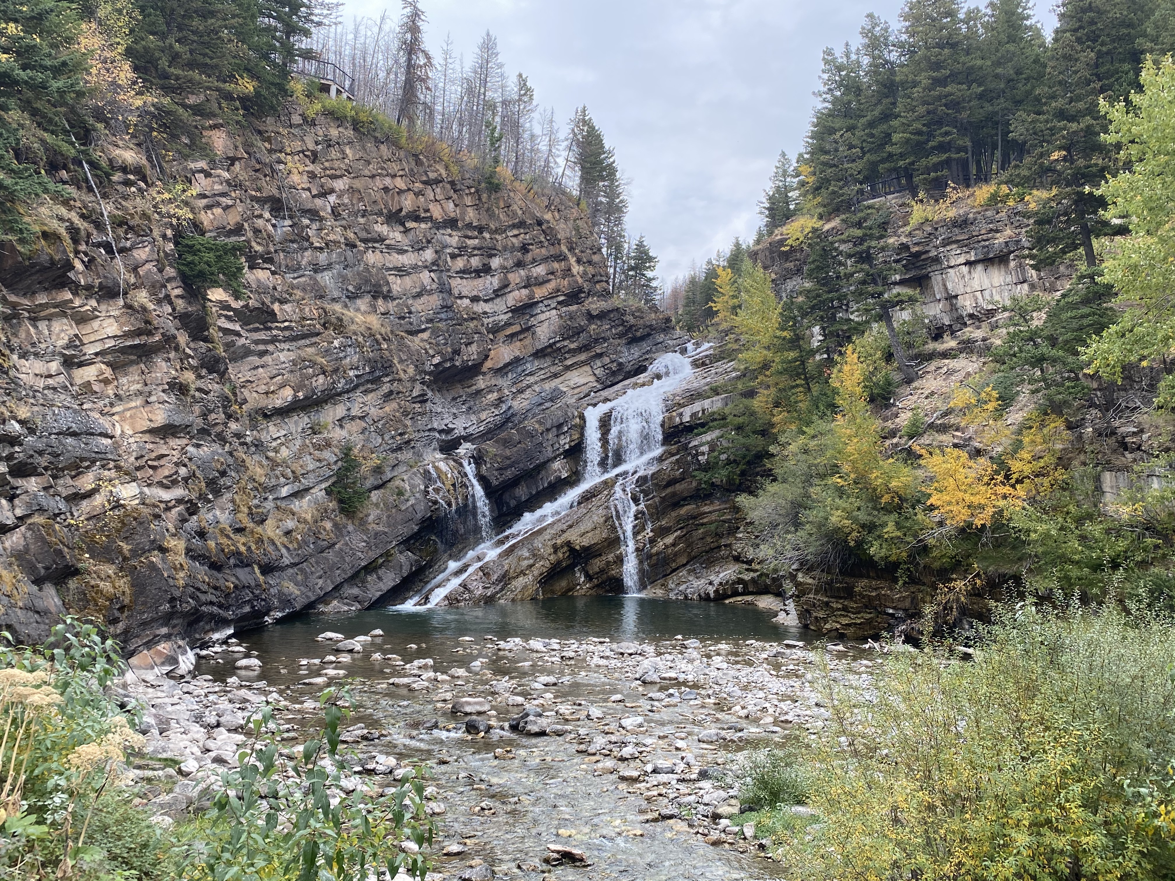
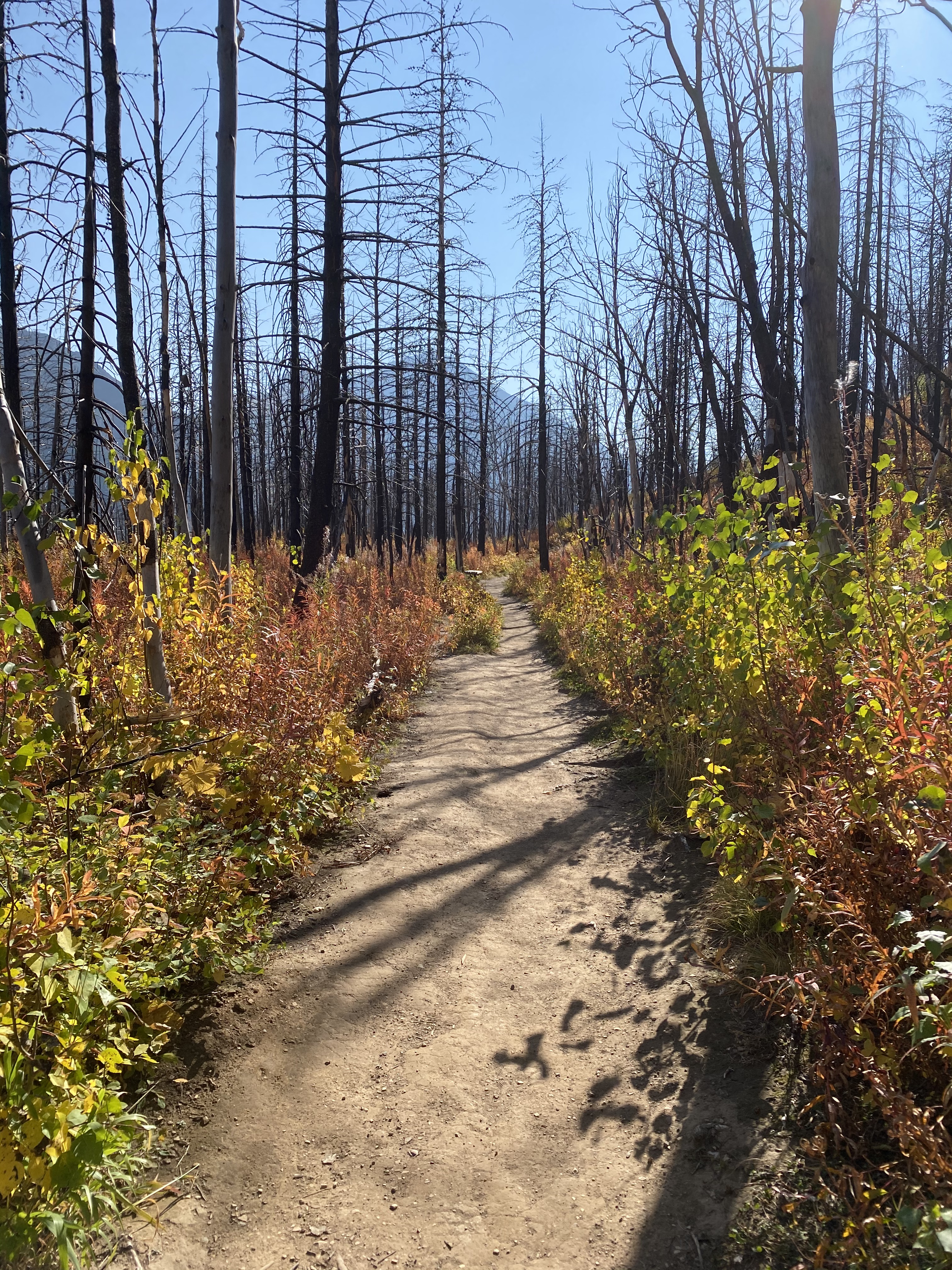
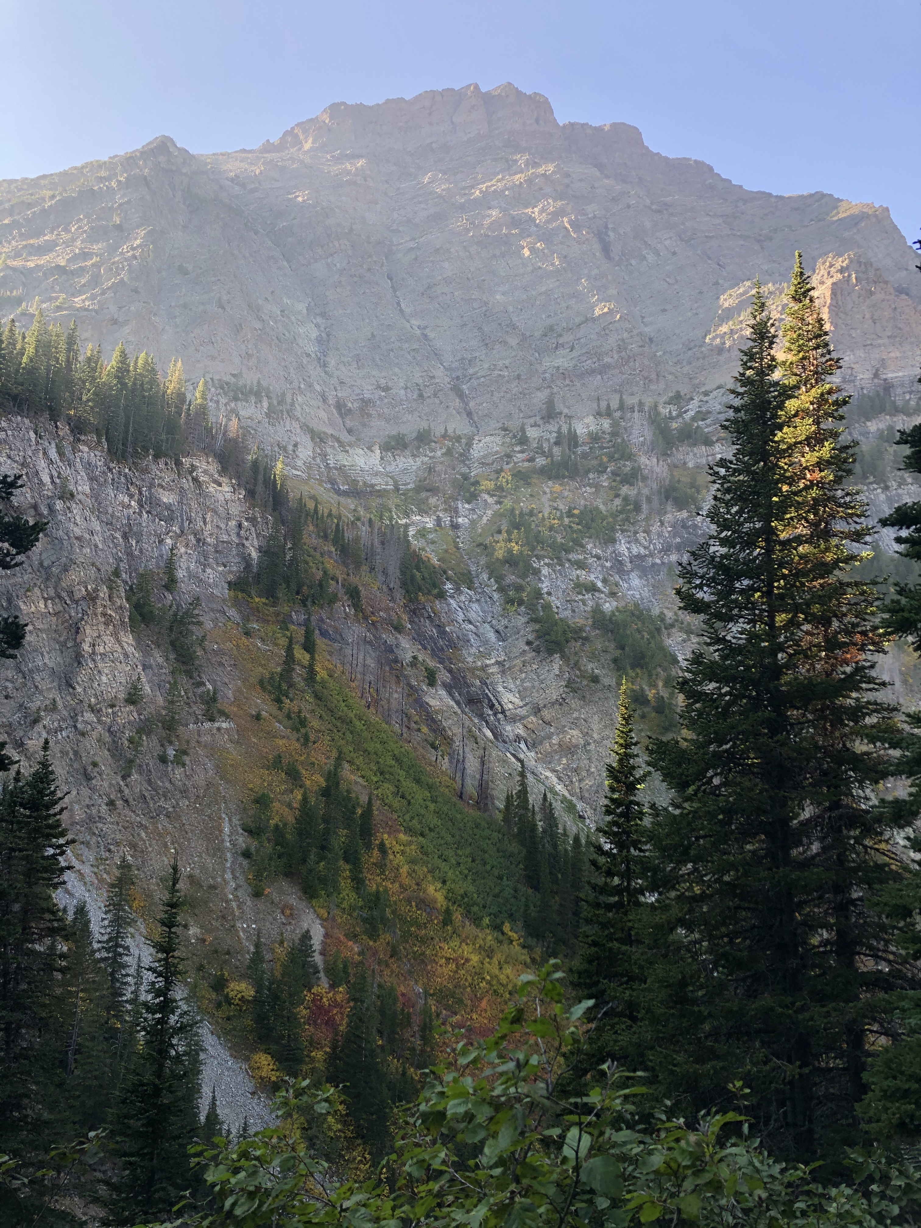
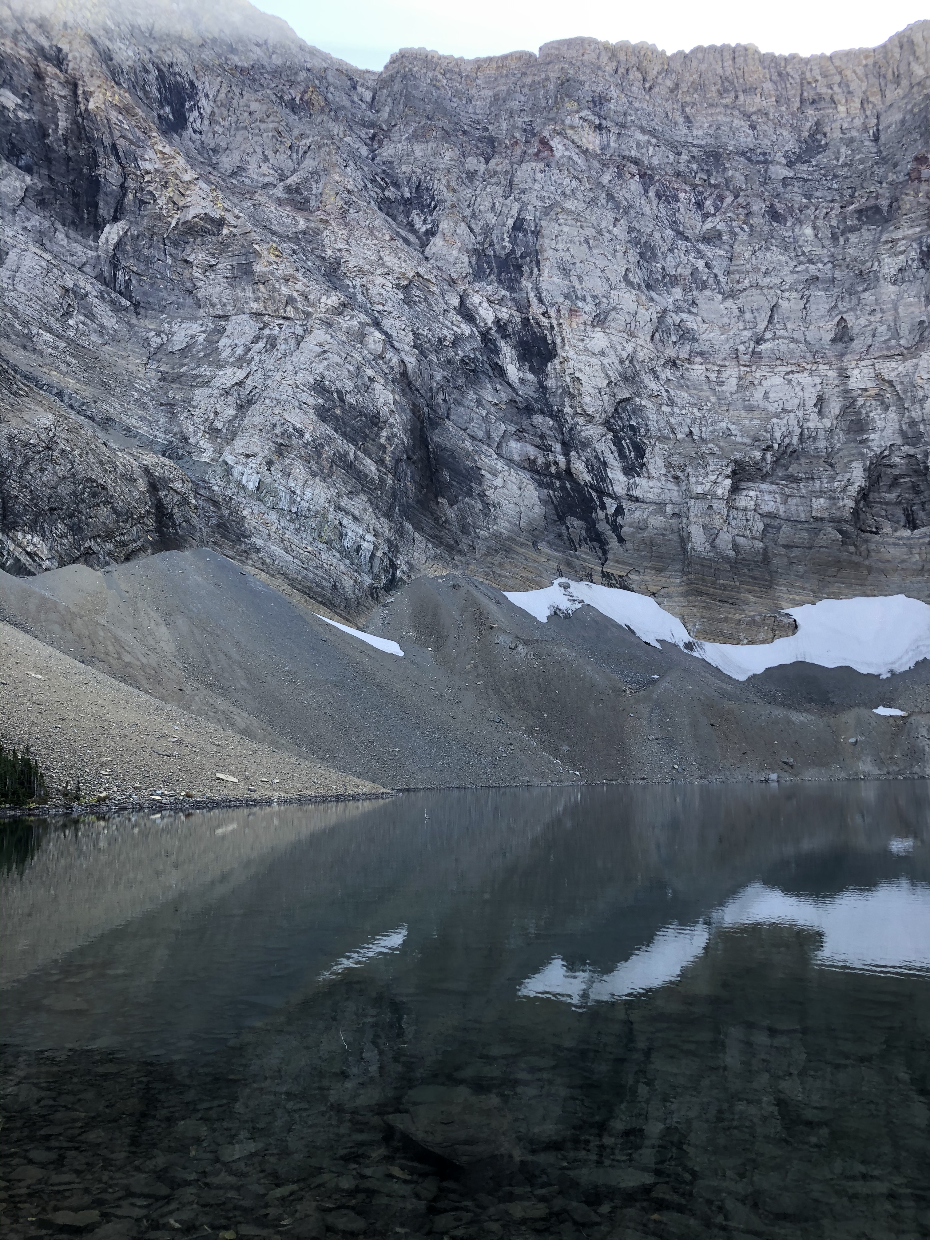
We had never visited Waterton Lakes National Park before and were excited to start exploring. Three years ago, the park made headlines for the worst of reasons…an uncontrolled wildfire was destroying much of the park. Valiant (and fortunately successful) efforts were made to save the iconic Prince of Wales Hotel but much of the surrounding forests and park infrastructure were burned. From that time, large areas of the park remained closed while clean-up and rebuilding were undertaken. On our first hike to Bertha Lake, the damage was obvious – most of the surrounding forest along the trail had been destroyed – but it did retain a rather eery beauty.
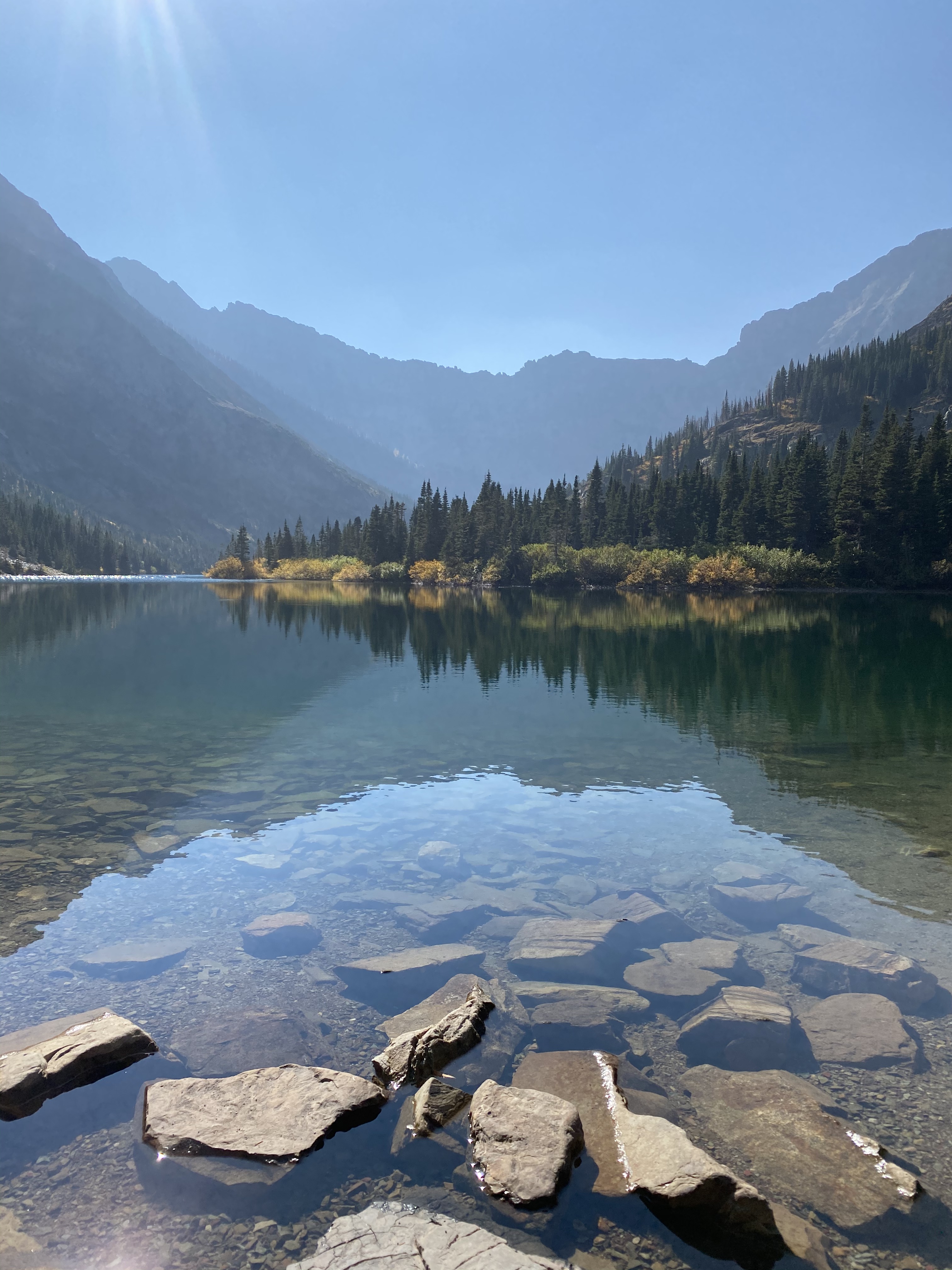
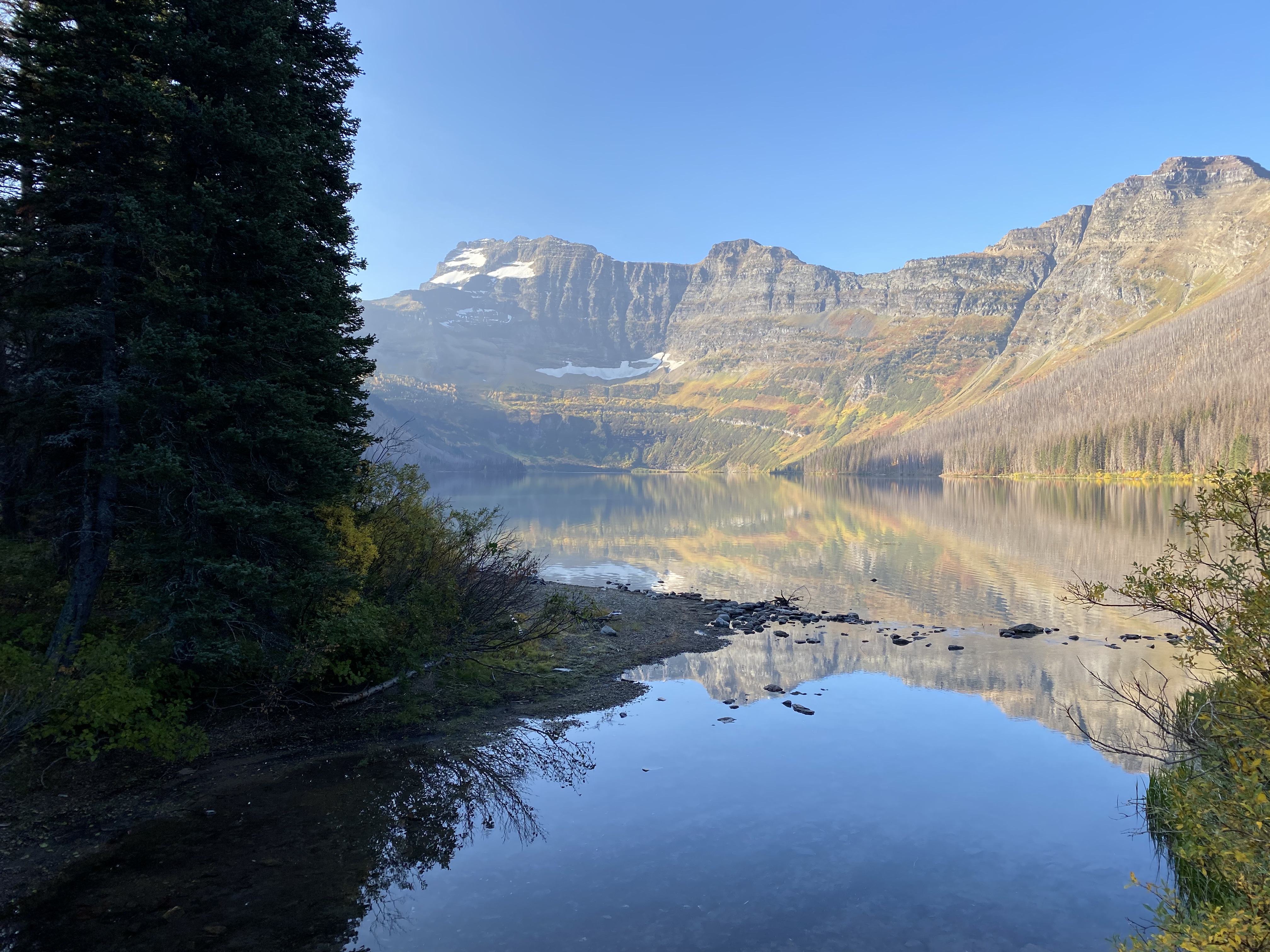
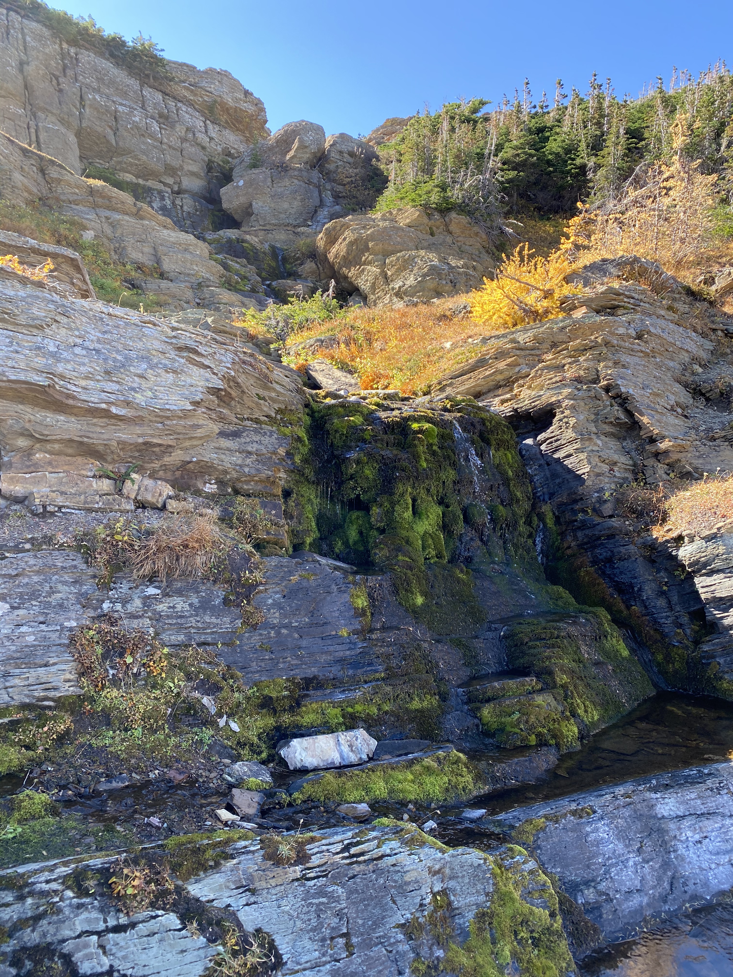
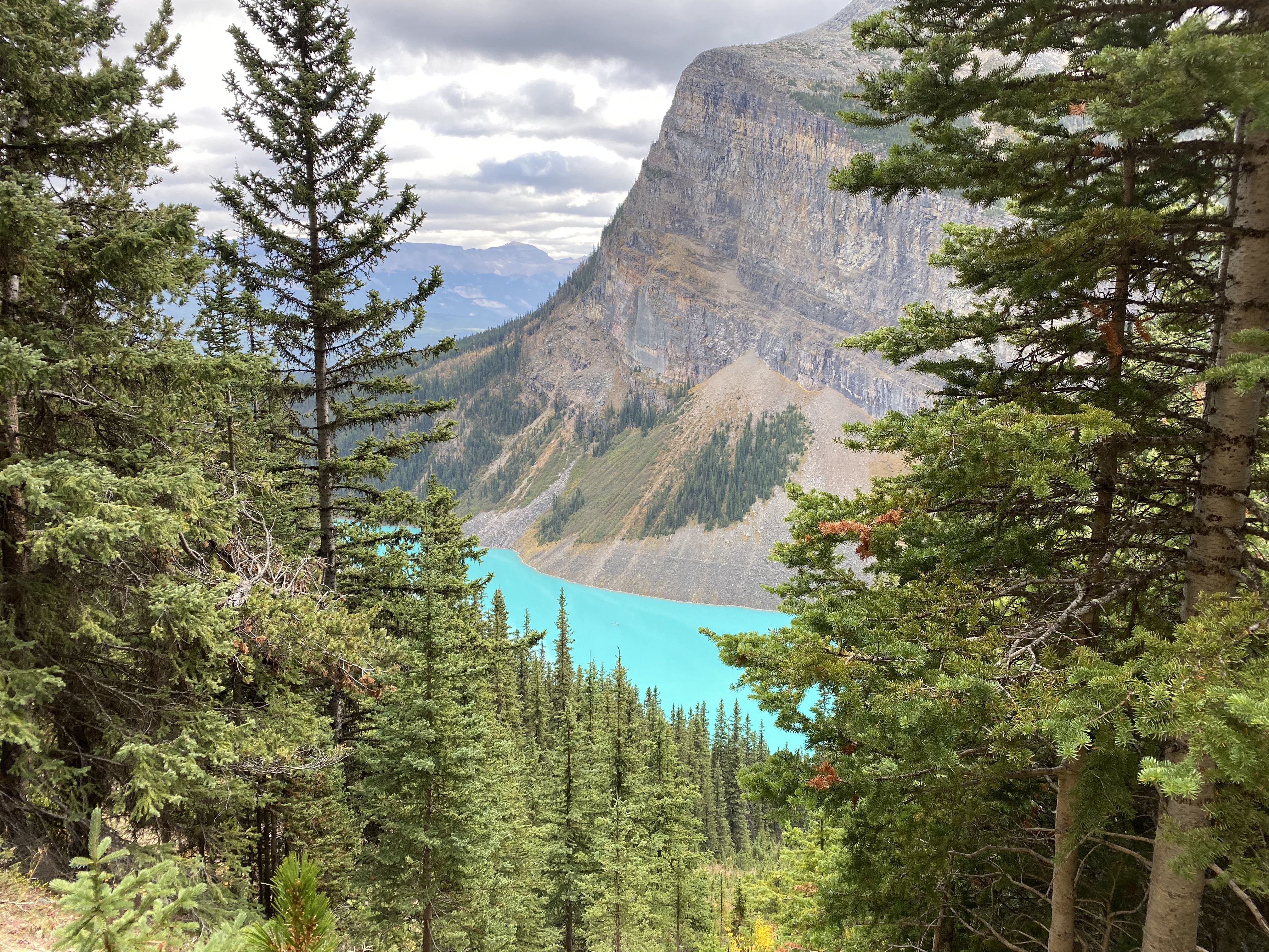
Our first hike in Waterton passed along Lower Bertha Falls then up to Bertha Lake, where this spectacular lake awaited us…
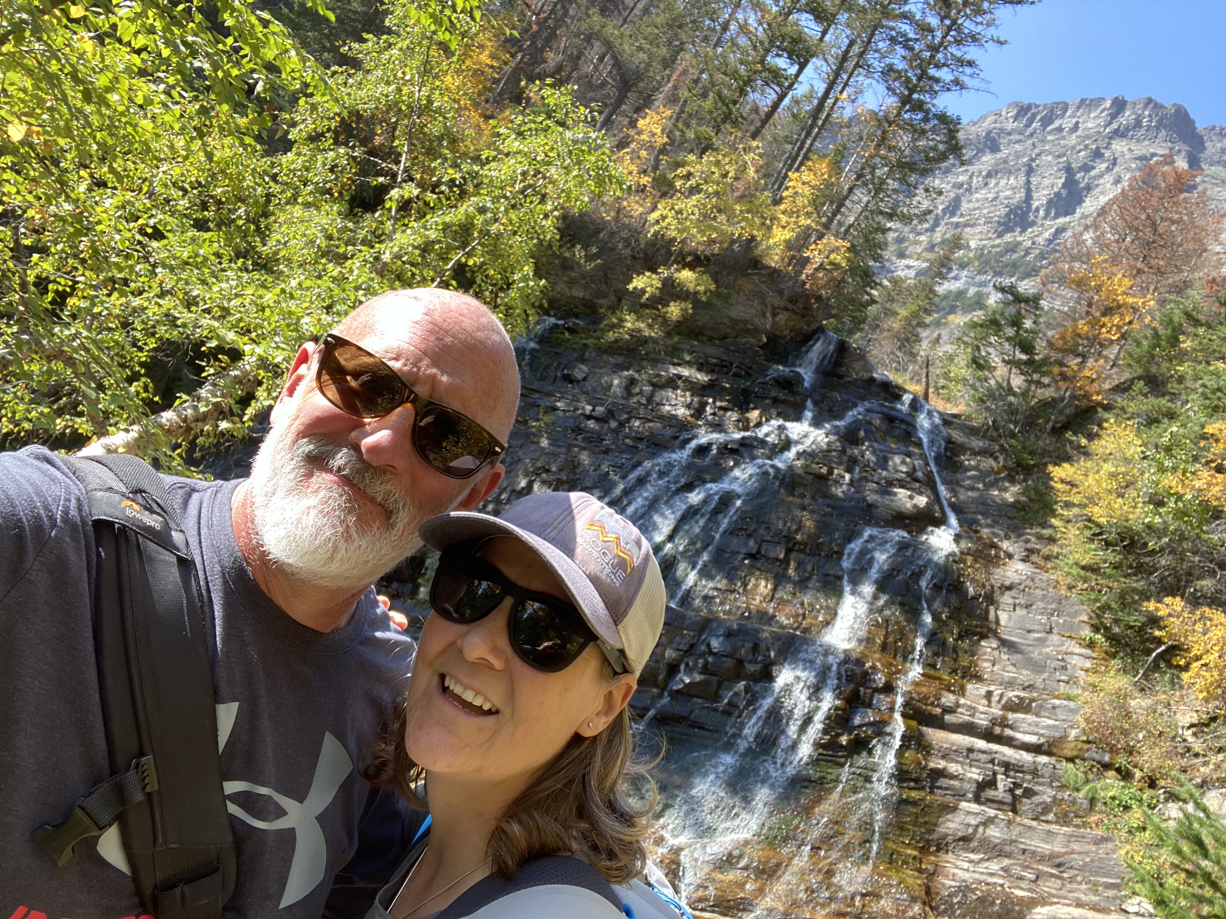
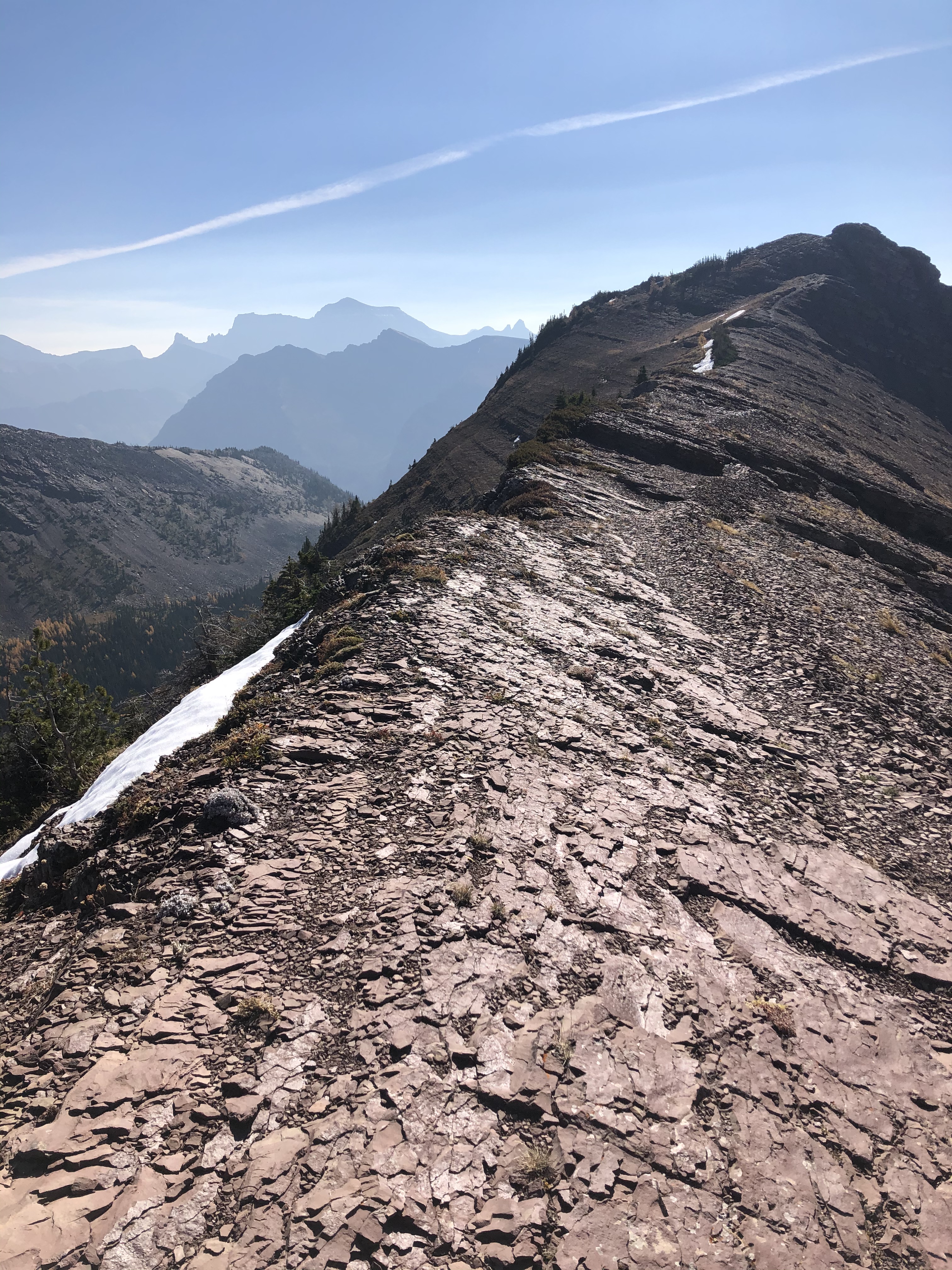
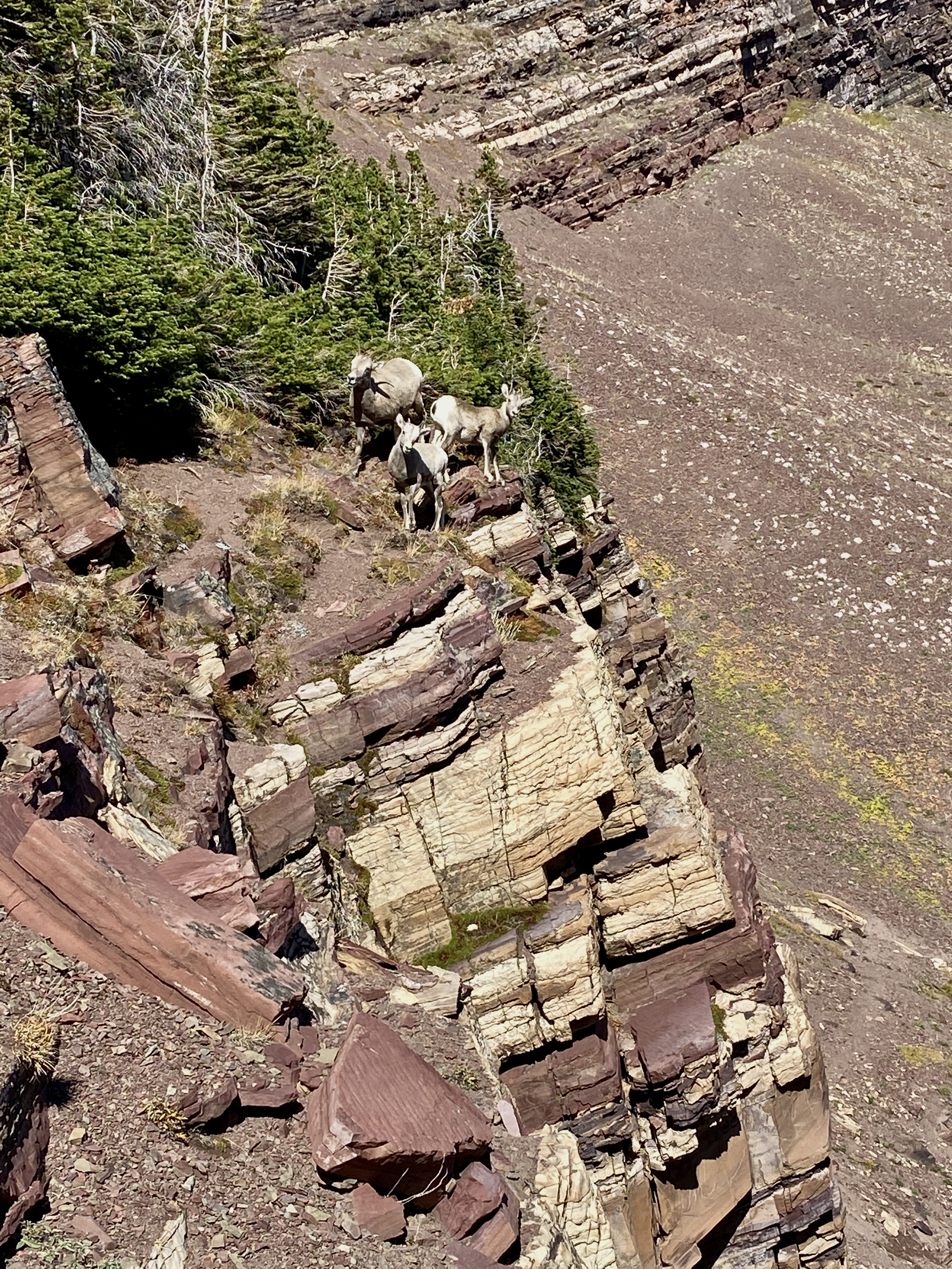
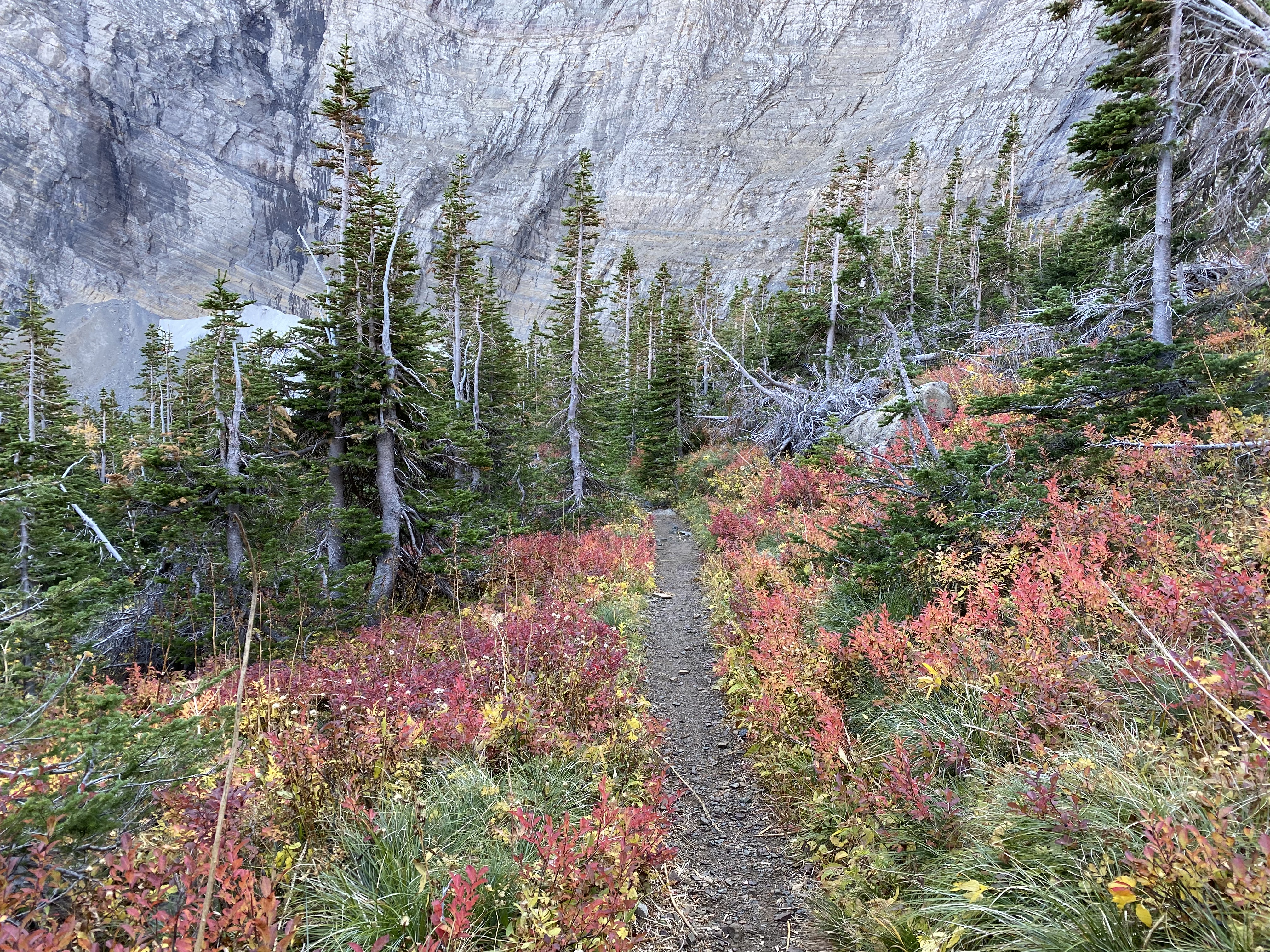
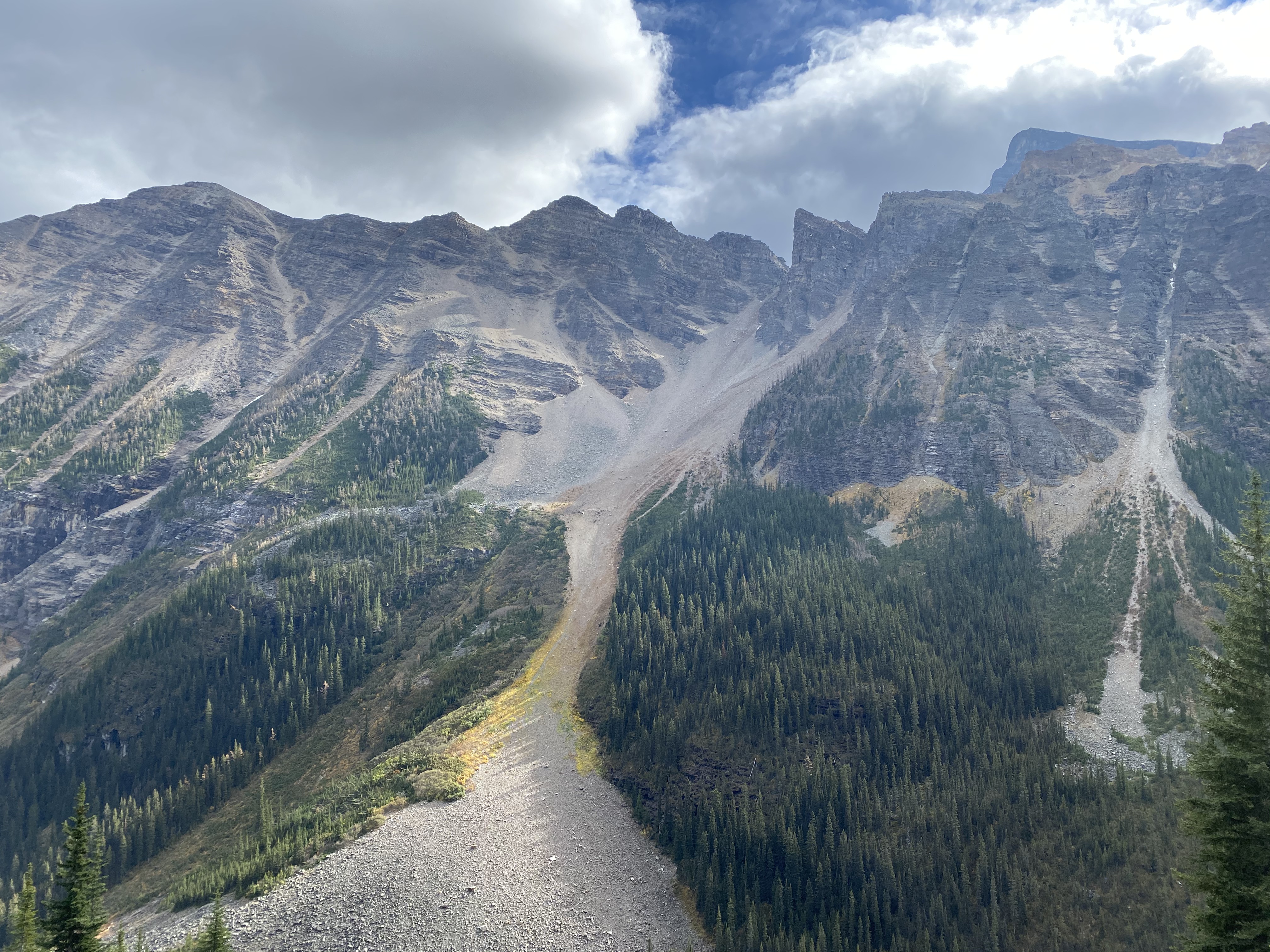
Our next day of hiking was on the Carthew-Alderson Trail. We were joined by our friend Tracy from Lethbridge – a fellow Canadian who we met in Patagonia earlier this year. It was lovely to catch up and have a local perspective on the trail. Our hike started at Cameron Lake and finished near the Waterton townsite. The Akamina Parkway is used to access the start of the trail but has been closed for the past three years as reconstruction from the wildfire in 2017 was undertaken. Turns out our timing was good on this one – the Parkway reopened the day we arrived in Waterton so we were among the first to drive the new road and hike the trail from Cameron Lake. The trail was uncrowded and the weather was spectacular….and we got a few curious looks from some of the wildlife!
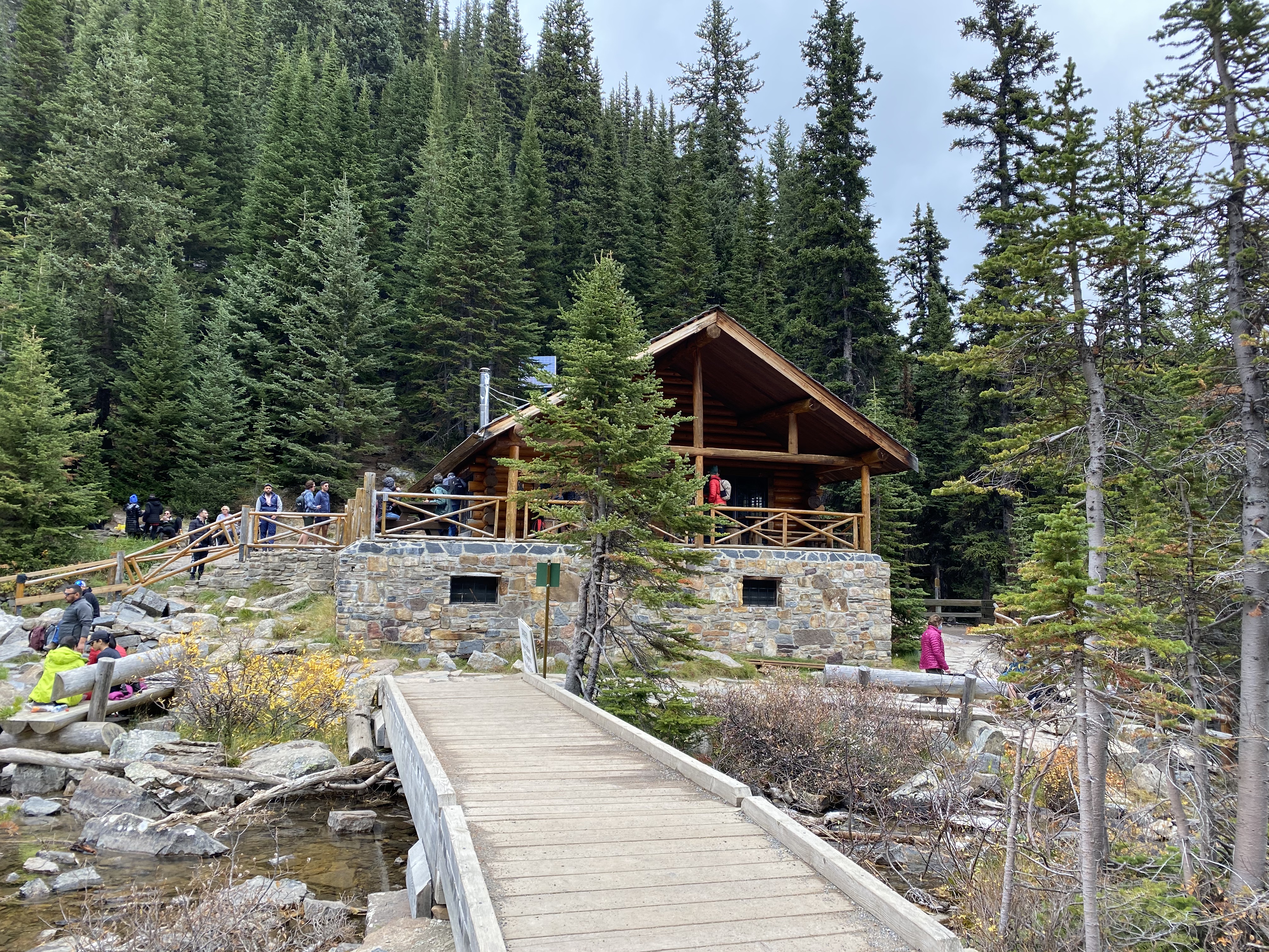
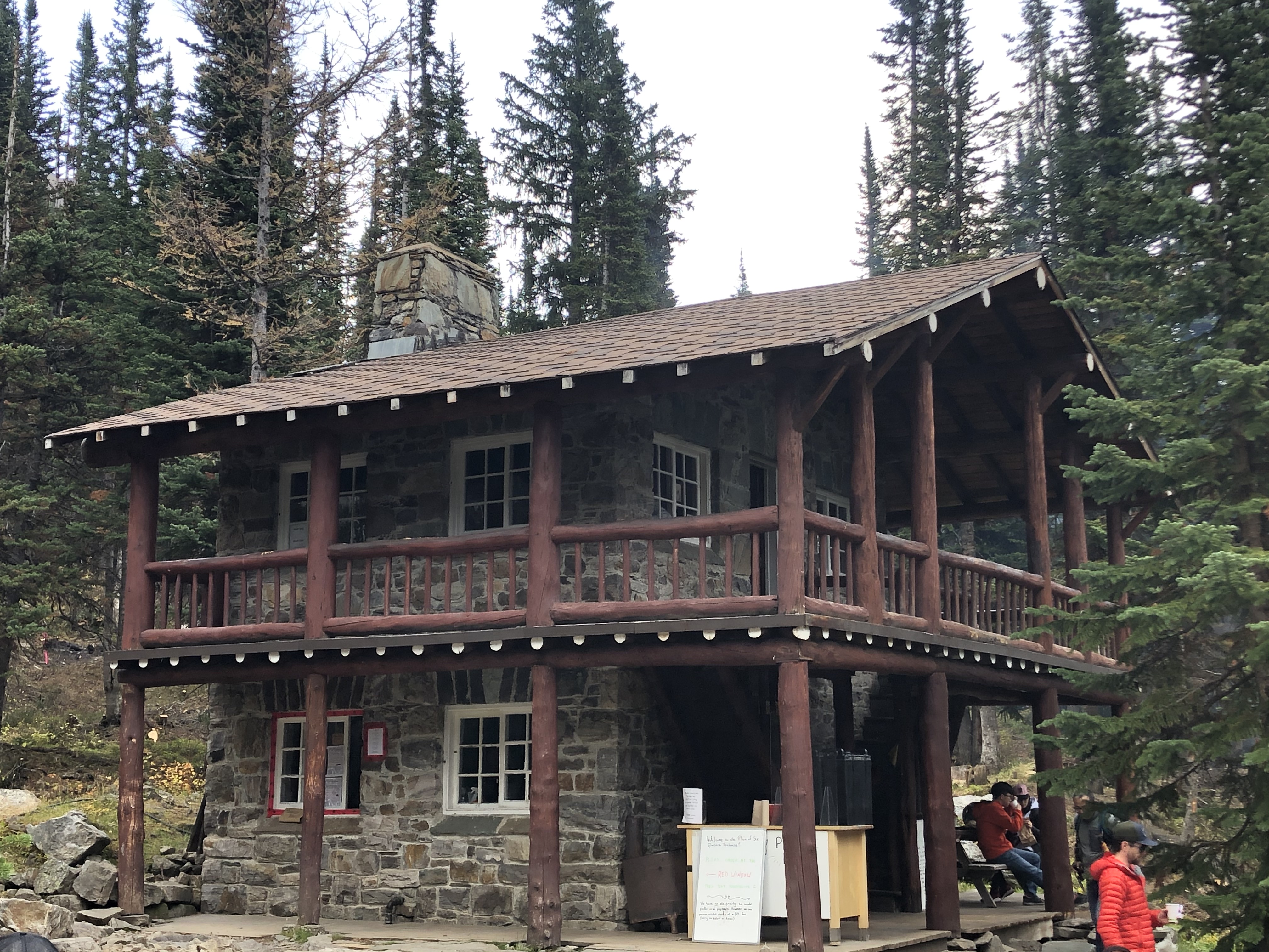
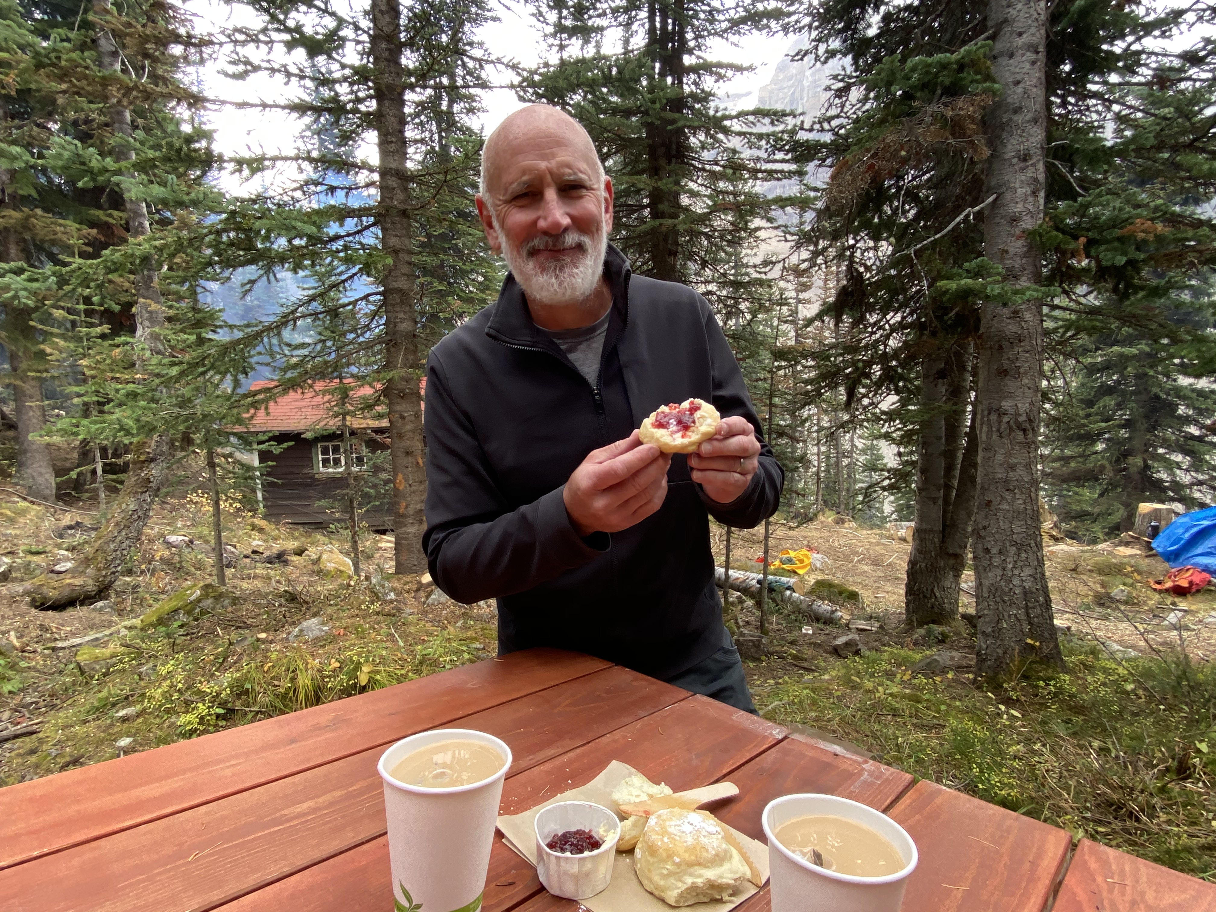
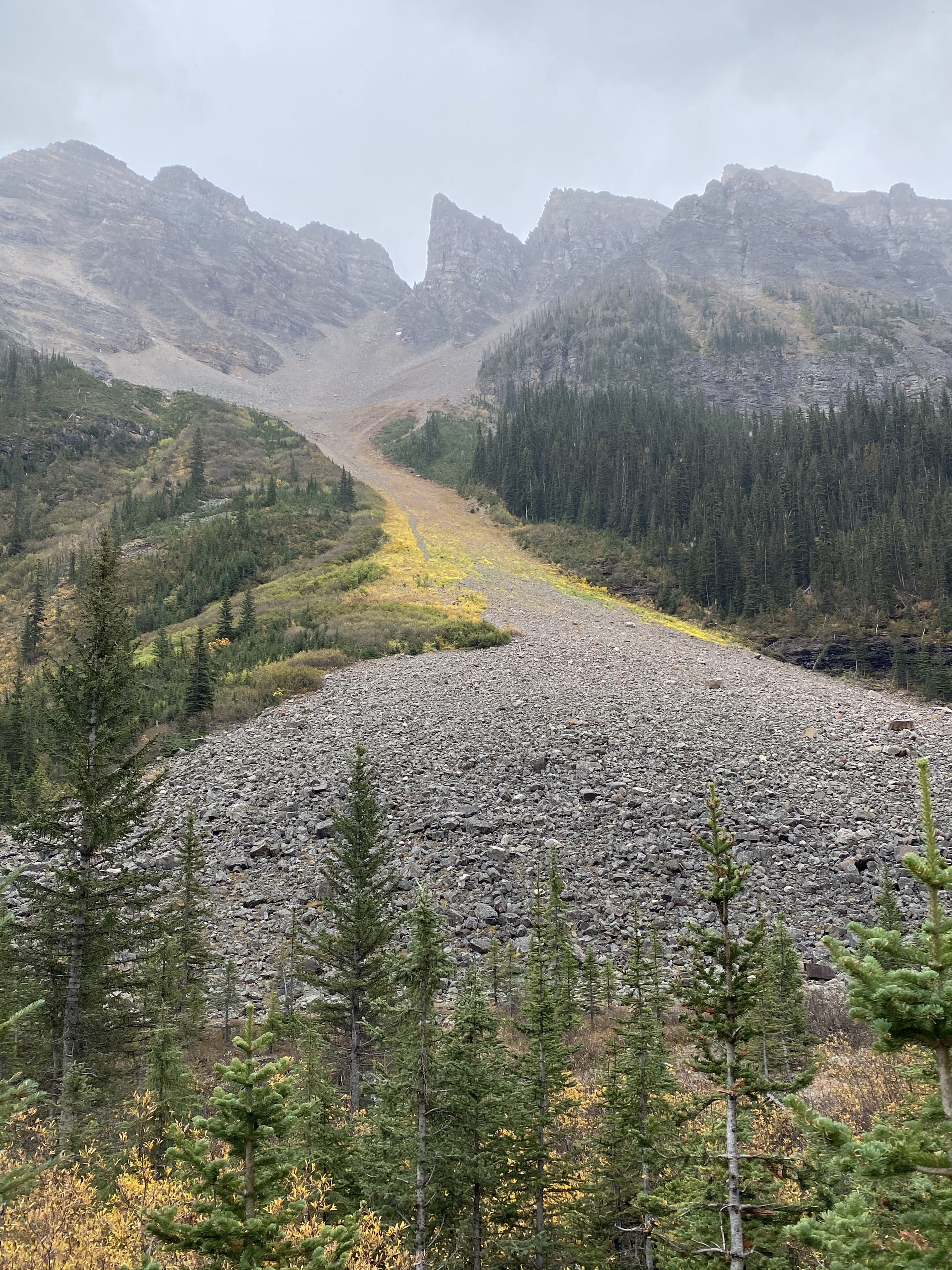
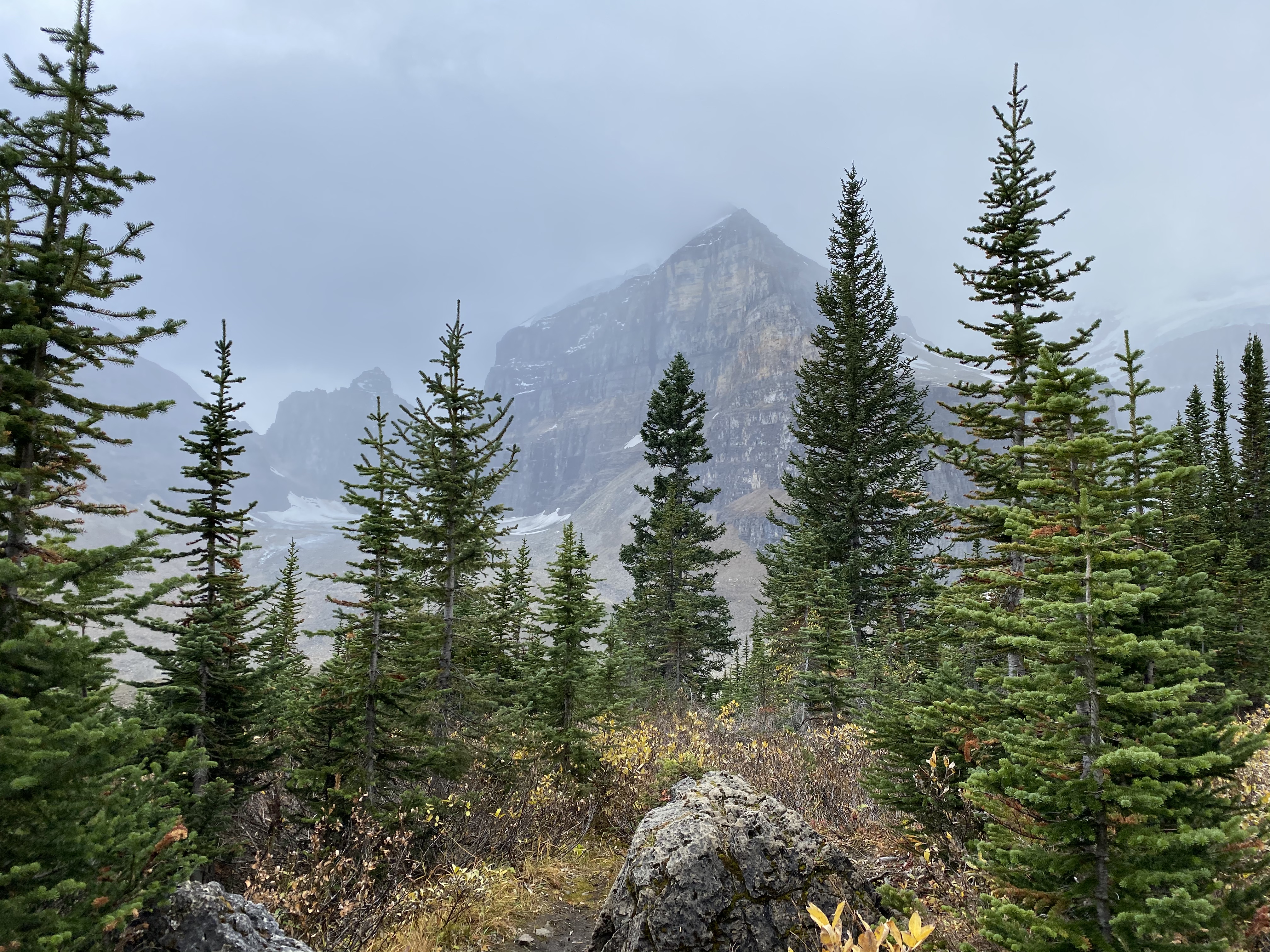
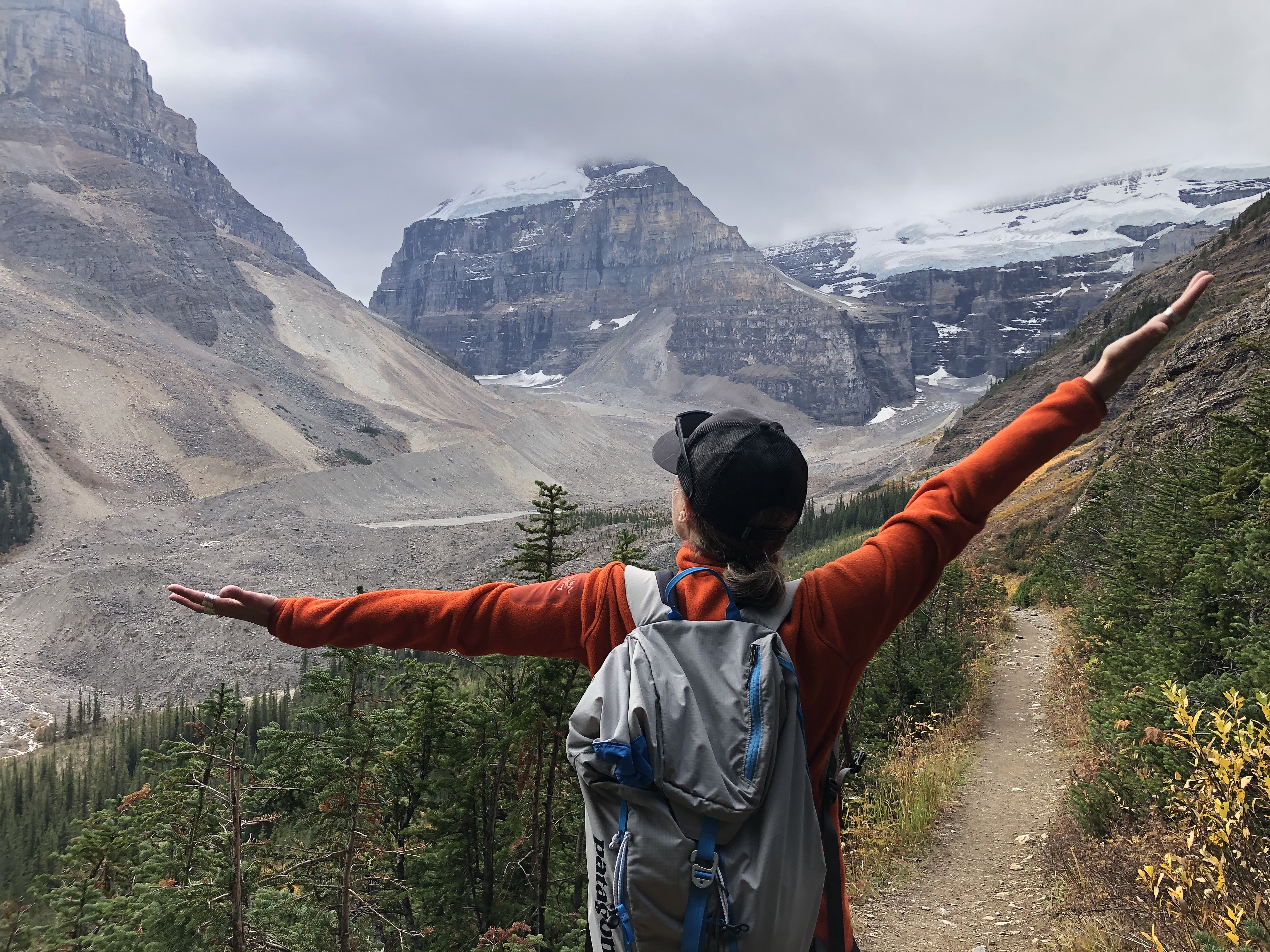
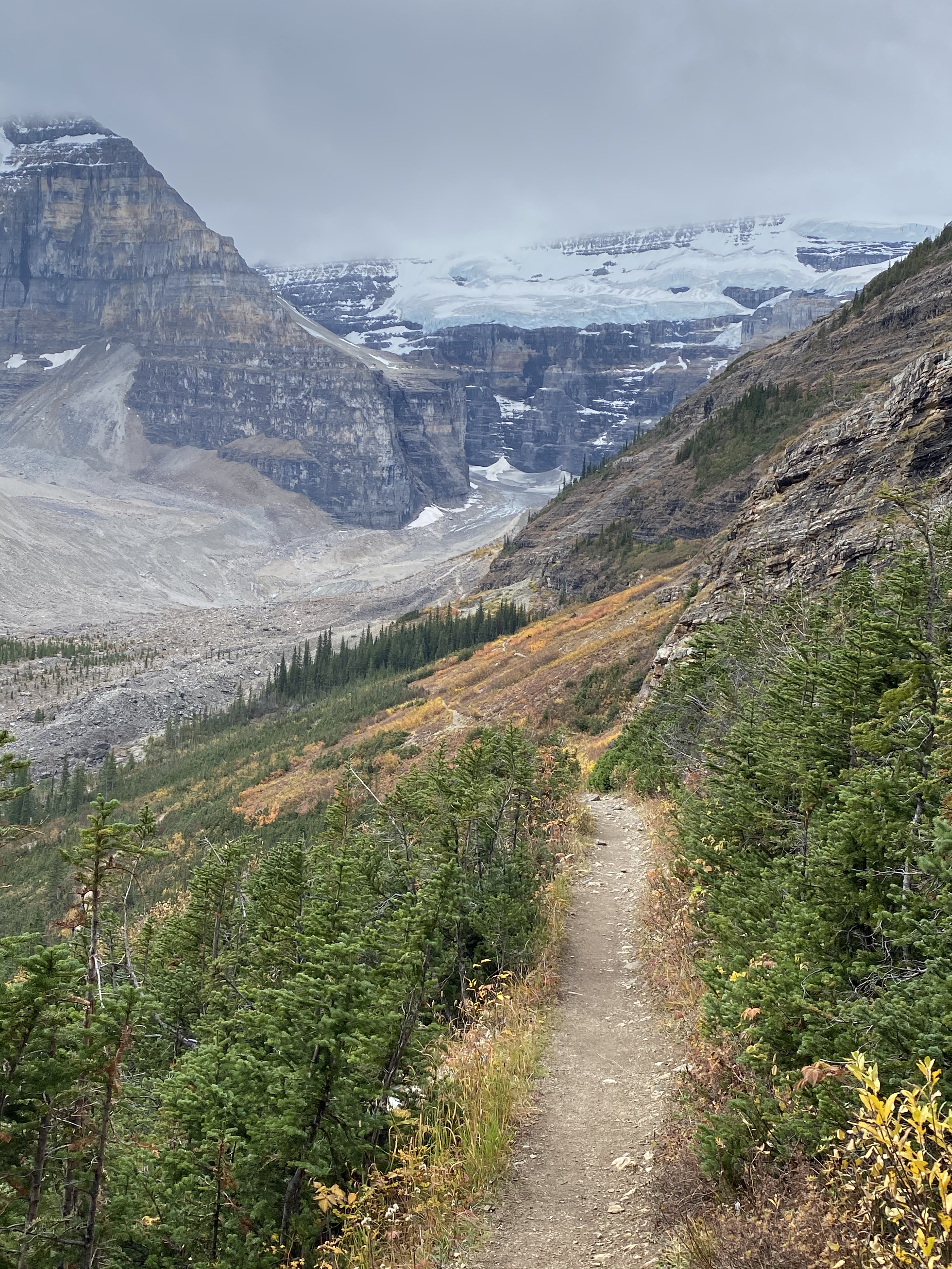
After leaving Waterton, we wanted to take advantage of the continued good weather so made a break for Lake Louise in Banff National Park to re-do one of our favourite hikes to the tea houses. There are two tea houses that are accessed from a trail that starts at Lake Louise. The Agnes Lake Teahouse was built in 1901 and the Plain of Six Glaciers Teahouse was built in 1924 by CPR employees as refuges for hikers. These teahouses remain true to their original roots and are off-grid and charmingly rustic. All supplies have to be hiked in so it is pretty special when you can sit down to a nice cup of hot tea and fresh biscuits when you are several hours into the wilderness. And the surrounding scenery isn’t too bad either! Fortunately with the good weather, the tea houses were still open for the season so we were able to enjoy tea and biscuits at both locations.
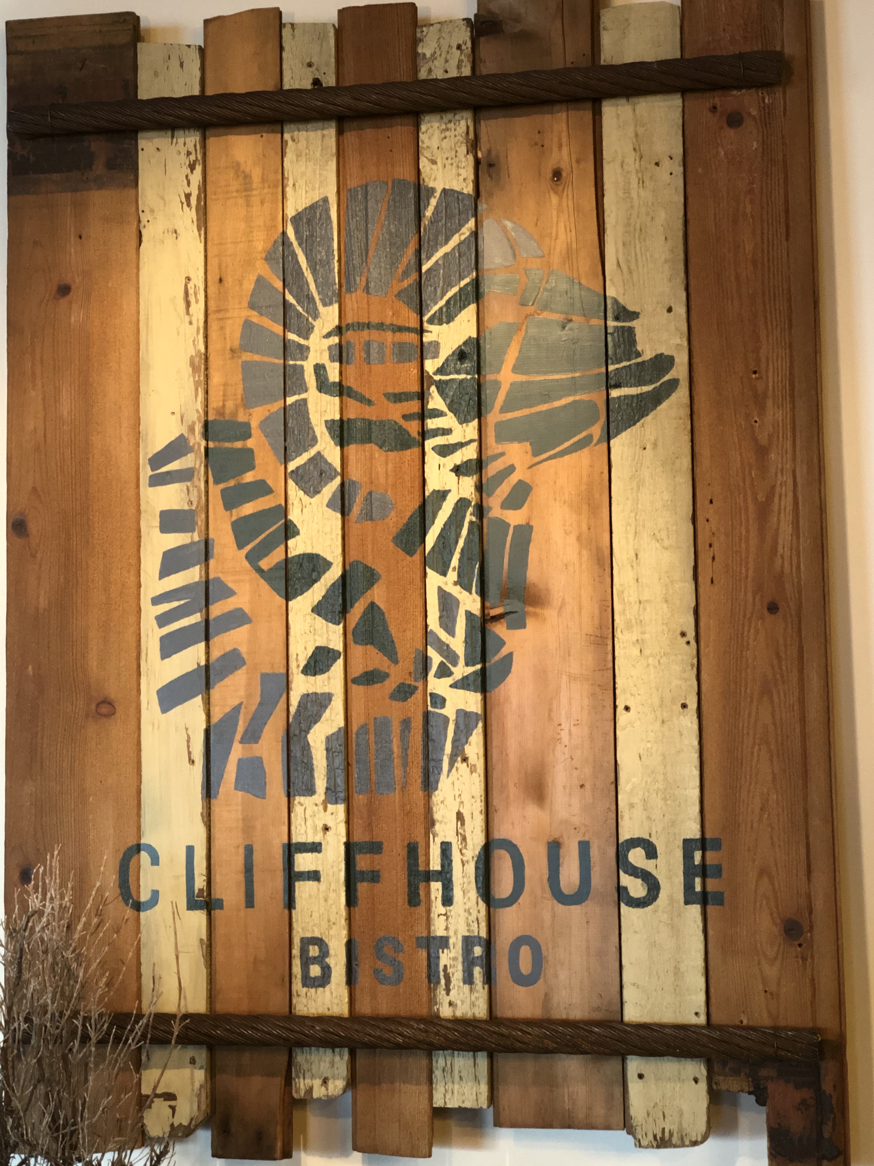
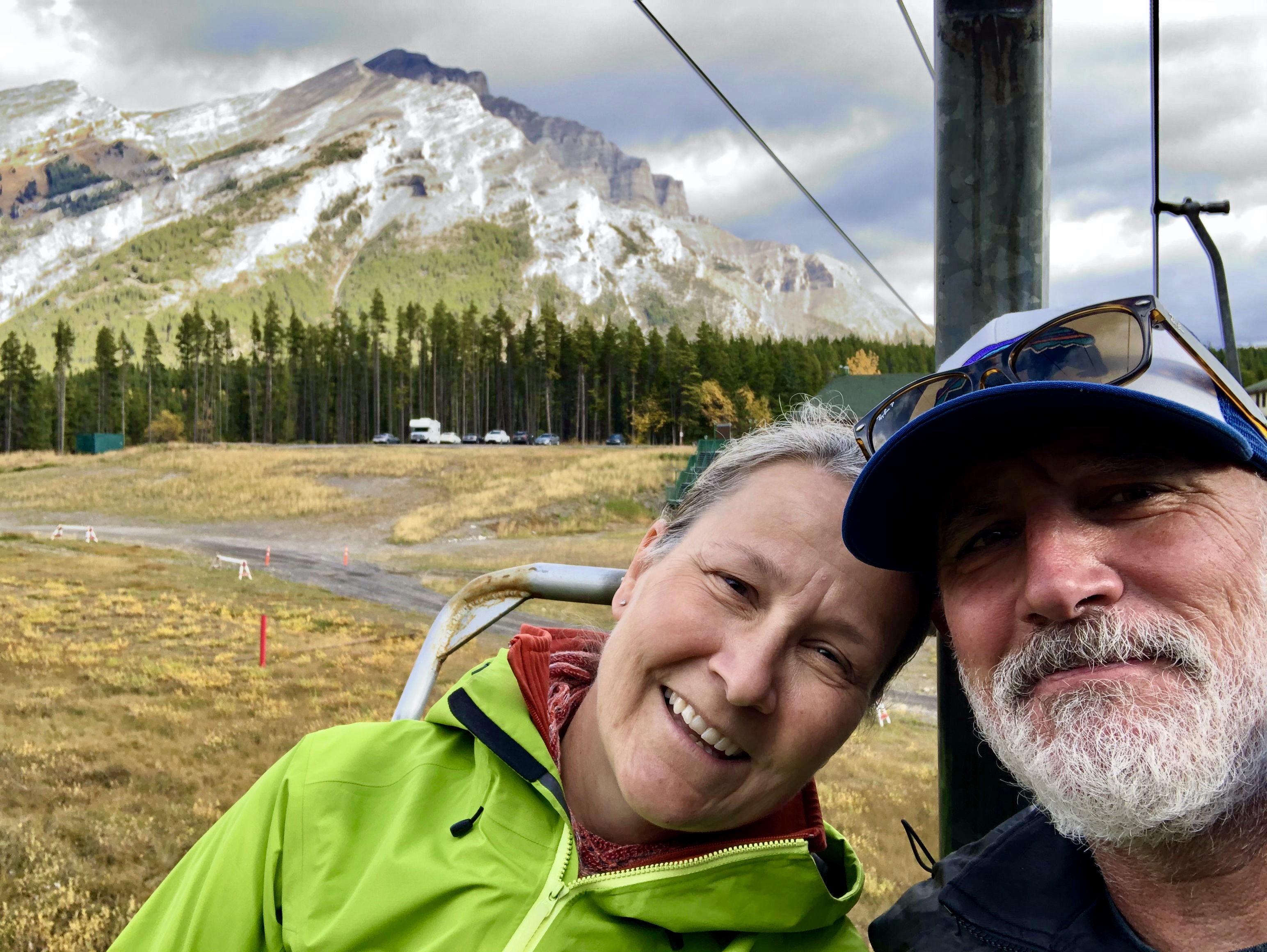
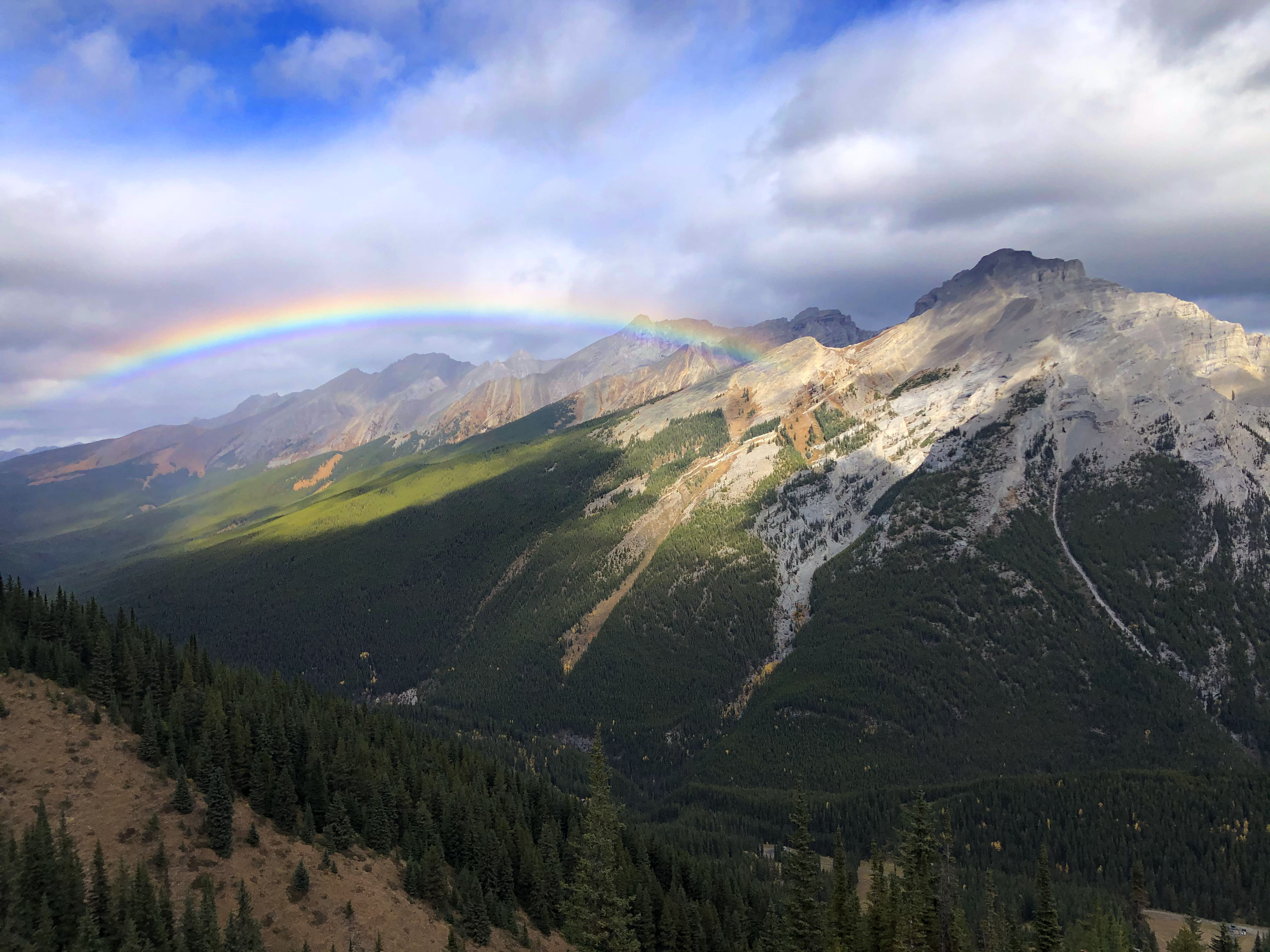
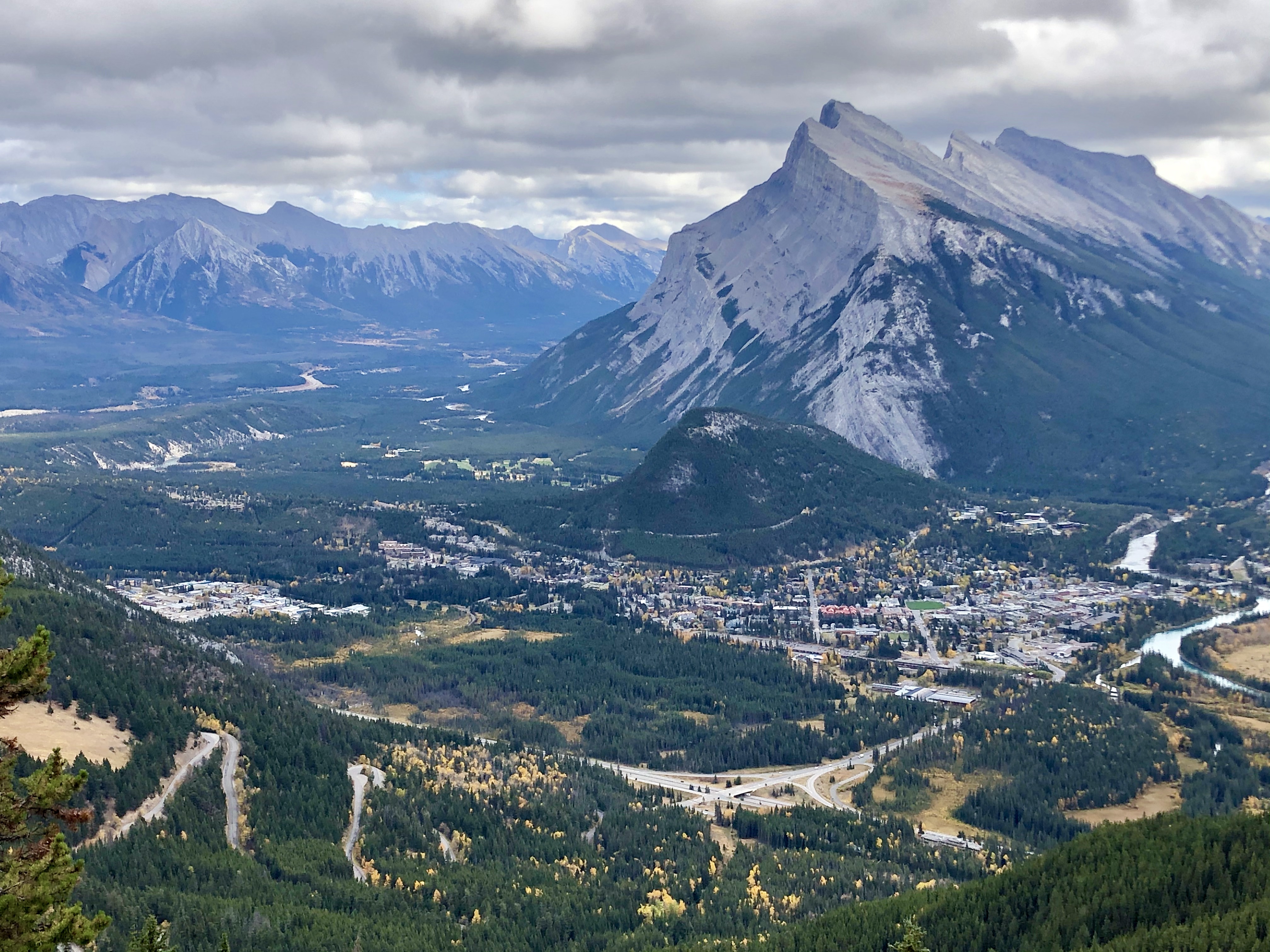
After Lake Louise, we took a break from hiking and opted for the chairlift up Mount Norquay, across the highway from the townsite of Banff. In the winter, it is a busy ski hill but in the summer, you can ride the chairlift to the historic Cliffhouse Restaurant, located at 6900 feet above sea level. It is a really cool renovated mid-century building that was famously visited by Marilyn Monroe in 1953 – they have the photos of her on the chairlift to prove it! We chowed down on a very tasty lunch (and a local craft beer or two for Warren) but the surrounding views were the star of the show here. The mountains are spectacular and we even had a rainbow appear on our way down the mountain.
Interestingly, a couple of weeks after our visit, Mount Norquay would open for ski season – its earliest opening in its 95 year history! Winter can come fast and furious in the mountains.
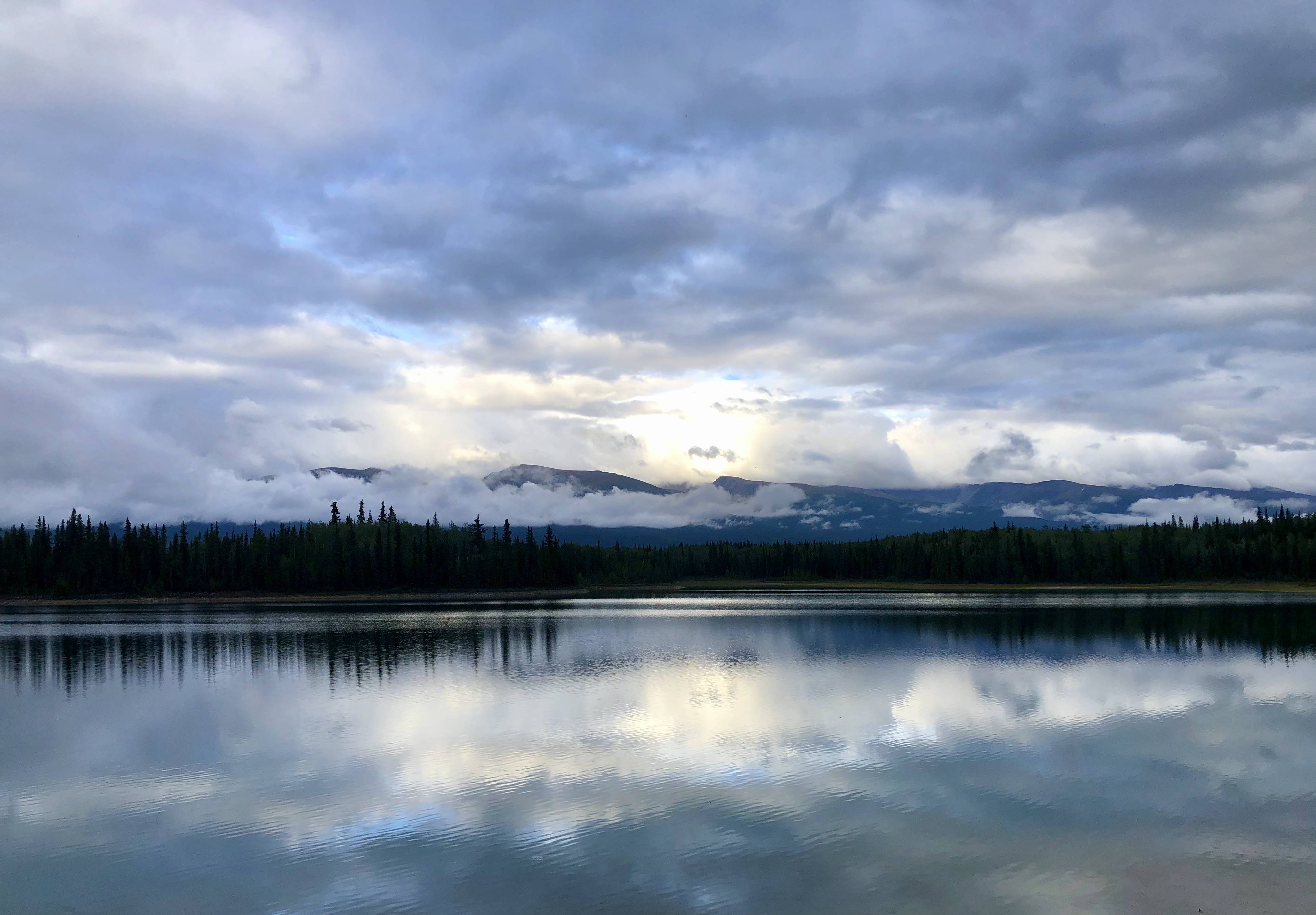
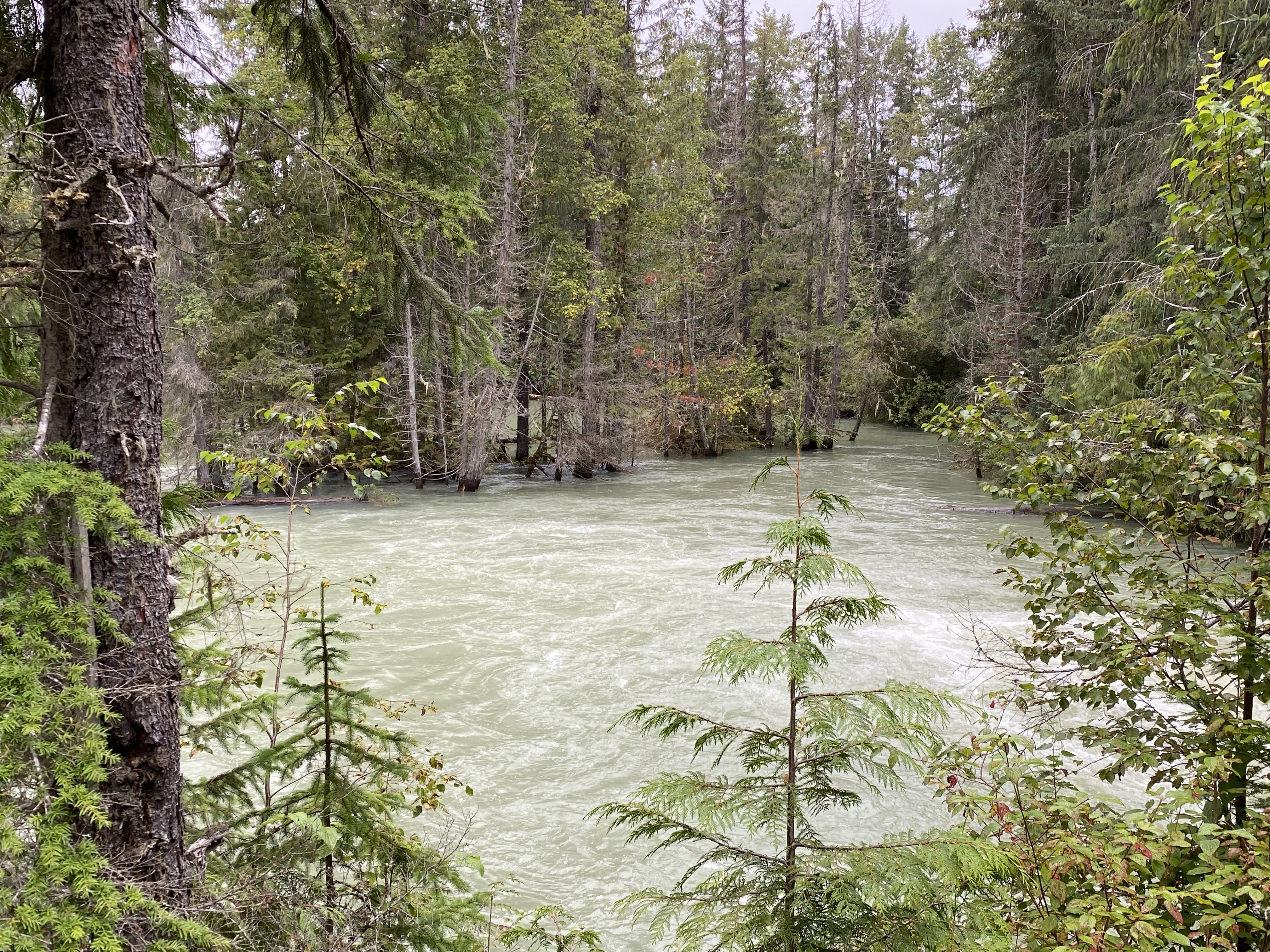
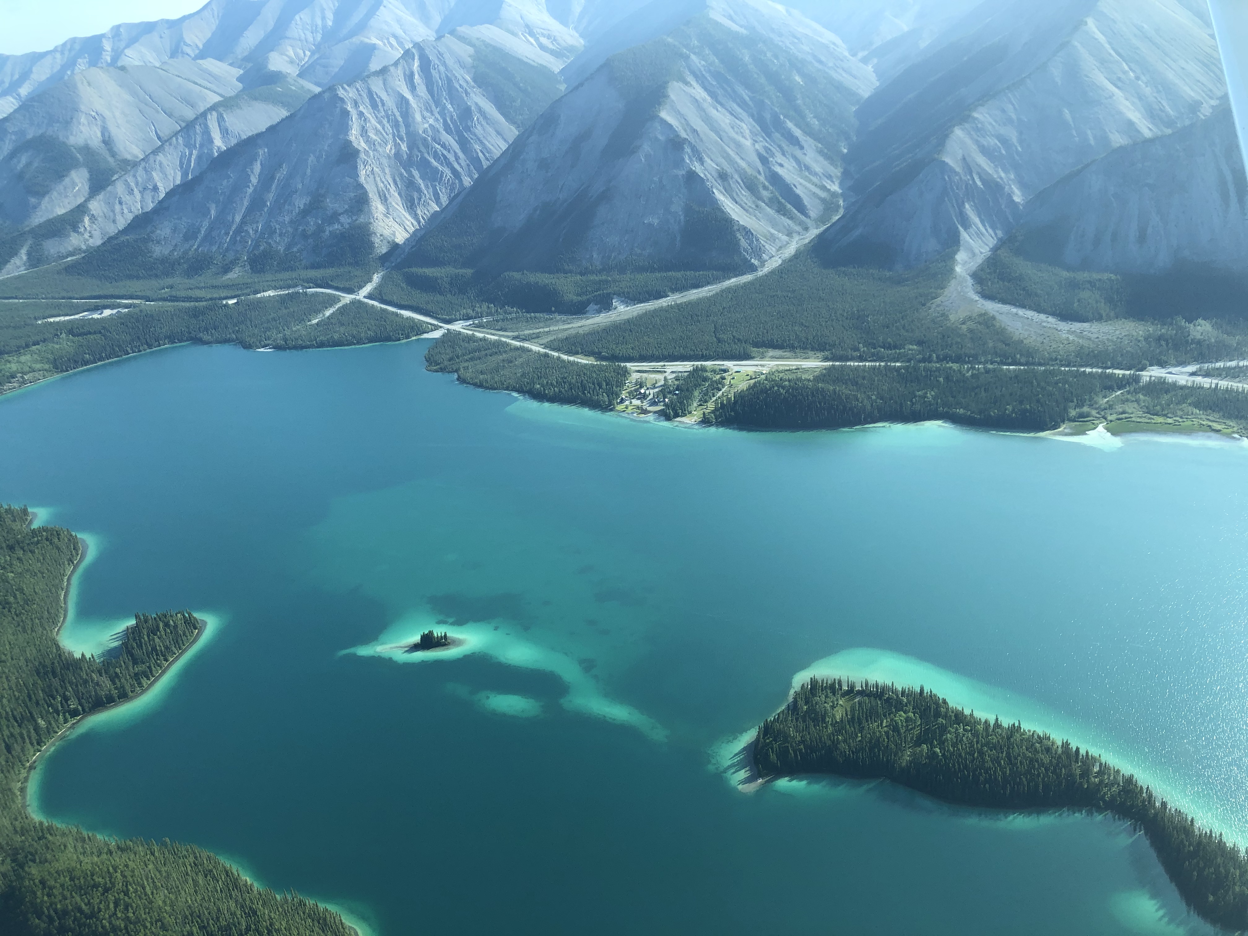
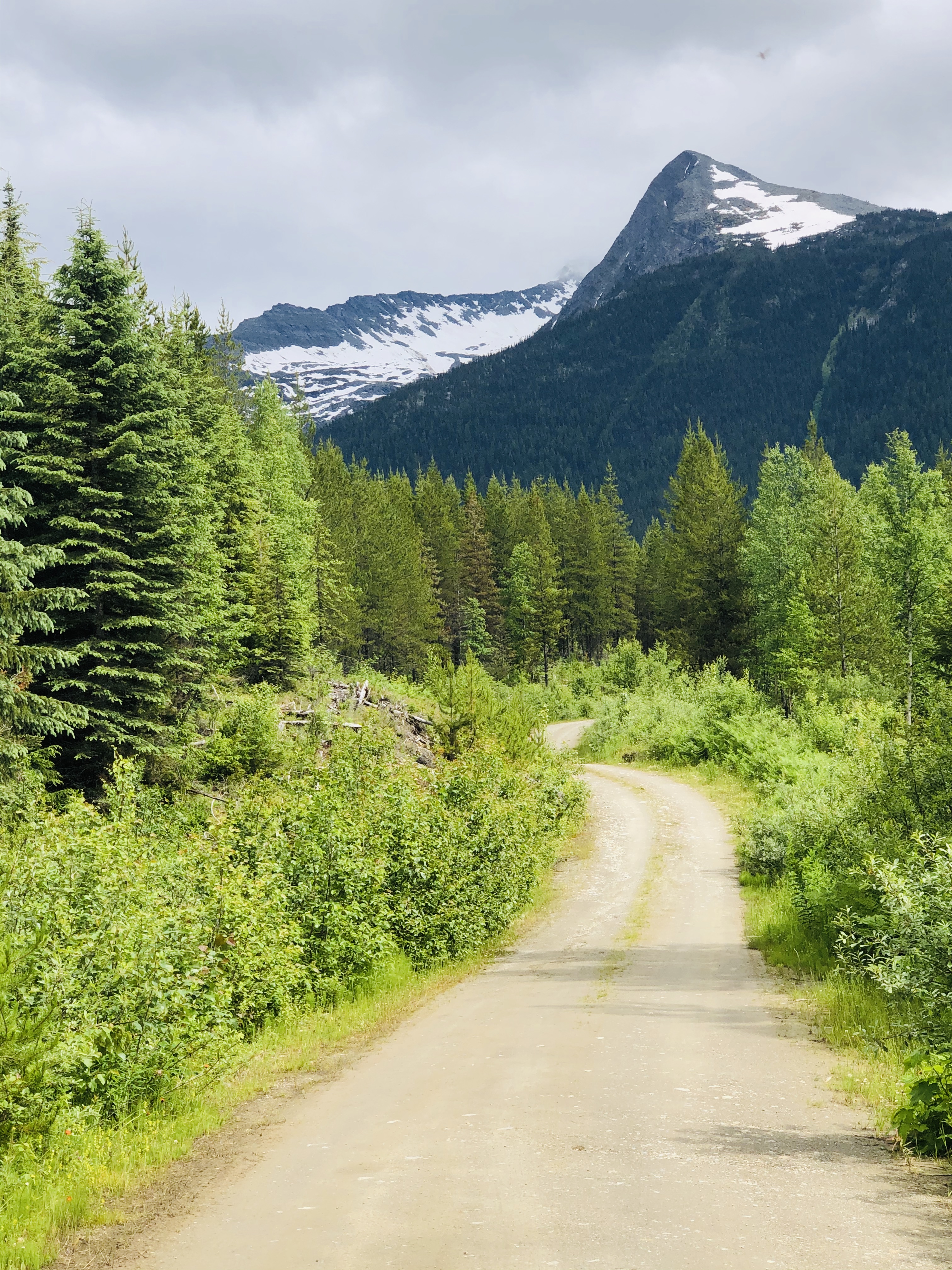
We decided to head home from the Yukon on a different route than the way up. From Watson Lake, we opted to take the Stewart Cassiar Highway instead of the Alaska Highway. It is a more westerly route and supposedly a couple of hundred miles shorter than the Alaska Highway, but it is windier, hillier and a bit more remote so it is actually the slower option. The scenery through the mountains was pretty spectacular though – and virtually no traffic on the road.
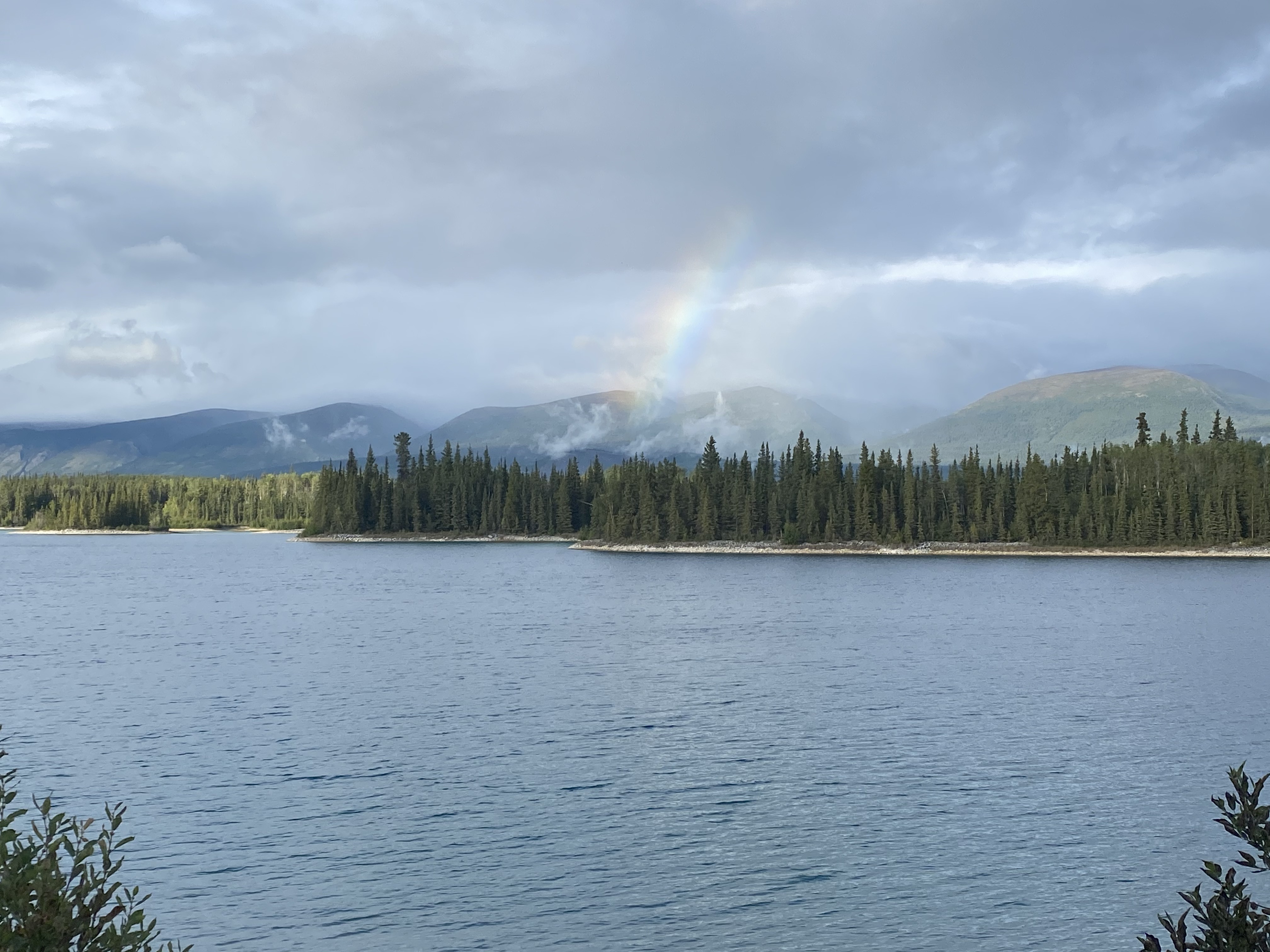
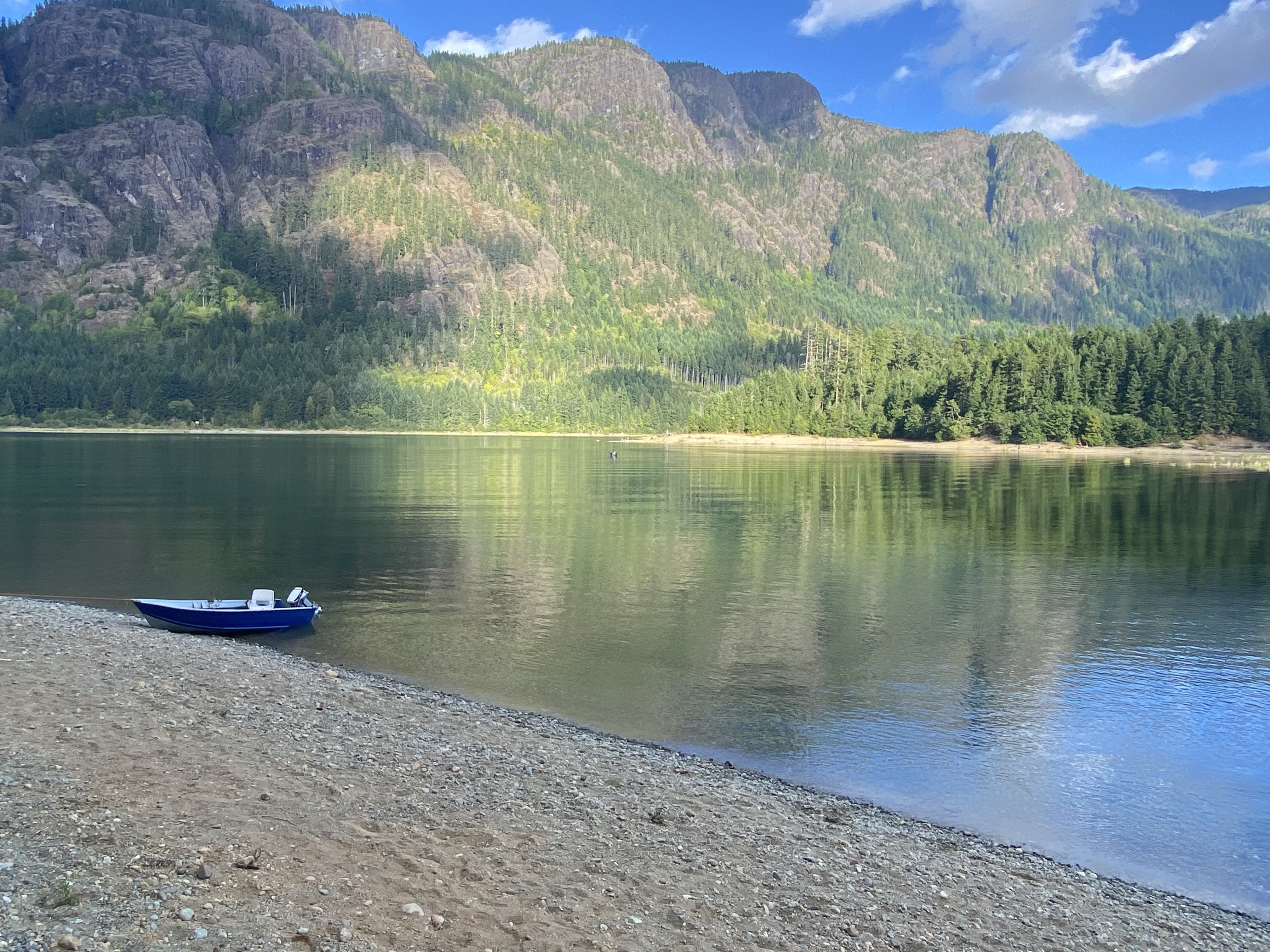
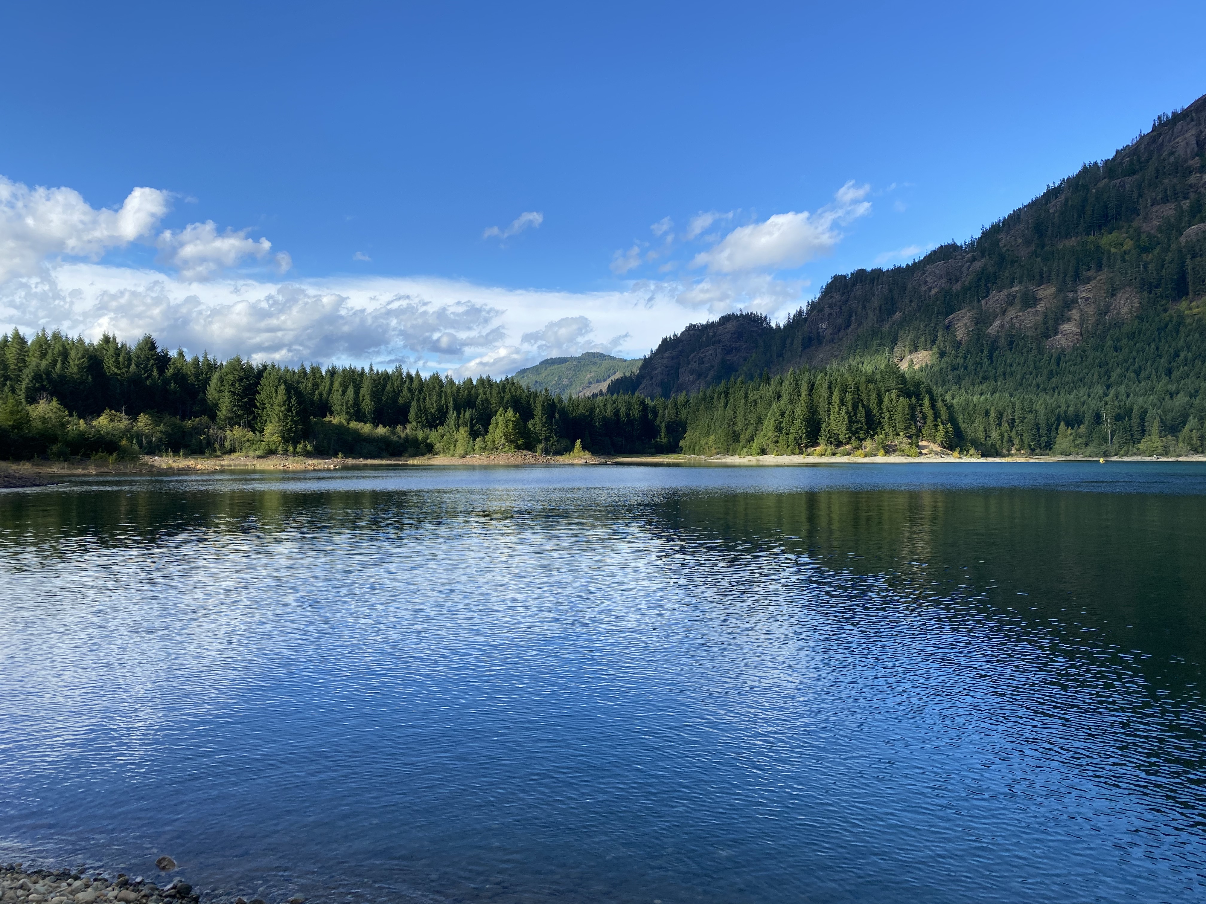
As we started making our way down the highway, we got word of a mudslide and washout at about the halfway point on the Stewart Cassiar. Another consequence of all the wet rainy weather we had been having! We decided to camp at Boya Lake Provincial Park, a couple of hours north of the slide, to wait out the clean-up and re-opening of the highway. It was a great choice – not only was the lake really beautiful but we had a water front camp site and the camp operator was a super sweet and friendly lady. After a couple of days, we were told that they were expecting to have periodic openings where they would escort one way traffic through for a few hours each day. So we packed up, made a run for it and arrived at the checkpoint with about five minutes to spare. Our timing was perfect – just as we pulled up the pilot car started to move so we barely slowed down. Wasn’t so nice for those at the other end though where cars seemed to be waiting for an hour or more to get through the slide area.
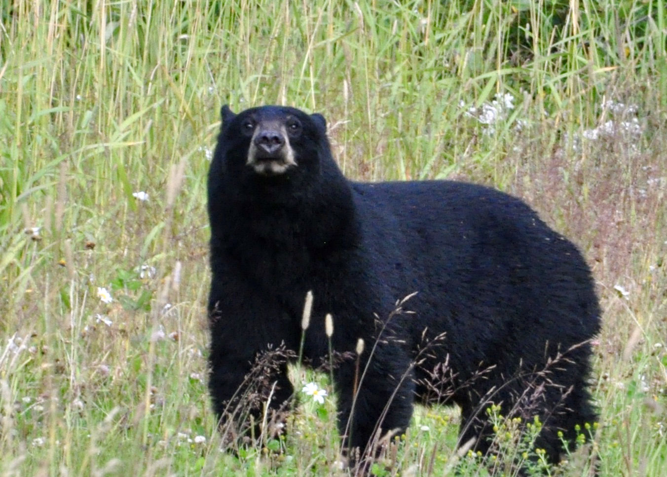
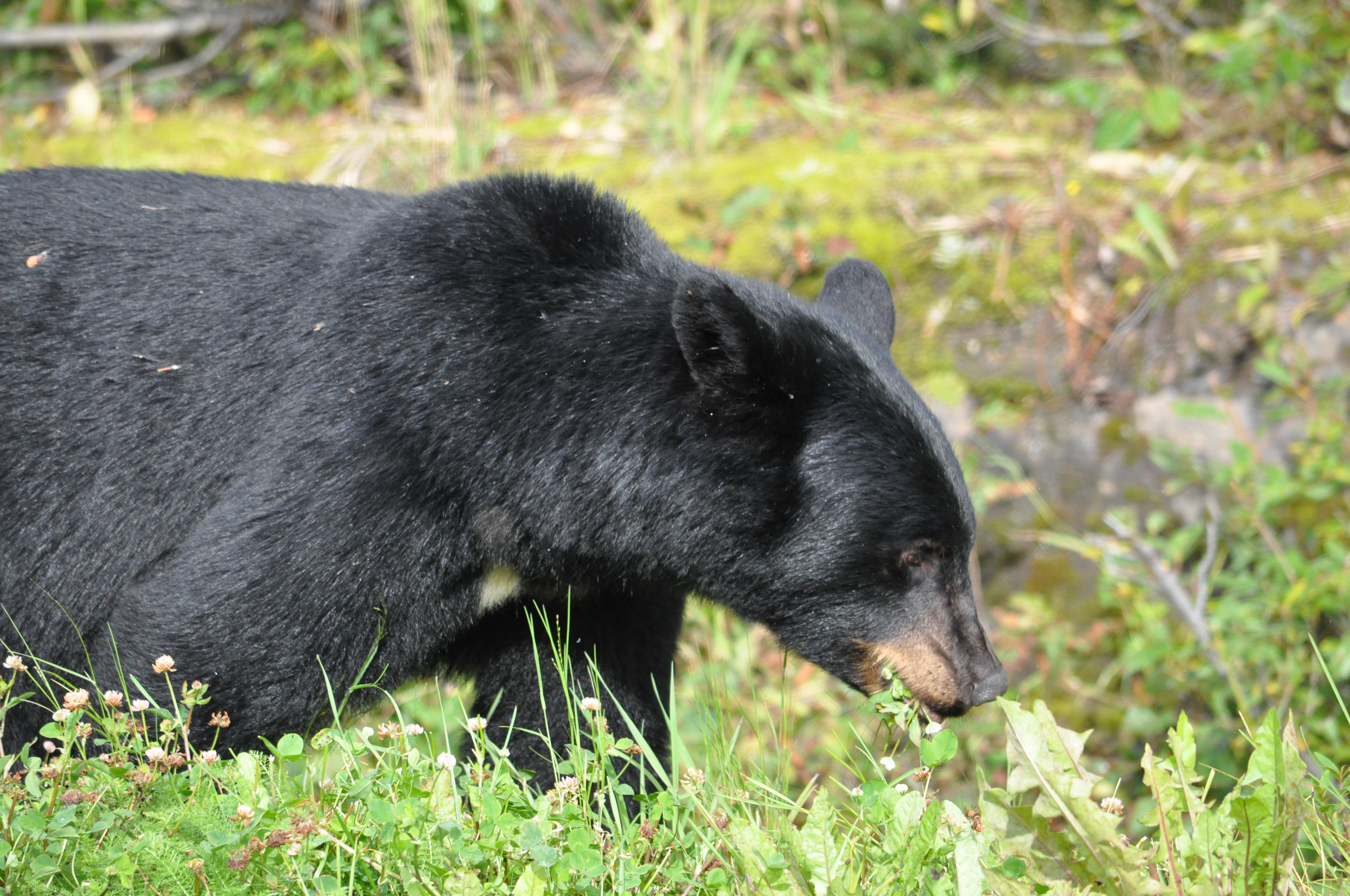
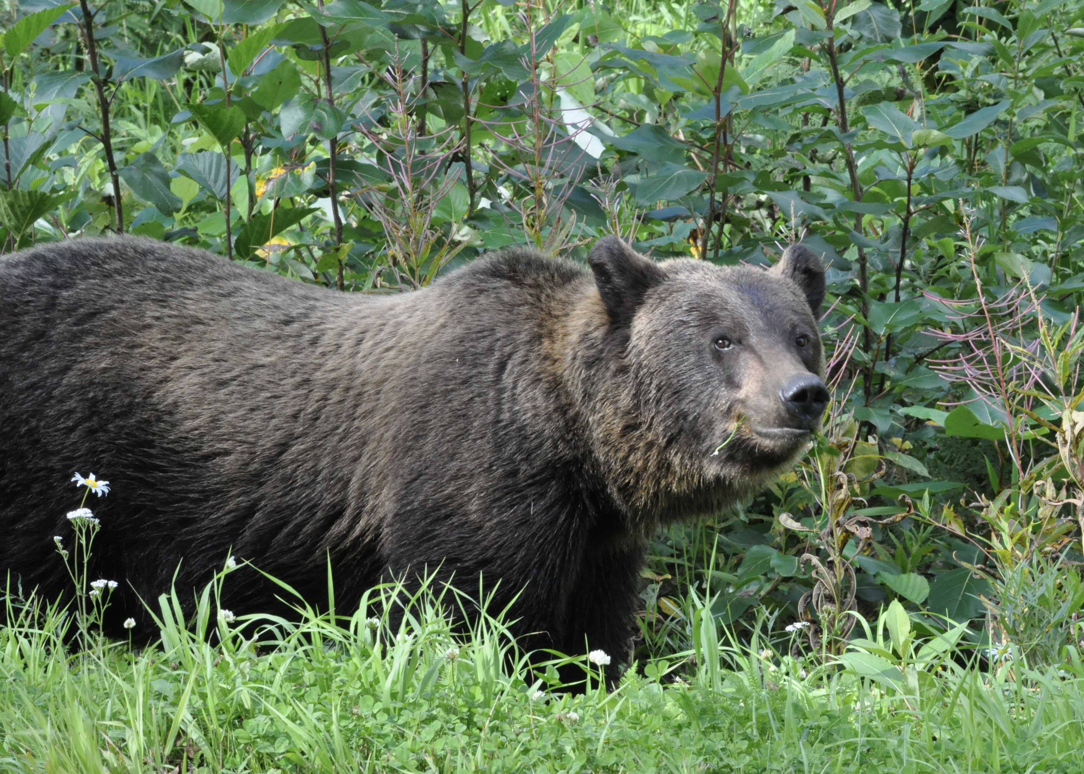
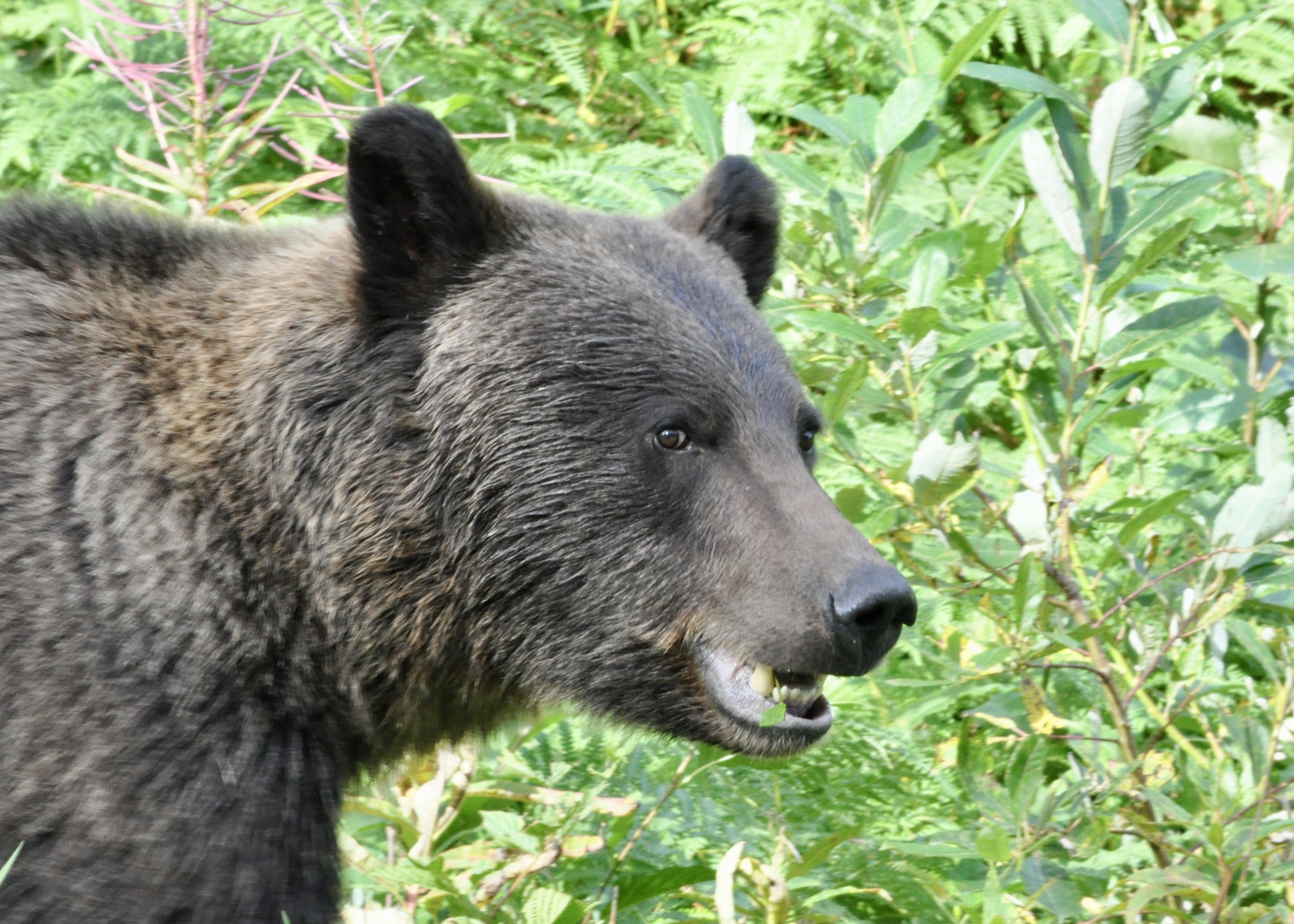
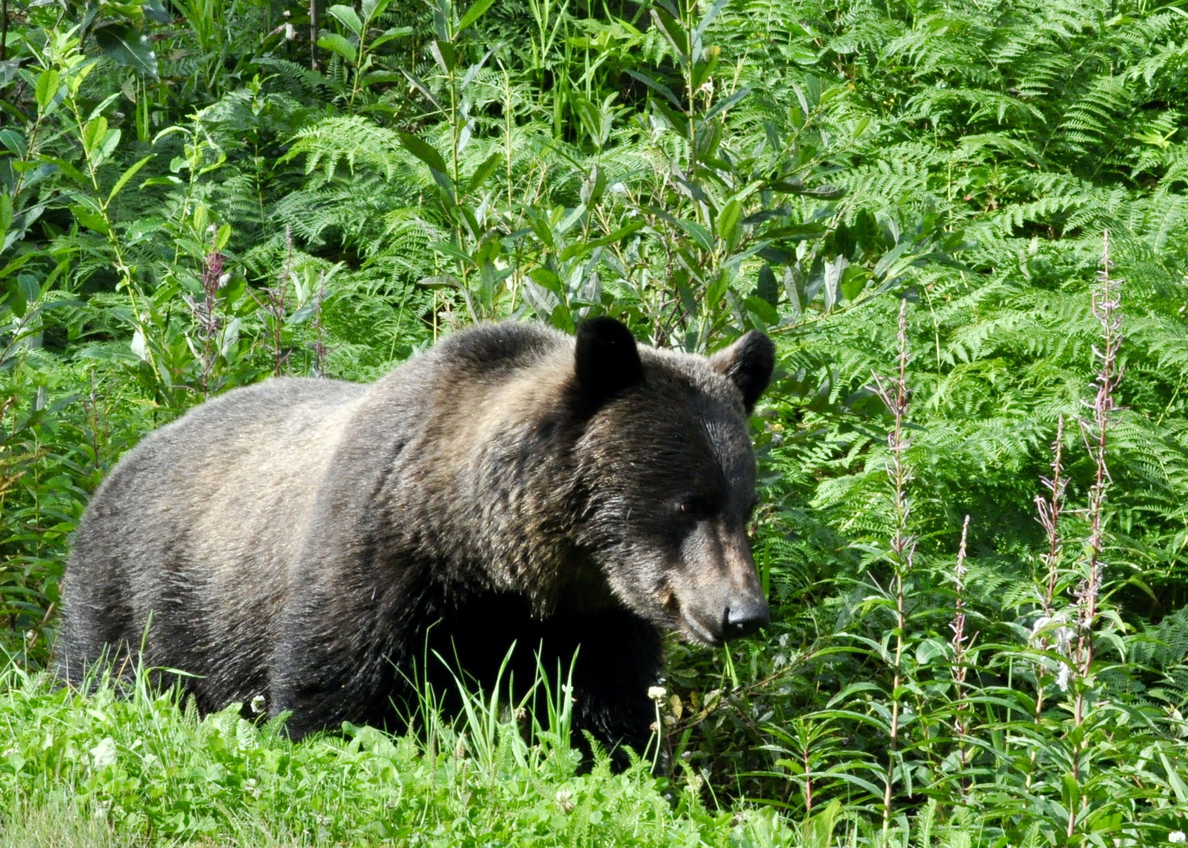
Once we were through the slide area, it seems that the bears in the area set up a welcome party for us! In just an hour of driving, we saw close to three dozen bears – black, grizzly, mommas and babies, you name it! They were quite happily chomping on the dandelions and grass on the roadside. The locals said that it was the greatly reduced traffic that brought the bears close to the road and even into the campsites. We were that vehicle that slowed down for nearly every bear…..fortunately there was no other traffic so we didn’t tick anyone off and managed to get some great photos!

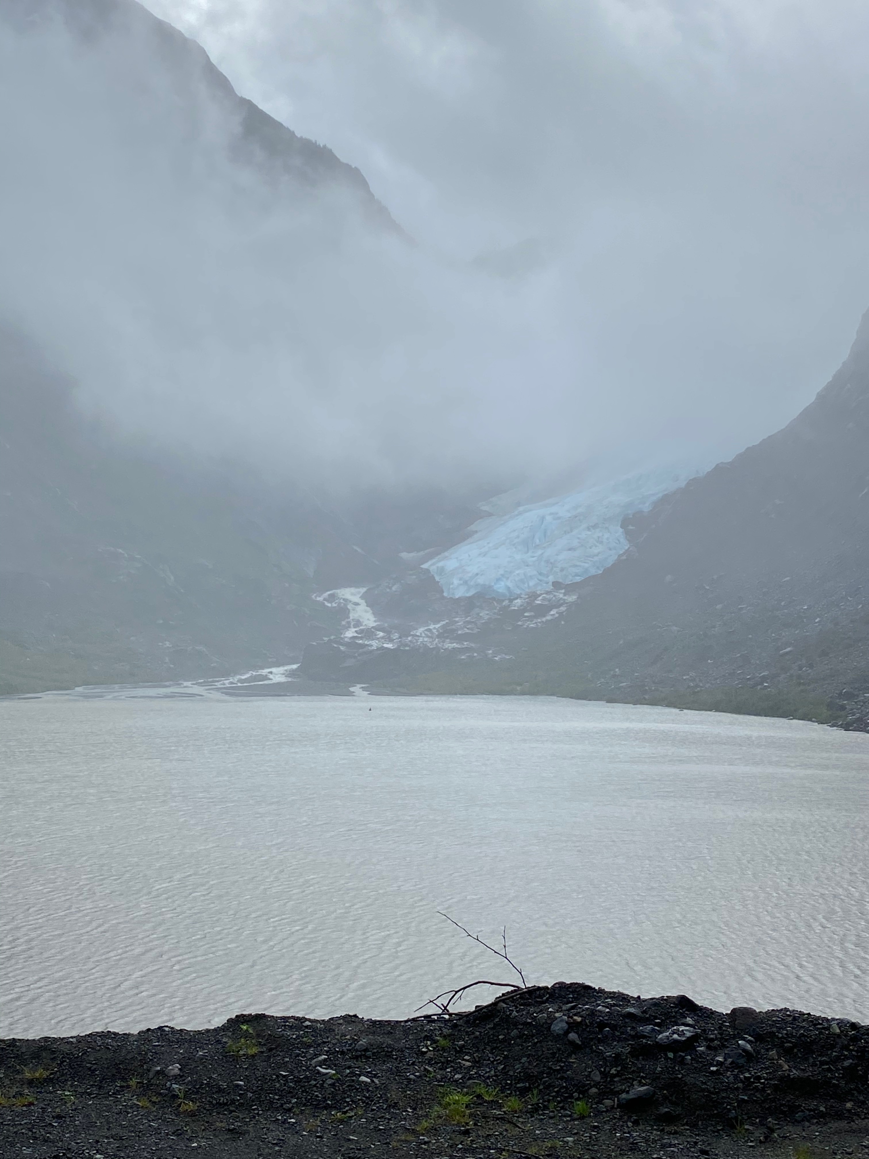
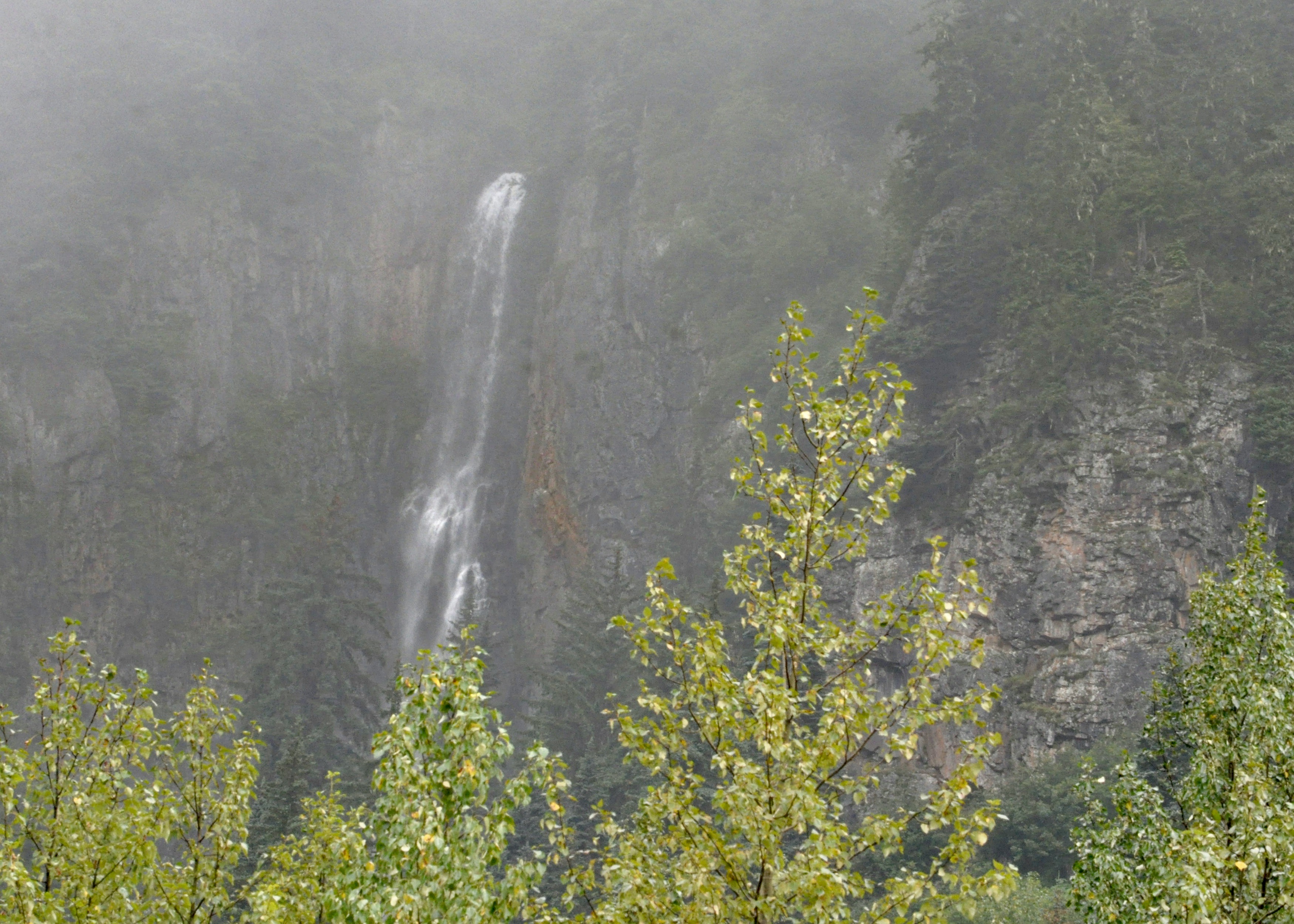
We stopped for the night in Meziadin Lake Provincial Park and took a little side trip to Stewart. Like many of the places we have visited on this trip, Stewart was once a bustling town but is now just a shadow of its former glory. That said, there are lots of really cool heritage buildings in town and its location at the end of a long inlet surrounded by mountains is pretty spectacular. On the drive in, we passed the Bear Glacier (appropriately named given the number of bears we encountered!) and more waterfalls than we could count.
From Meziadin, we carried on into Terrace where we had the almost forgotten pleasure of sitting in a pub and watching the Canucks win a playoff game! Not exactly what we were expecting to see in August but hey – we’ll take what we can get.
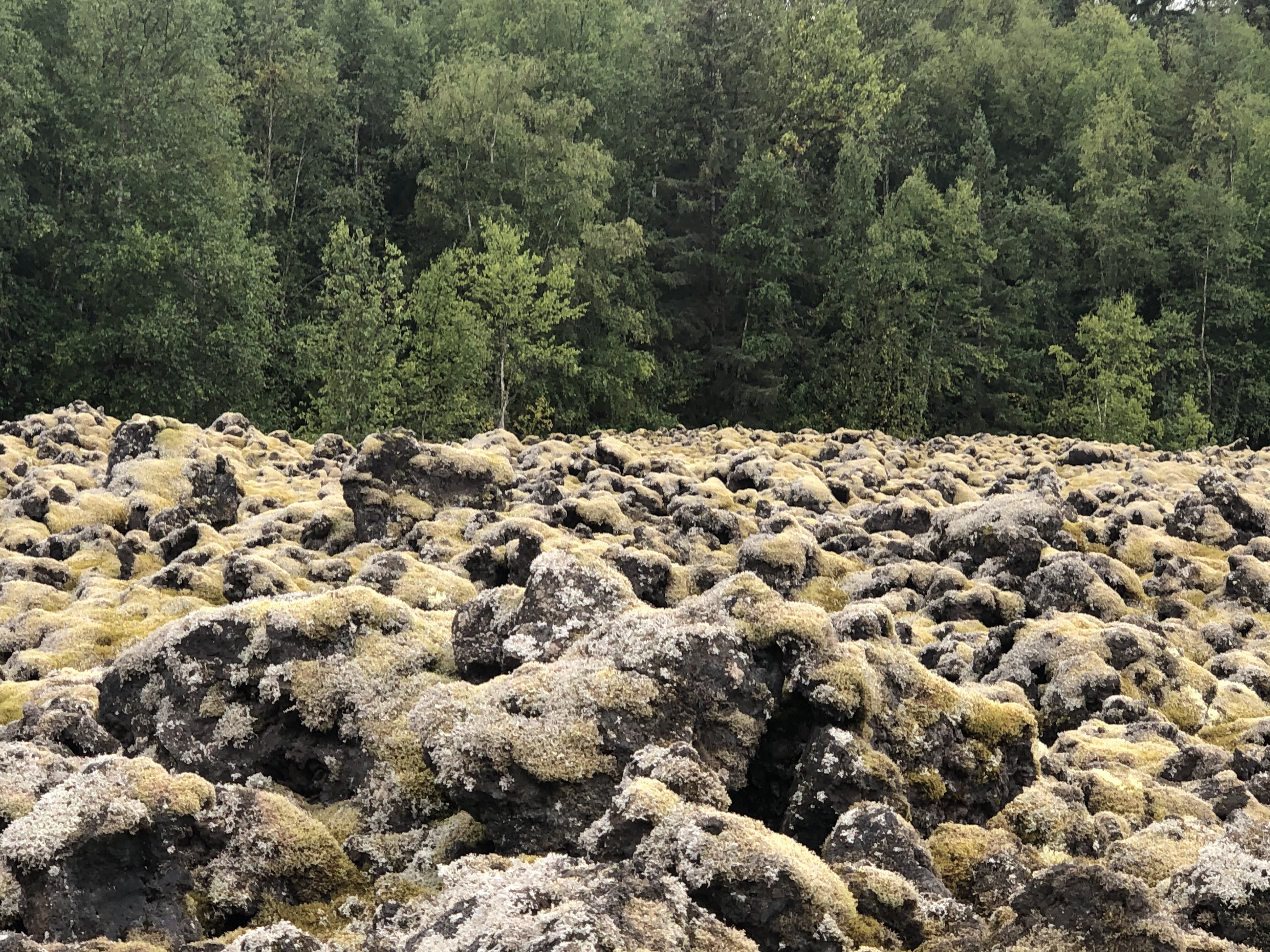
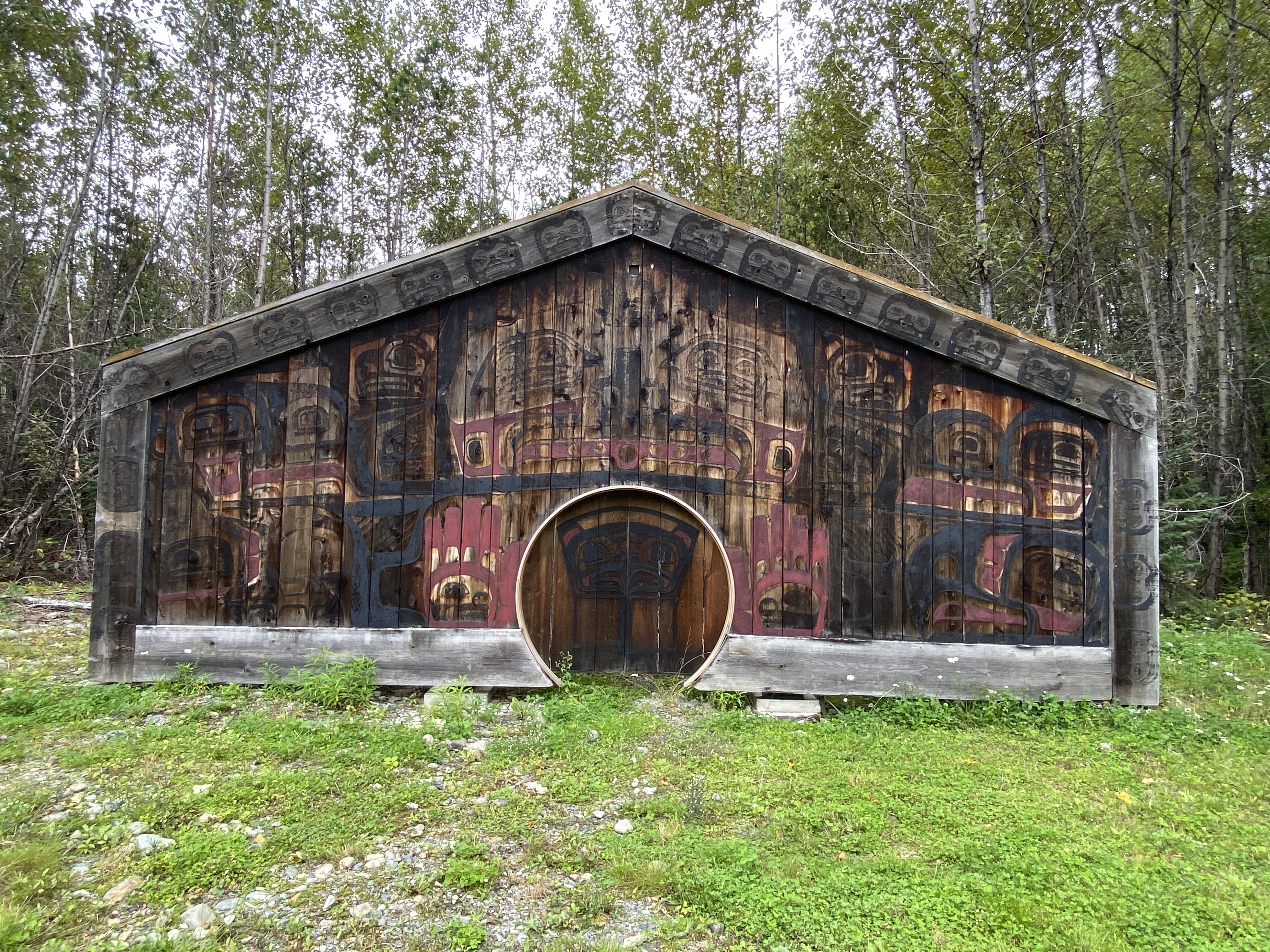
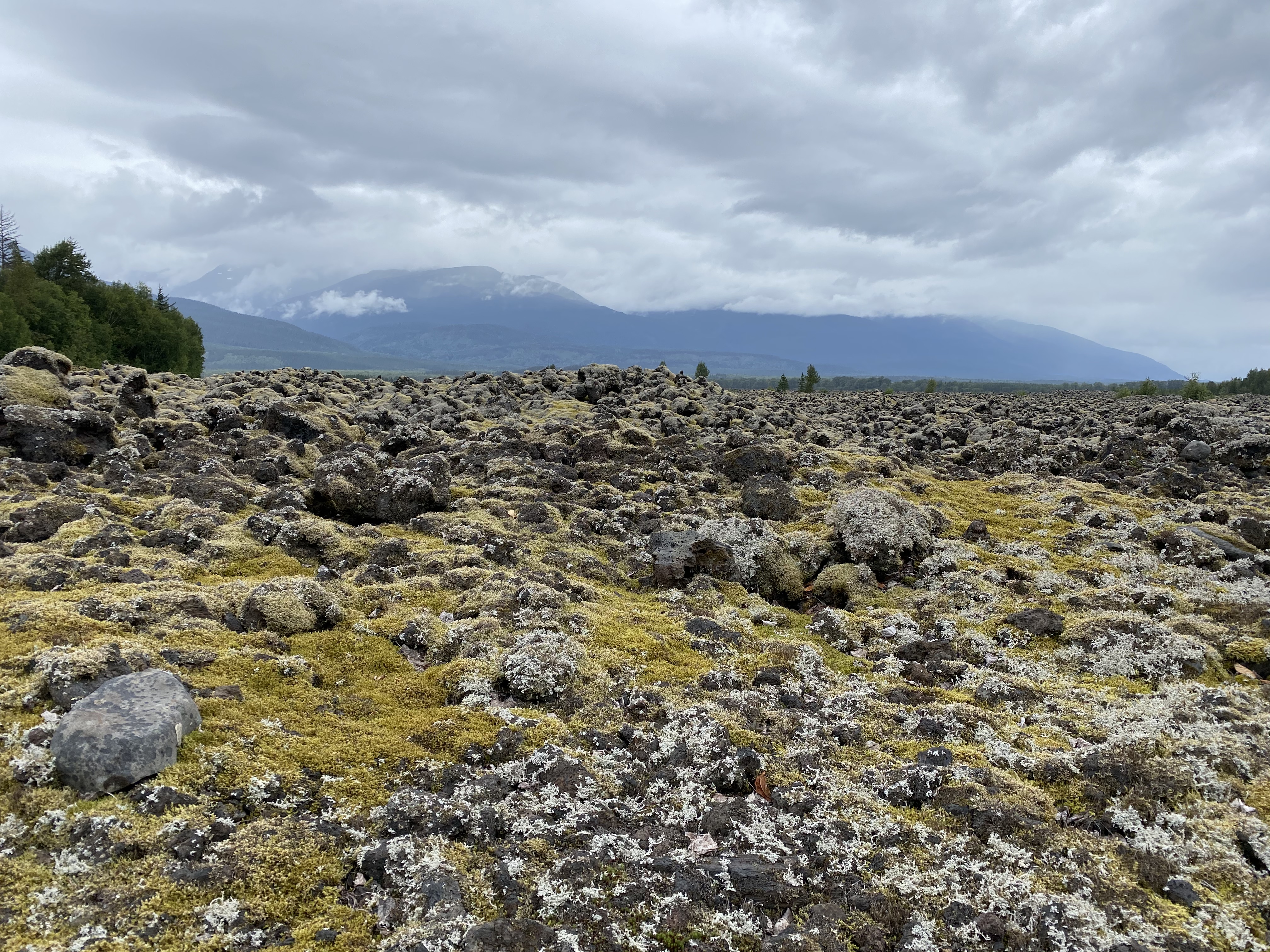
The next morning, we ventured up the Nisga’a Highway for another interesting side trip to the Nisga’a Memorial Lava Bed Park. This is the site of what is believed to be the last great volcanic eruption in Canada which occurred approximately 250 years ago. Tragically, when the Tseax Cone erupted, the lava spilled down the Nass Valley, blocking the river and destroying two Nisga’a villages. An estimated 2000 people died. The landscape it left behind is uniquely beautiful and haunting. It is difficult not to feel the spirituality of the site when you visit.
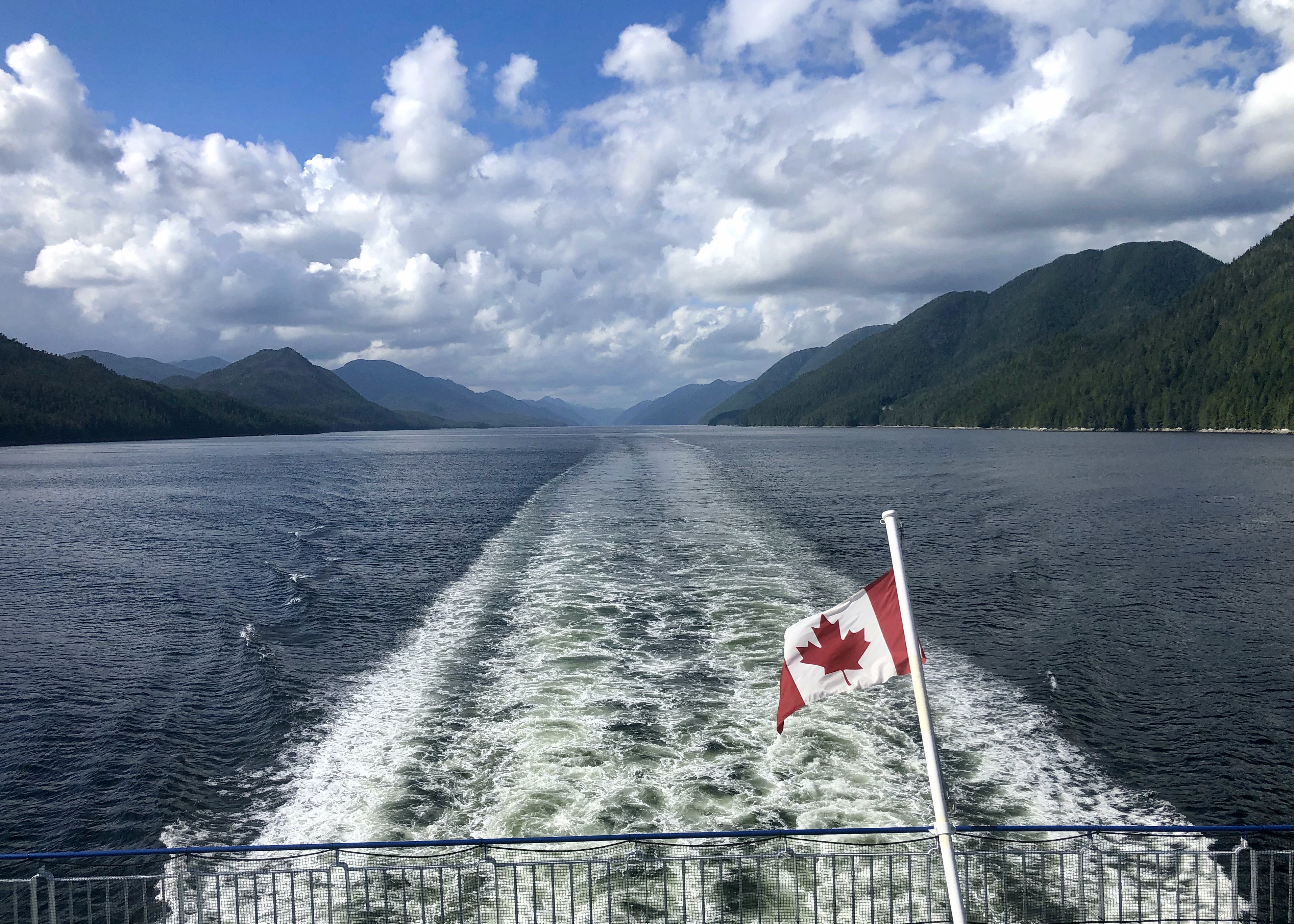
We continued our journey to the very end of the road in Prince Rupert with the hope that we would be able to catch the ferry down the coast to Port Hardy. It promised to be a rather long but incredibly scenic voyage through the inside passage with stops in Bella Bella and Klemtu. Taking the ferry down the coast is something we have talked of doing for a while and we were quite excited about the prospect of finally making the trip. Unfortunately this year though, BC Ferries has been operating on a significantly reduced summer schedule so by the time we made up our minds to take the ferry, our targeted sailing was fully booked. We were wait listed for August 28 and had our fingers crossed. Two days before the departure, we got the news that we were confirmed! In the meantime though, we had kind of mentally planned our drive home via Highway 16 so now had a decision to make….sail or drive? We opted for the ferry and two days later we packed up and boarded the ferry homeward bound. The drive will have to wait for another time – but we have a little pre-planning done now!
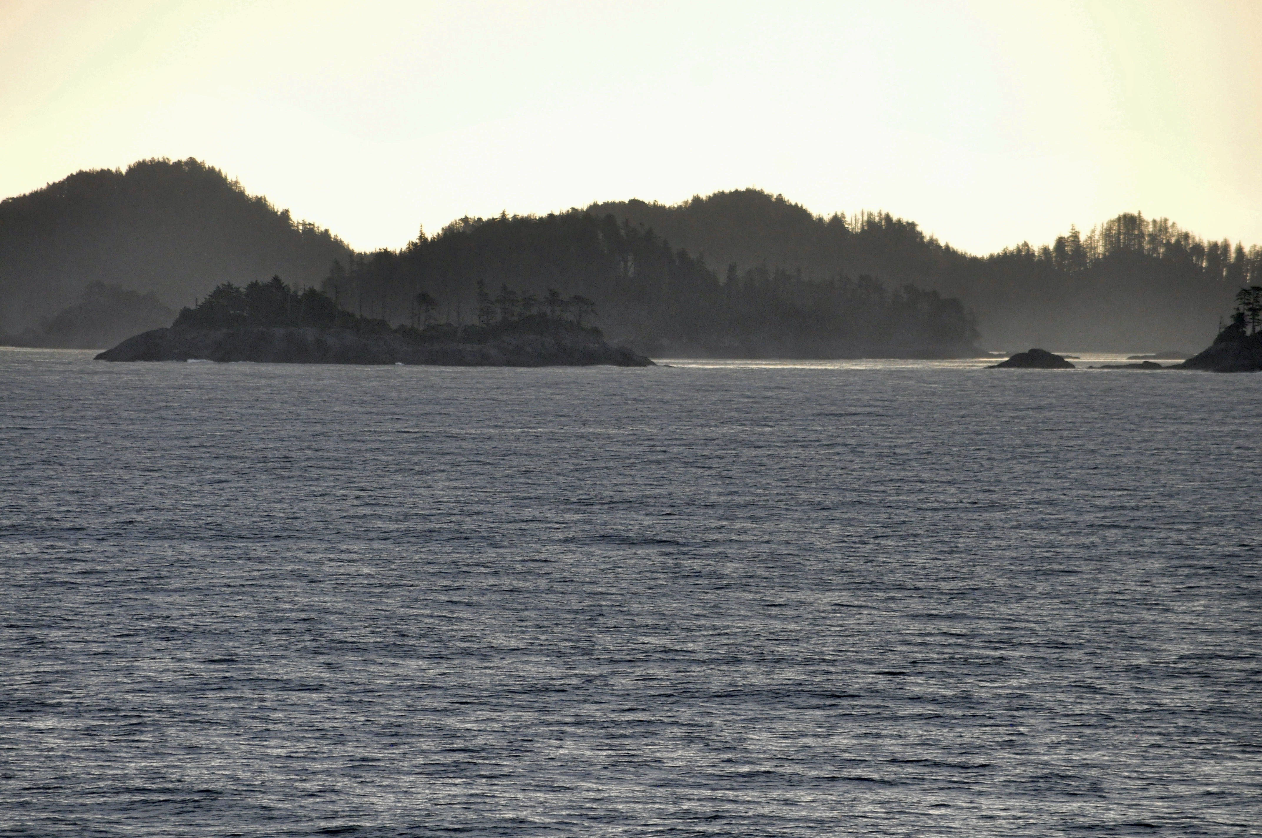
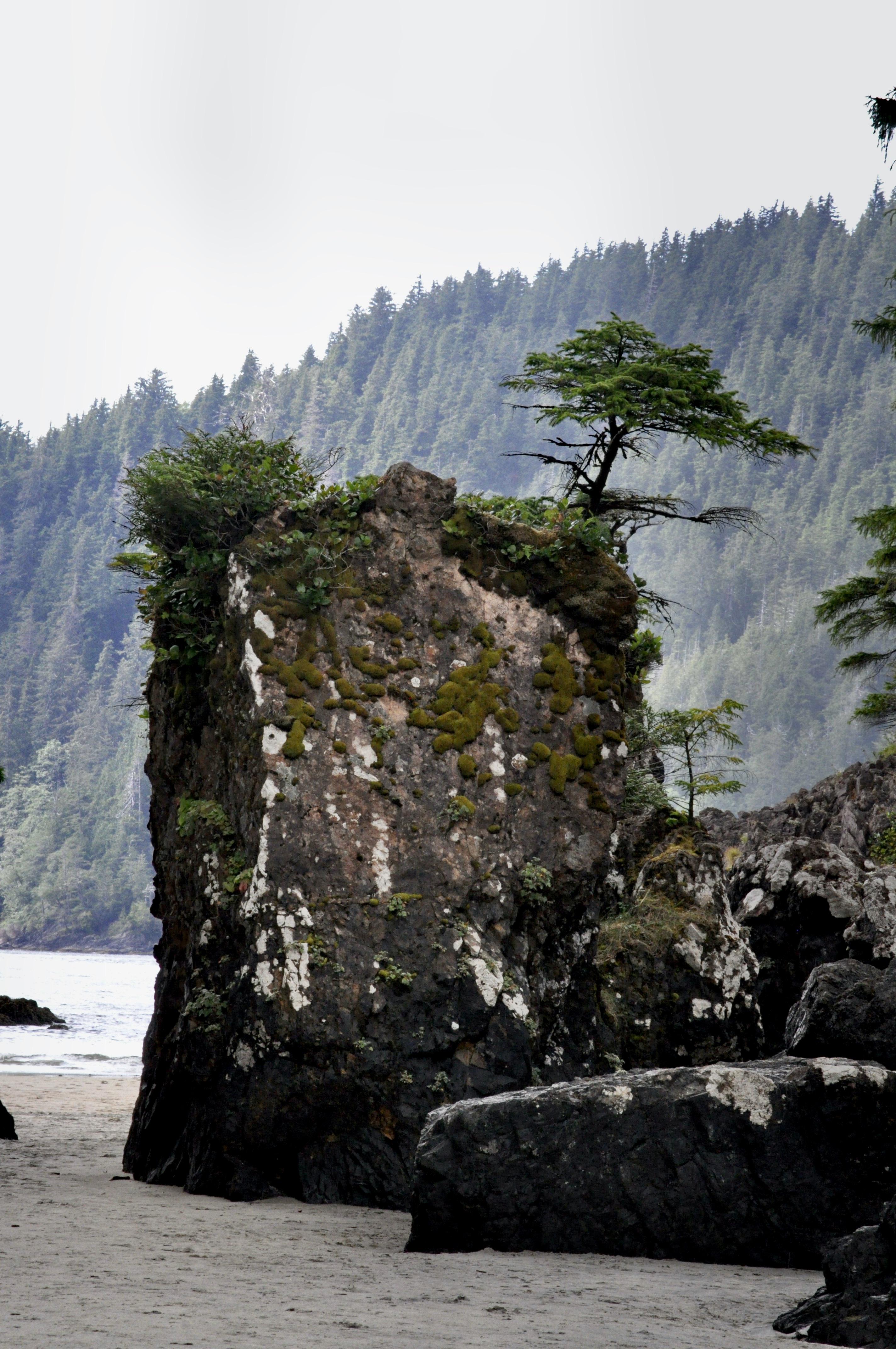
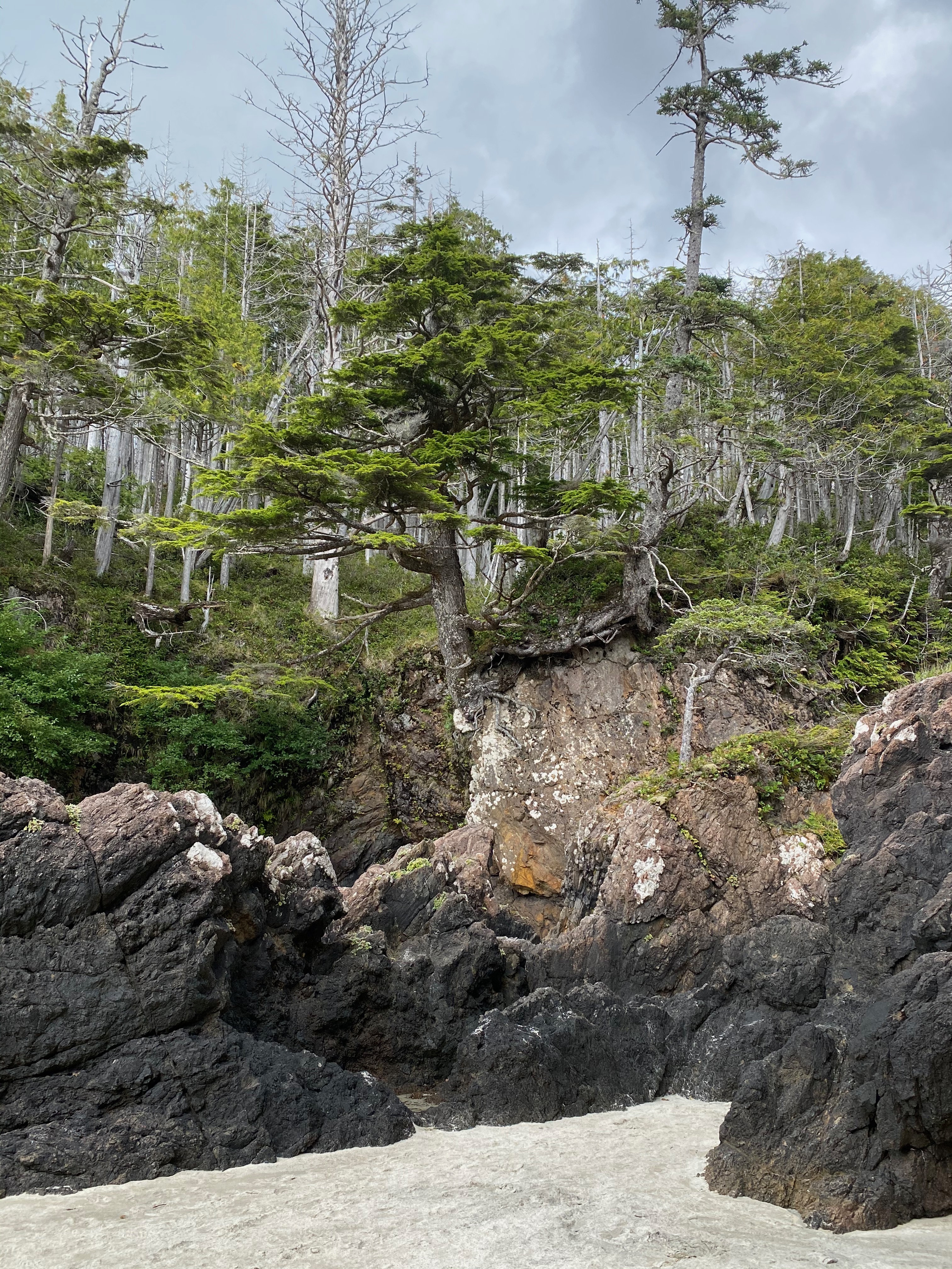
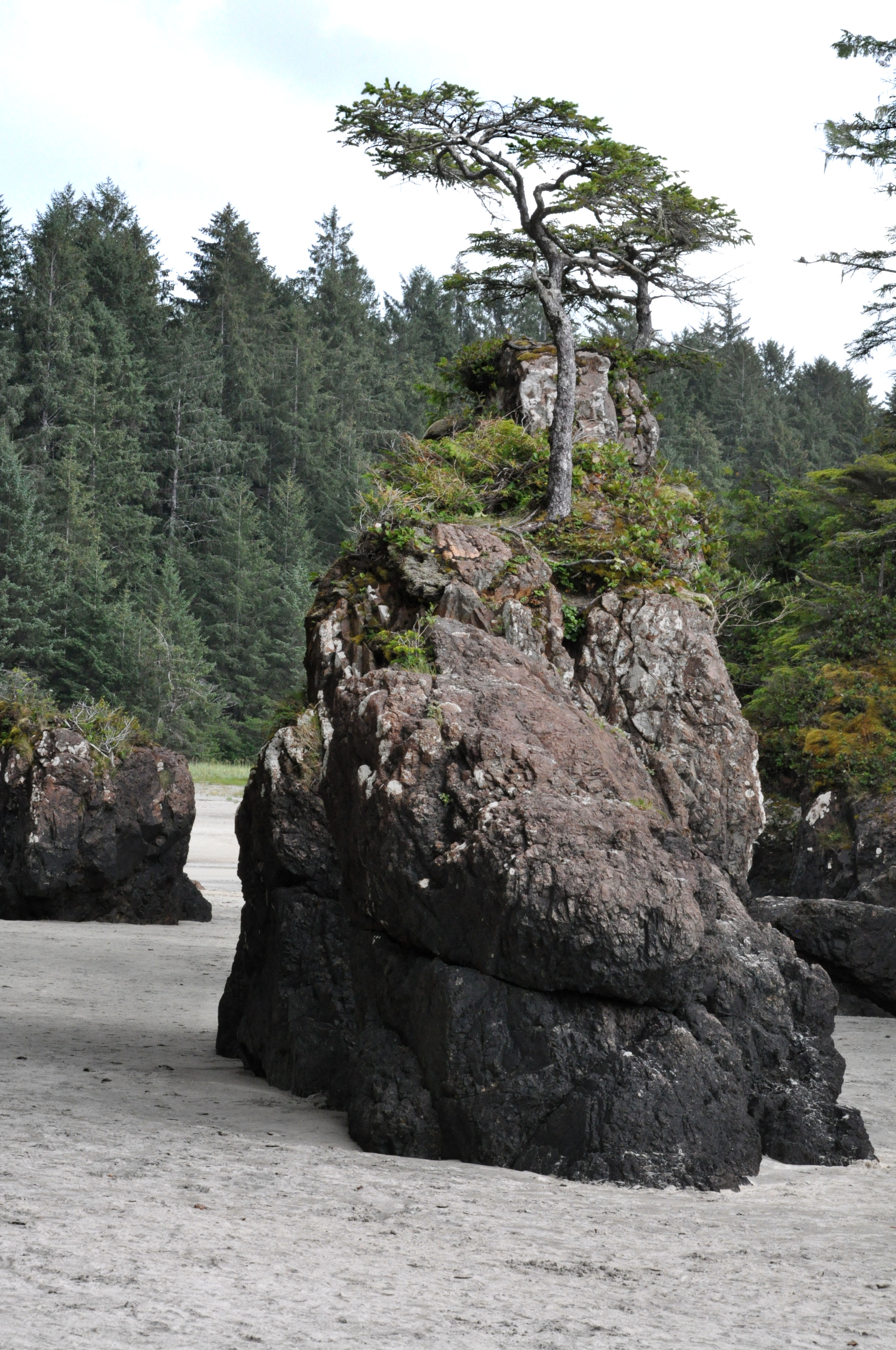
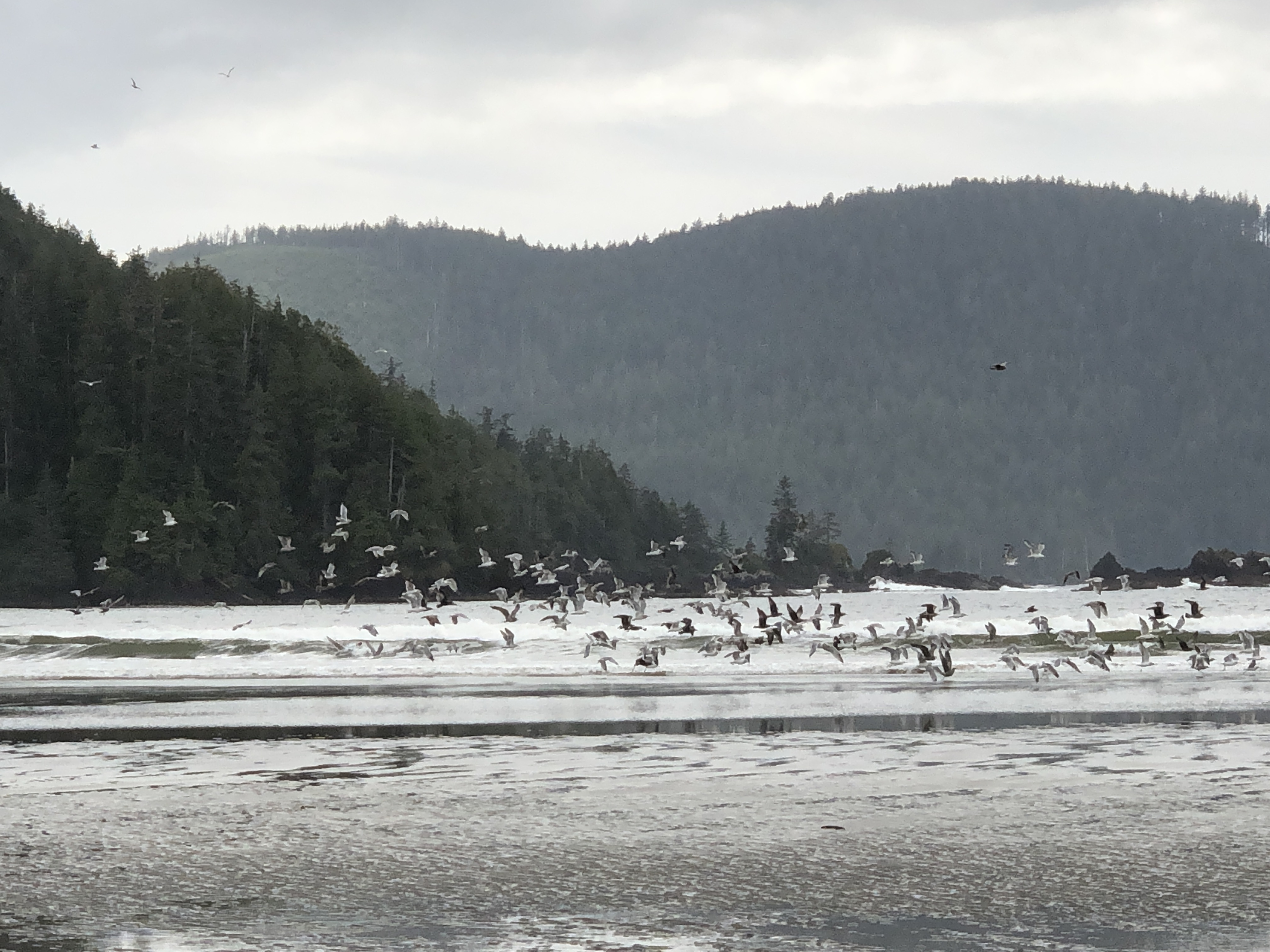
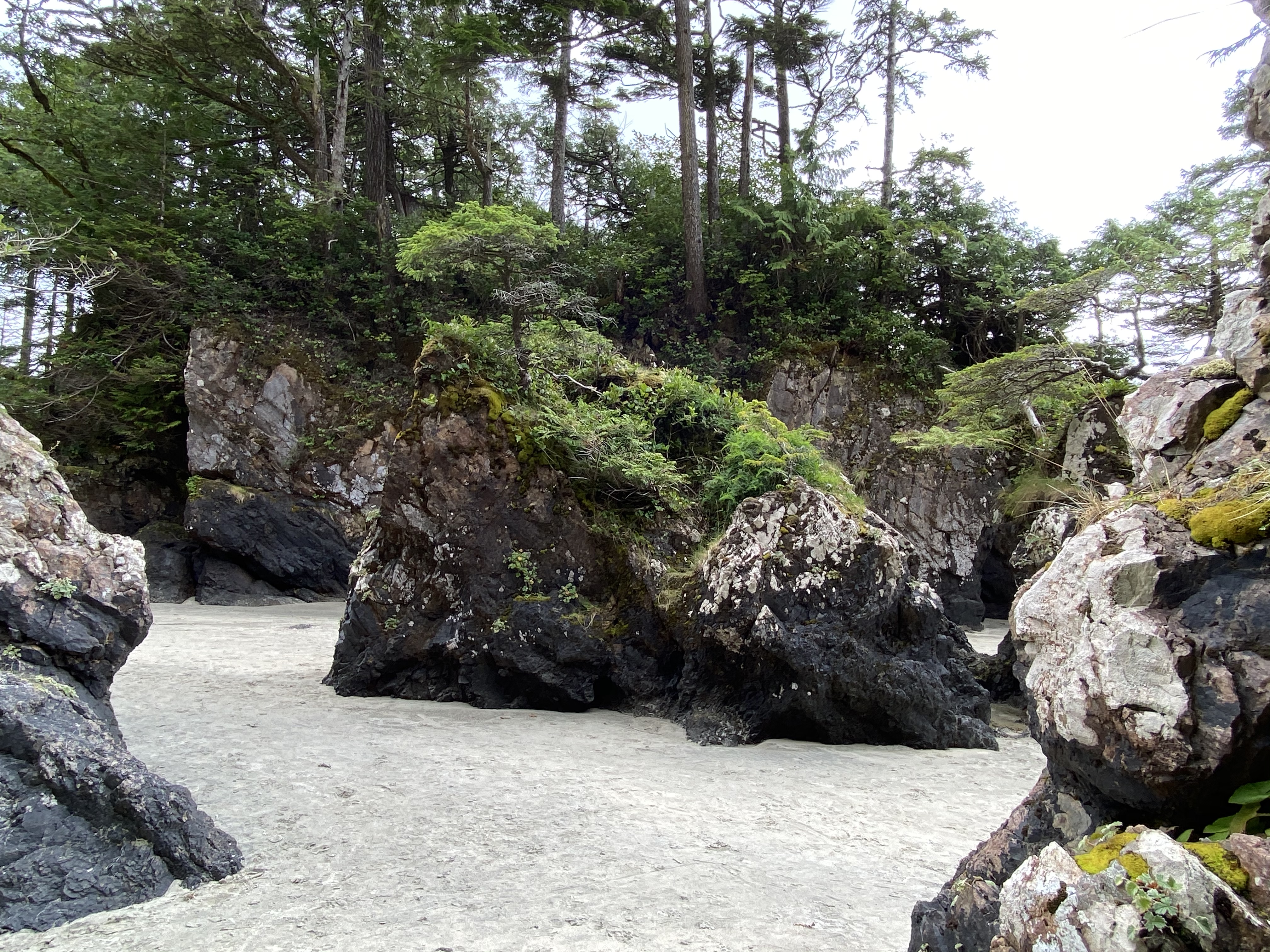
After disembarking in Port Hardy in the morning, we grabbed some coffees and muffins to go and hit the road to Cape Scott Provincial Park. Cape Scott is home to some great hiking, beautiful beach (complete with sea stacks and caves), a lighthouse and is the northern most point on Vancouver Island. After all the driving we did up north, we thought the worst of the gravel roads were behind us….turns out we had one last test for B! The road in to Cape Scott is only about 60 km but is actually quite nasty so it is not a quick drive. Regardless, we made it in and out safely. The scenery on the coast was beautiful so the trip was worth it but next time we might stay for more than one night and try the hike to the lighthouse.
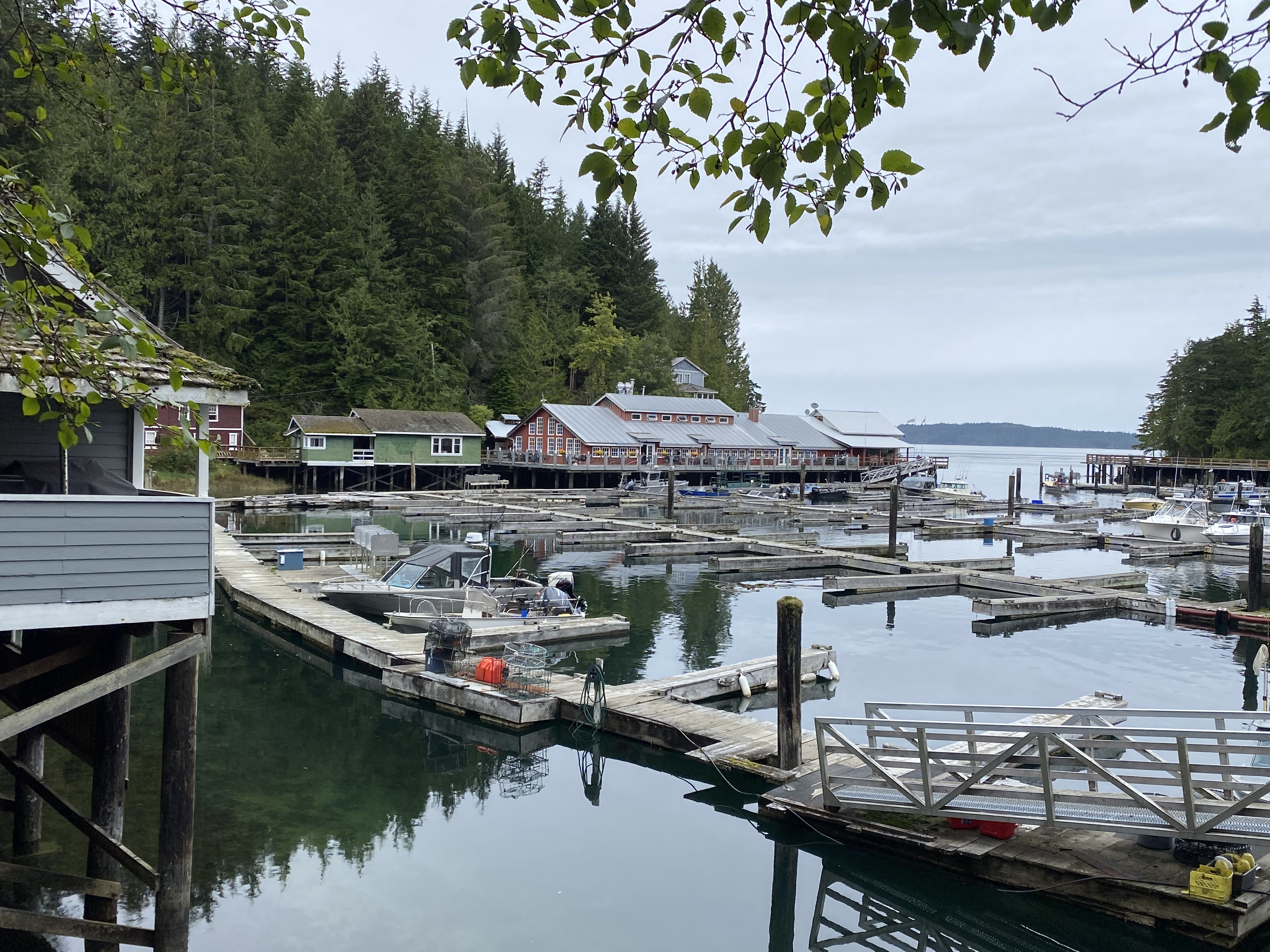
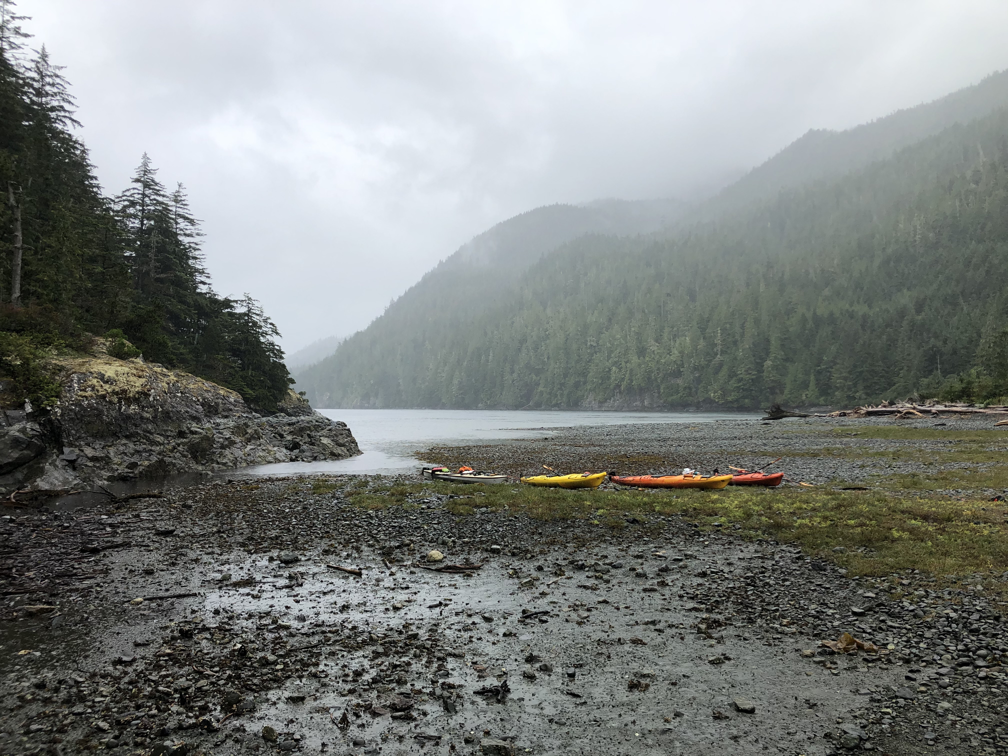
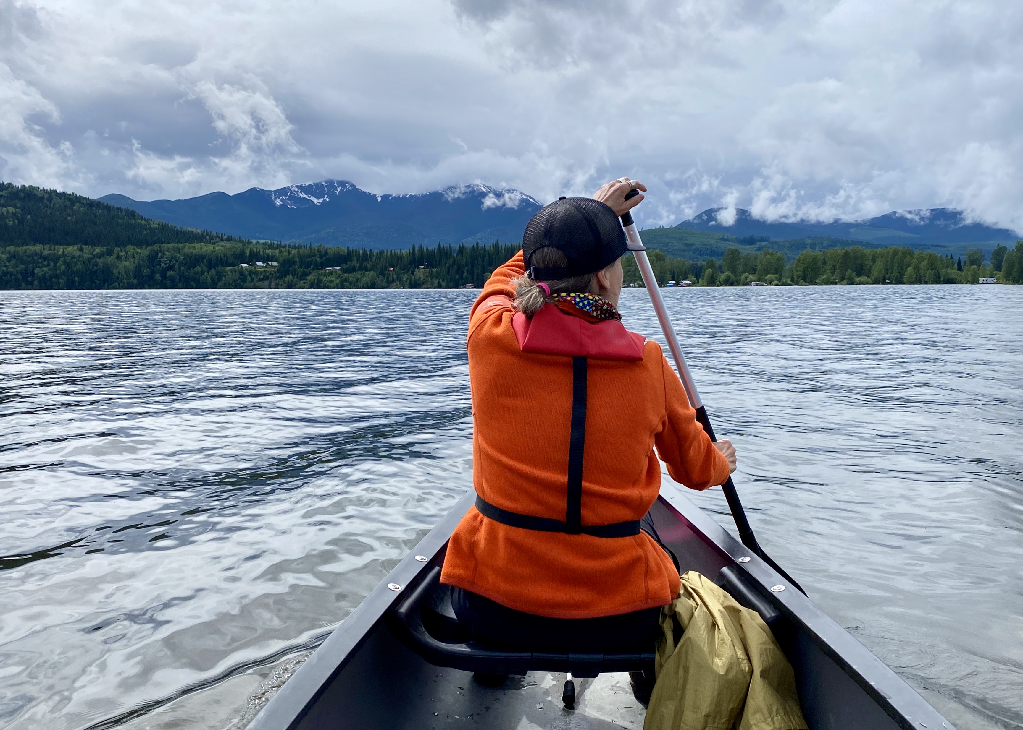
Our next stop as we headed down Vancouver Island was at the charming little village of Telegraph Cove where we had a very wet day of kayaking….
…. then on to Strathcona Park for two more nights before finally hopping on the ferry at Duke Point to take us home to Vancouver!
All tolled, we were on the road in our 19-foot motorhome for ten consecutive weeks. We managed to see so many cool places in BC and the Yukon, many for the first time. We were able to take our time and explore all those famous and not-so-famous ‘points of interests’ along the way that we often don’t have the time or inclination to stop for. We visited many beautiful BC Provincial and Yukon Territorial Parks – we are very lucky to have access to such amazing natural spaces. It wasn’t exactly the way we were planning to spend our summer but we are so very thankful that it was an option for us in this crazy year of Covid.
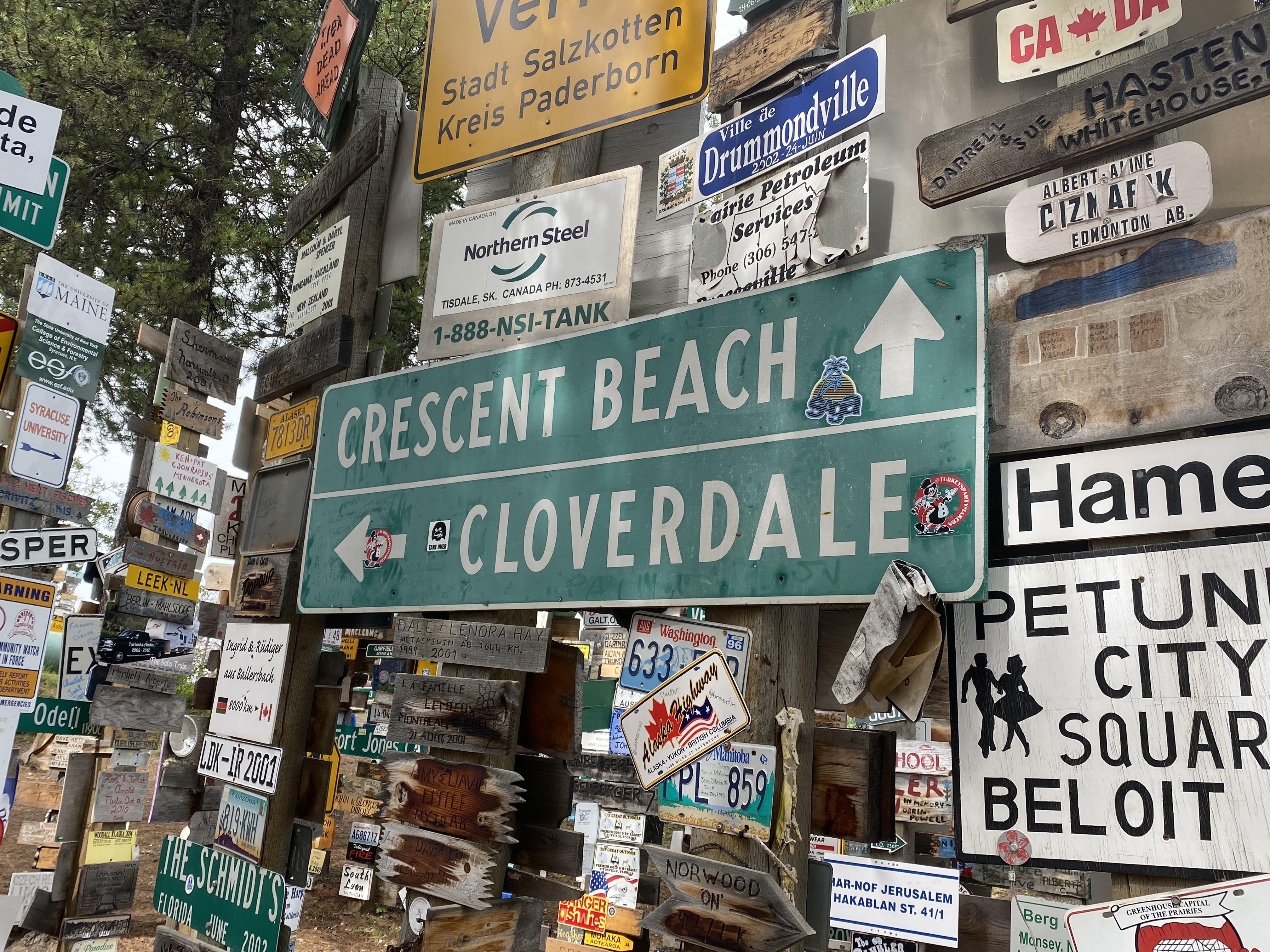
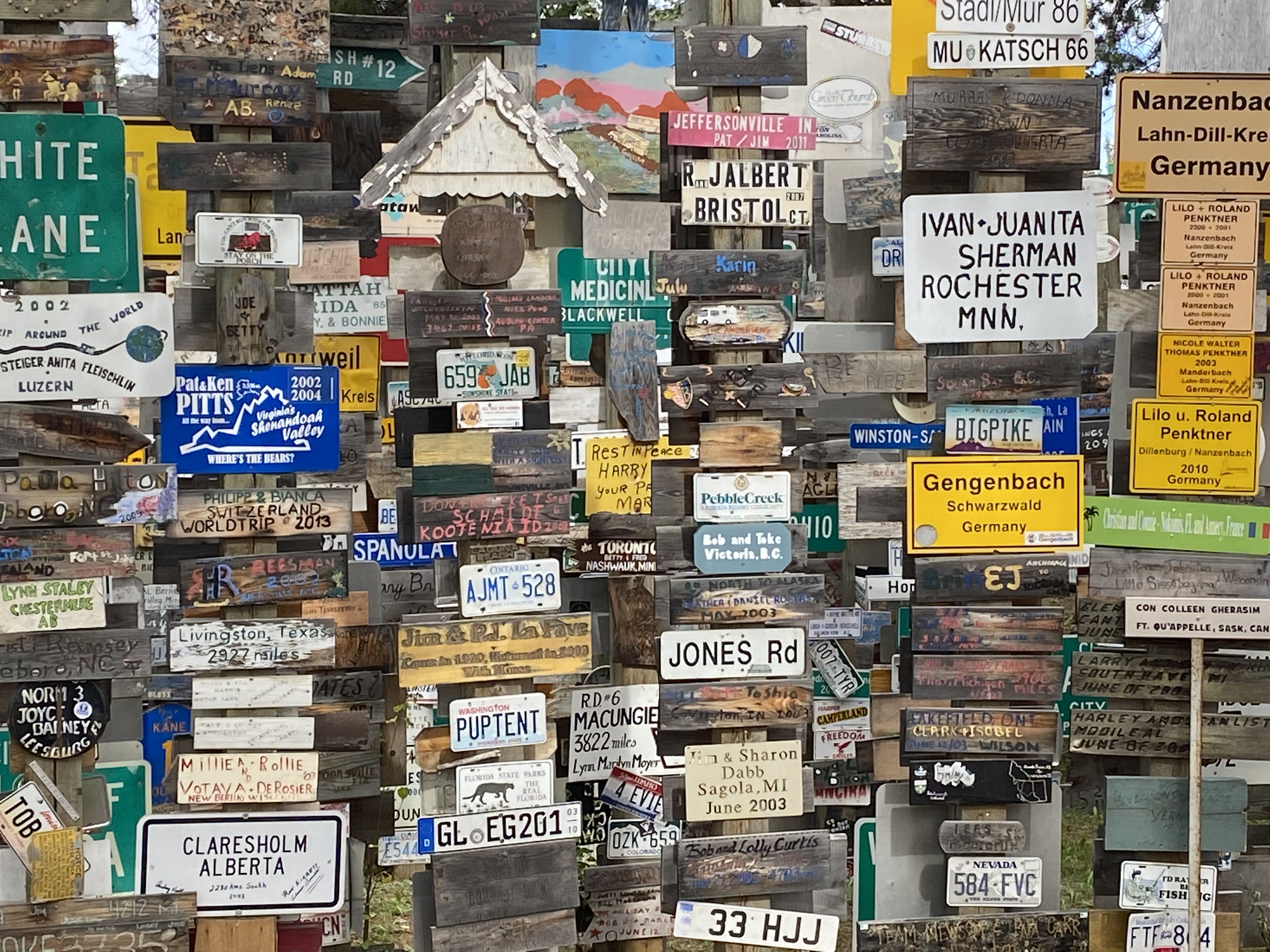
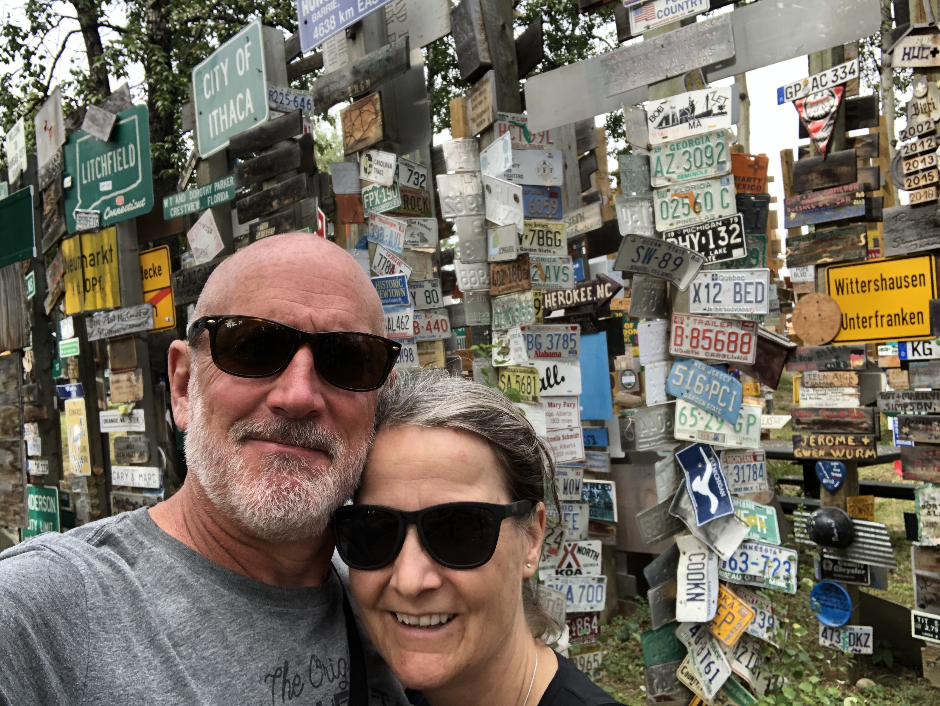
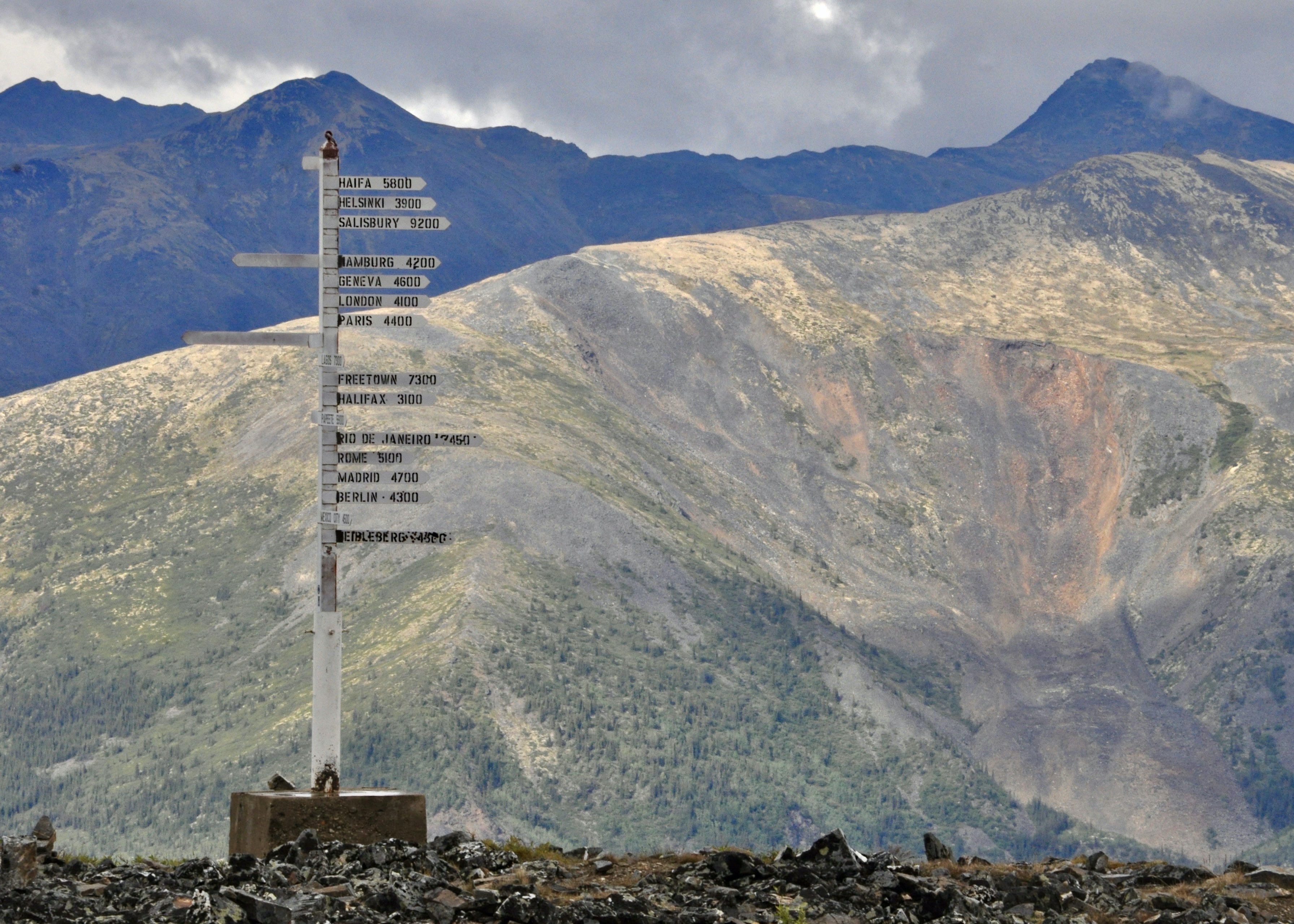
After answering a few questions at the border checkpoint between BC and the Yukon, we were deemed Covid-safe and released to roam free in the Yukon. Our first stop was for supplies, camping permits and fishing licenses in Watson Lake. This is also where we found the infamous sign post forest. The story goes something like this….during the construction of the Alaska Highway, a lonely serviceman from the US decided to attach a sign from his hometown to one of the highway mile markers. From this a tradition was born! People from all around the world have contributed town signs, street signs, licence plates, home made family trip signs, you name it – the results are a haphazard forest of sign posts stretching a block or so down the highway. It is pretty cool to spend a little time walking around and seeing where travellers have come from and when they were here.
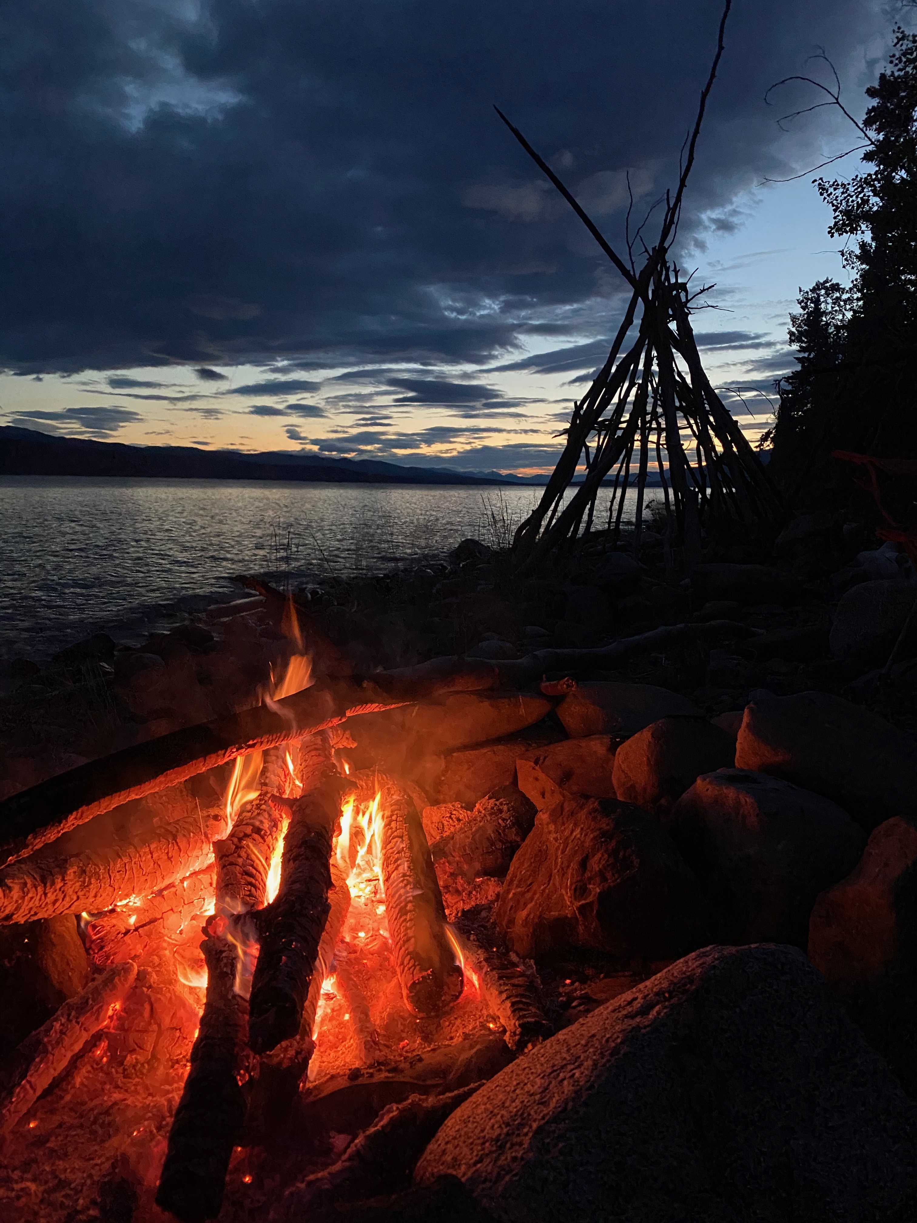
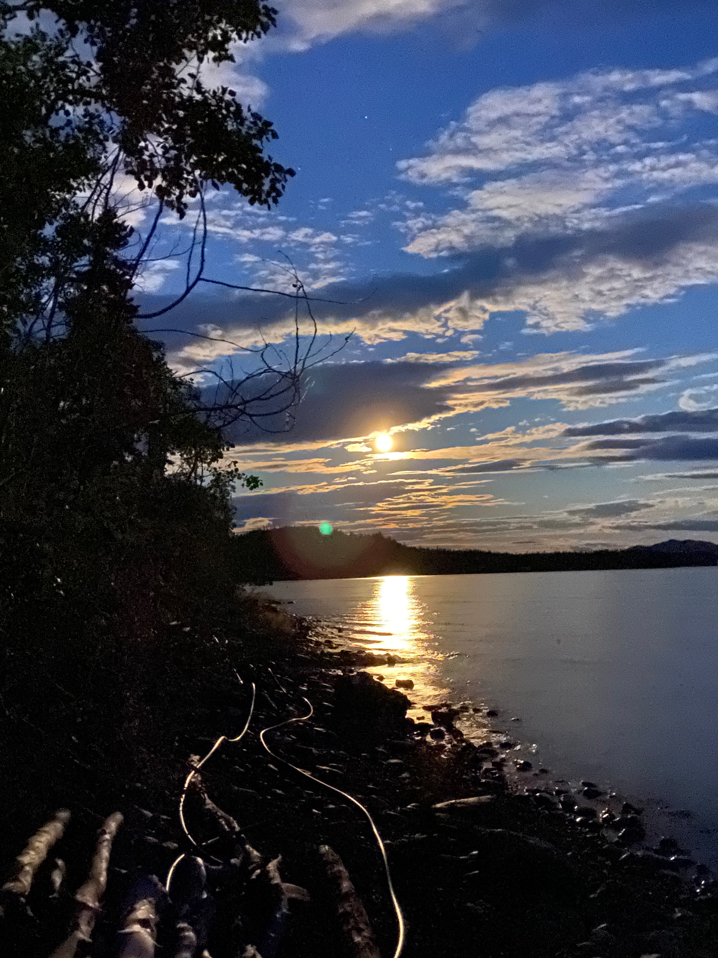
From Watson Lake, we travelled along the Alaska Highway with a quick overnight in Teslin then on to visit some dear family members – Warren’s Aunt Pat on the beautiful Takhini River and Cheryl’s Uncle Don on the equally beautiful Marsh Lake. We managed to coordinate schedules and connect with many cousins too! We had some great family time, shared some fabulous meals and enjoyed a few lakeshore fires until late into the night….the long days can fool you into believing it is much earlier then it really is!
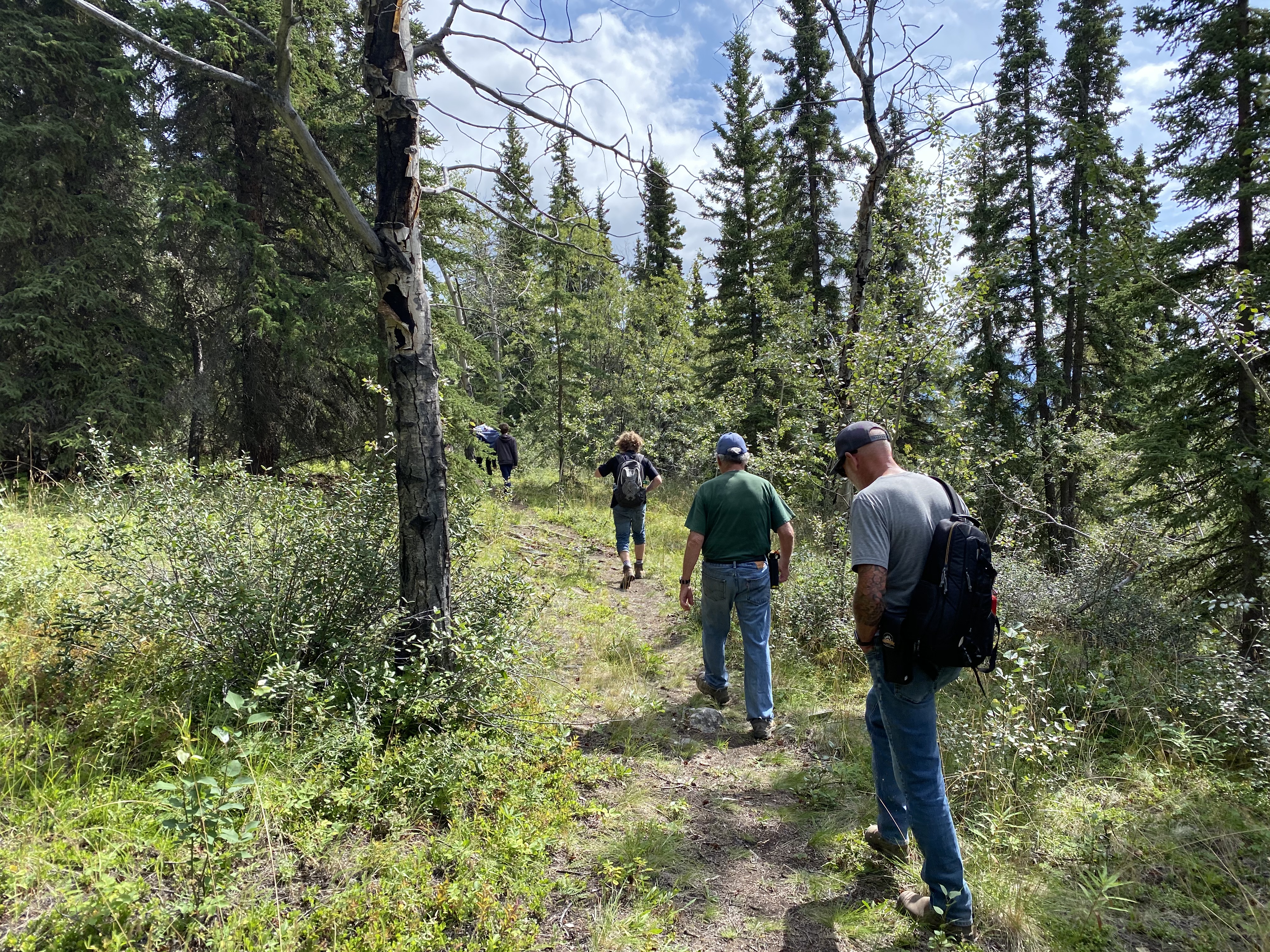
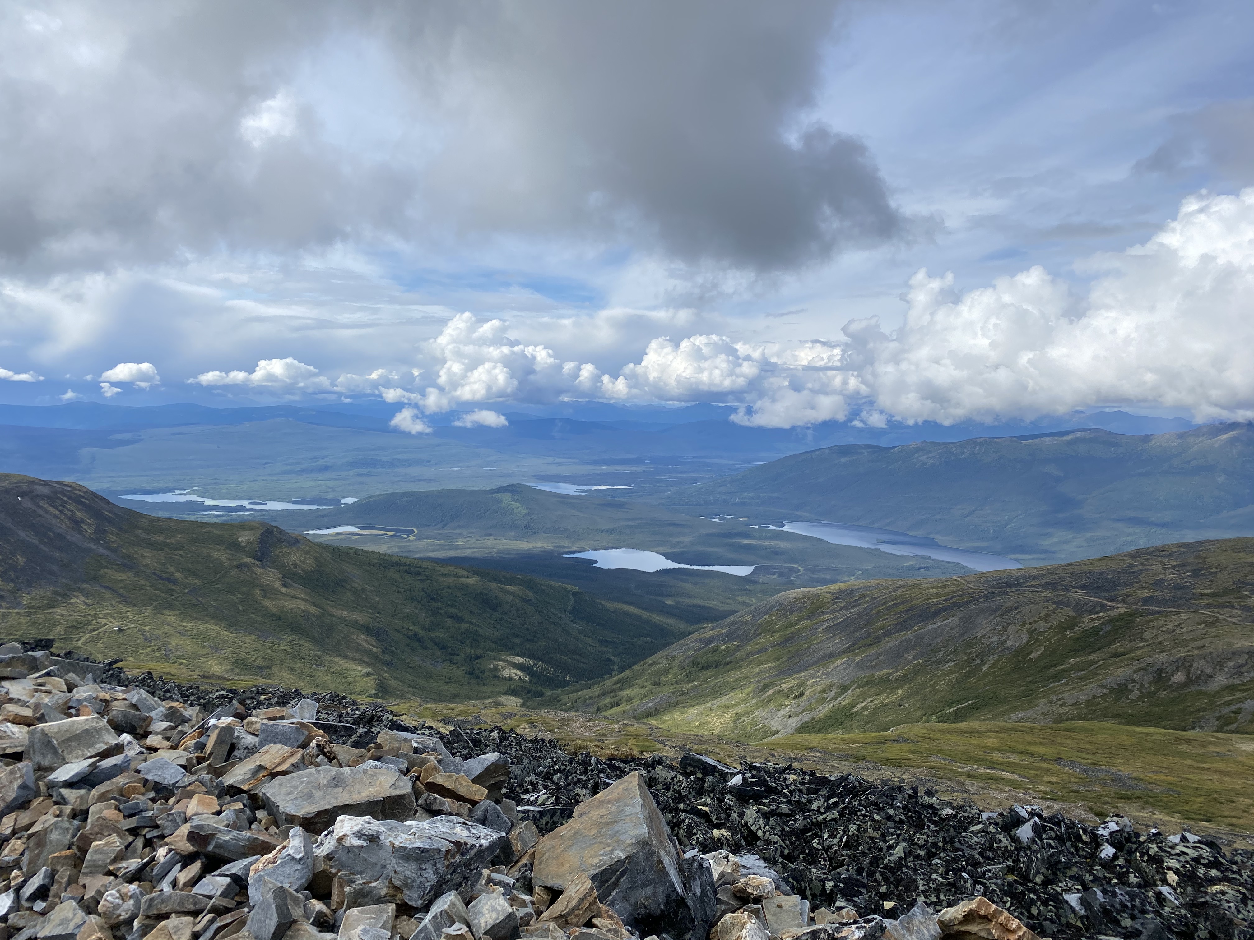
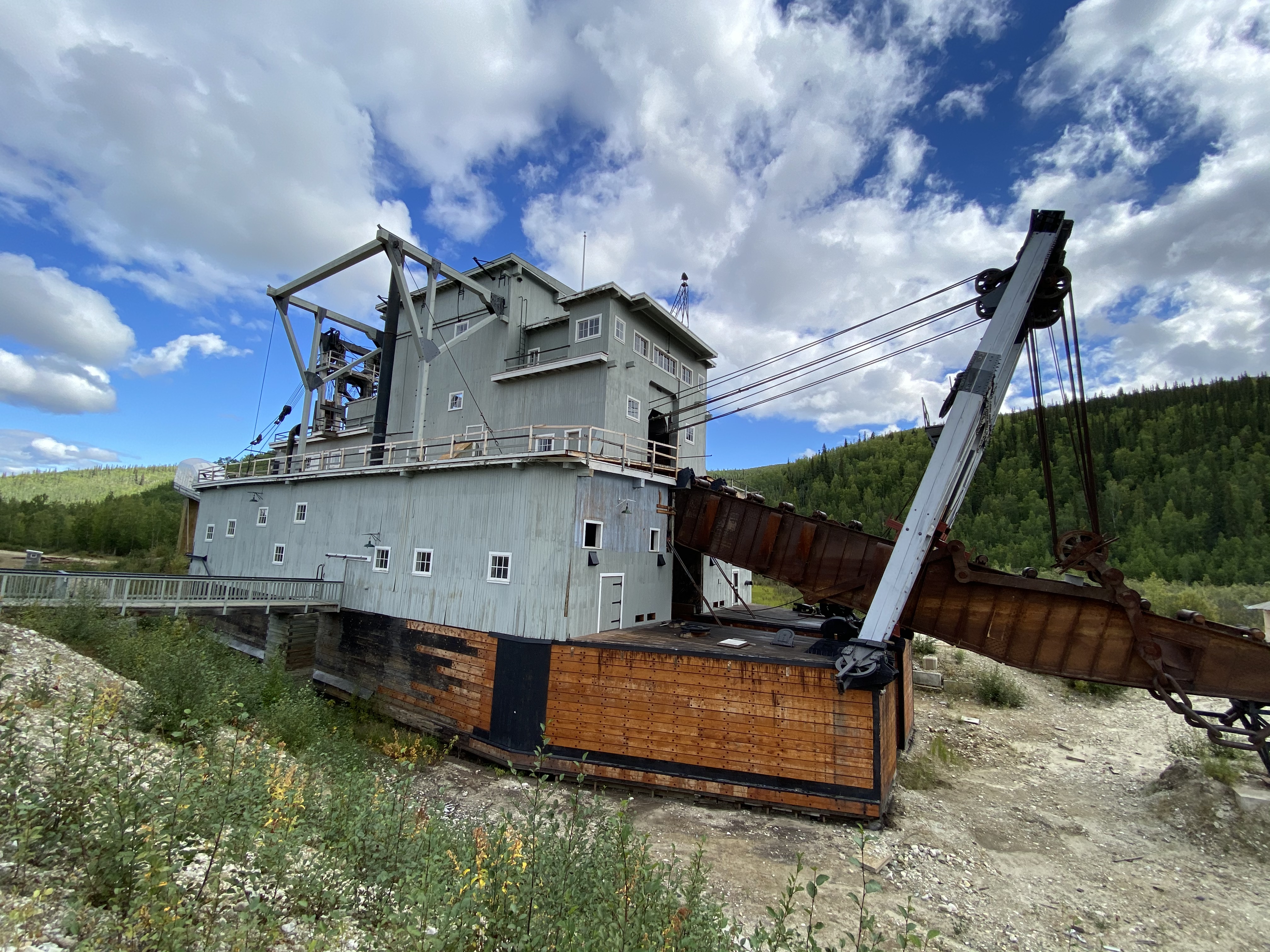
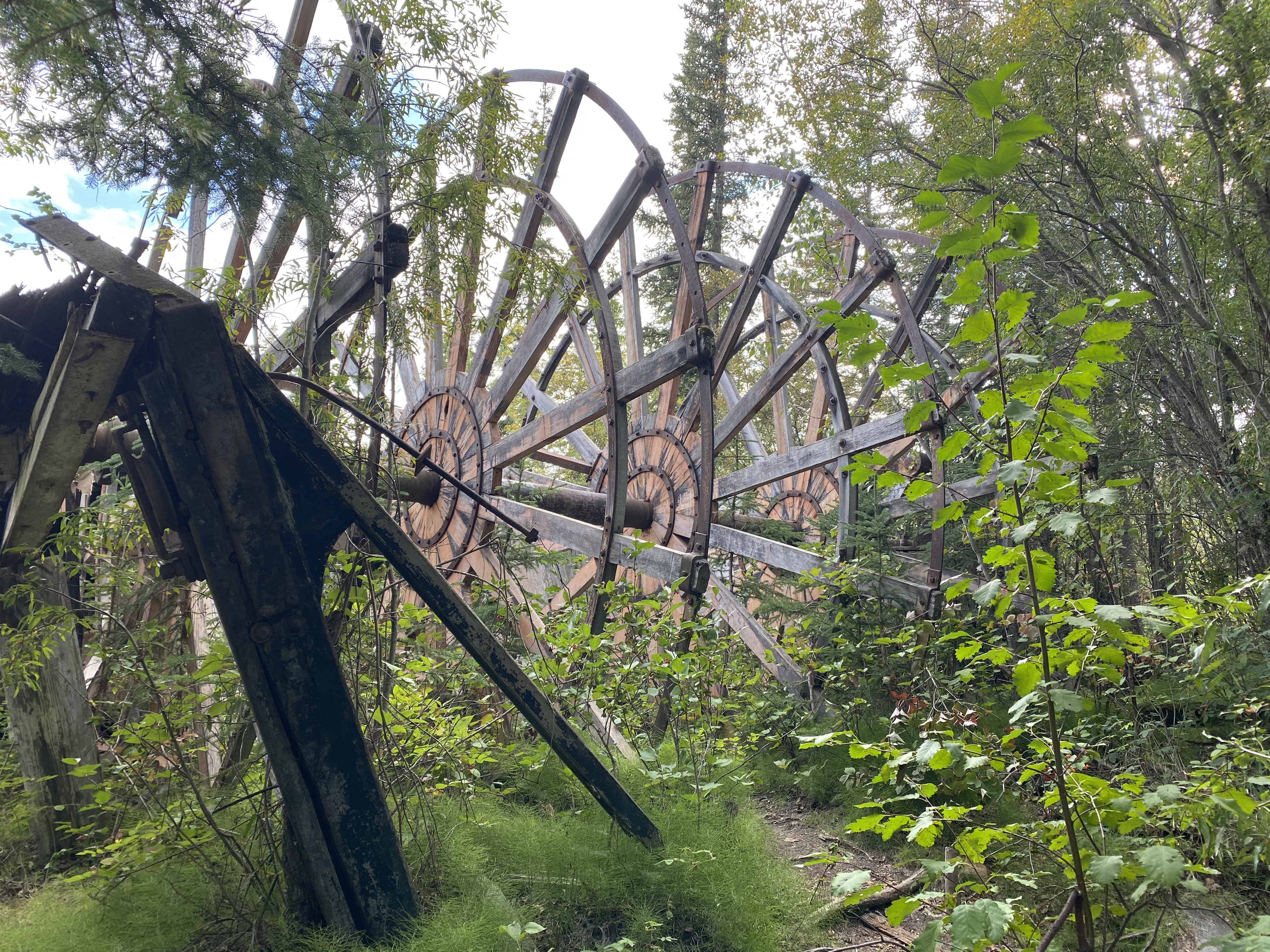
The next leg of the journey took us north on the Klondike Highway with a little out and back along the Silver Trail to Mayo and Keno. The Klondike is of course famous for its gold rush but there was a significant silver boom in the hills surrounding Keno early in the 20th century as well. Today Keno has a total population of 24 but has quite a museum and many cool historical buildings. We checked out a bit of the village then headed up Keno Hill to see the view from the Sign Post.
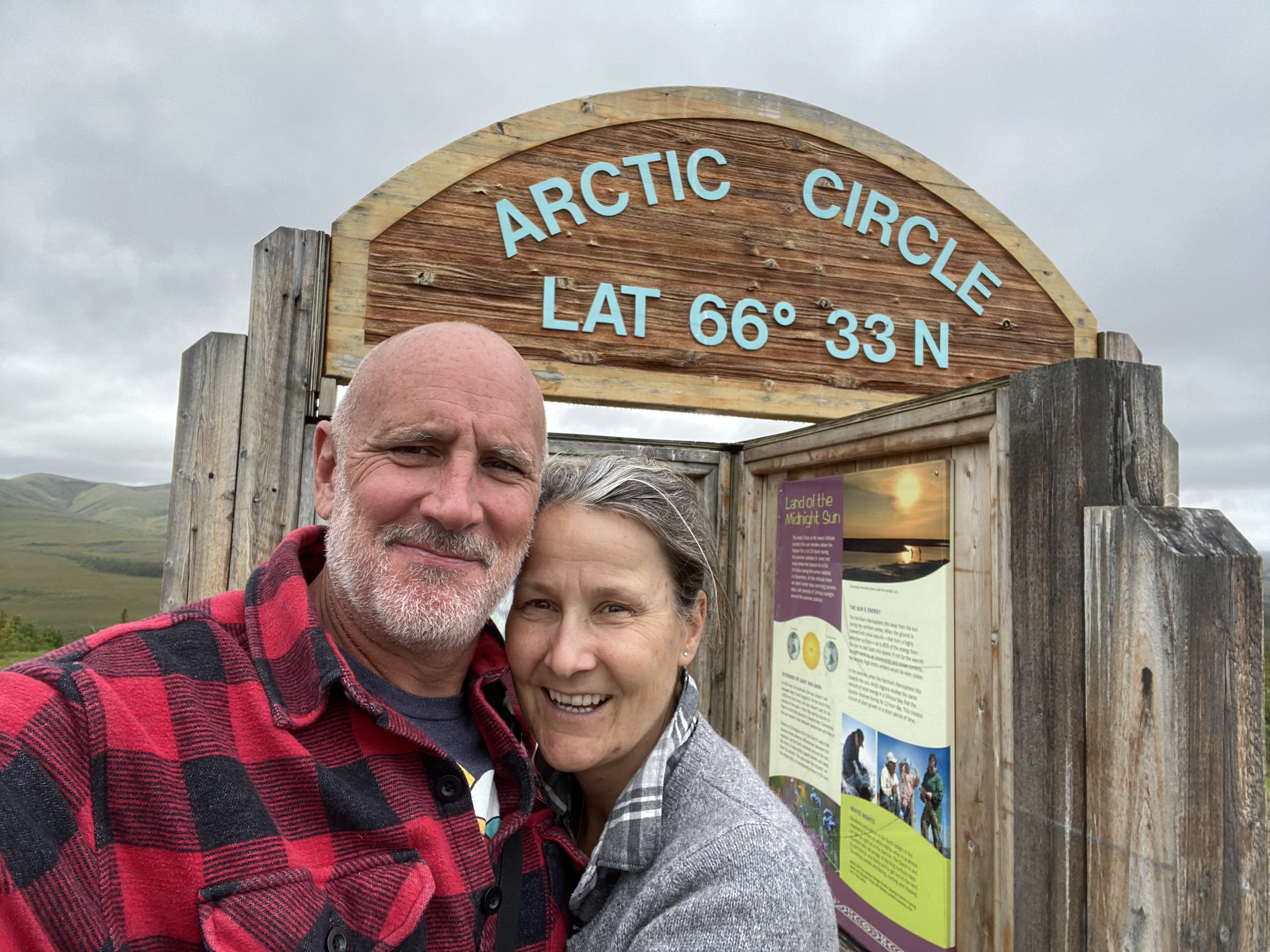
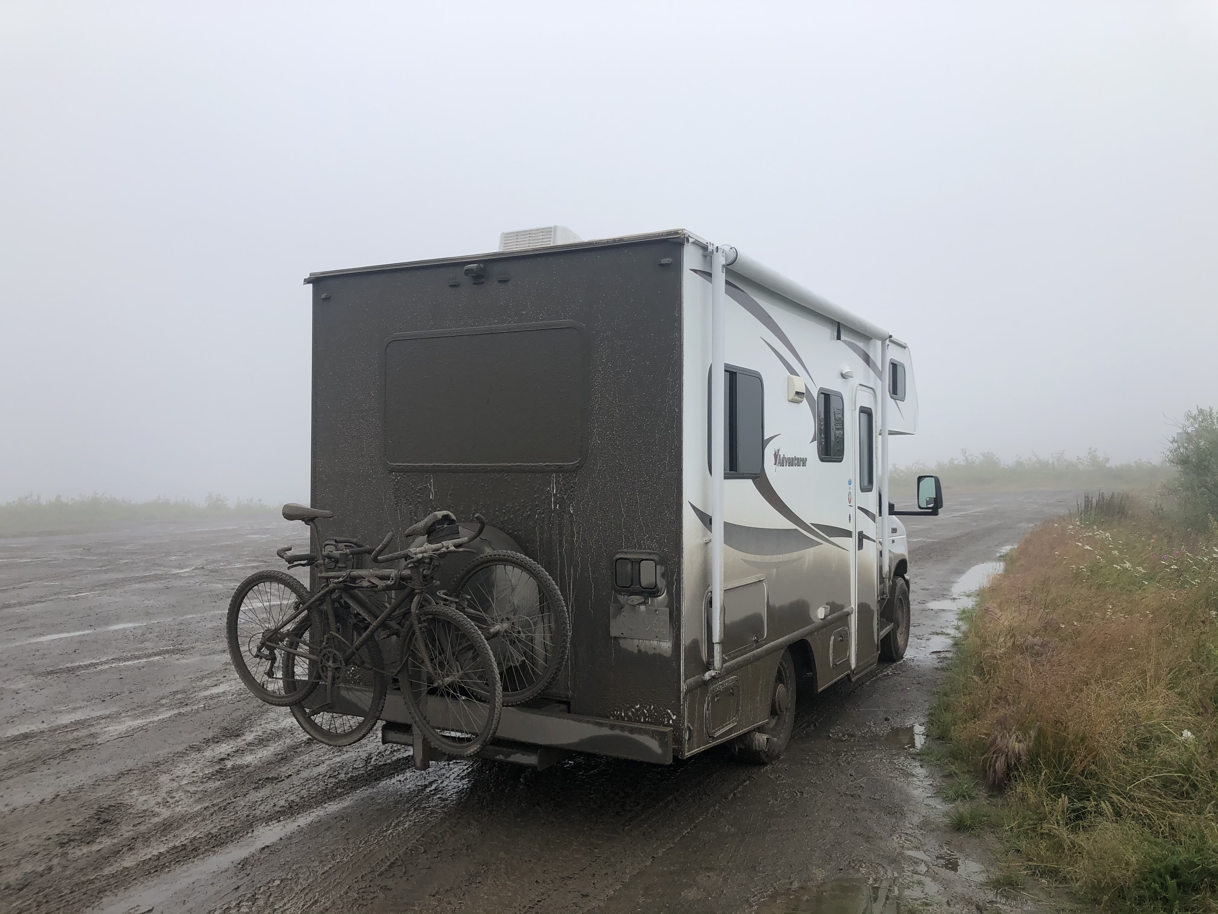
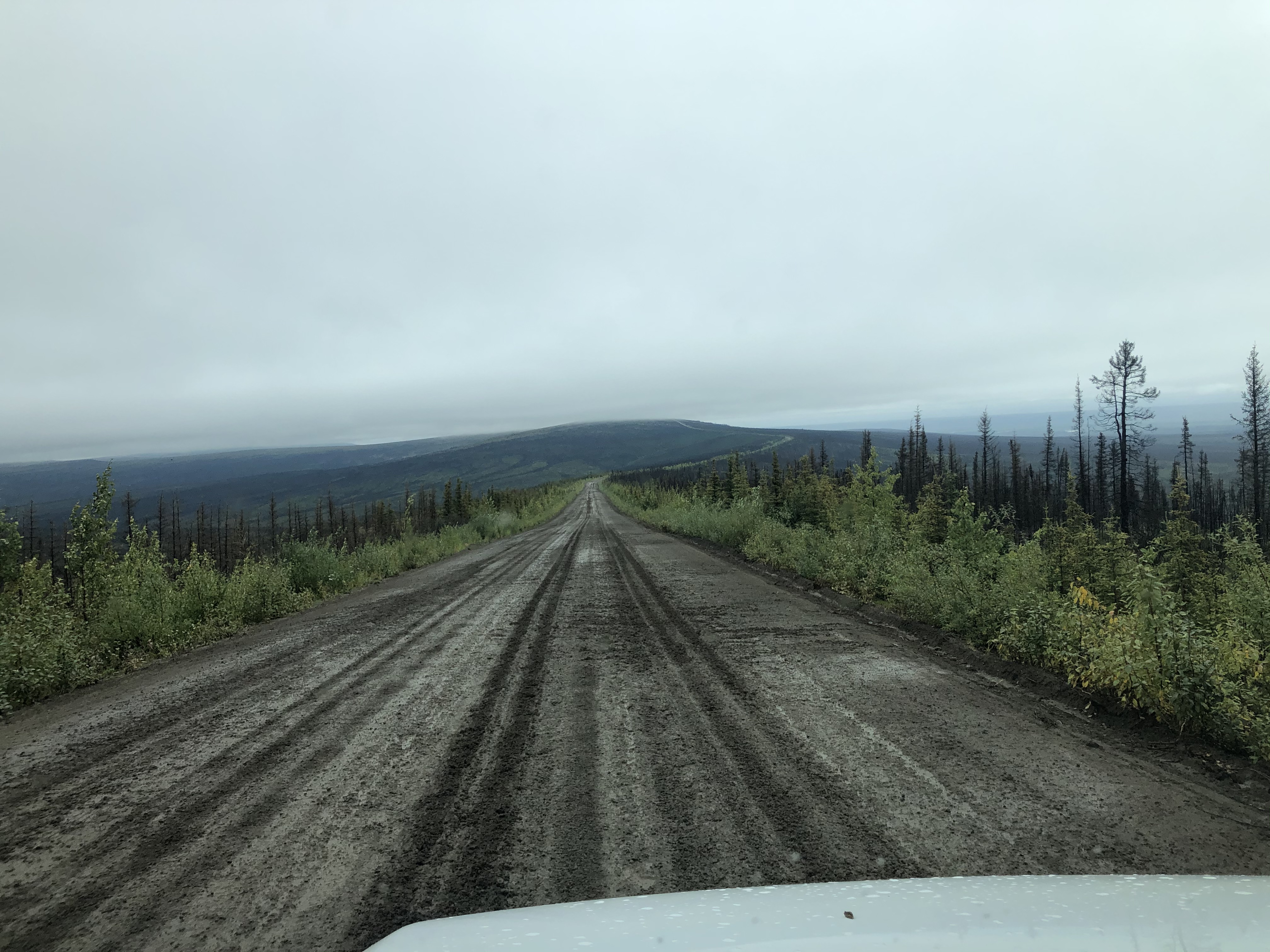
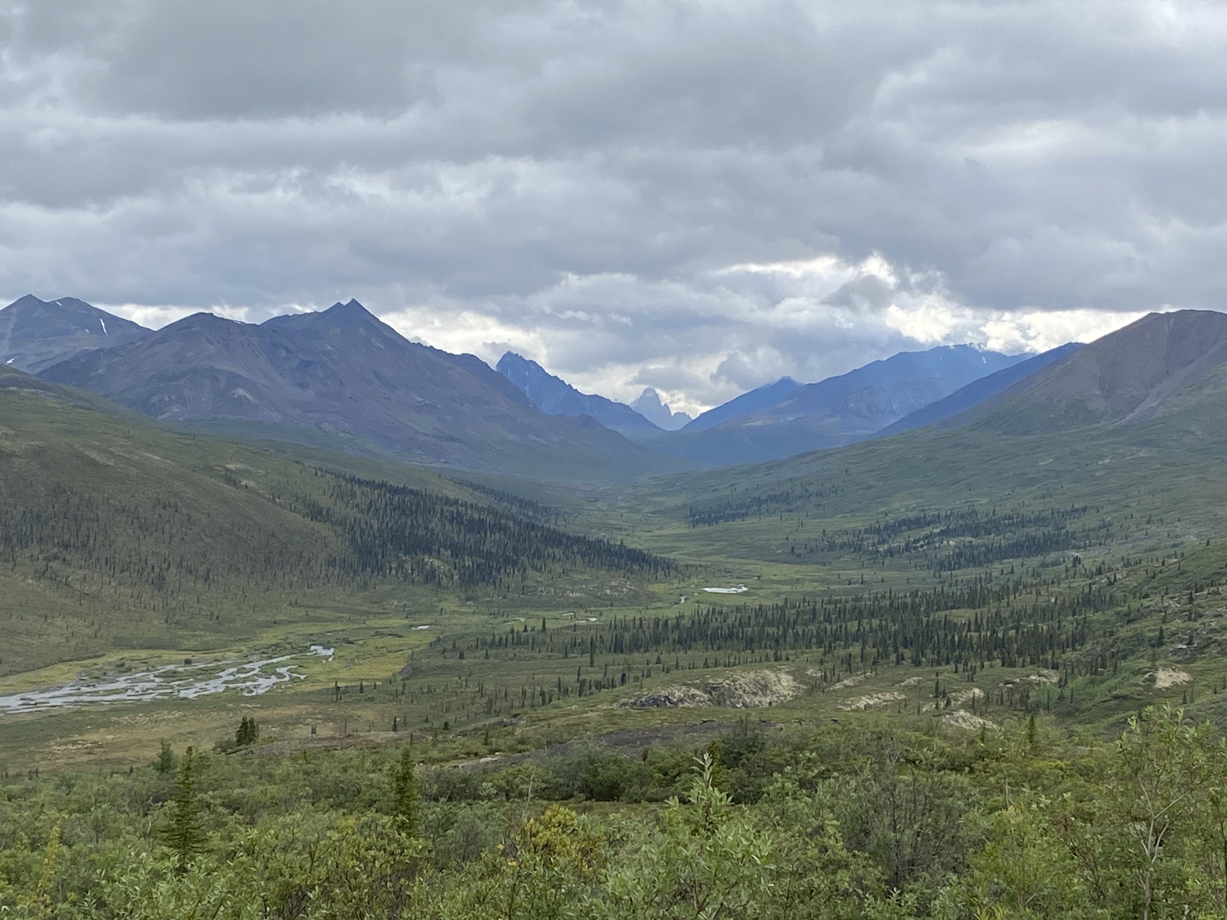
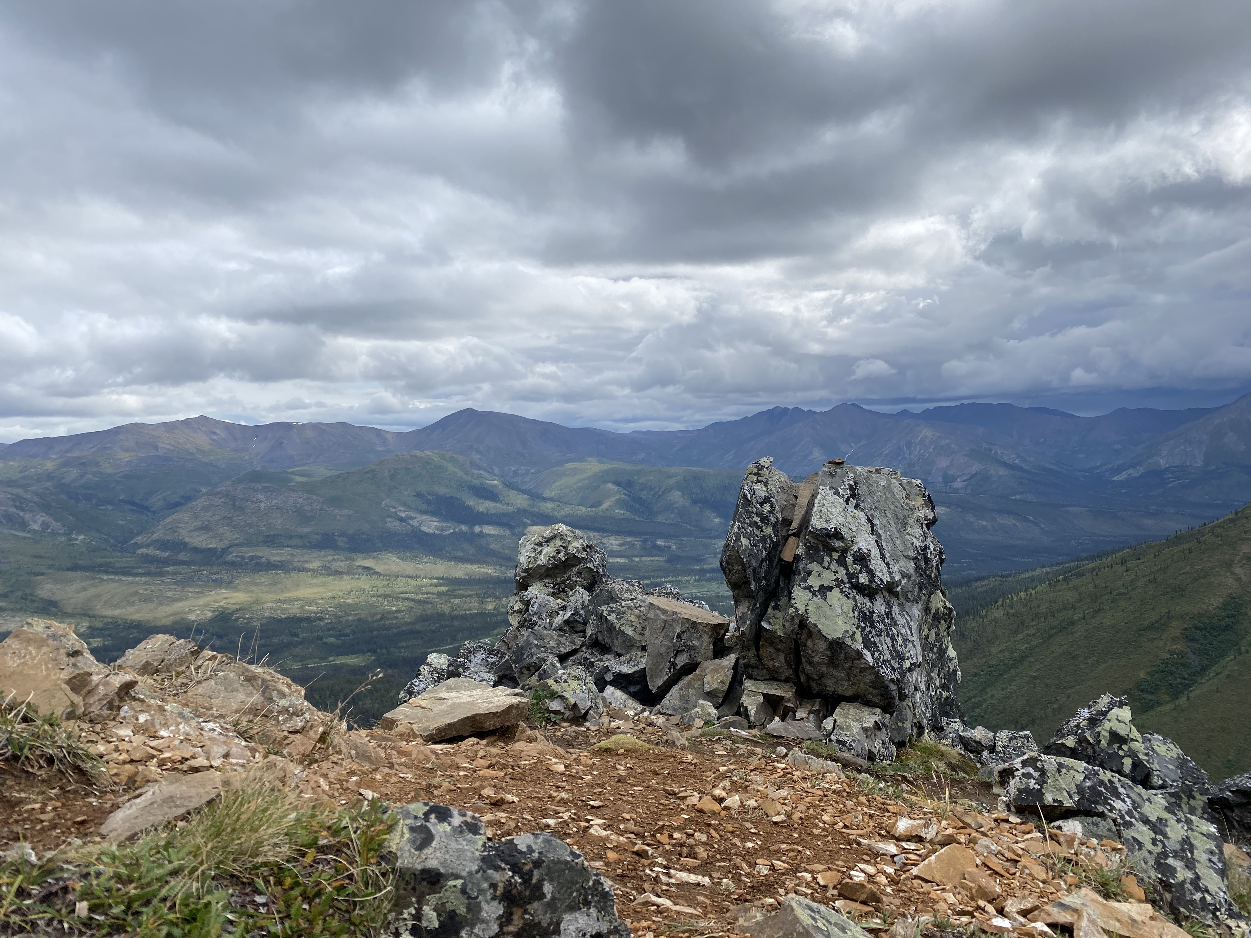
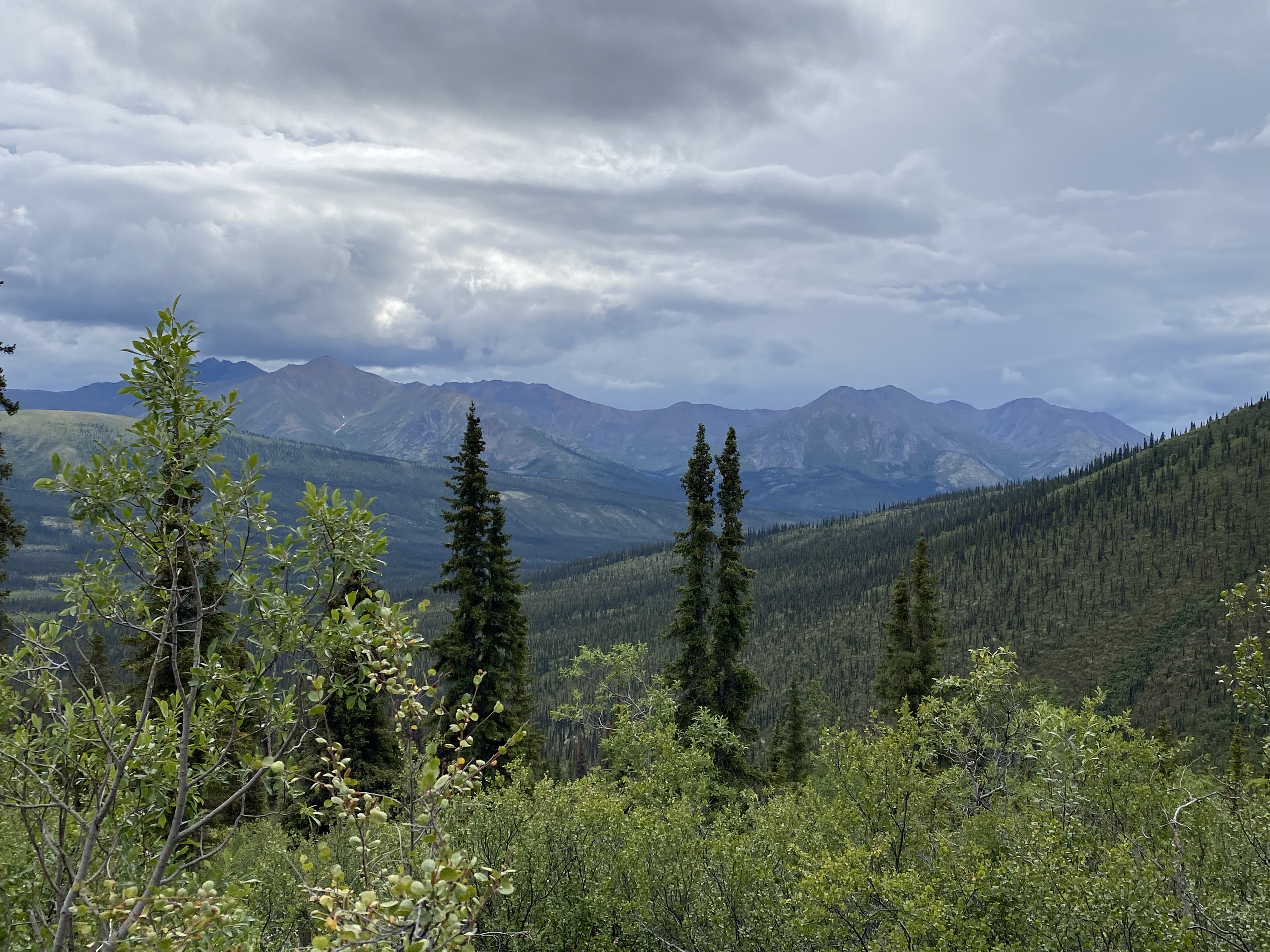
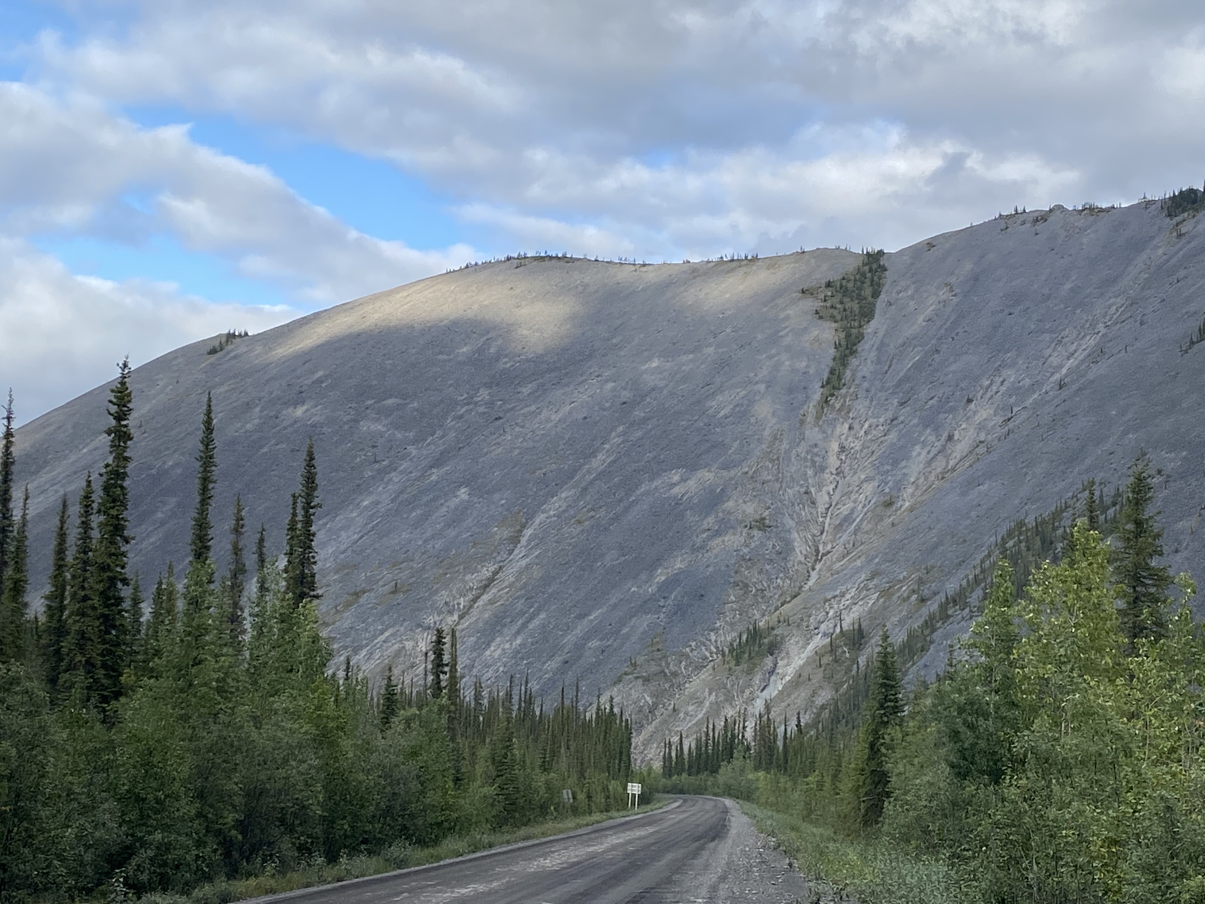
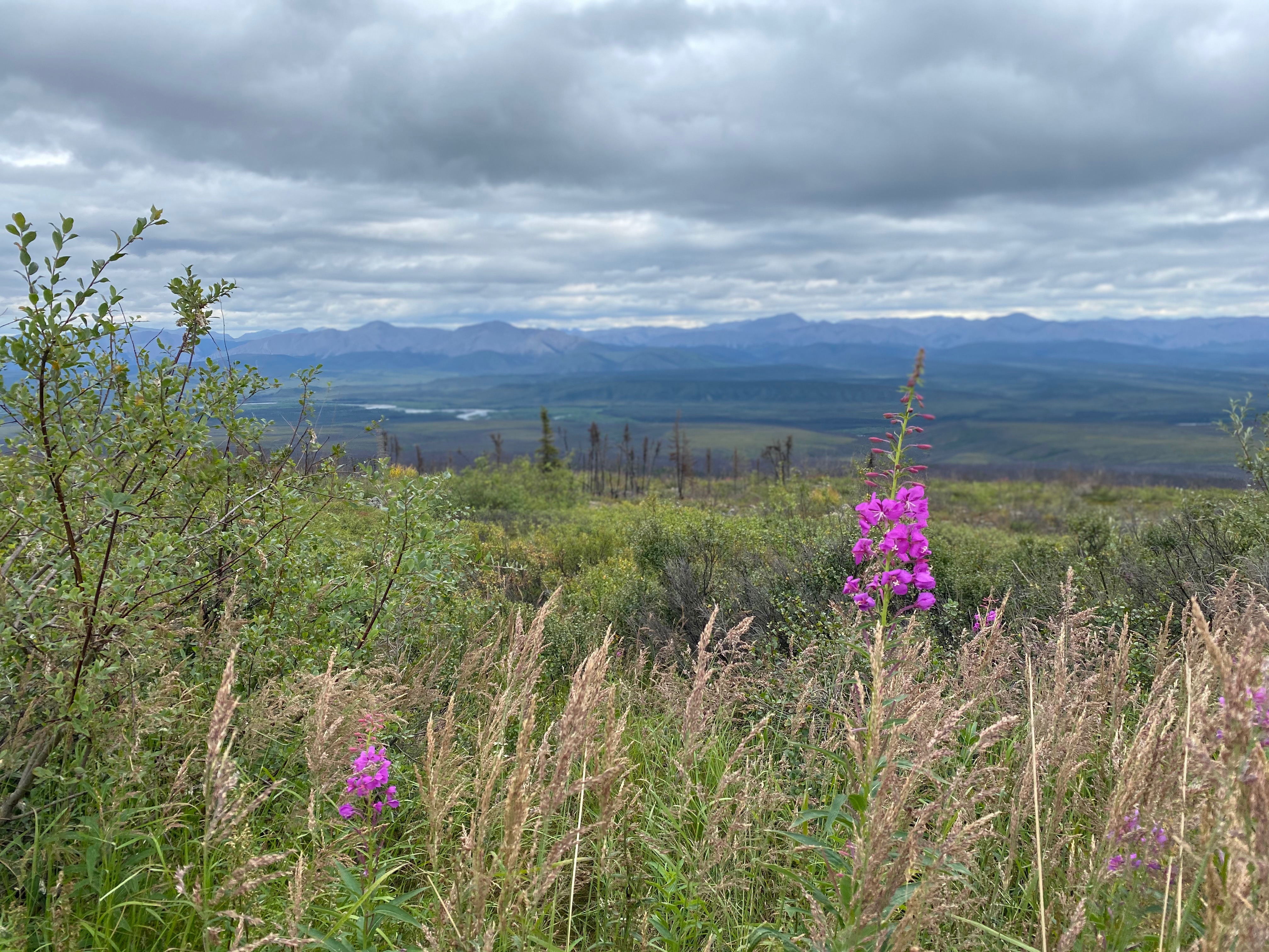
So, I hate to use the word bucket-list but the next part of the journey is something we have wanted to do for quite a while. I have heard stories and seen so many beautiful photos of the Dempster Highway (although don’t let the name Highway fool you….it is at best bumpy gravel and at worst an extremely muddy, potholed road with sharp rocks that are just waiting to pop your tires)! It was completed in 1979 and is quite decidedly remote. The road goes through the aptly named Tombstone Territorial Park and on to the Arctic Circle before crossing into NWT. With Covid restricting our entrance into NWT, we had to be content with travelling only the first 450km or so, visiting Tombstone and getting to the Arctic Circle. What makes this extra special this year is that we crossed the Antarctic Circle in January so now we can say we have been past both! The journey along the Dempster was truly impressive – the mountains are rugged, dramatic and ever-changing and the valleys stretch for miles. At a certain point, I think we were both expecting the drive to become mostly rolling, grey tundra but we were surprised by the beautiful and changing landscape the whole way.
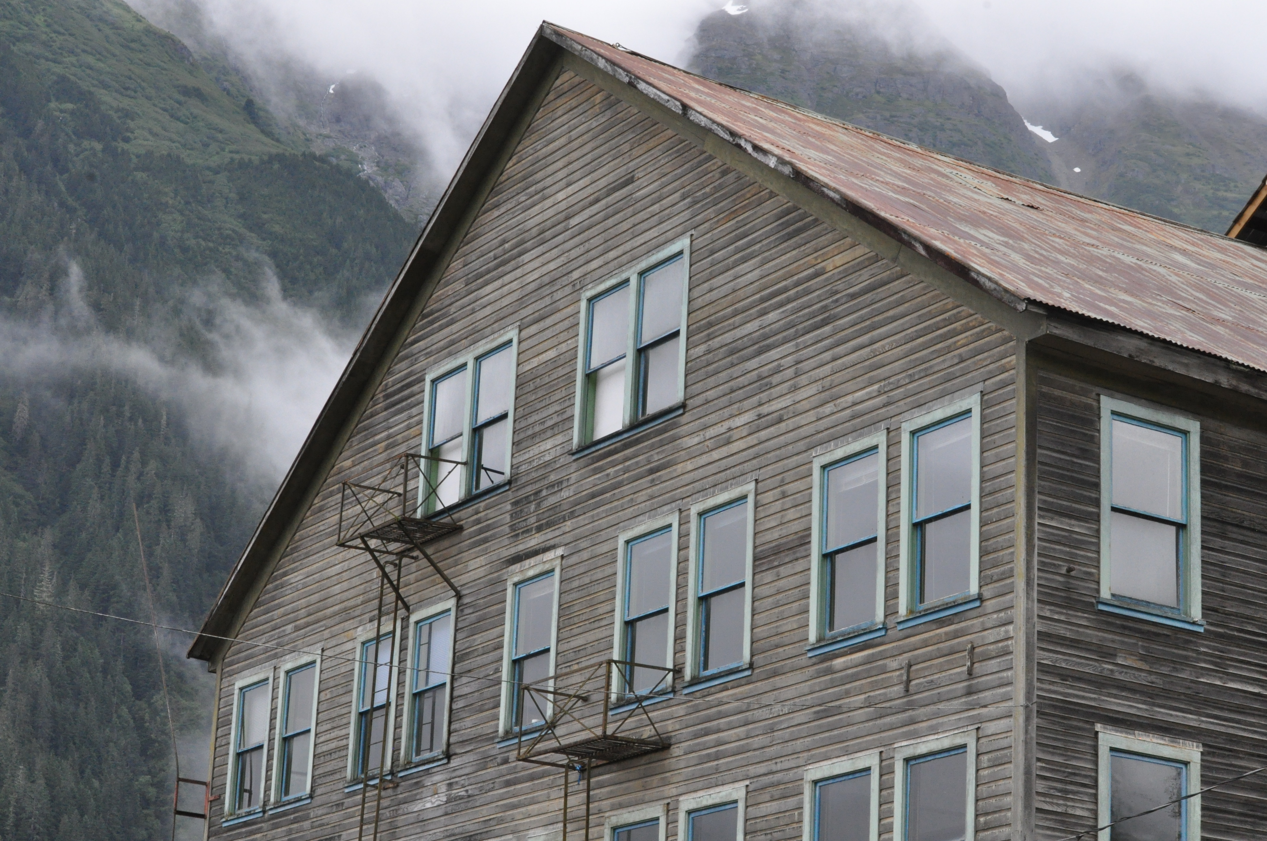
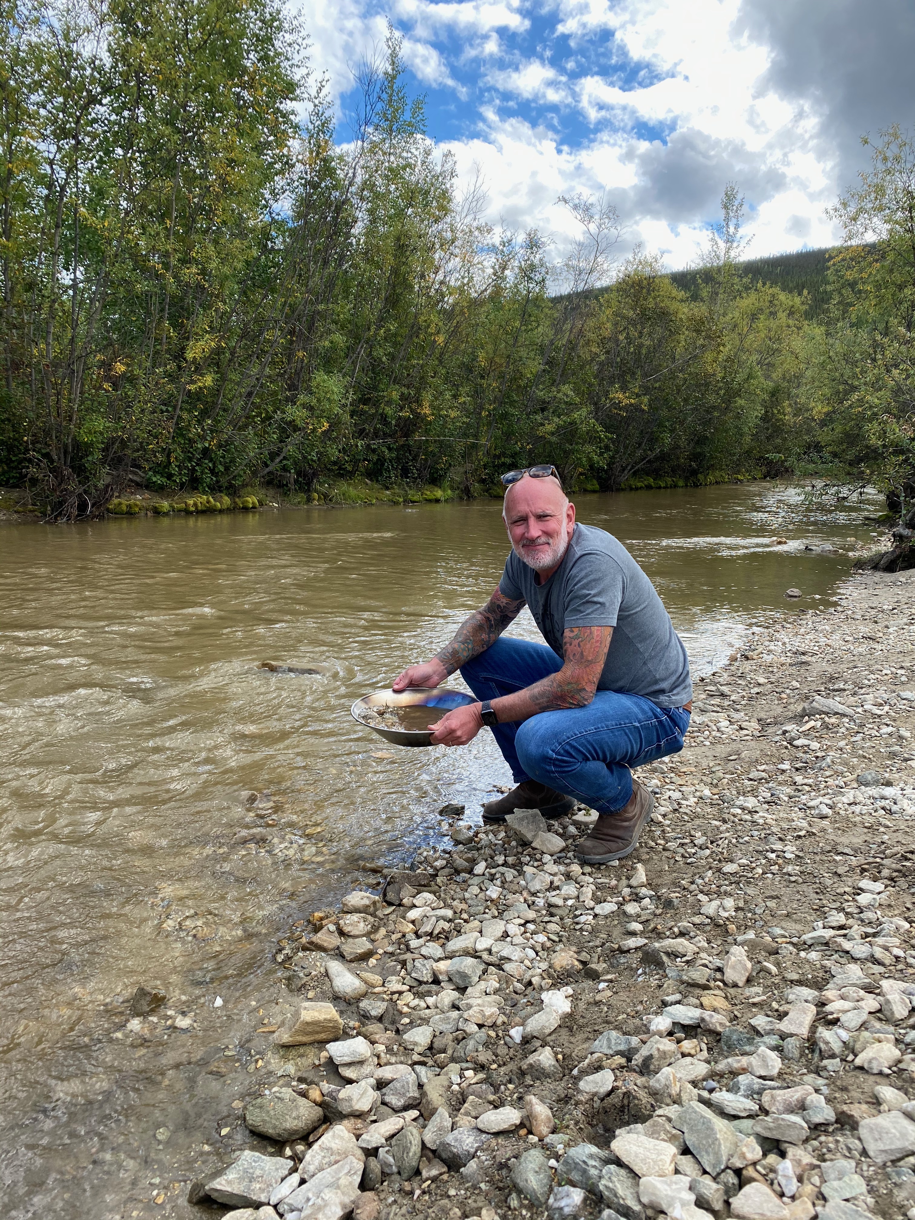
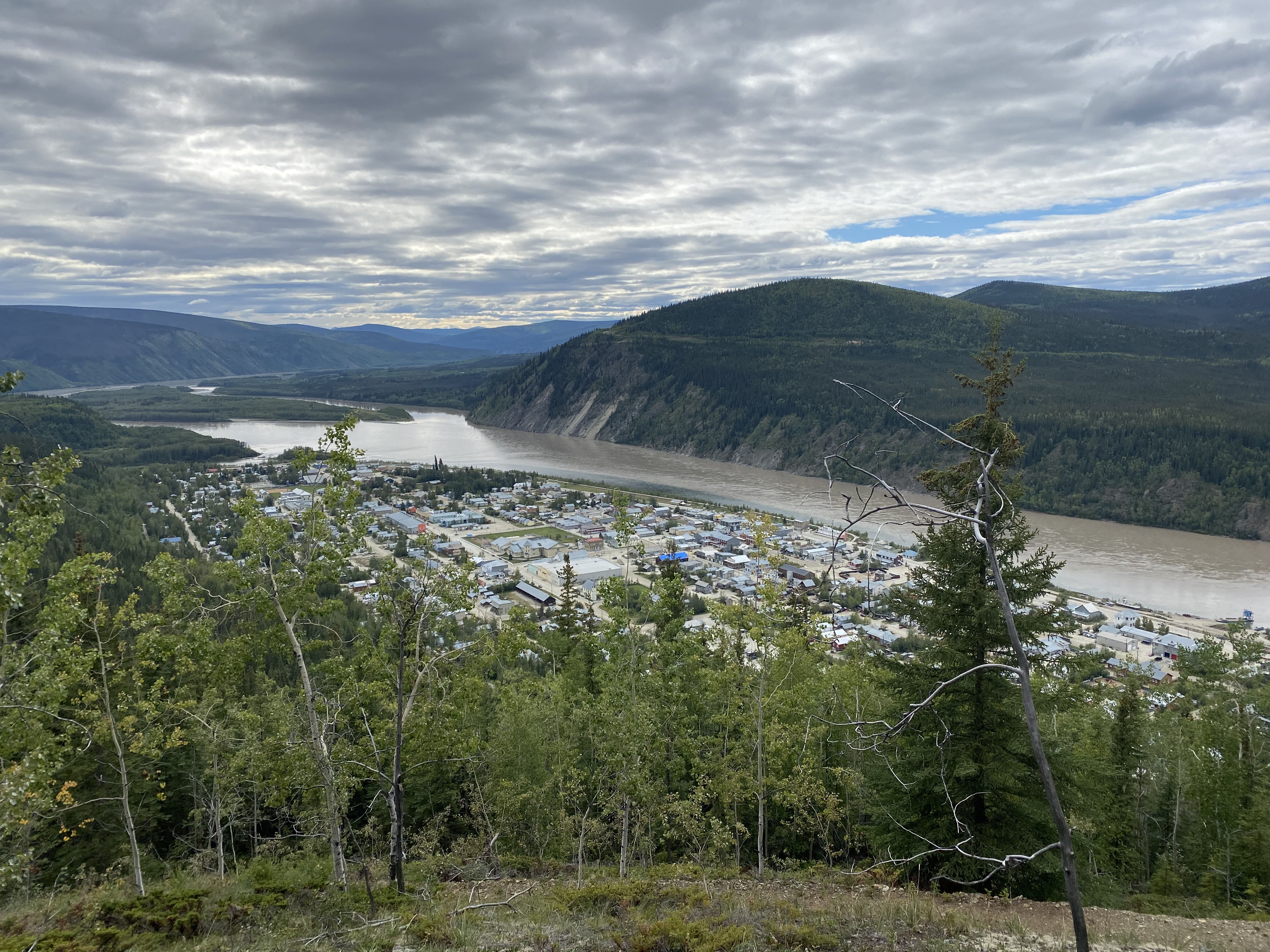
Our return to civilization was three nights in Dawson City. It was the Discovery Day long weekend and there was lots of activity in town. The infamous Diamond Tooth Gertie’s was finally open after an extended Covid closure and we were surprised to see the line up stretch down the block to get in. I seem to recall Gertie’s being more popular with the older cruising/bus tour set but the clientele this time was definitely young and looking for a party. In fact the whole town seemed to be looking for a party – it was a sunny long weekend and there was definitely some pent up Covid fatigue in the air. We enjoyed a couple of nice hikes, went out for dinner and took in some of the history of the town….tried our hand at gold panning on Bonanza Creek as well but sadly didn’t strike it rich. I think we might be getting too settled into camper life though – we were both happy to be on the road again!
Our path from Dawson City was a bit different than the way up. We opted to take the Campbell Highway from Carmacks through Faro back to Watson Lake. We weren’t entirely sure what to expect road-wise and couldn’t find anyone who had driven it recently so were thankful to discover that almost half of it is paved. The route took us about 500km through some really beautiful country, including great little campsites at Little Salmon Lake and Frances Lake along the way. It is hunting season here and we saw quite a number of hunters along the road – and other than a few porcupines, understandably not much wildlife though – it is like they know and make themselves scarce near the roads!
Now back to BC and the road home!
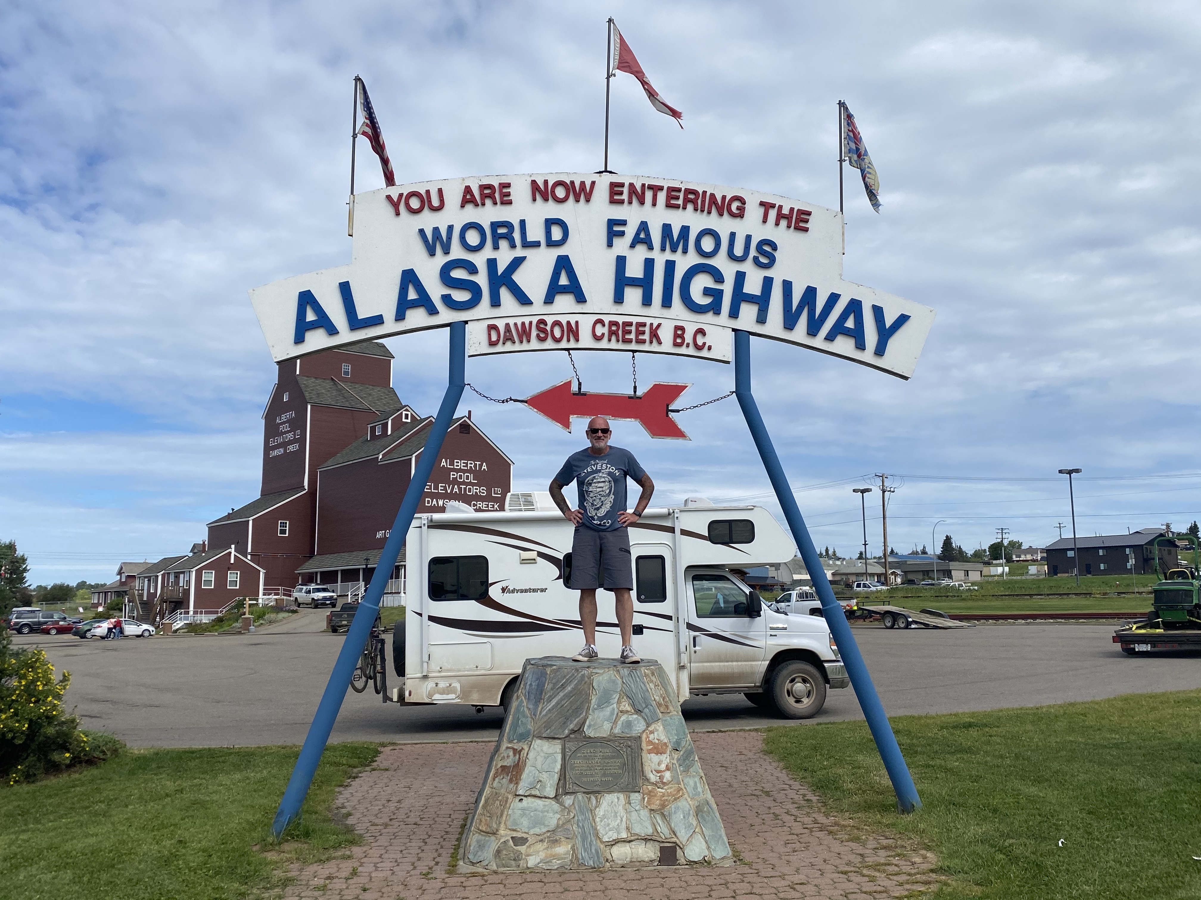
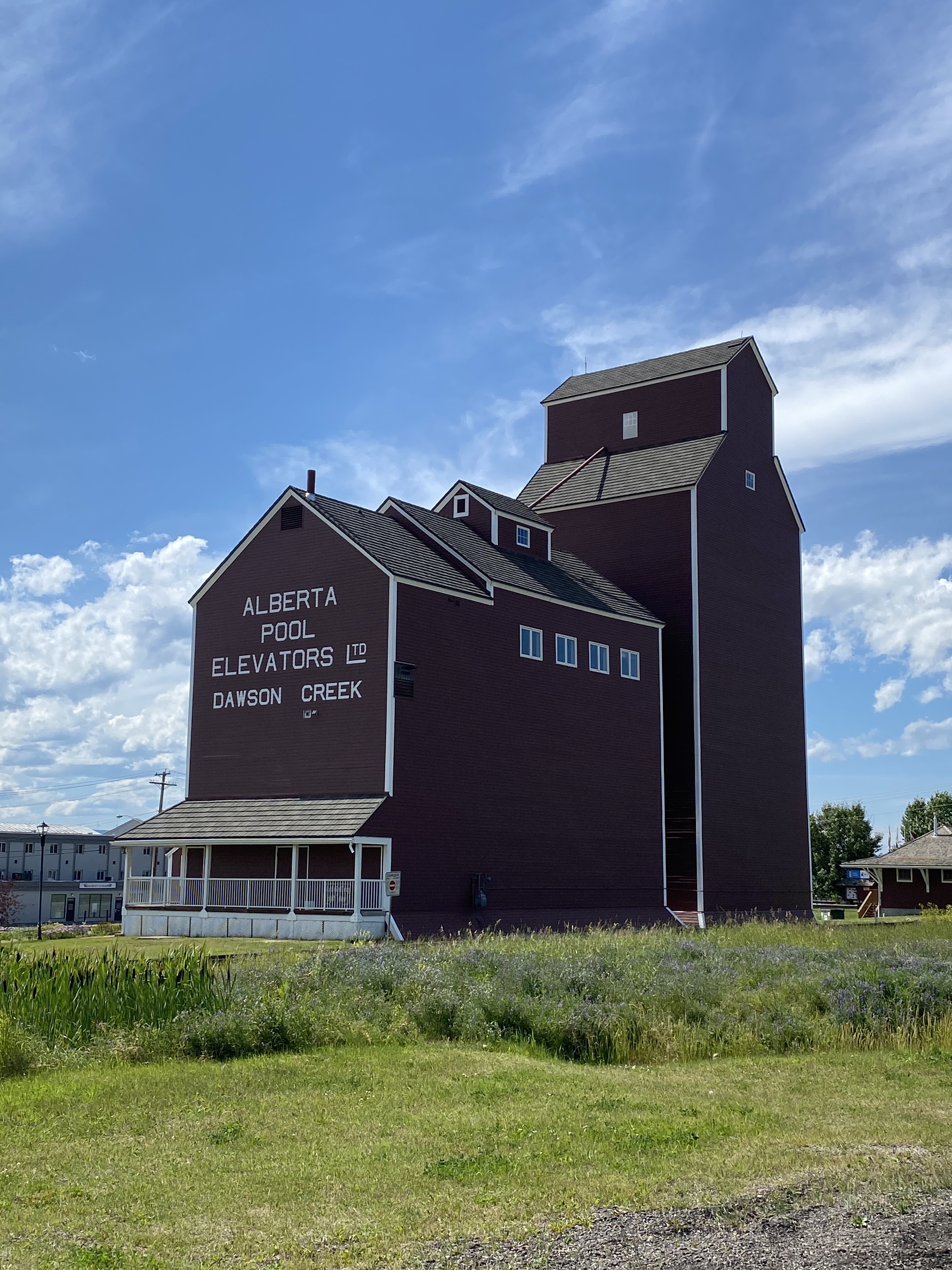
We started our journey on the Alaska Highway appropriately at Mile 0 in Dawson Creek. From here, we cruised through Fort St. John (where we gave poor mud-covered B a good wash) and on to Fort Nelson where we broke camp for the night at a lovely forestry site a few miles from town.
As a quick aside….if you don’t know the story of the Alaska Highway, it is a rather interesting one. During WWII, the U.S. Army Corps of Engineers were tasked with building a supply road to Alaska in response to the threat from the Japanese. In 1942, it took less than nine months to build the road from Dawson Creek to Delta Junction, just outside of Fairbanks. The two ends of the road met at Contact Creek near the Yukon/BC border. All tolled the original road was nearly 1500 miles long with hundreds of bridges! Crazy to think about the manpower and resources it must have taken to accomplish this. Now back to our journey on the highway…
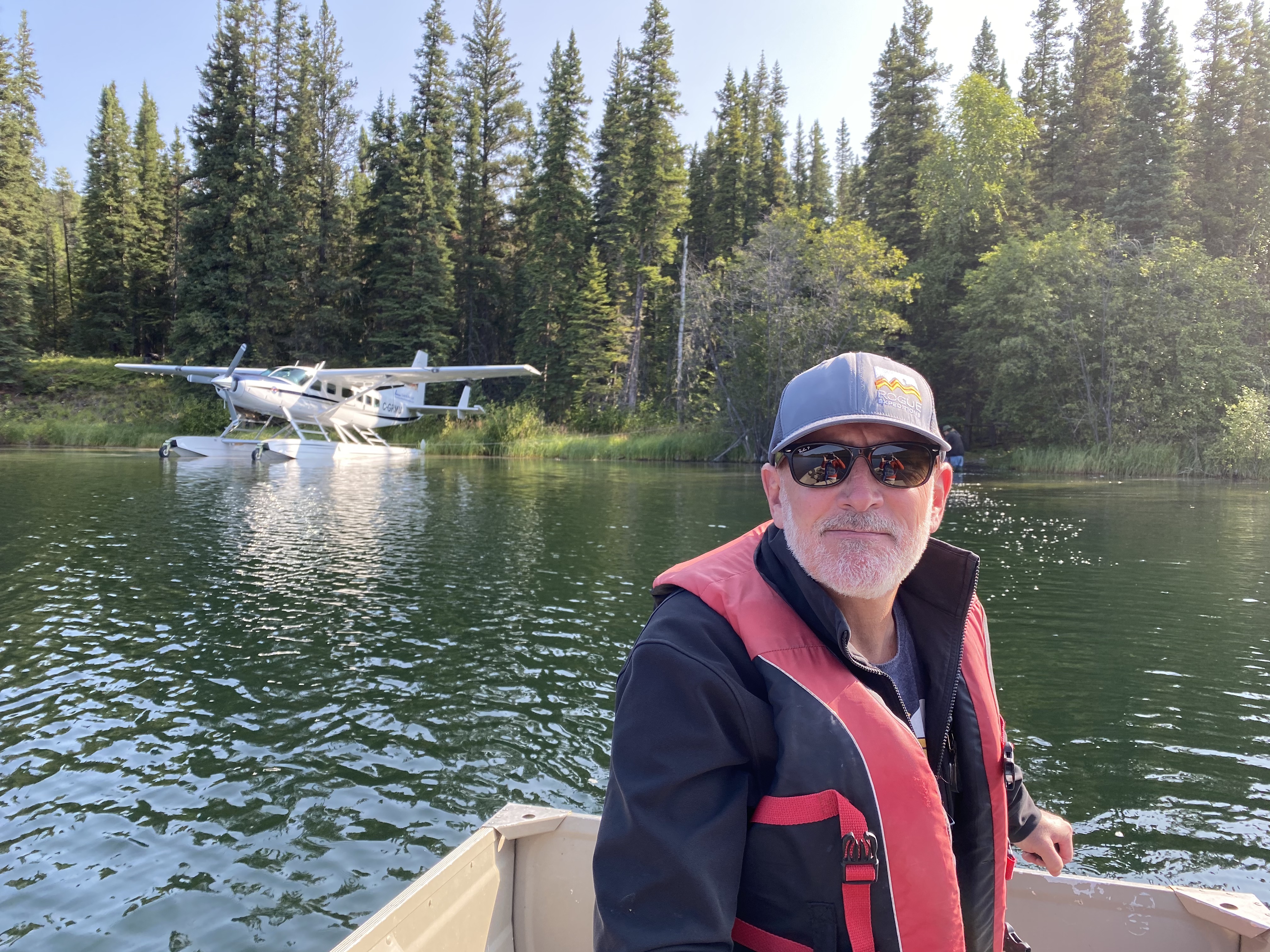
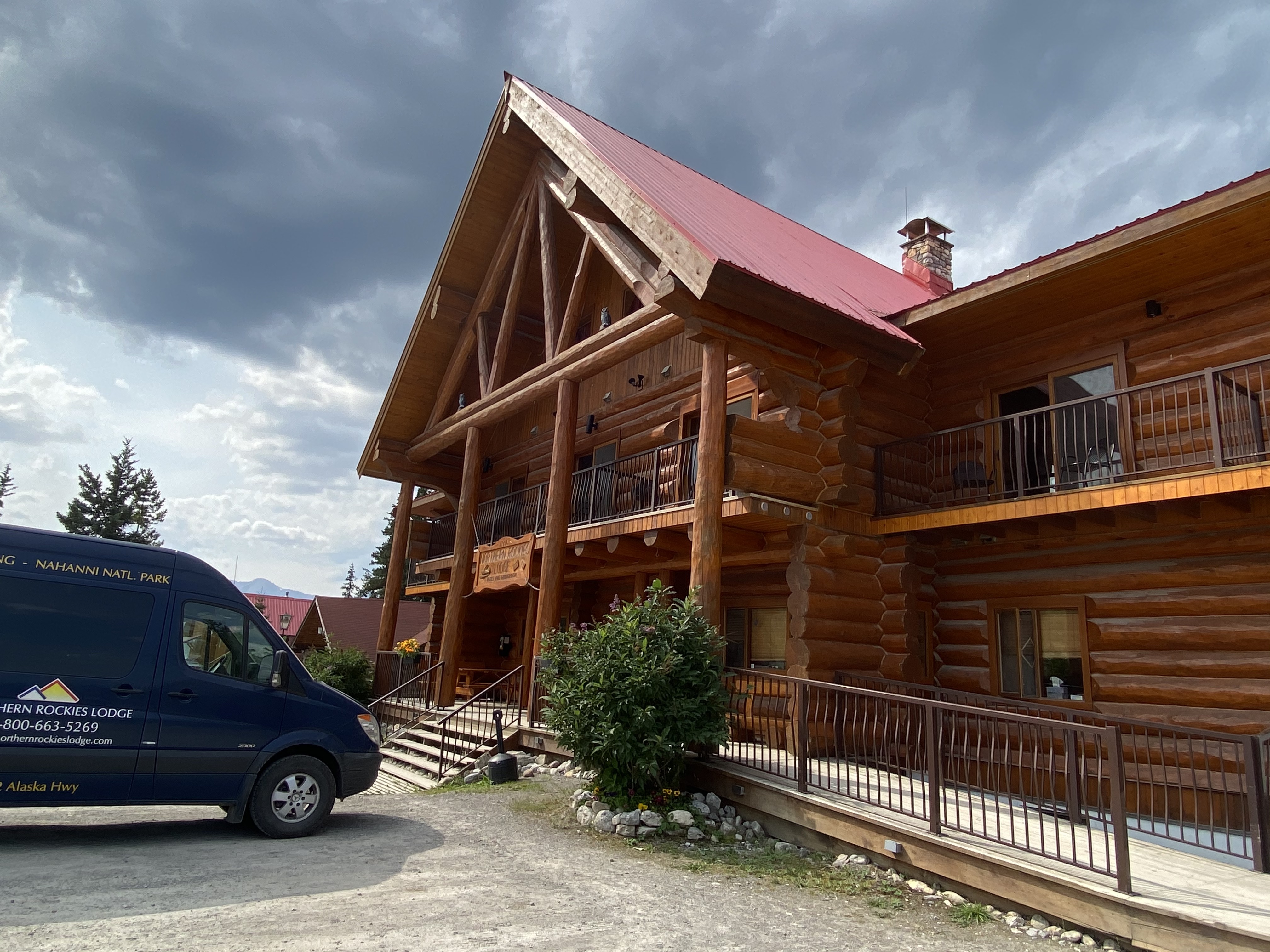
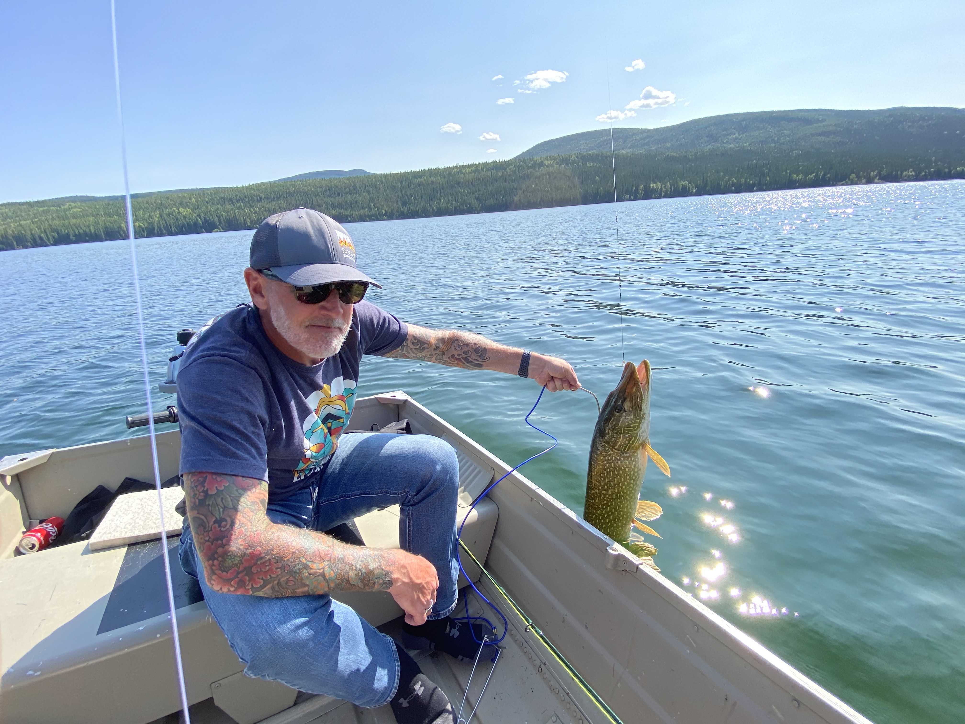
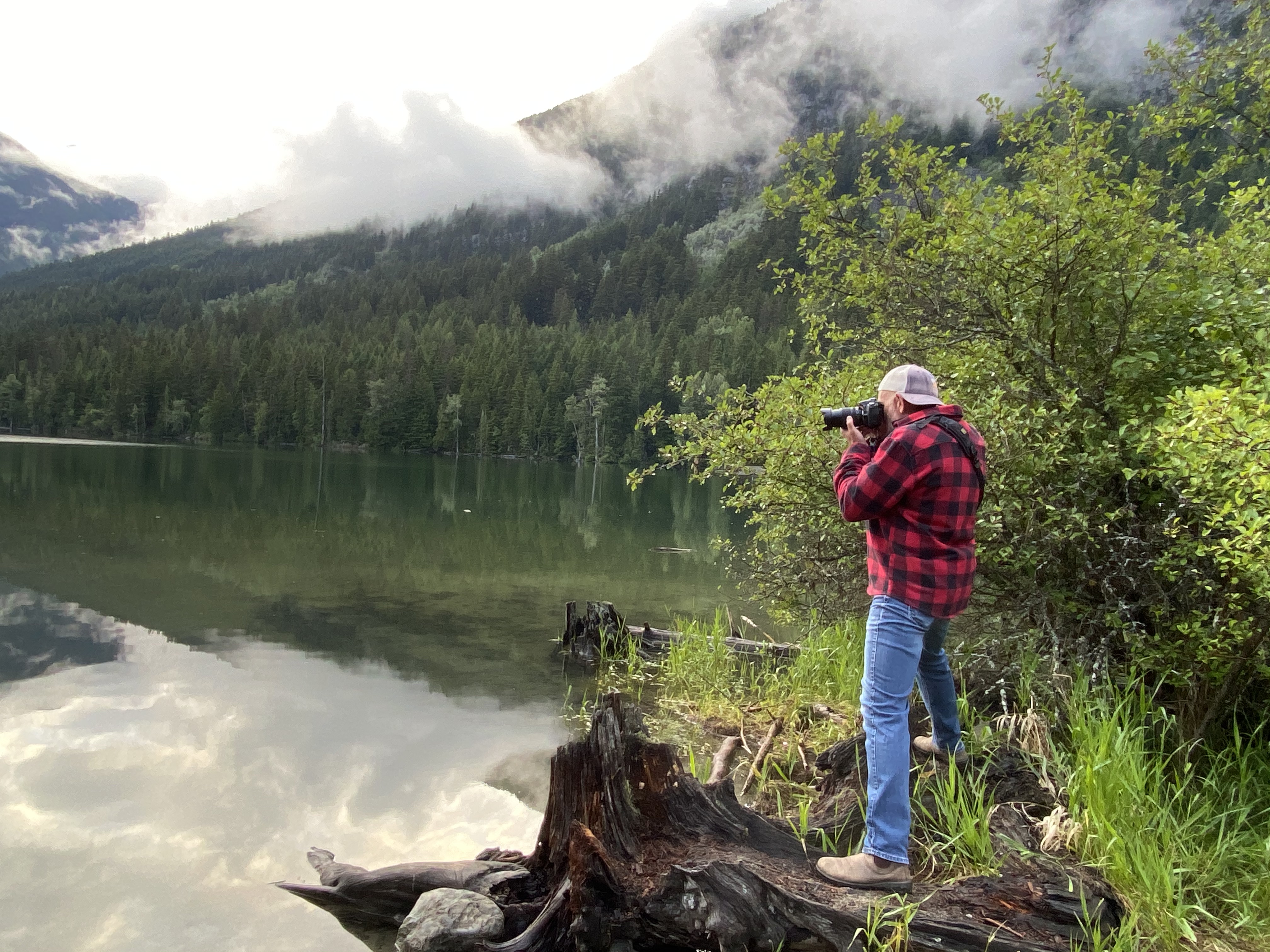
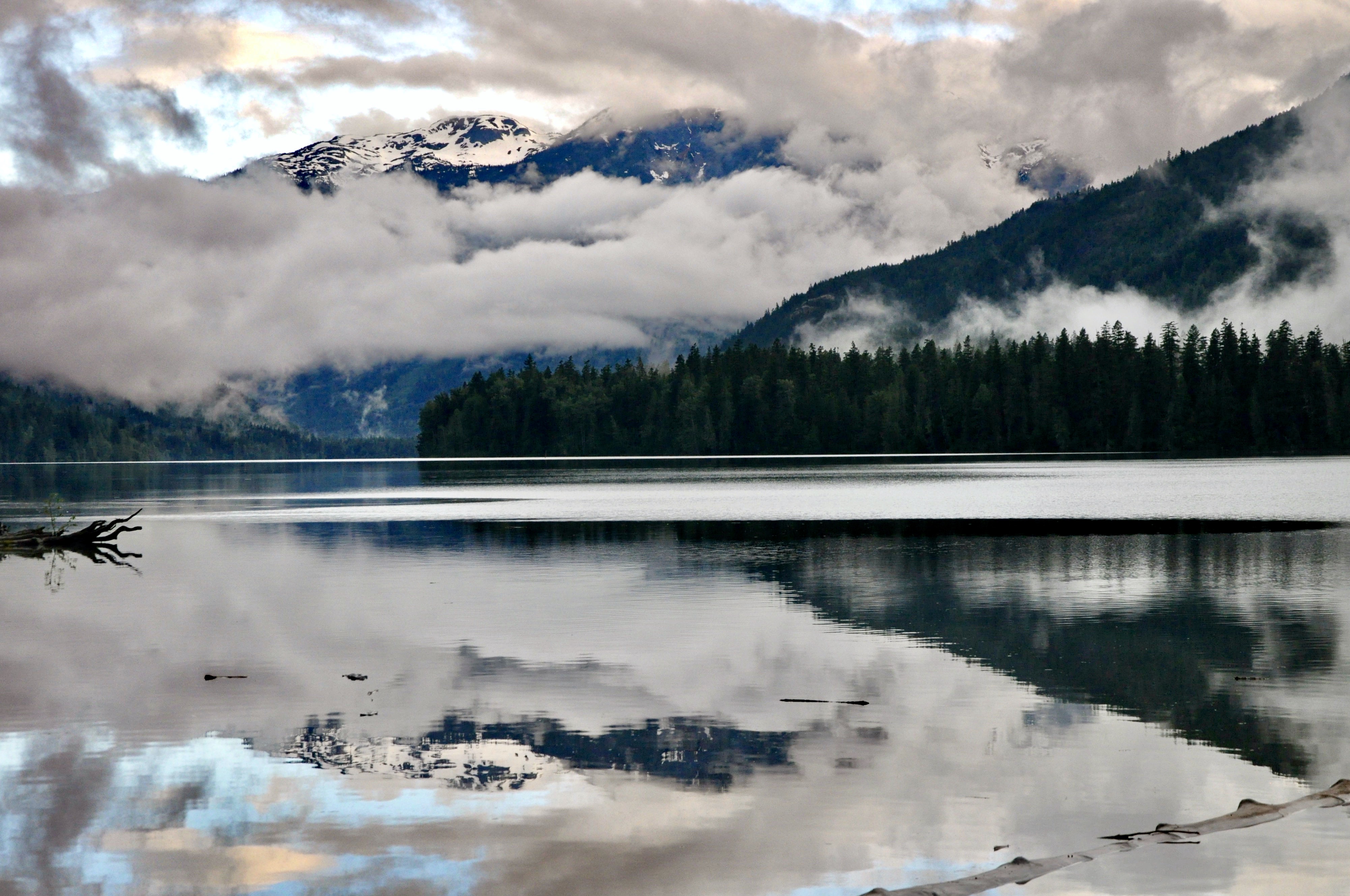
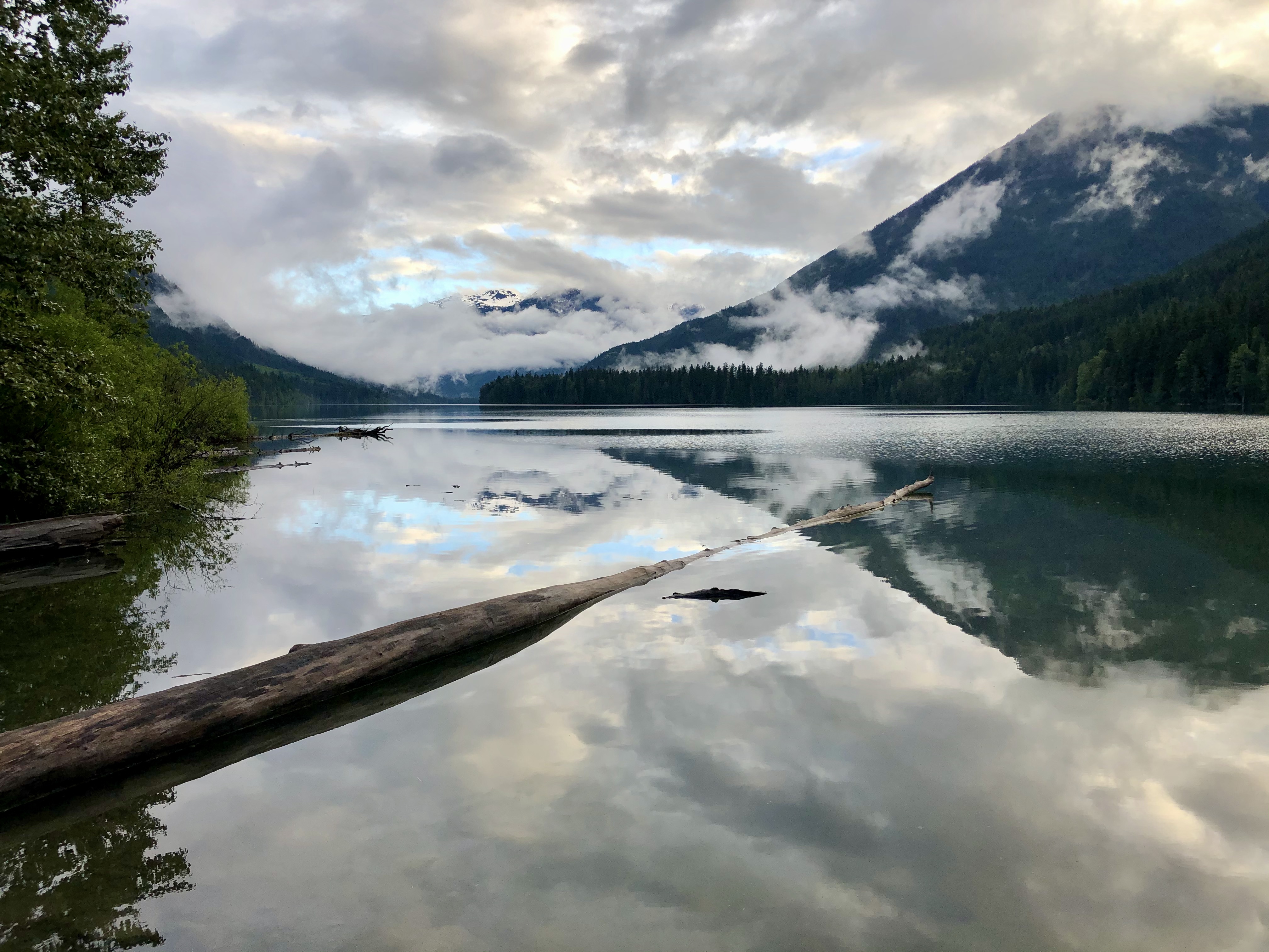
From Fort Nelson, we continued north through Summit Lake (the highest point on the Alaska Highway) and on to Muncho Lake Provincial Park. We gave B a short break here and stayed for three nights at the Northern Rockies Lodge. OK, I admit, it was so that I could have a bath and sleep in a real bed! In any event, it was a spur of the moment decision and quite a lovely find. The lodge was great and the setting on Muncho Lake was just spectacular. While we were there, we hired Urs, lodge proprietor and bush pilot/guide to take us out for a day of fly in fishing. We landed on the aptly named Fishing Lake for a day of Northern Pike fishing. It was really warm – the hottest day of the summer by far – and the fish were a bit lethargic in the morning. We had better luck in the afternoon though and landed enough for our shore lunch plus a few that were safely released back into the wild to fight another day. The flight in was amazing and Warren was pretty thrilled to be in the co-pilot seat. I suspect flying lessons may be in his future….

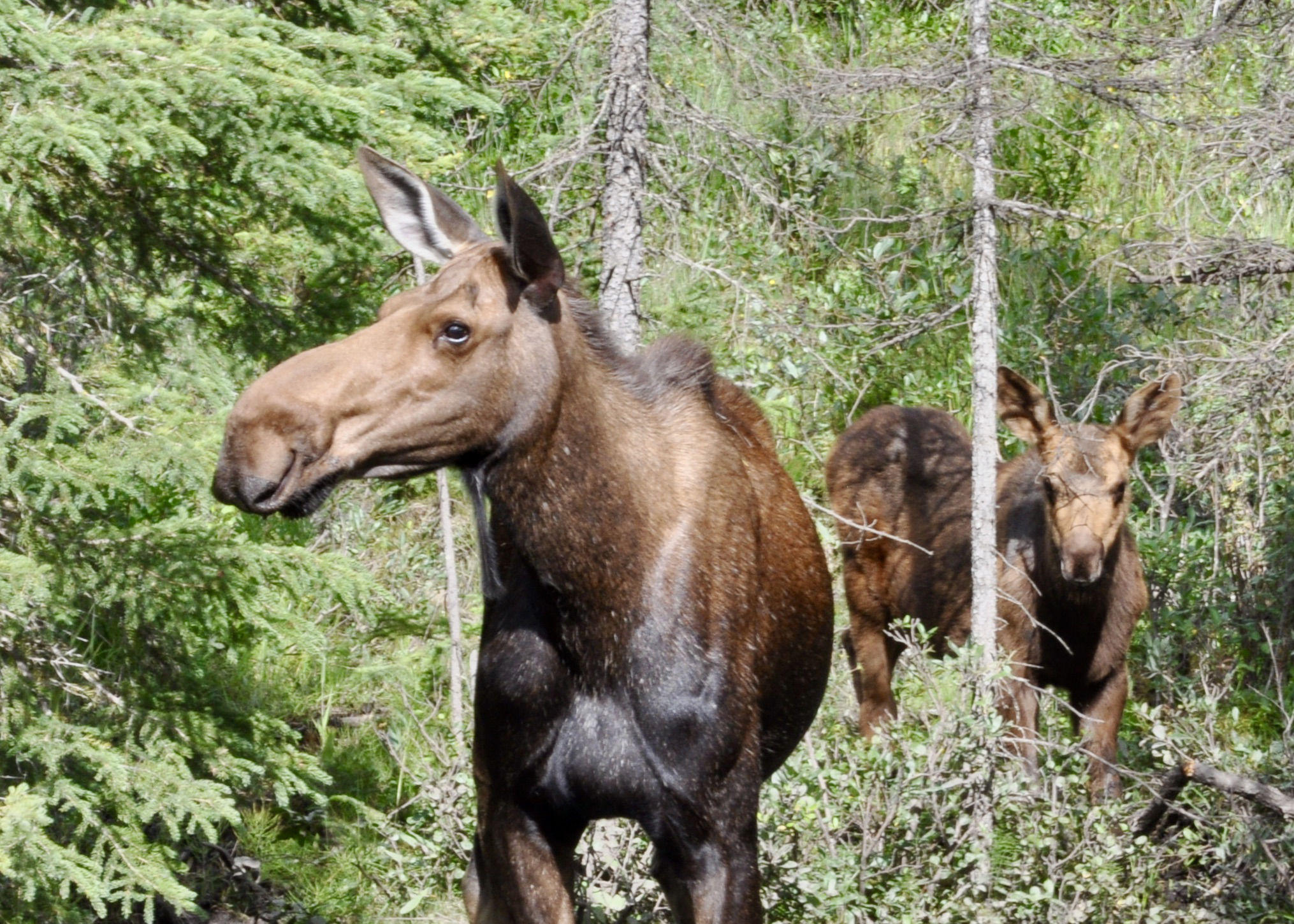
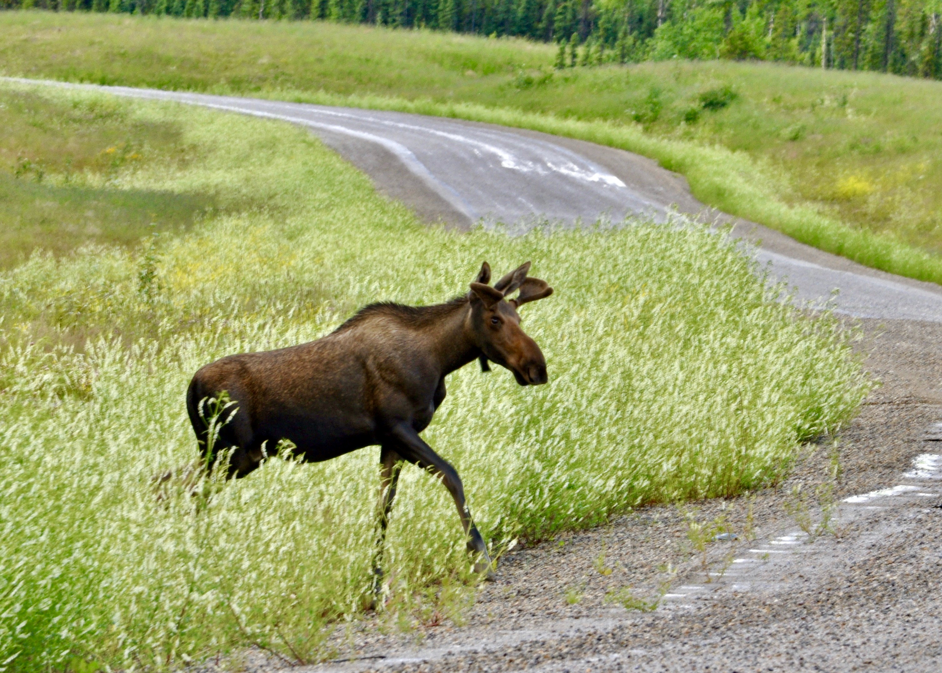
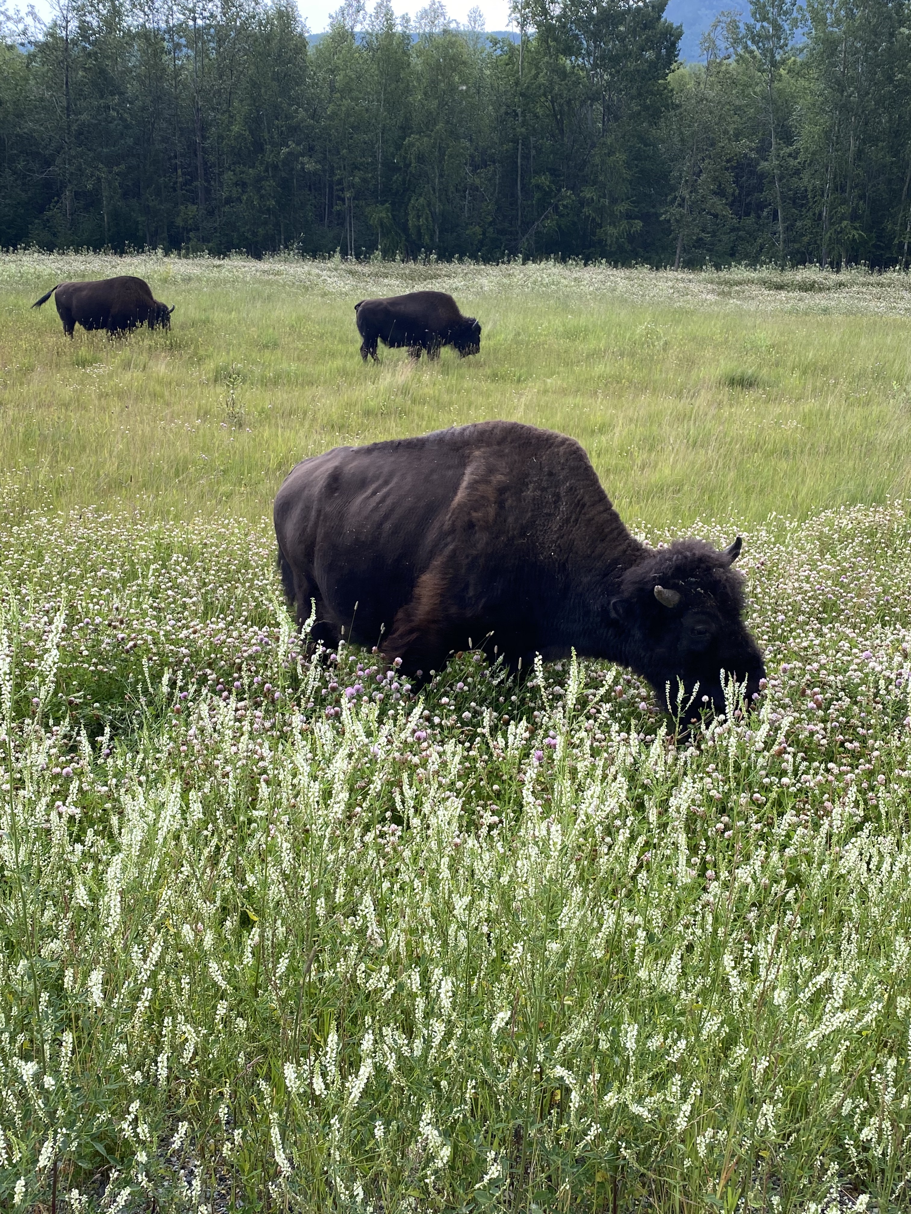
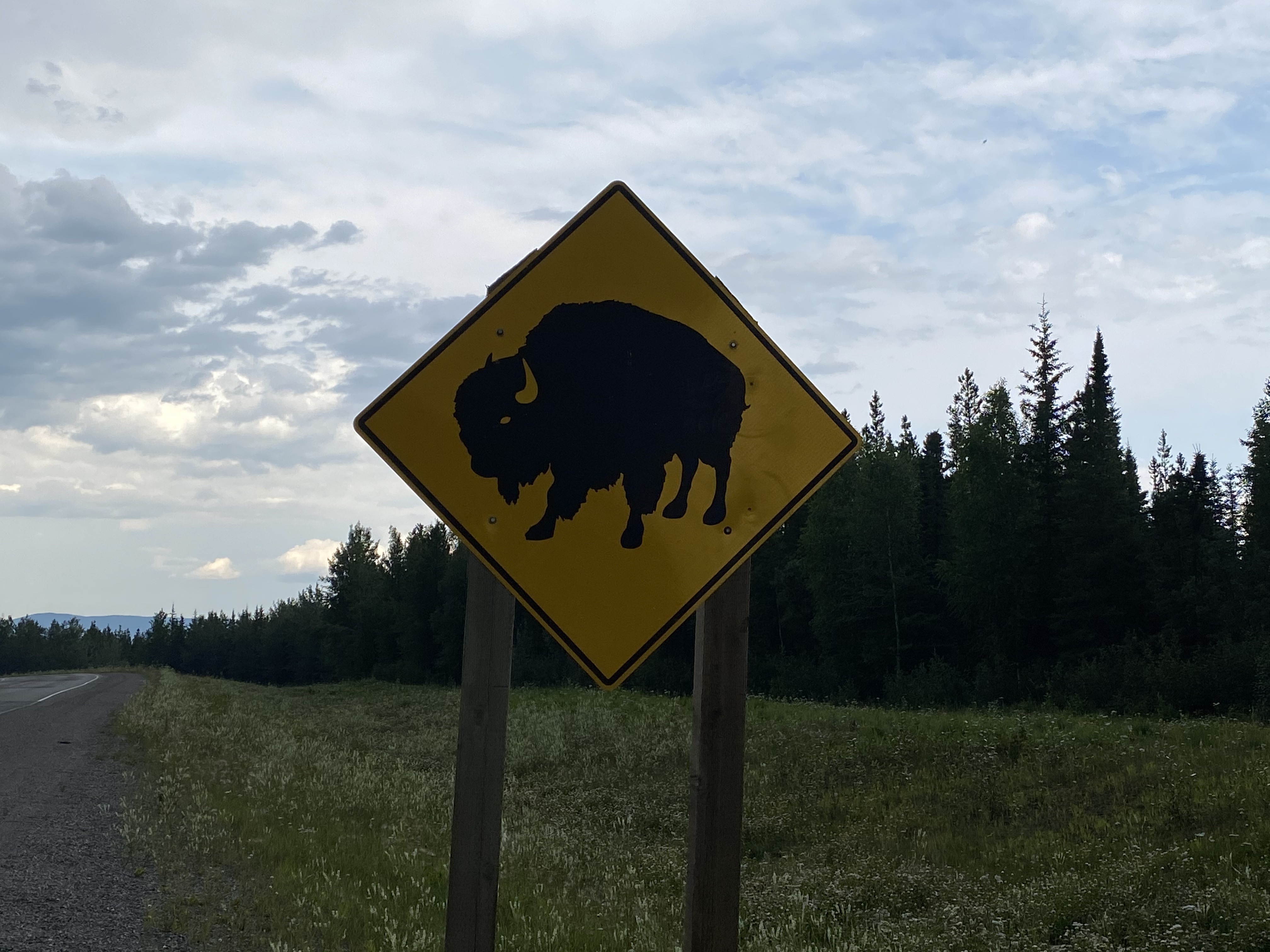
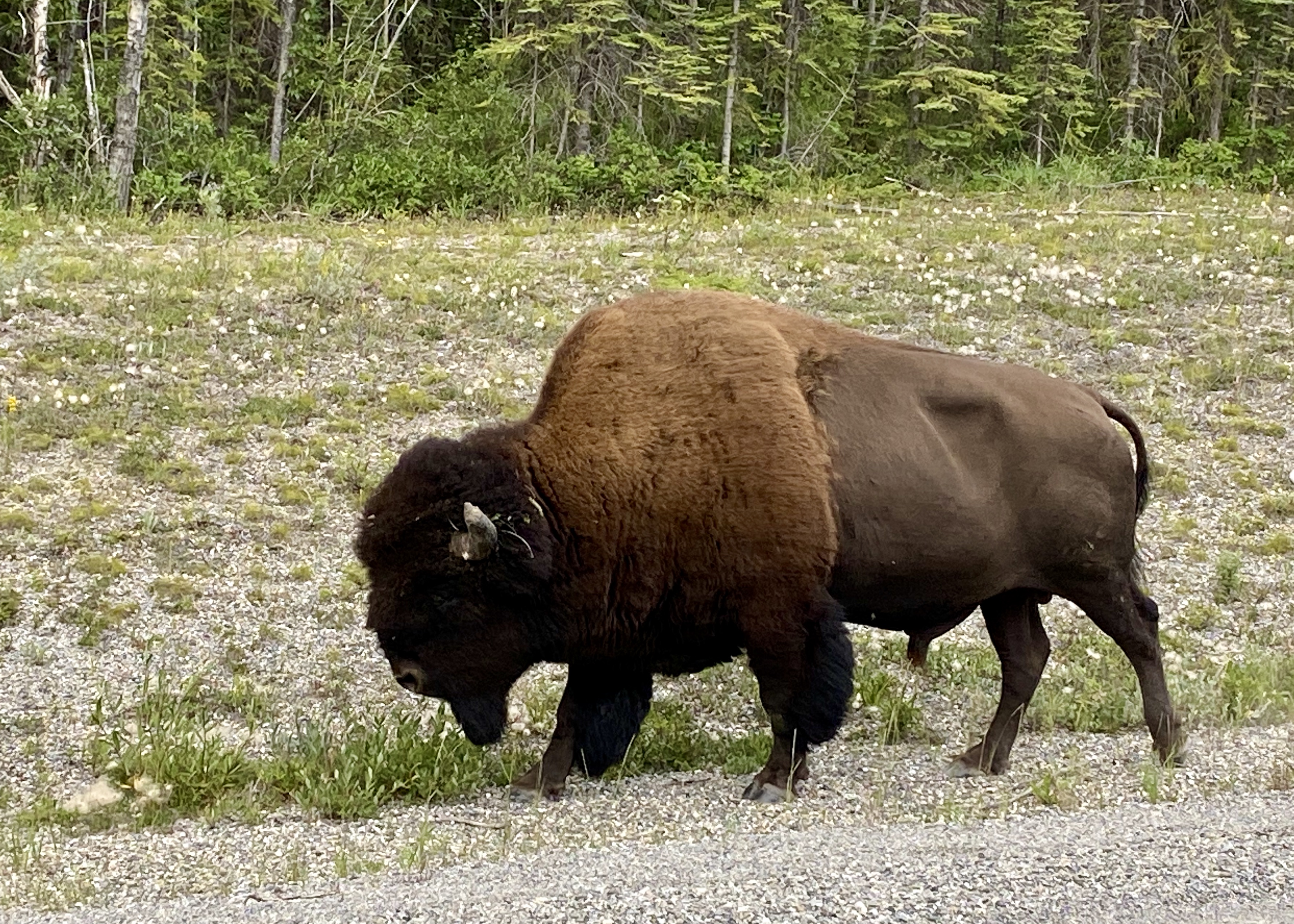
A little further down the Highway between Muncho Lake and the Yukon border, we encountered bison…..first one old bull walking with purpose down the road and completely ignoring us snapping away with our cameras…..then larger groups of the beasts on the road allowance. The little babies playing in the dirt, chasing each other and butting heads were the cutest! I had heard that there were bison roaming around this section of the Highway but never expected to see quite so many of them. It was pretty cool to see them thriving in their natural environment.
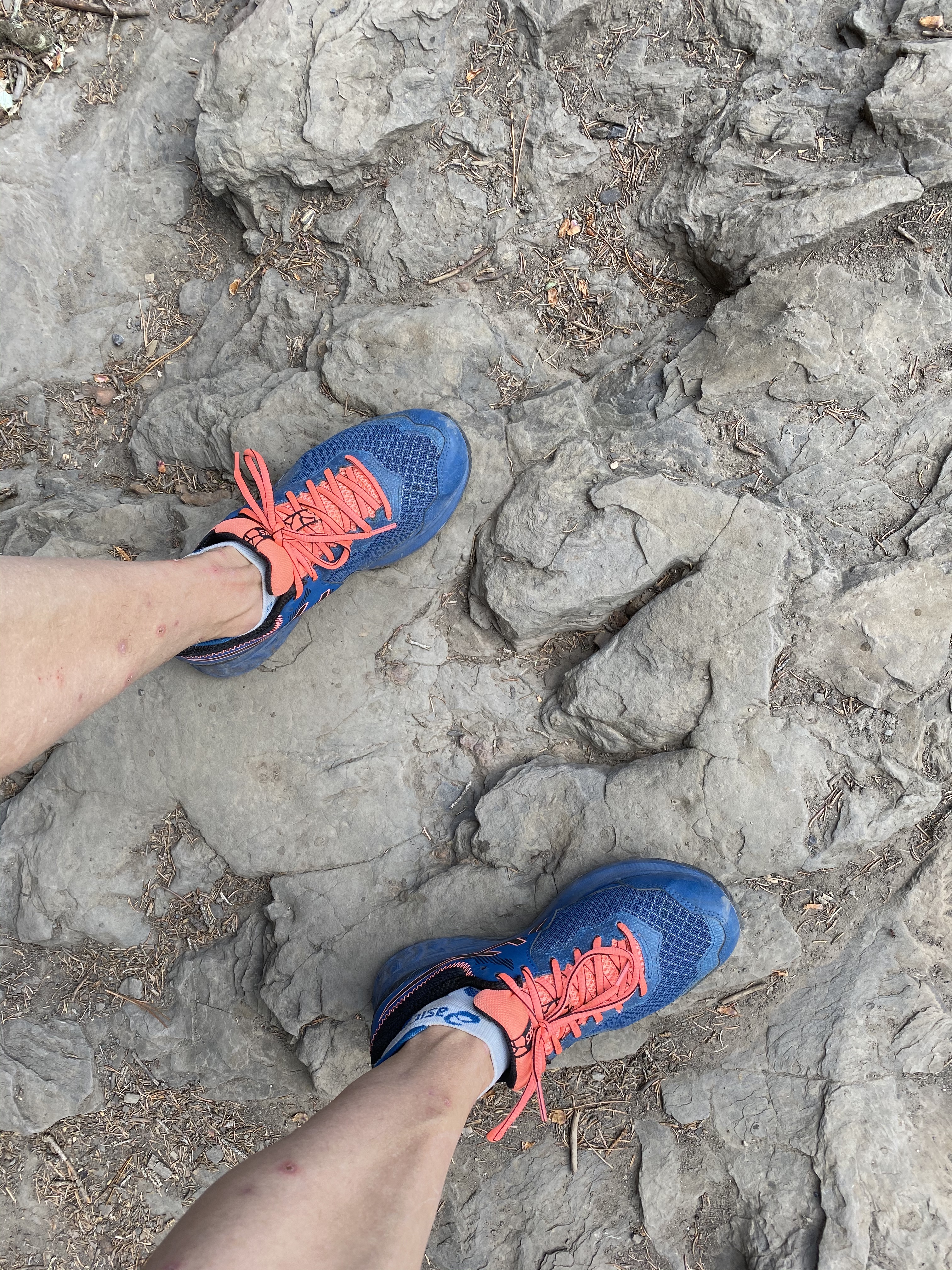
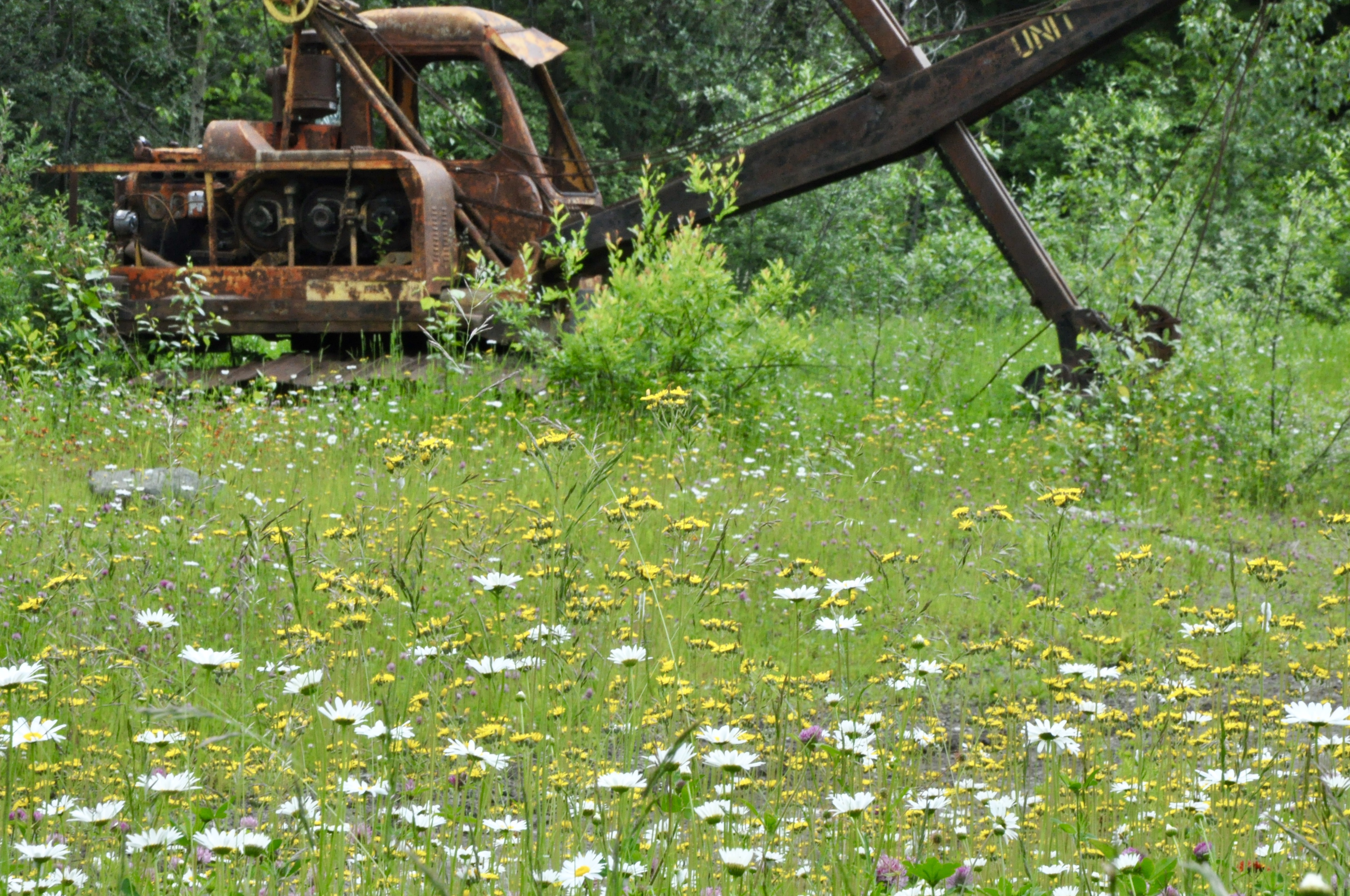
I first heard of Tumbler Ridge as a kid (I think a friend’s father was working up there) and for some reason the name intrigued me. The town was built to support the mining operations in the area in the 70s and 80s but has more recently floundered with the closing of the mines and decline of the industry. About 20 years ago though, a couple of young lads out for a day of fun on the river inadvertently discovered some of the most complete and impressive dinosaur tracks in the world. Since then, many more discoveries of tracks, bones and fossils have been made and the area has now been designated a UNESCO Global Geopark. We made the short jaunt to the river bank and walked along real dinosaur tracks. How awesome is that?!?
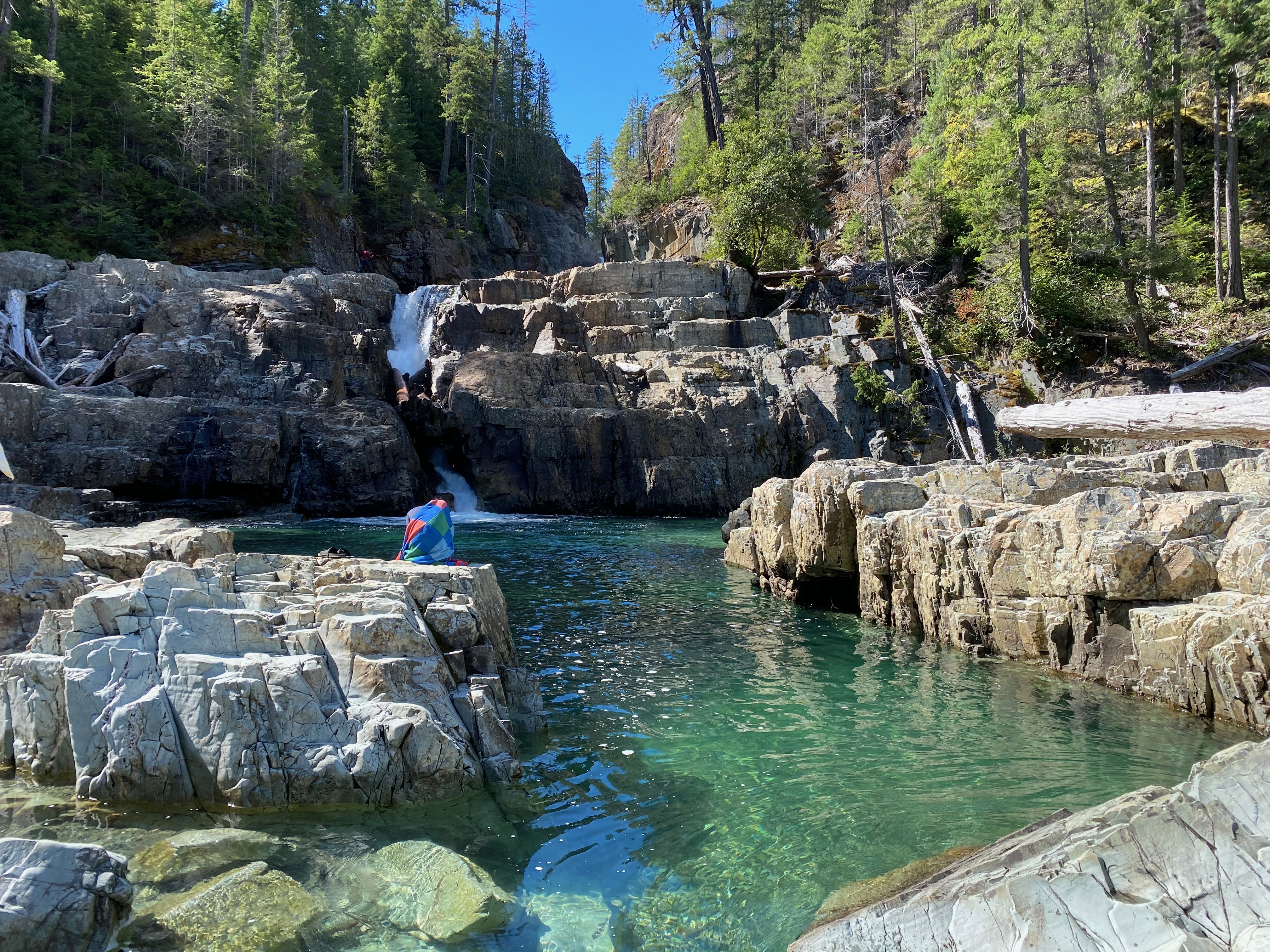
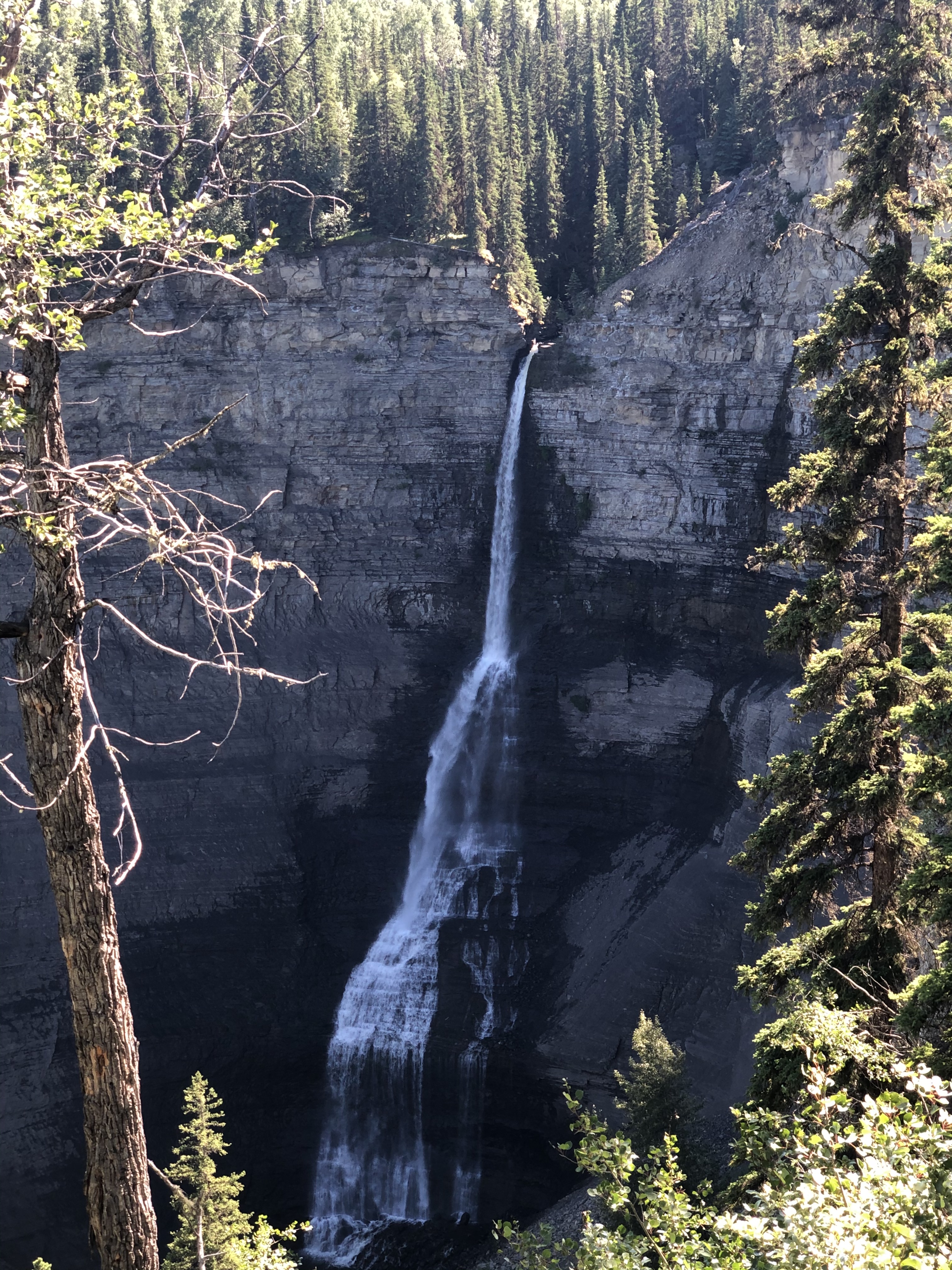
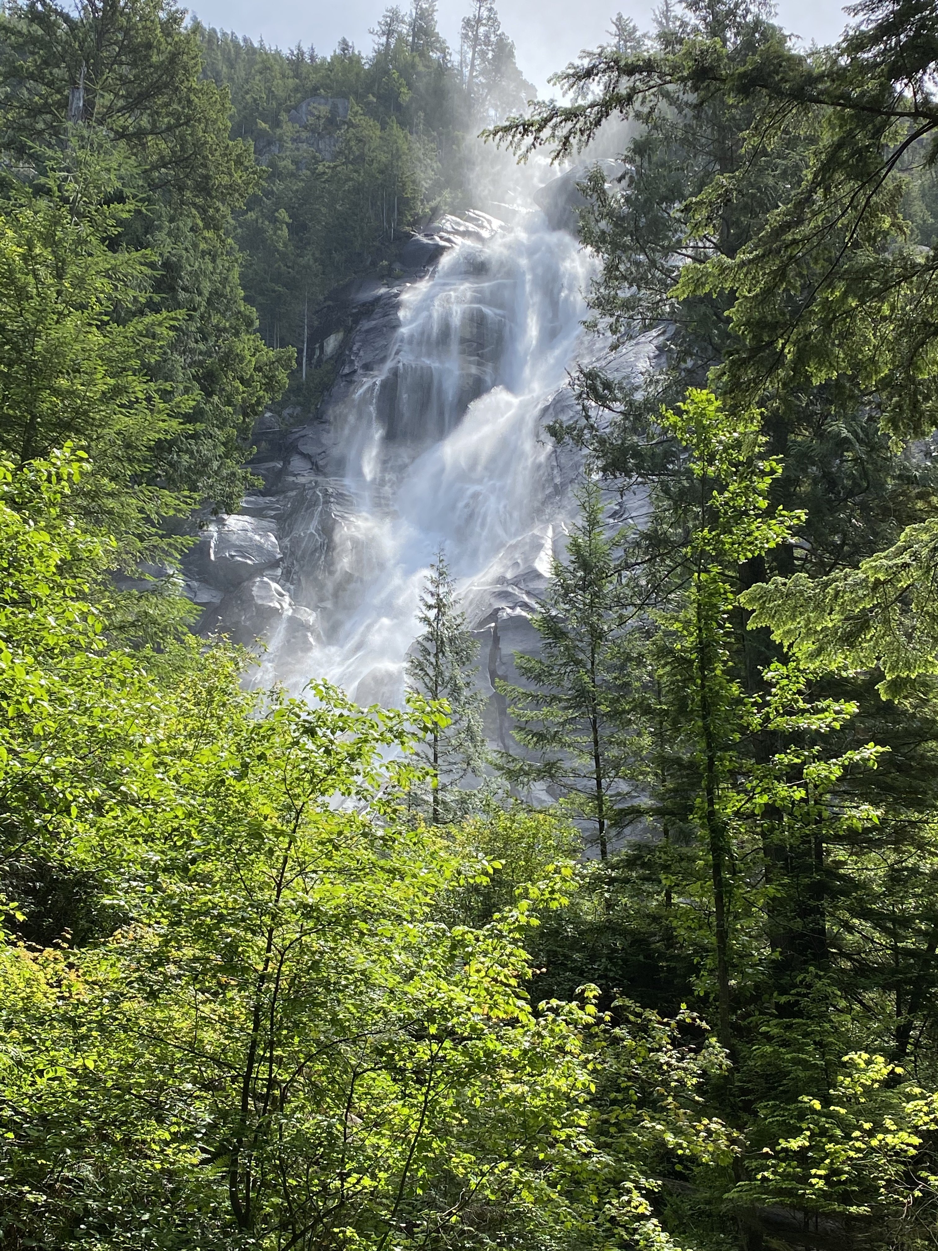
The other cool thing about the Tumbler Ridge area is the profusion of impressive waterfalls. We hiked to quite a number of them but the highlights would definitely be the beautiful Kinuseo Falls in Monkman Provincial Park and Bergeron Falls north of town. Bergeron Falls is the highest accessible waterfall in Northern B.C. at 100 metres tall. And you have to work some to get to it – the trail has many ups and downs and several creek crossings that require a little fancy footwork but it was well worth it to take in the falls from both the bottom and the top. And yes, we both managed to keep our feet dry – but just barely!


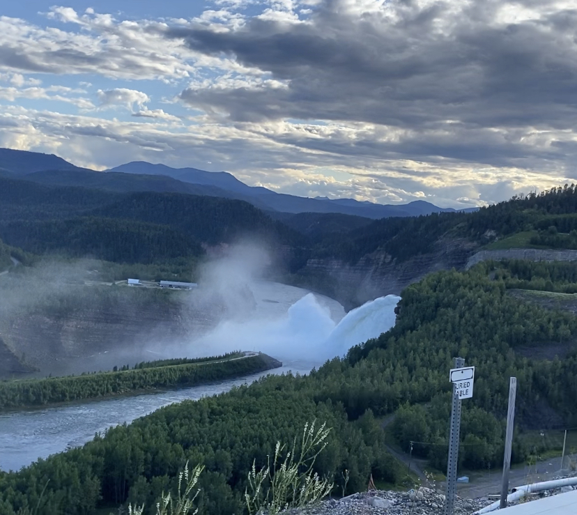
While we were in the area, we decided to check out the two hydro electric dams on the Peace River that supply a sizeable chunk of our energy here in B.C. Unfortunately the WAC Bennett Dam visitor centre was closed due to Covid, but we were able to drive across the top of it. It is the largest earthen dam in the world and holds back a massive reservoir in Williston Lake. As a rare treat, they had the spillway open so we could witness the huge torrent of water jetting out of the spillway and into the Dinosaur Reservoir below. Apparently the mist could be felt miles down the lake. It was pretty impressive….definitely made up for missing the visitor centre.
At the end of June, we loaded up B, left Vancouver and headed north! Our first two stops were in a couple of beautiful but rather busy provincial parks in the Pemberton Valley. We enjoyed a little hiking, trail running and chilling on the lake. The weather wasn’t great but B kept us dry and comfortable.
As we wound our way north up the Gold Rush Trail from Clinton, it became pretty clear that the weather was not going to improve and that we had better prepare for a lot of rainy days. Between the rain and the late snowmelt making its way to the rivers and lakes in the Cariboo, we found that a number of our intended destinations were actually under water!
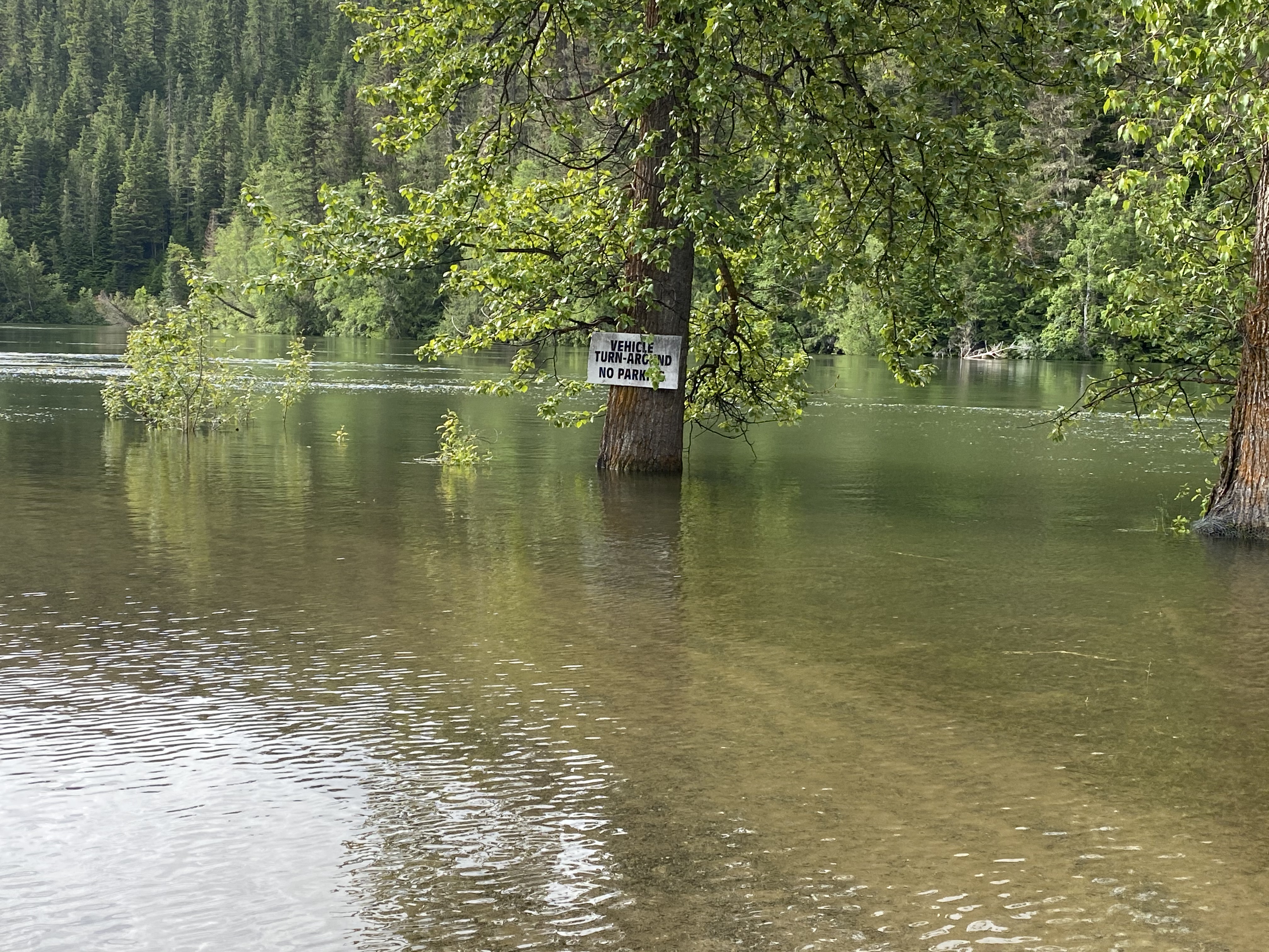
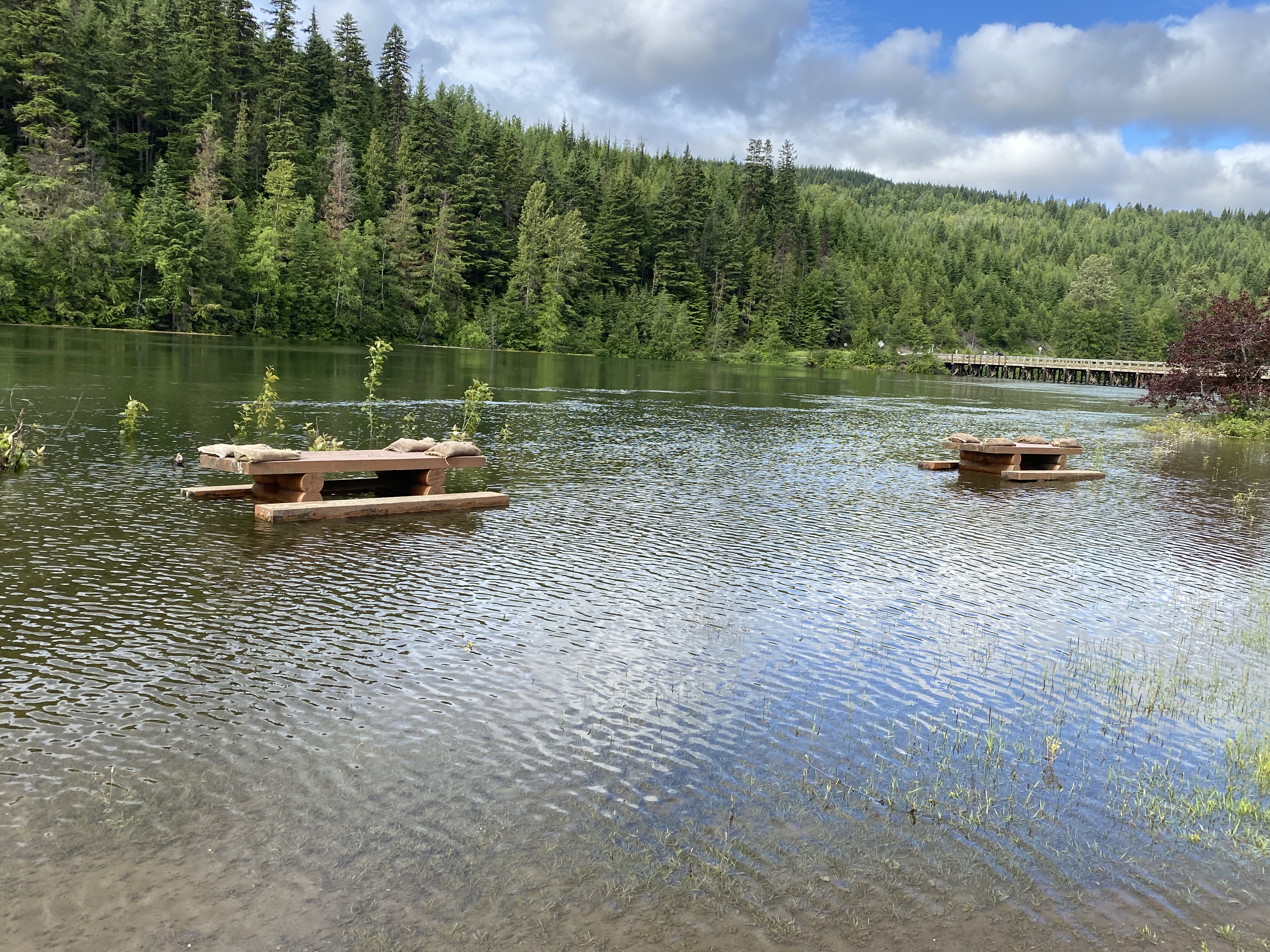
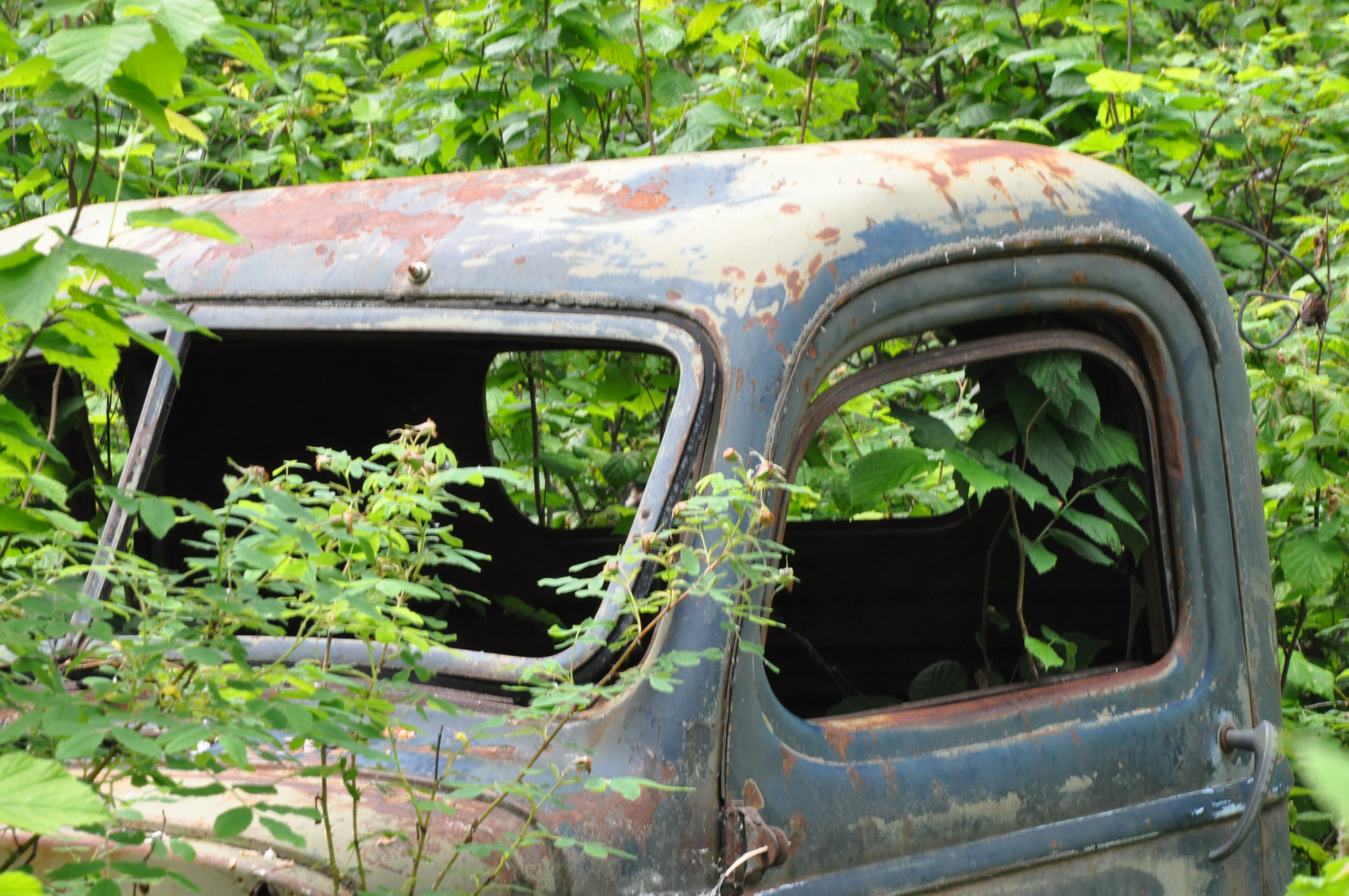
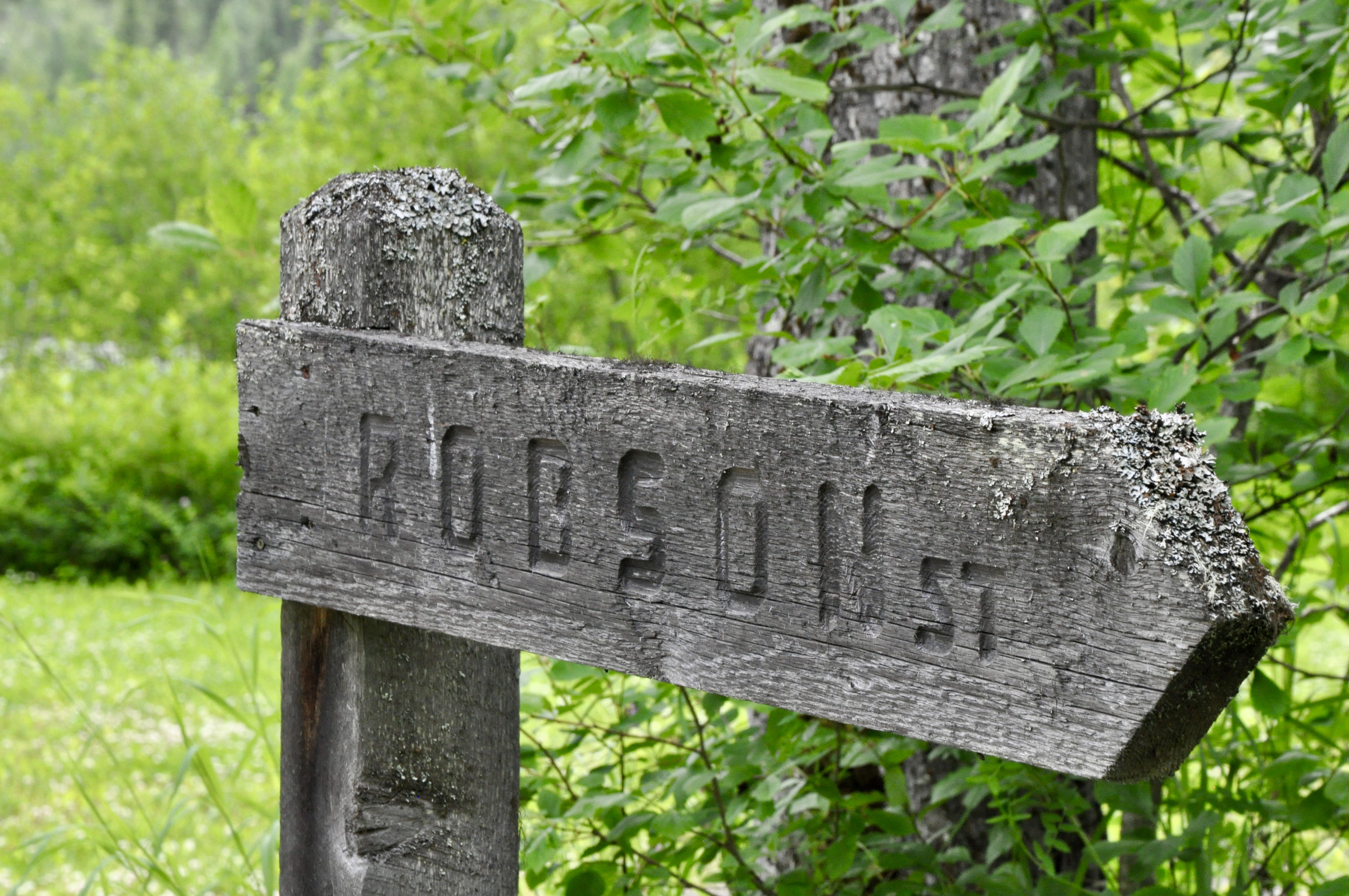
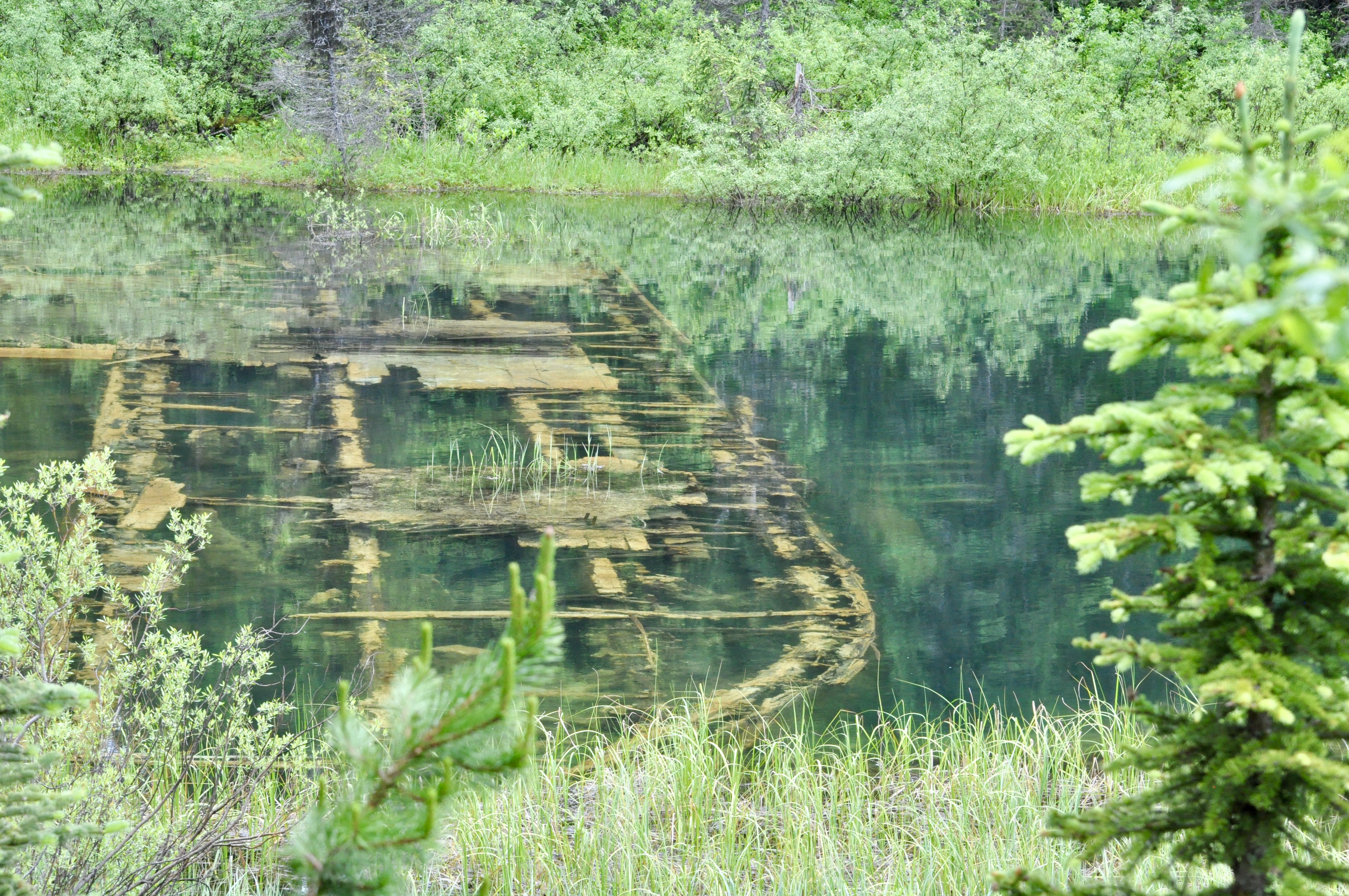
Likely was the first such destination….we were hoping to stop at the provincial park on Quesnel Lake just outside of town but it was closed due to flooding. In Likely itself, picnic tables lining the river were under water and had sand bags on top to ensure they didn’t float away. We did a quick pivot and headed instead for Quesnelle Forks, a ghost town about 13 km down an old dirt road from Likely. We heard that there was a recreation site where we could camp so decided to check it out. It ended up to be quite a find! Quesnelle Forks was a gold rush town, established in 1860. It boomed and was all but abandoned within a dozen years. There were a few who remained, mostly Chinese miners and a few merchants, until the 1950s when the last resident finally passed. There are a number of buildings in Quesnelle Forks that are in various states of disrepair and an old graveyard which was really interesting. There were so few visitors there and we were free to wander around the site. It was a kind of eery and peaceful at the same time.
There is a seasonal road between Likely and Barkerville that is locally known simply as “the Backroad.” The road promised dramatic mountain scenery and beautiful lakes interspersed with historic sites….we were intrigued so we decided to put B to the test and see if we could make it around the 150 or so kilometres to Barkerville. I am happy to say that B was up to the challenge and other than one particularly nasty area that was under active logging operation, we made our slow and steady way quite comfortably to our destination and enjoyed a few great stops along the way.
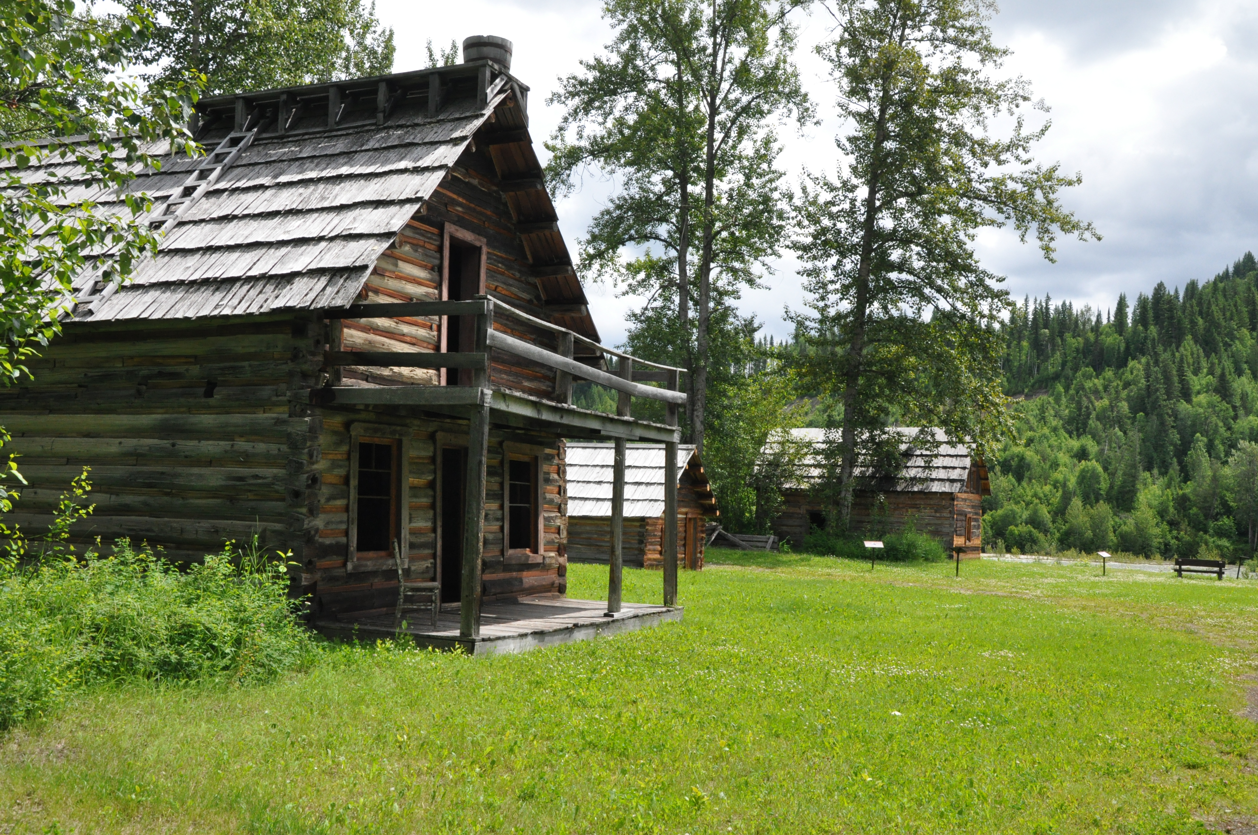
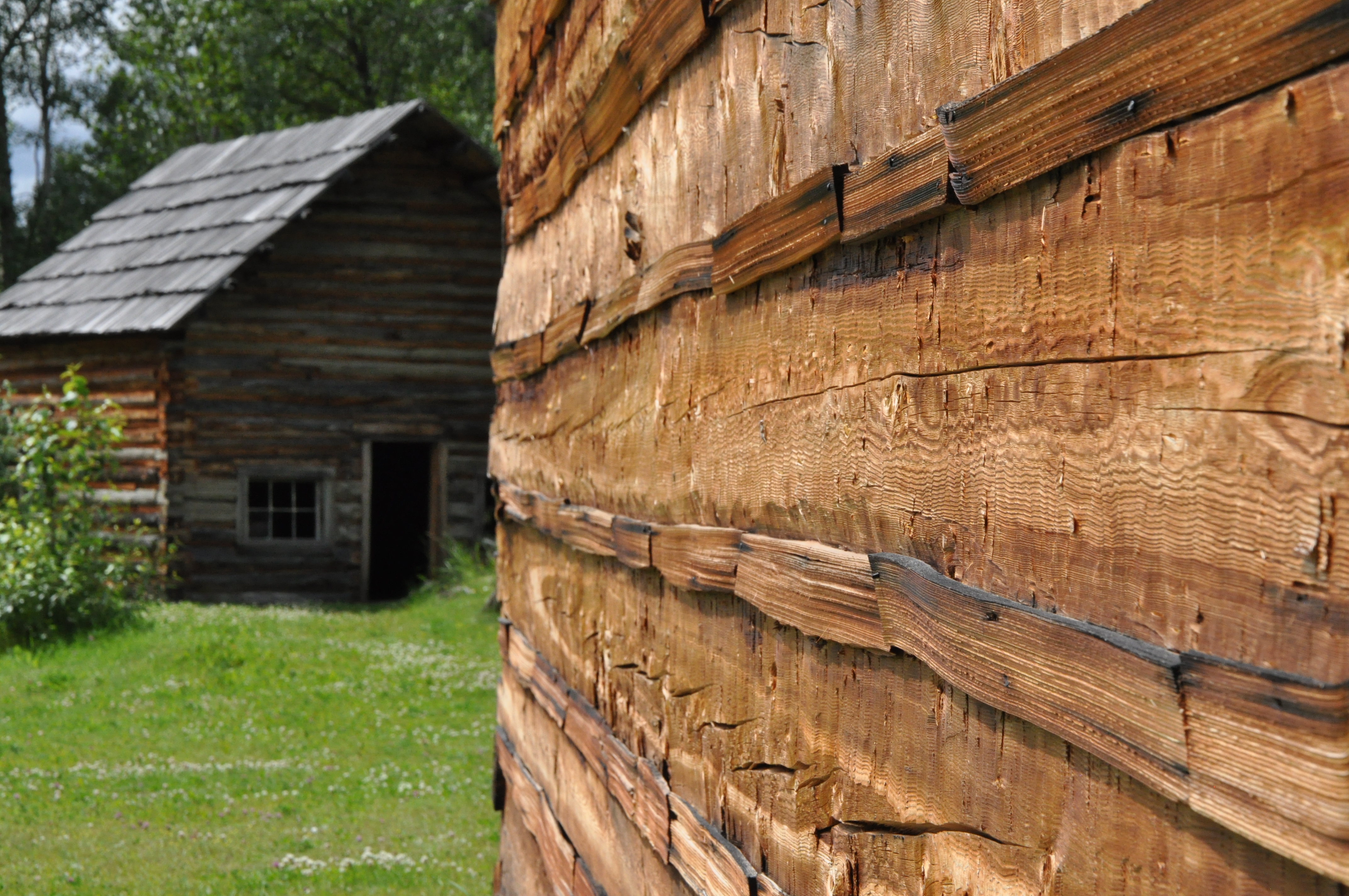
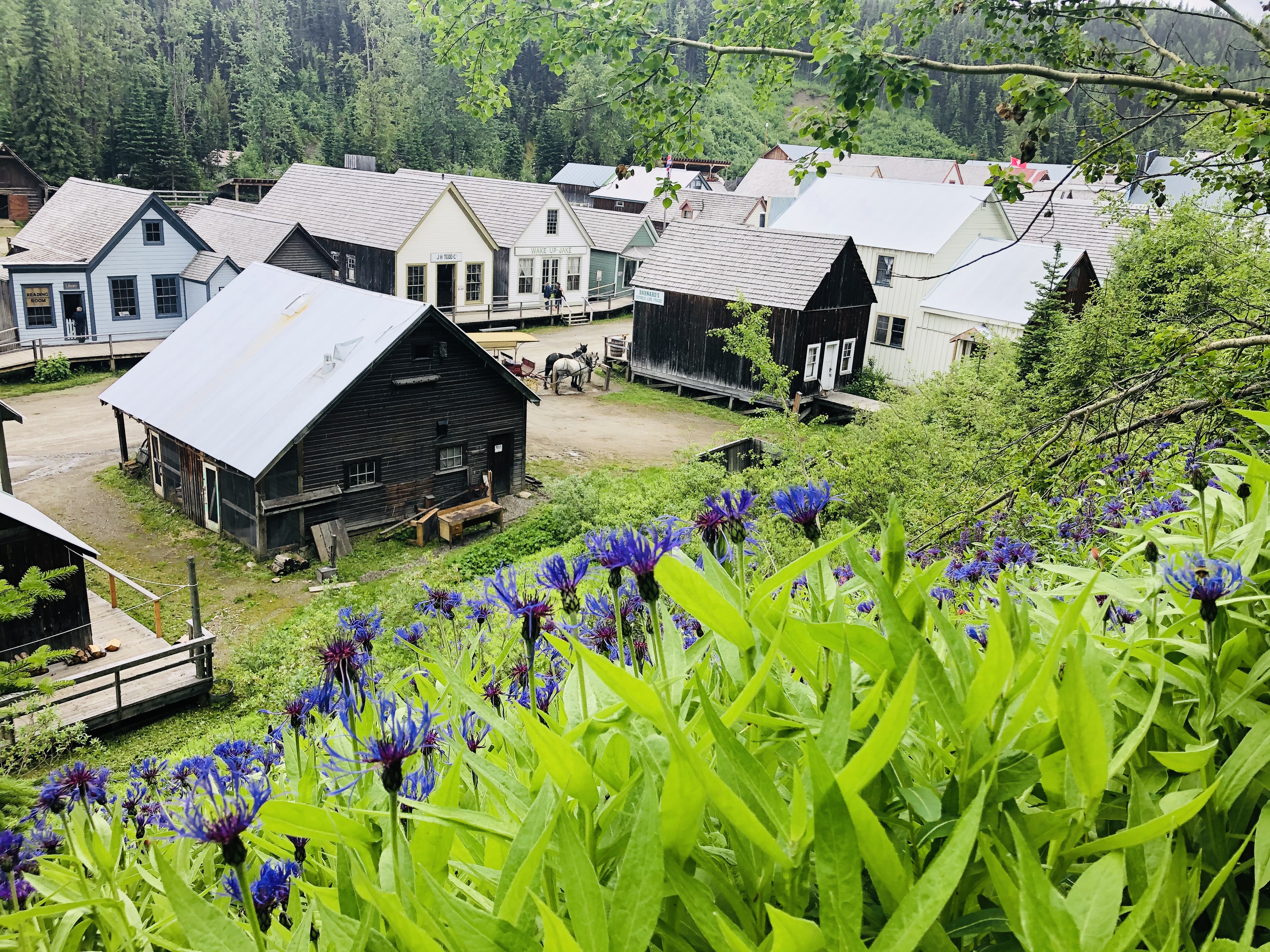
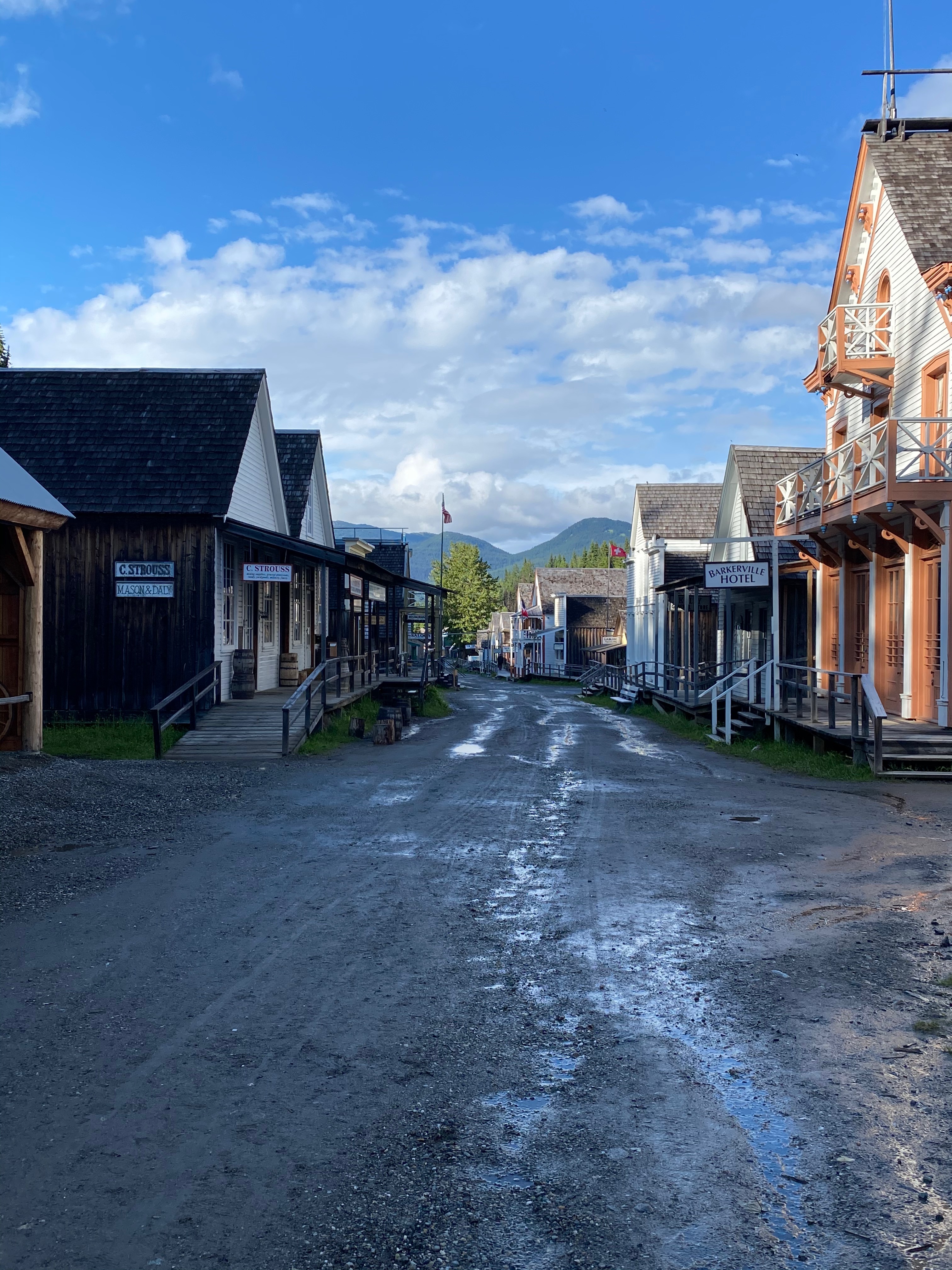
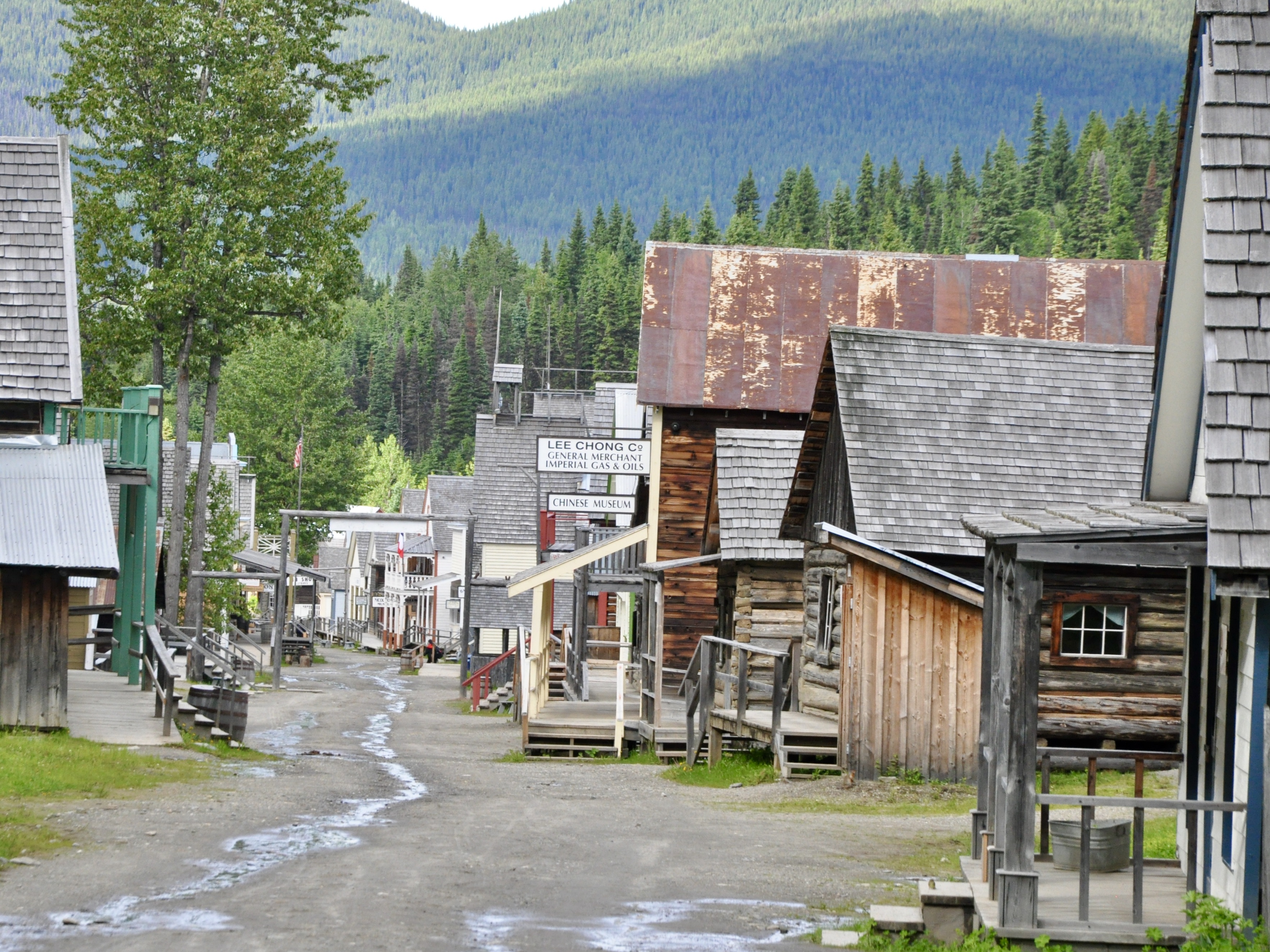
Barkerville itself is a heritage town and Canadian National Historical Site. Gold was discovered by Billy Barker on the nearby Williams Creek in 1862 and the town sprung up nearly overnight to service the ensuing gold rush. Over the next 35 years or so, over 35,000 kilos of gold were extracted from the creek. I can’t even imagine what that would look like! Understandably Barkerville was a big deal back in those days – one of the largest cities in the West. Nowadays there are restored buildings, old shops, restaurants and historic interpreters – in old-time garb – to give a sense of what it must have been like in its heyday.

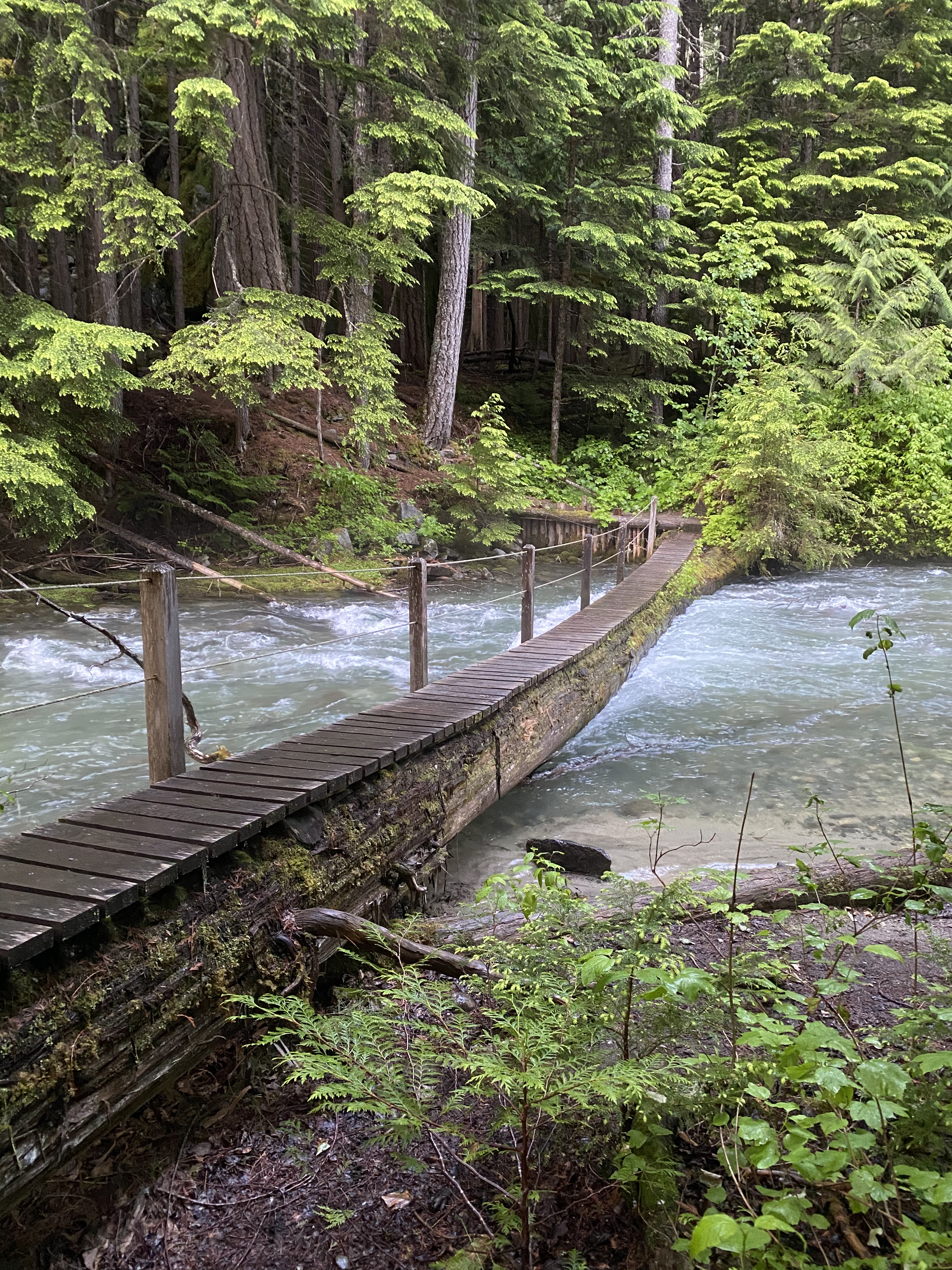
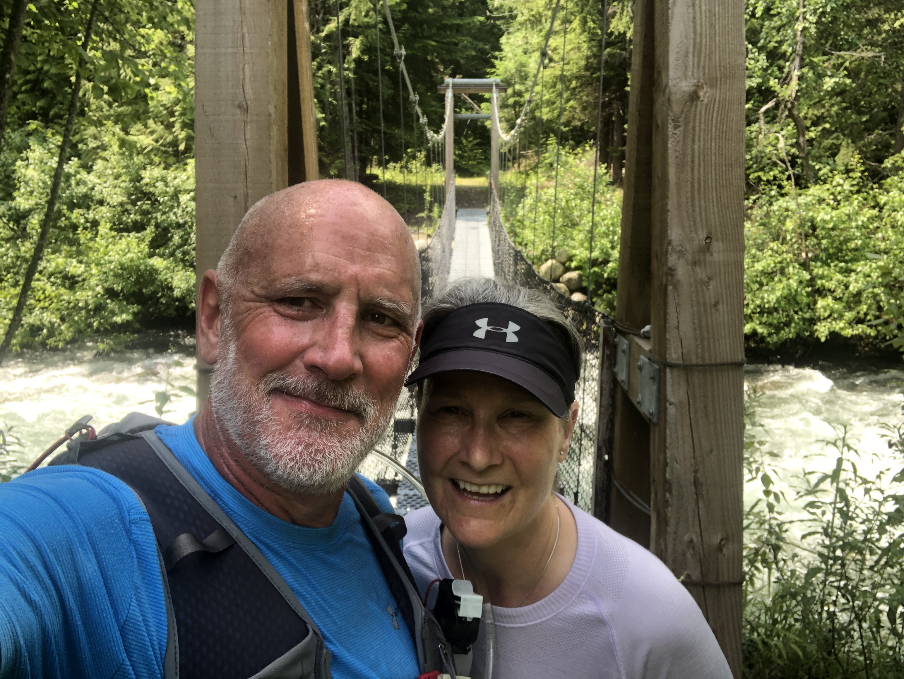
From Barkerville, we made a short side trip to Bowron Lake Provincial Park. This area is quite famous for its 116km canoe circuit and in the summer sees visitors from all over the world who come to enjoy some paddling amid the beautiful scenery. When we arrived in July though, only a small portion of the circuit was accessible – the rest of it was flooded out. We didn’t have any designs on paddling the circuit (this year anyway) so we were happy to spend a couple of nights in the provincial park and paddle around camp. In the end it was rainy, cool and the mosquitos were just crazy so I am quite glad more canoeing and tenting was not in the plan this time around.
With our quarantine complete and future international travel on the back burner for the foreseeable future, we needed to come up with a plan to keep the adventure rolling….we were enjoying the extra time with family, helping out with some chores and generally chilling but we were not going to let our wandering ways die just yet.
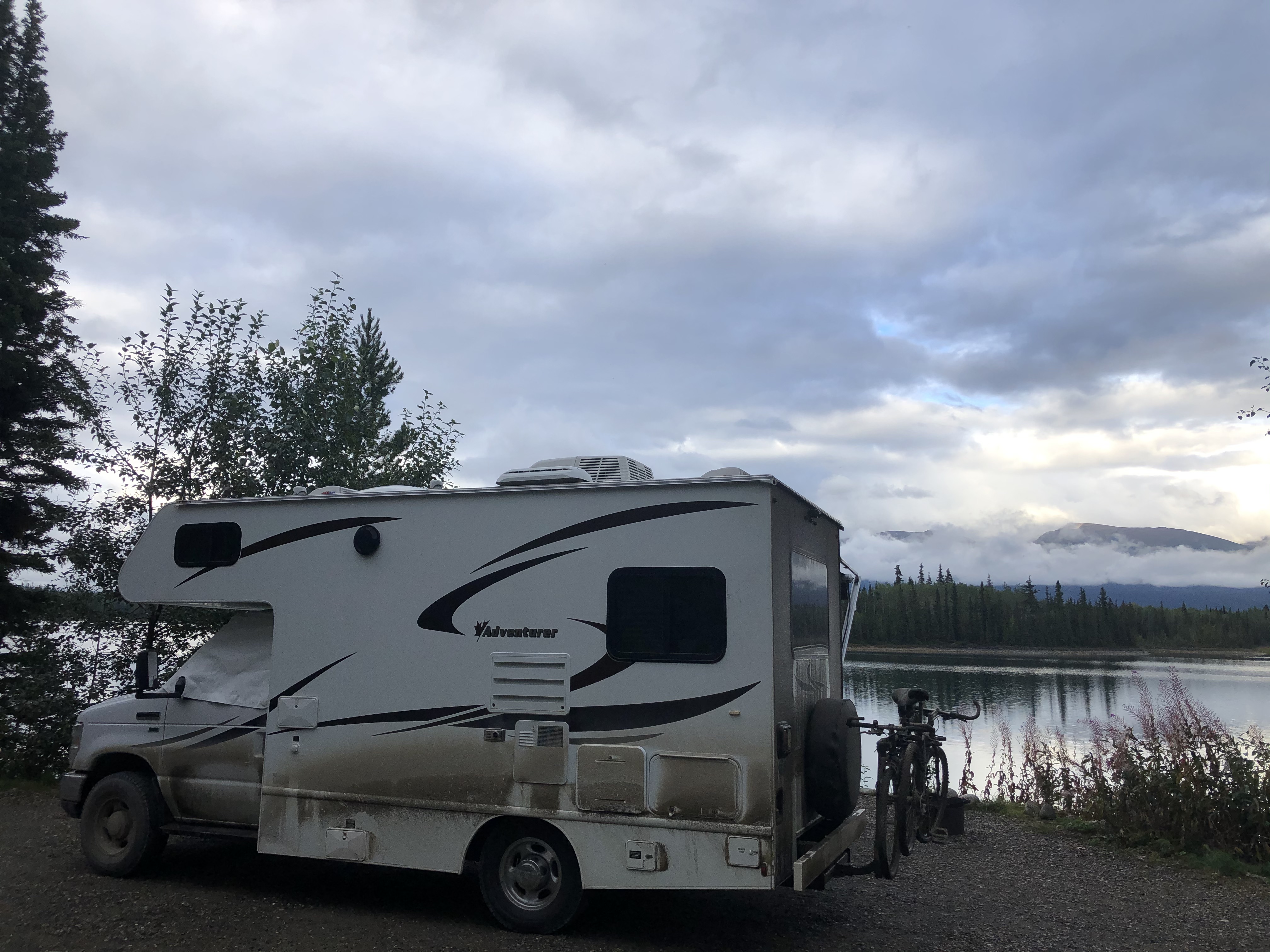
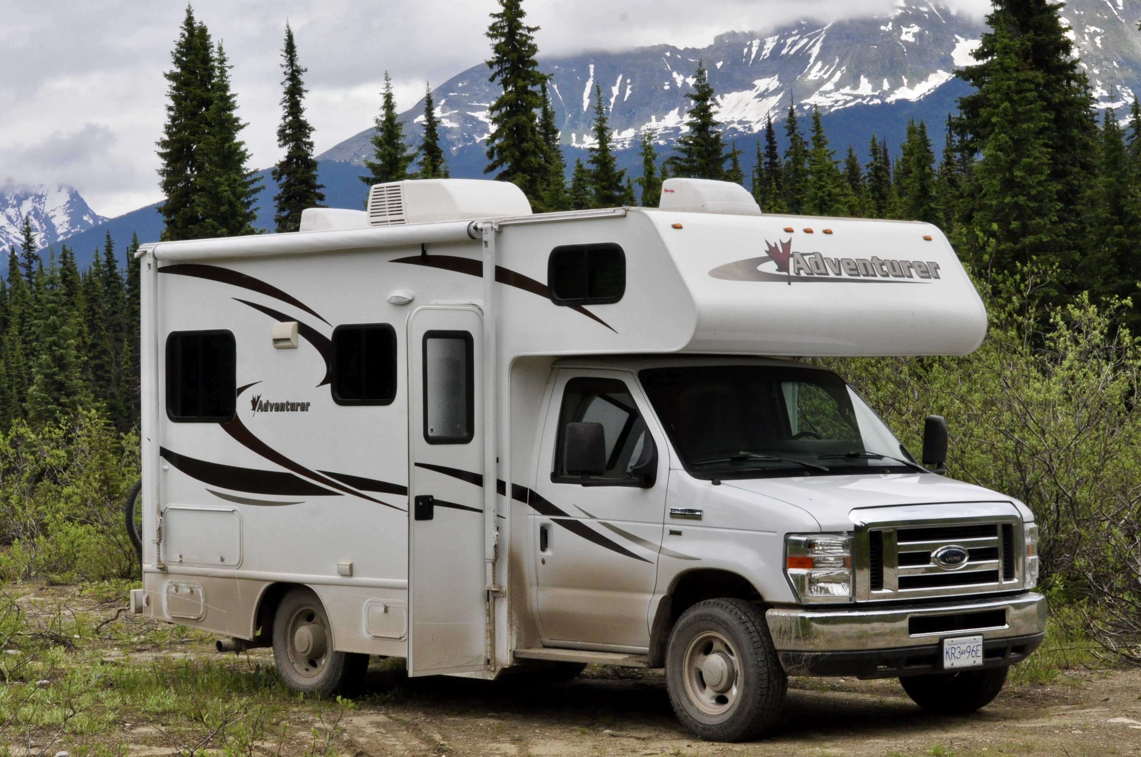
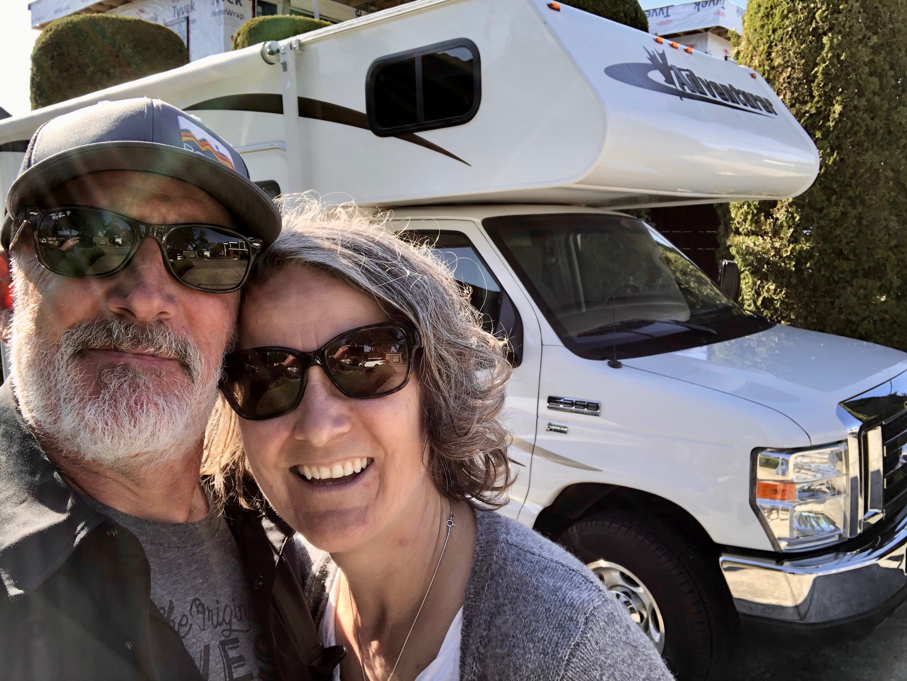
At the beginning of May, with little forethought or research, we decided to buy an RV to travel the province. It just so happened that a nice little unit was available around the corner from my parent’s place. We sent them (and their dog) for a little walk to check it out. It passed the Mom test so we drove out, took it for a test drive and Plan B was born!
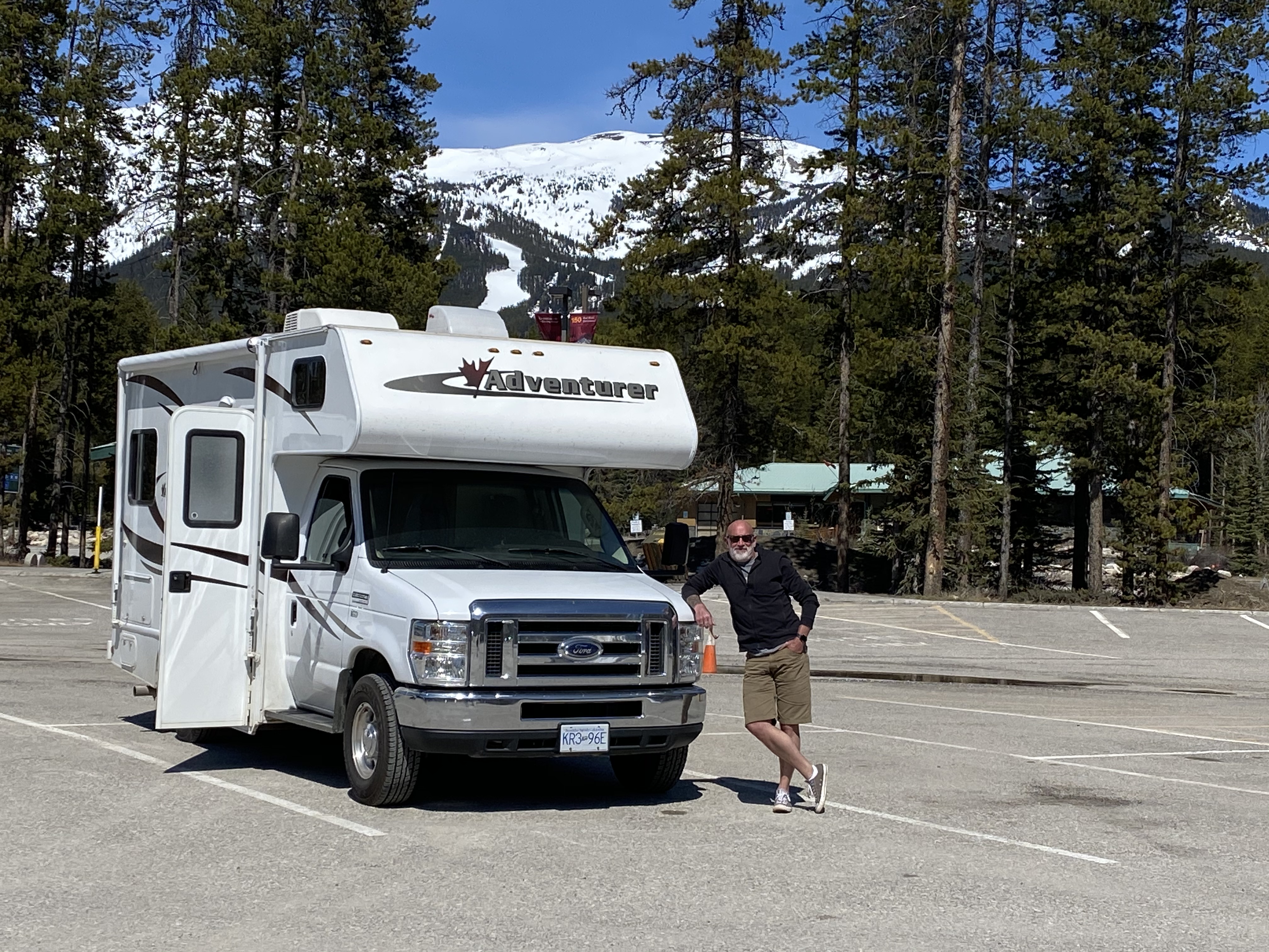
B is a lightly used 19ft motorhome…big enough to be comfortable for two (we don’t need much room) but small enough to get in and out of tight spots, on and off ferries and fit into city-sized parking spots. She has been well looked after and has lots of adventure left in her!
If all goes well, we will get a lot of enjoyment out of B this summer as we wander our way around the province.
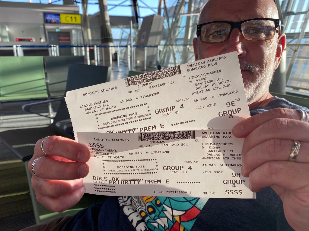
As we were boarding our flight back to the mainland from Rapa Nui, we received notification that the next part of our journey was cancelled due to the developing Covid-19 situation. We had intended to take a cruise ship from Chile to San Diego to get us most of our way home. However, it seems that the Chilean government refused to let the ship into the port at San Antonio so the passengers who were on board were not able to disembark. So, for us it meant having to find another way home. For the folks on board, it meant a slightly longer voyage than they were expecting….
After arriving back in Santiago, we considered our options and regrouped at the Holiday Inn at the airport. Air Canada had a not-outrageously priced flight available in six days so we decided to book an Airbnb on the coast and enjoy a bit of beach time while we waited for our flight home. Things were still quite calm and there were no signs of panic buying or any restrictions being contemplated locally. The number of Covid-19 cases in Chile were still reported to be in the single digits. So much can change in one day though. By the time we drove to the coast, got some groceries and were settled into a really lovely apartment with fantastic views of the ocean, we heard that the Chilean government was closing its borders at midnight the following day. What?!? OK, forget Plan B! We were now on to Plan C!
We spent out one and only night at the beach frantically trying to find flights home that weren’t thousands of dollars. Each time it seemed we had found something, either the system crashed, the payment failed or the price went up exponentially before we could complete the purchase. Air Canada was not answering their phones as they had too many callers to even put us on hold. Finally, we managed to get a couple of seats on an American Airlines flight the next day to Dallas then onward to Vancouver. Under normal circumstances, we try to avoid stopovers in the U.S. if possible as it just adds one more level of customs to clear but this time it seemed to be our only option.
The next day we packed up, checked out of our Airbnb and headed back to the airport where we sat on pins and needles for a few hours until we could check in. By this time we were hearing stories from friends and in the news of airlines just abandoning passengers in Morocco and elsewhere as borders were closing. So even though we had tickets in hand, nothing felt assured. To make matters worse, even after we checked our bags and cleared security, the airline still did not have confirmed seats for us. Fortunately about an hour before our scheduled departure time, we went to the gate agent (again!) and this time they could actually assign us seats. Phew! We departed just before 10:00 p.m. on what ended up being the last American Airlines flight out of Chile since.
We arrived in Dallas very early in the morning and were expecting line ups, temperature checks and assorted delays between flights as we had seen news reports of terrible crowds in Chicago and other hubs of people returning from abroad. What we got was a sleepy customs agent asking us if we felt ill – no – and if we had been to Europe or China in the last 14 days – no. That’s it?!? Thankfully the airport was all but deserted so we had no issues with our connection to Vancouver.
Vancouver airport was also eerily quiet. I think we were one of two flights in that morning. What is usually a bustling baggage claim full of people, suitcases and loaded luggage trolleys, was all but empty. Coming out of the airport, we were definitely thankful to be back on home soil. We didn’t know then how Covid-19 would challenge the world in the coming days but did know that we were very fortunate to be home in a safe country with excellent healthcare.
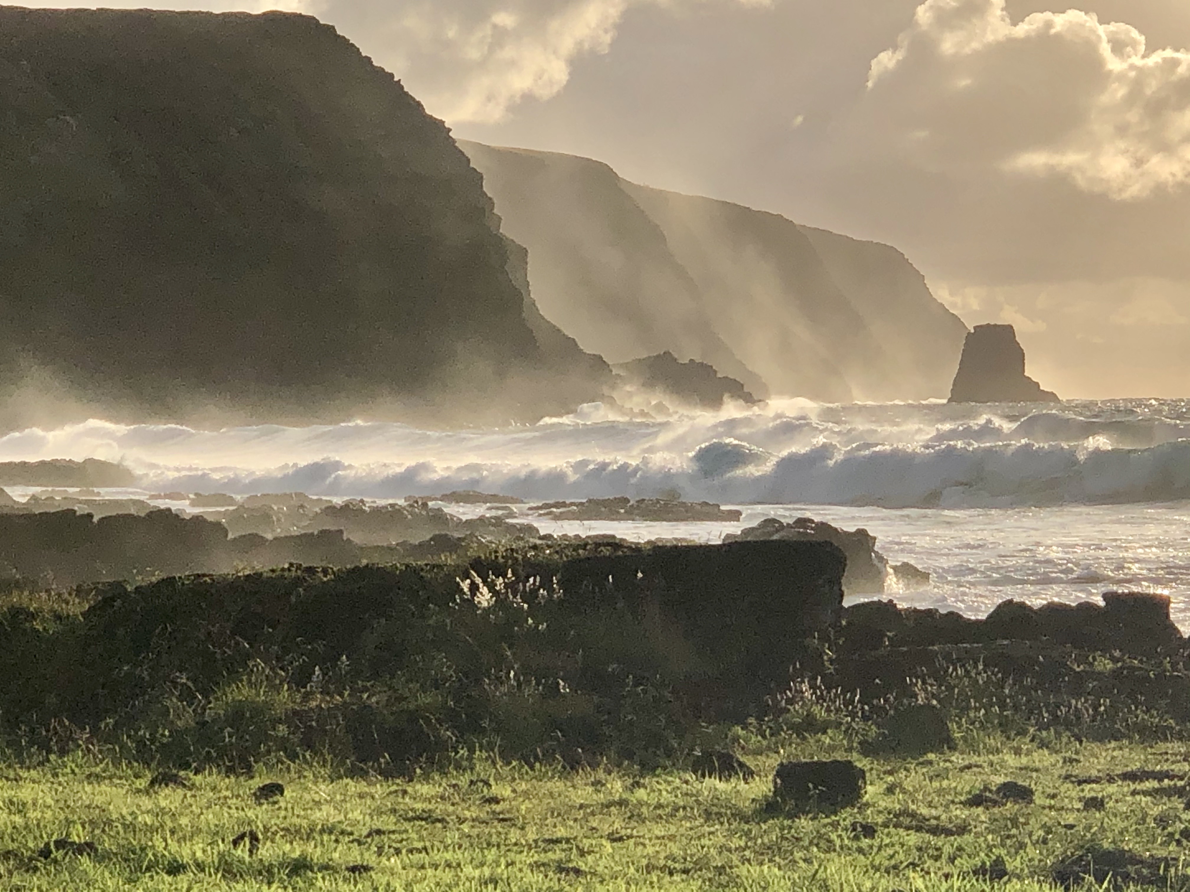
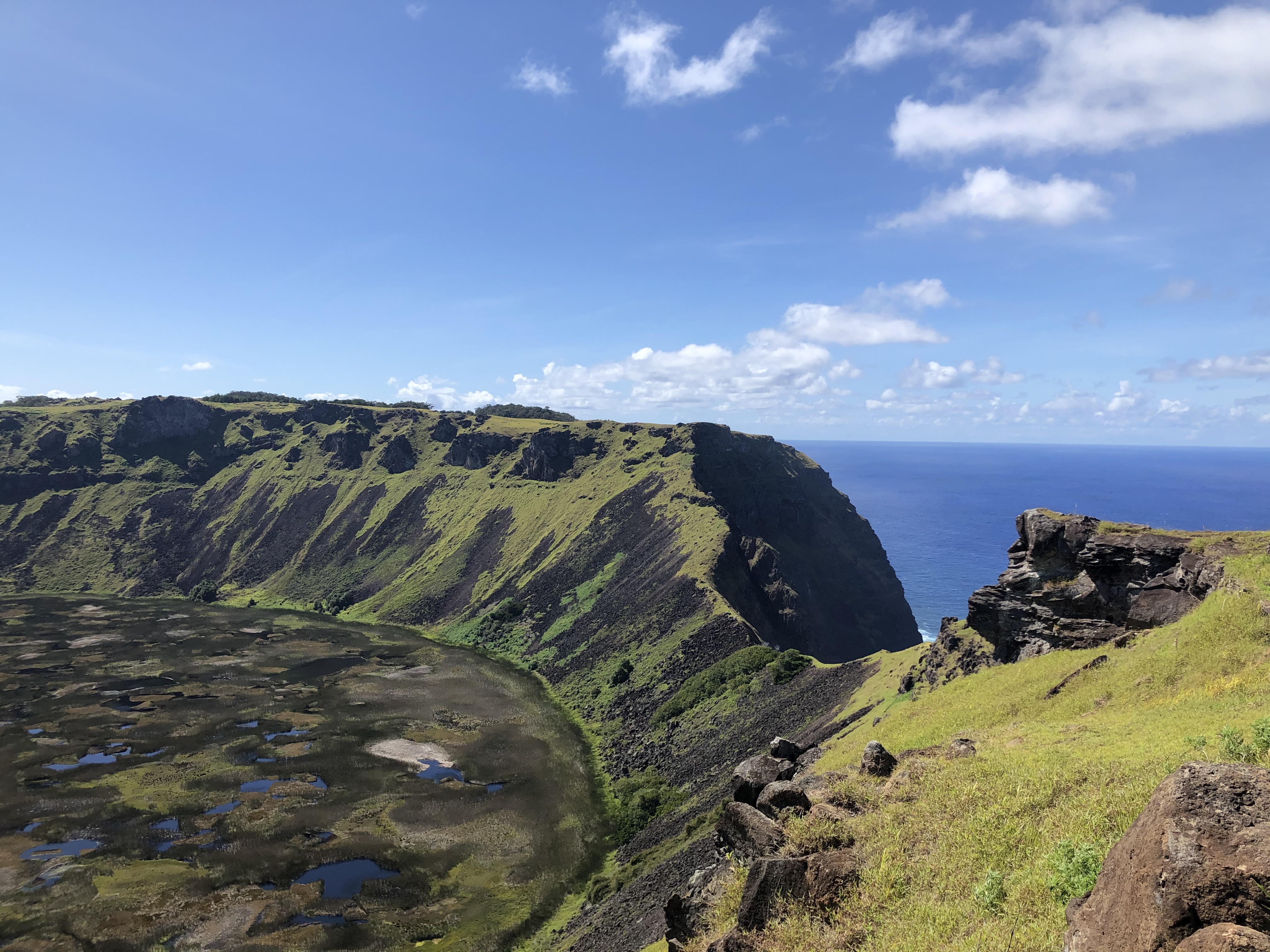
Rapa Nui (also known as Easter Island) is said to be the most remote inhabited island in the world. It is located more than 3500 kms from Chile and over 4000 kms from Tahiti, in the middle of the southeast Pacific Ocean. Any way you approach it, it is a long flight to get there! The current population is just over 5000 people, of which about 60% are indigenous Rapa Nui. The island itself is about 15 miles long and 7 miles across at its widest point. So for such a small island, why the big attraction? One word – Moai!
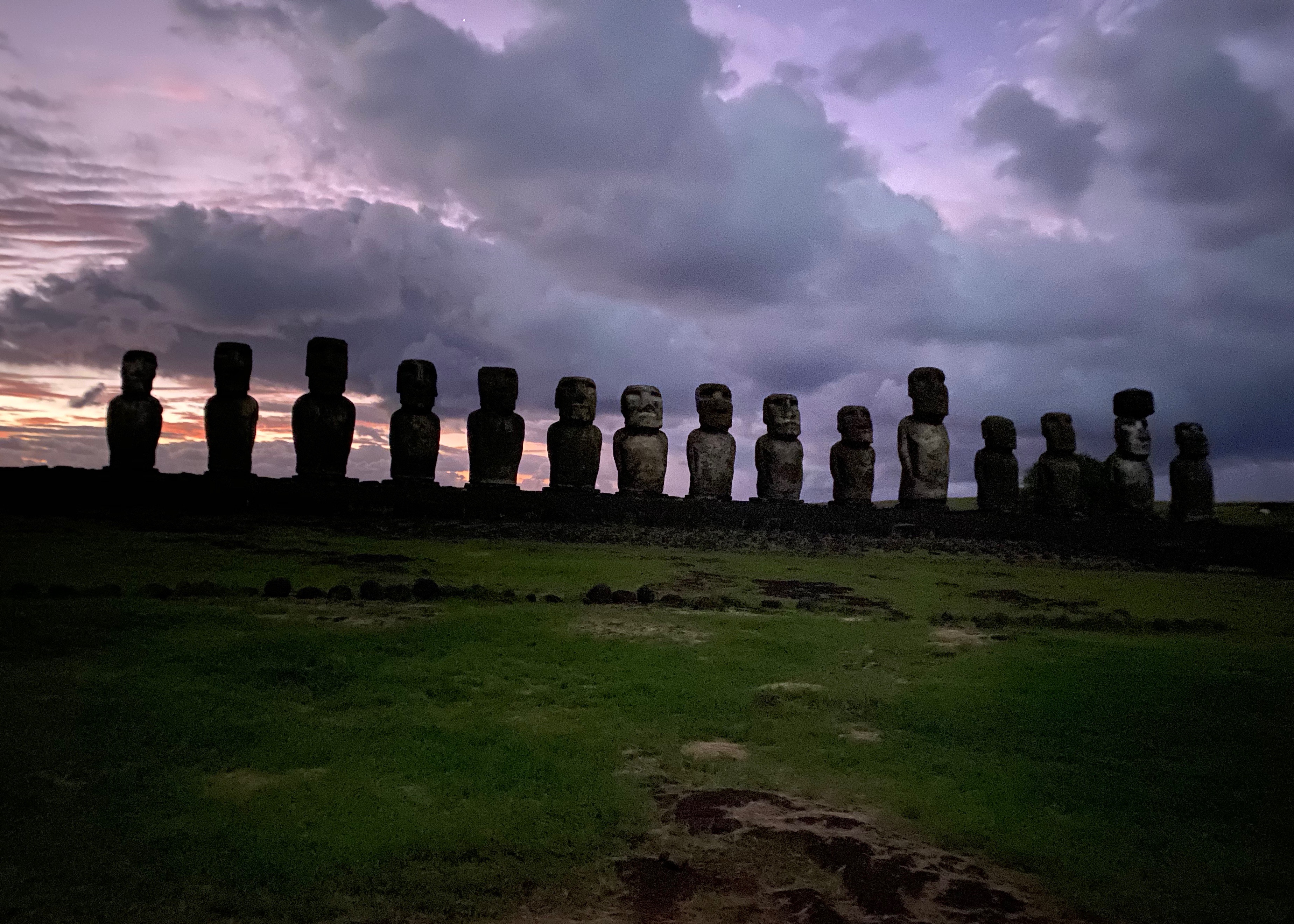
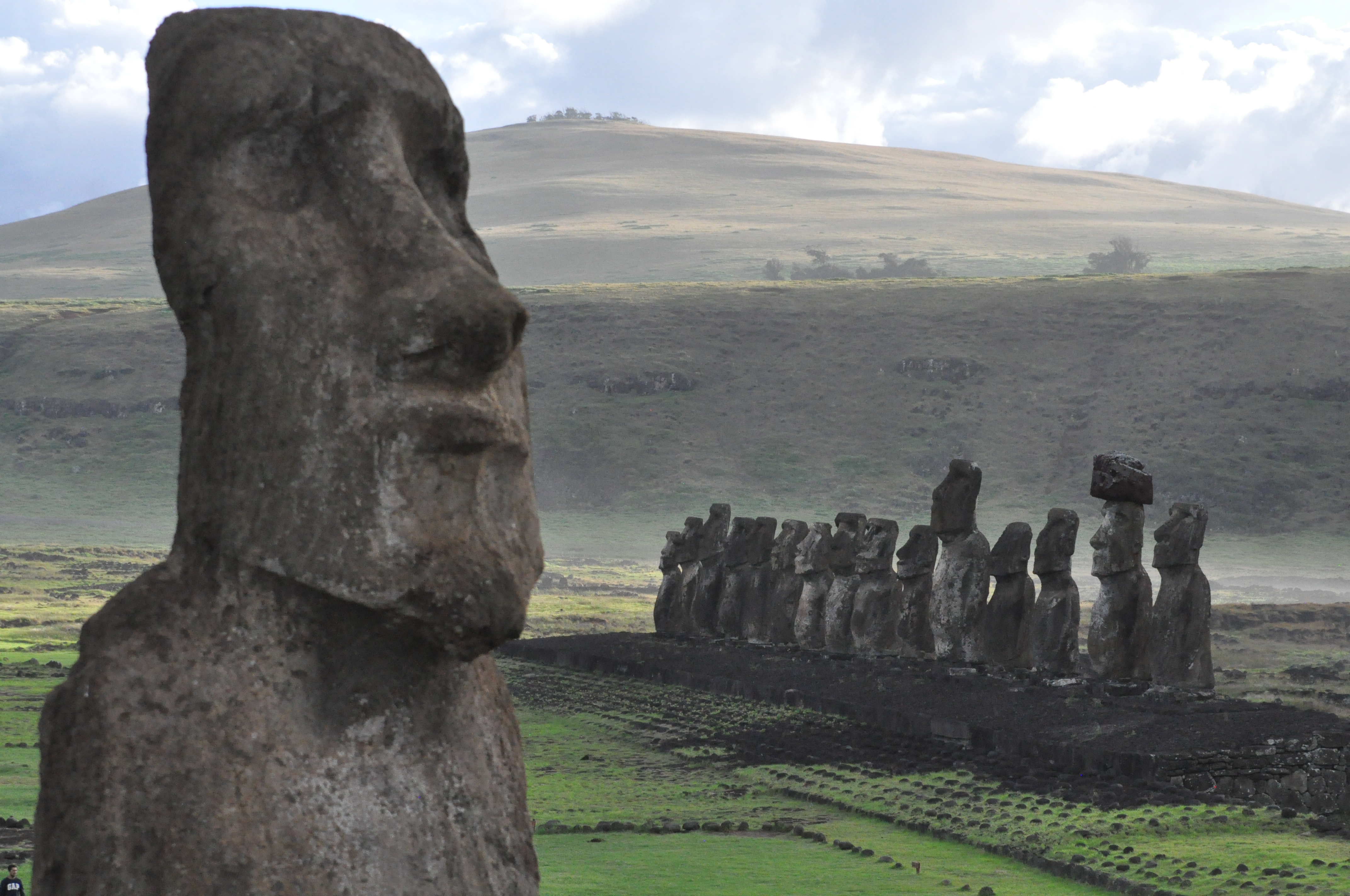
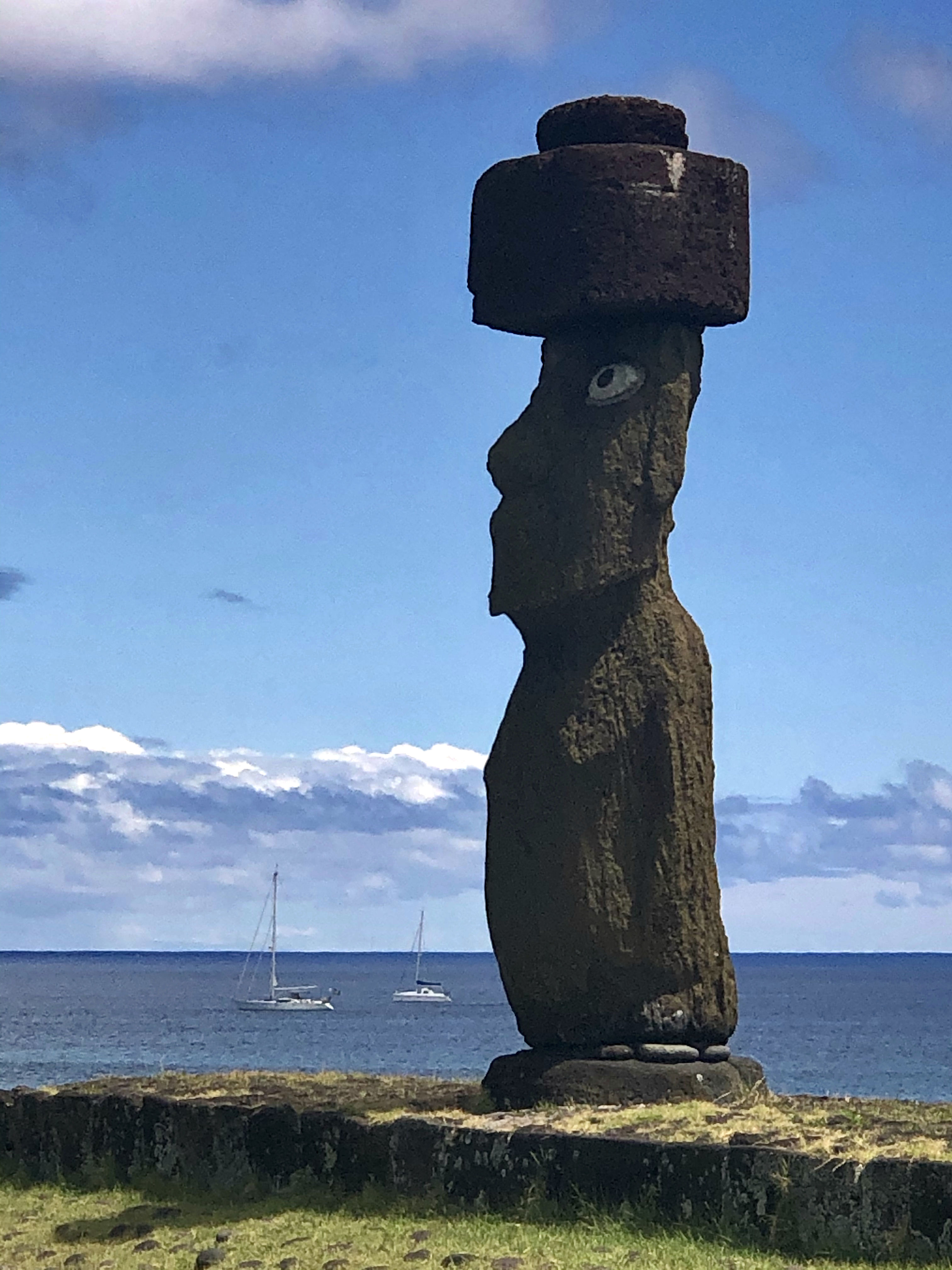
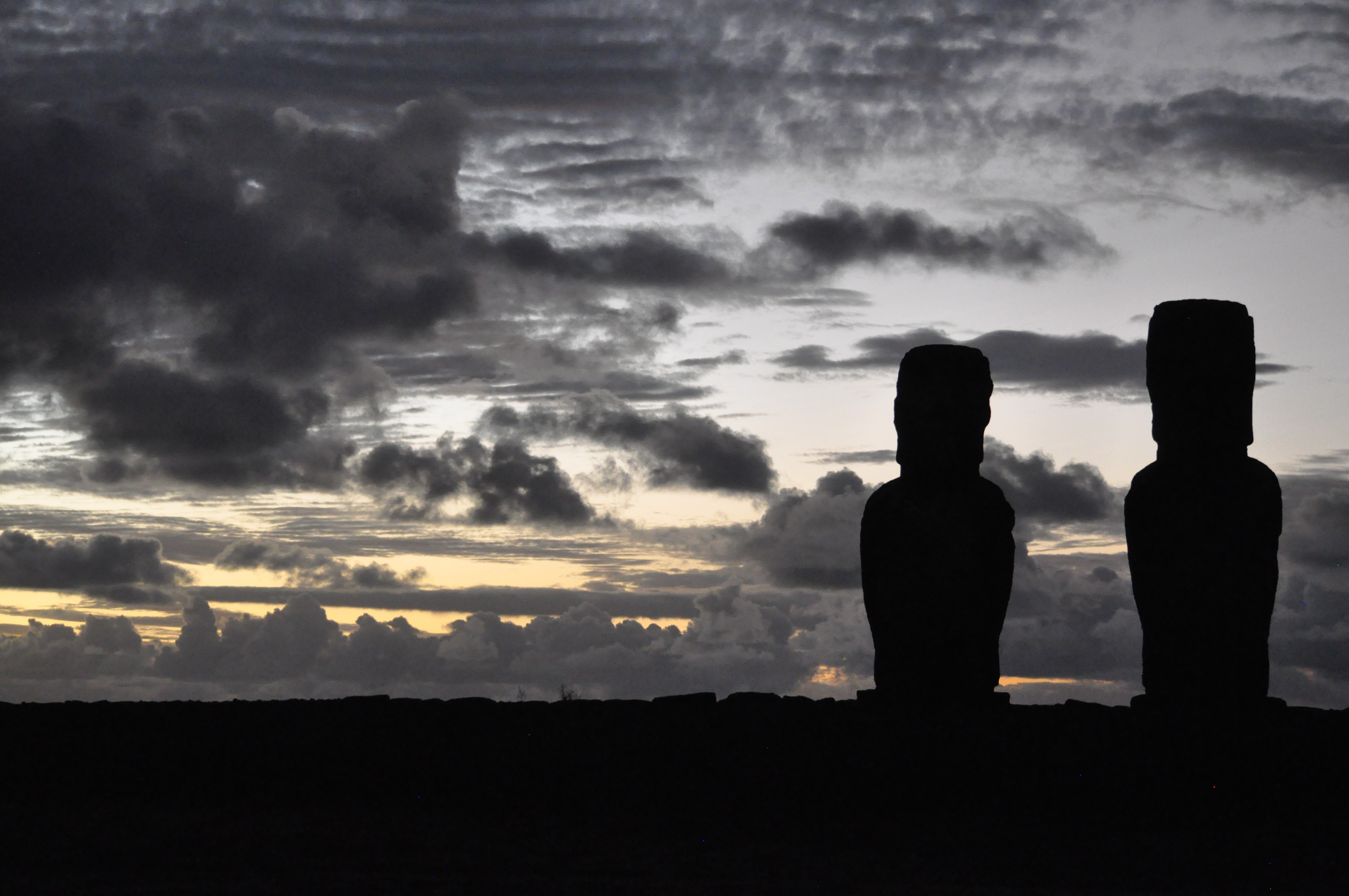
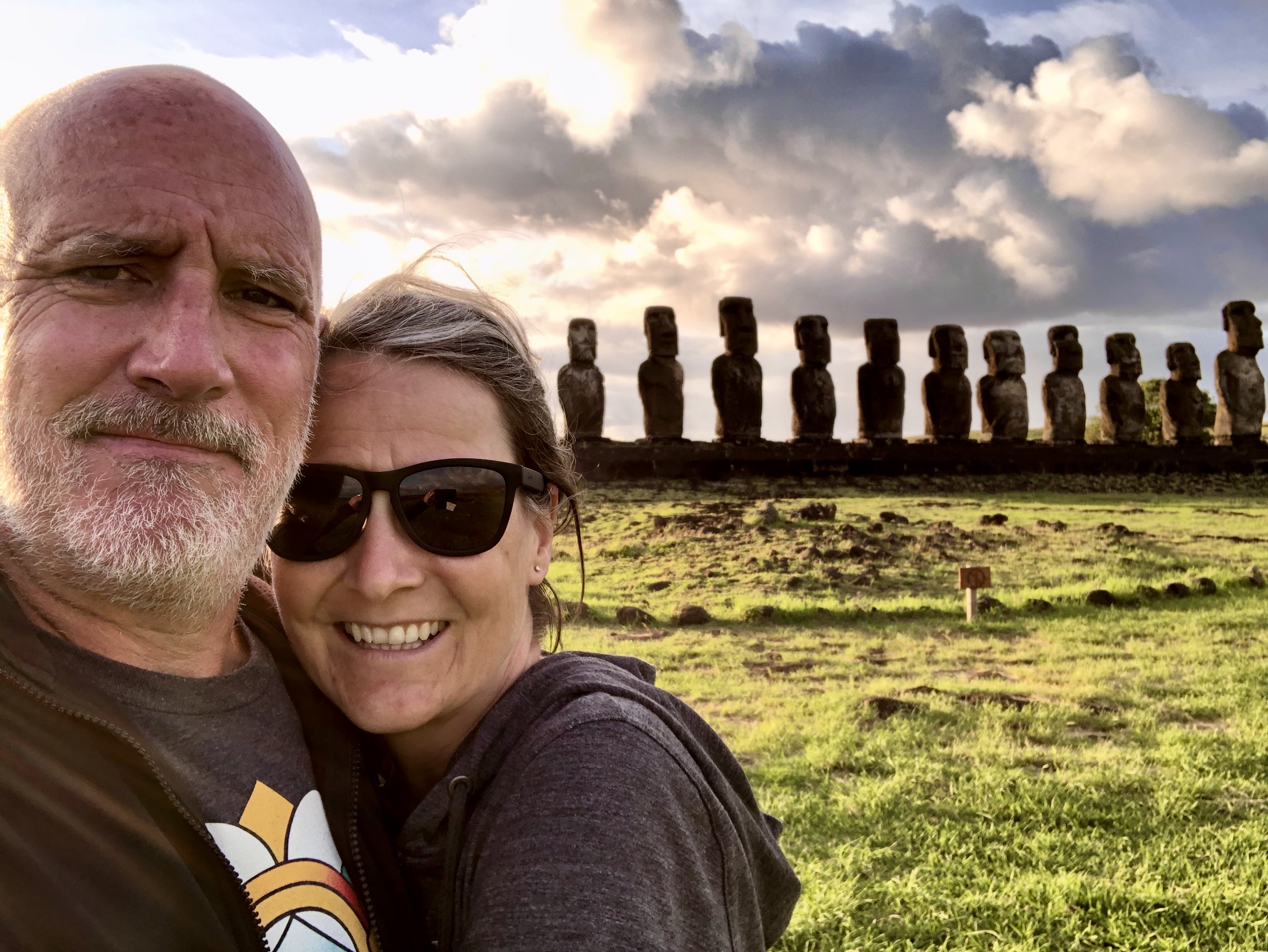
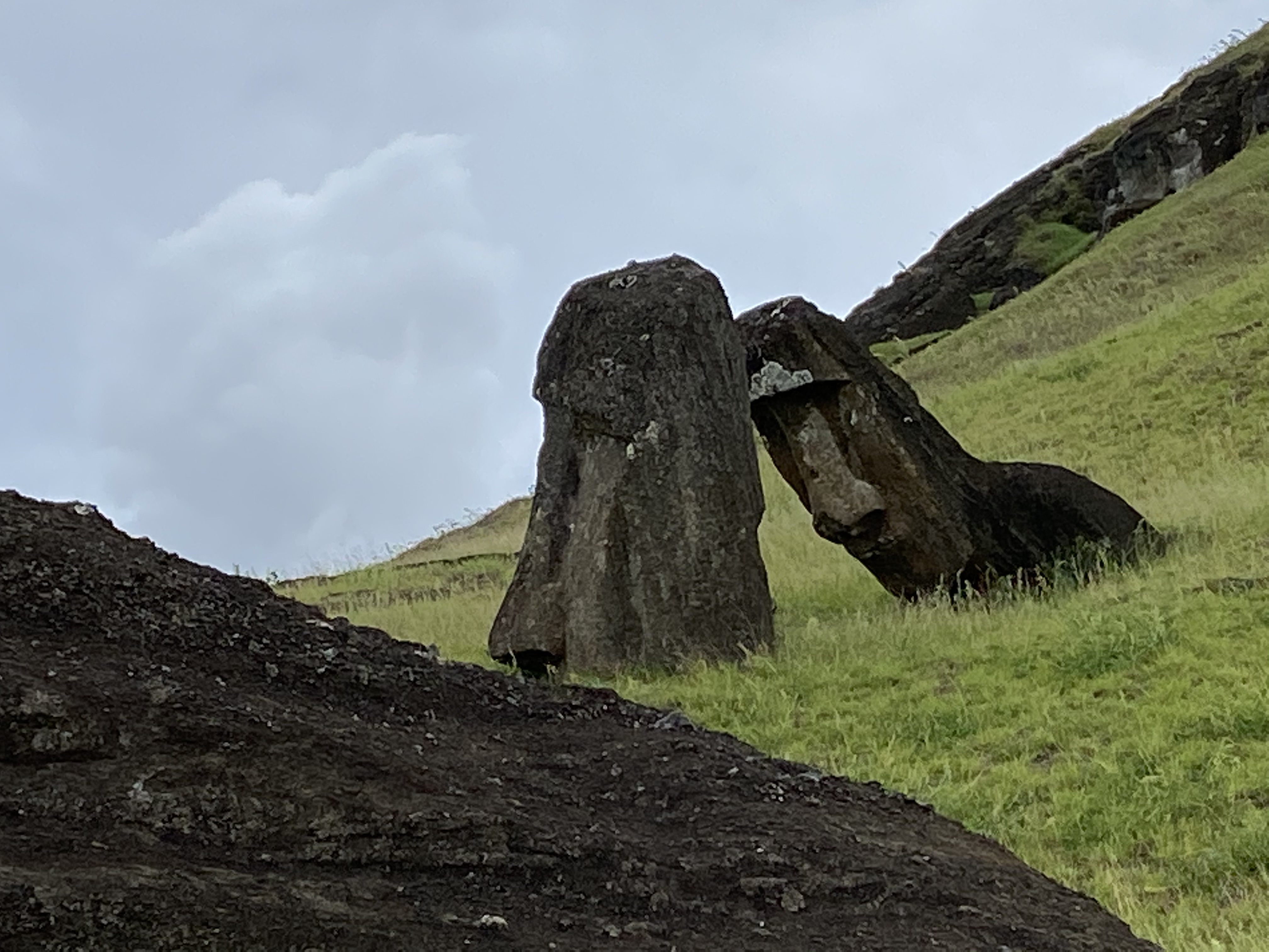
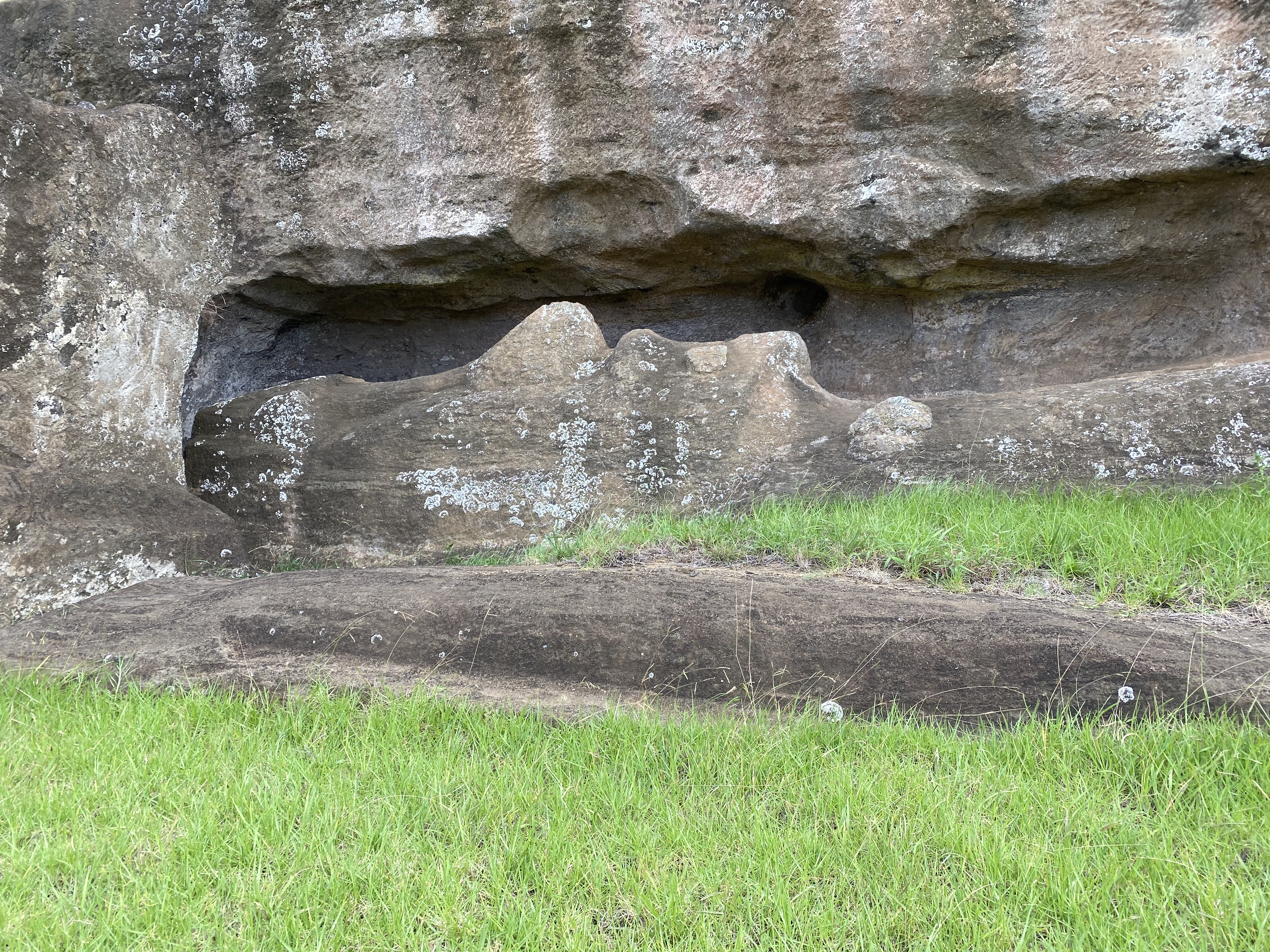
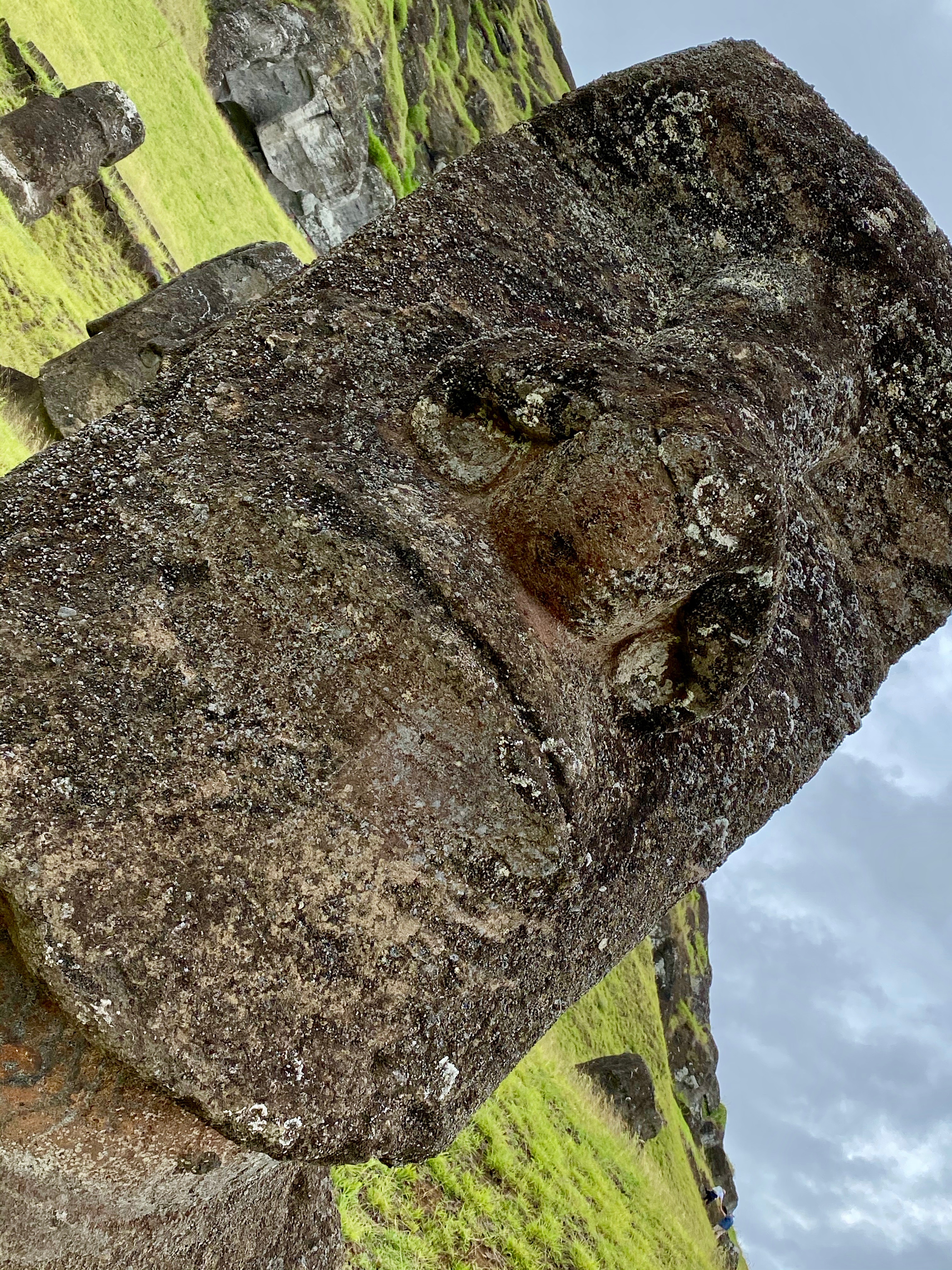
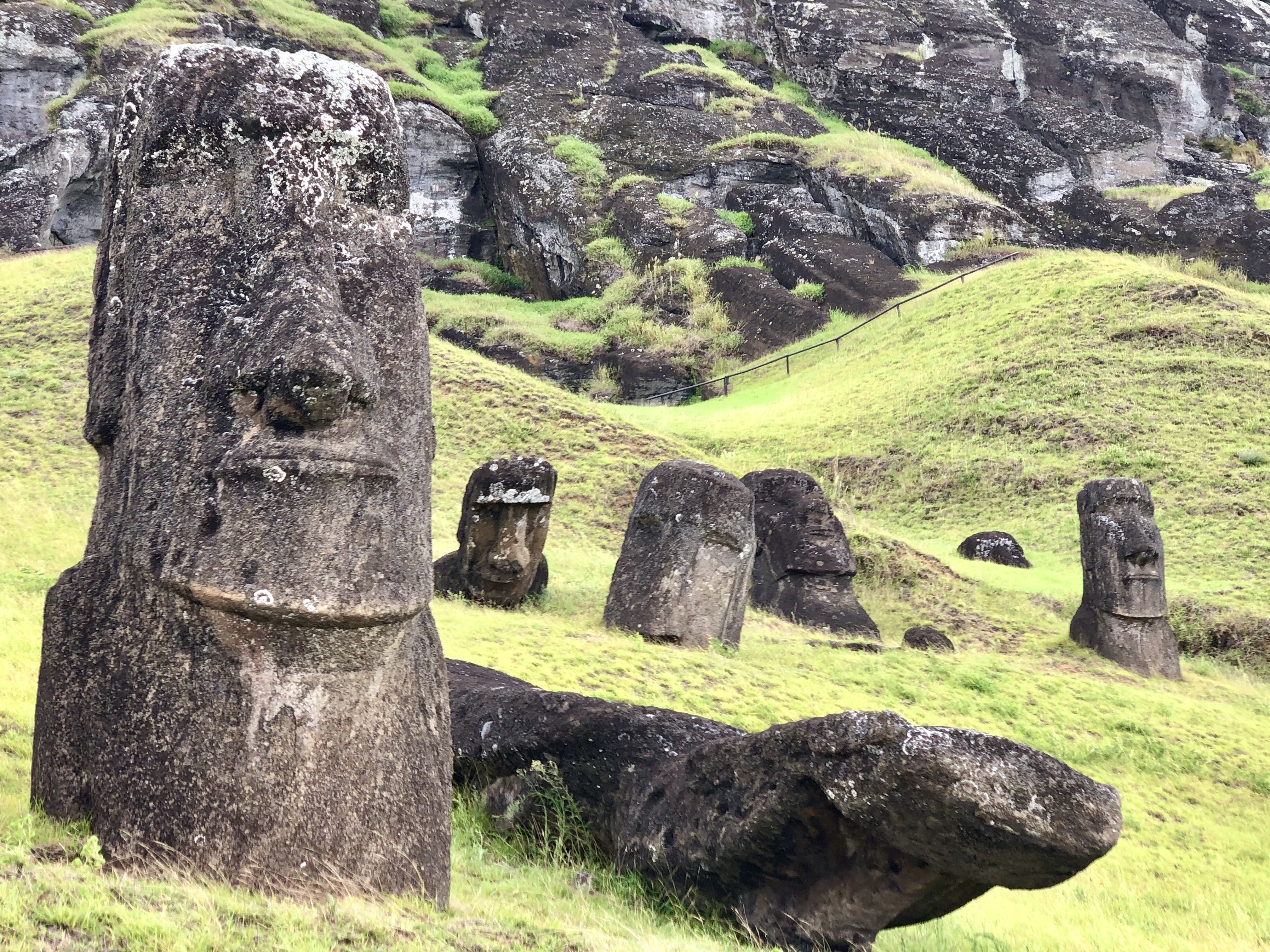
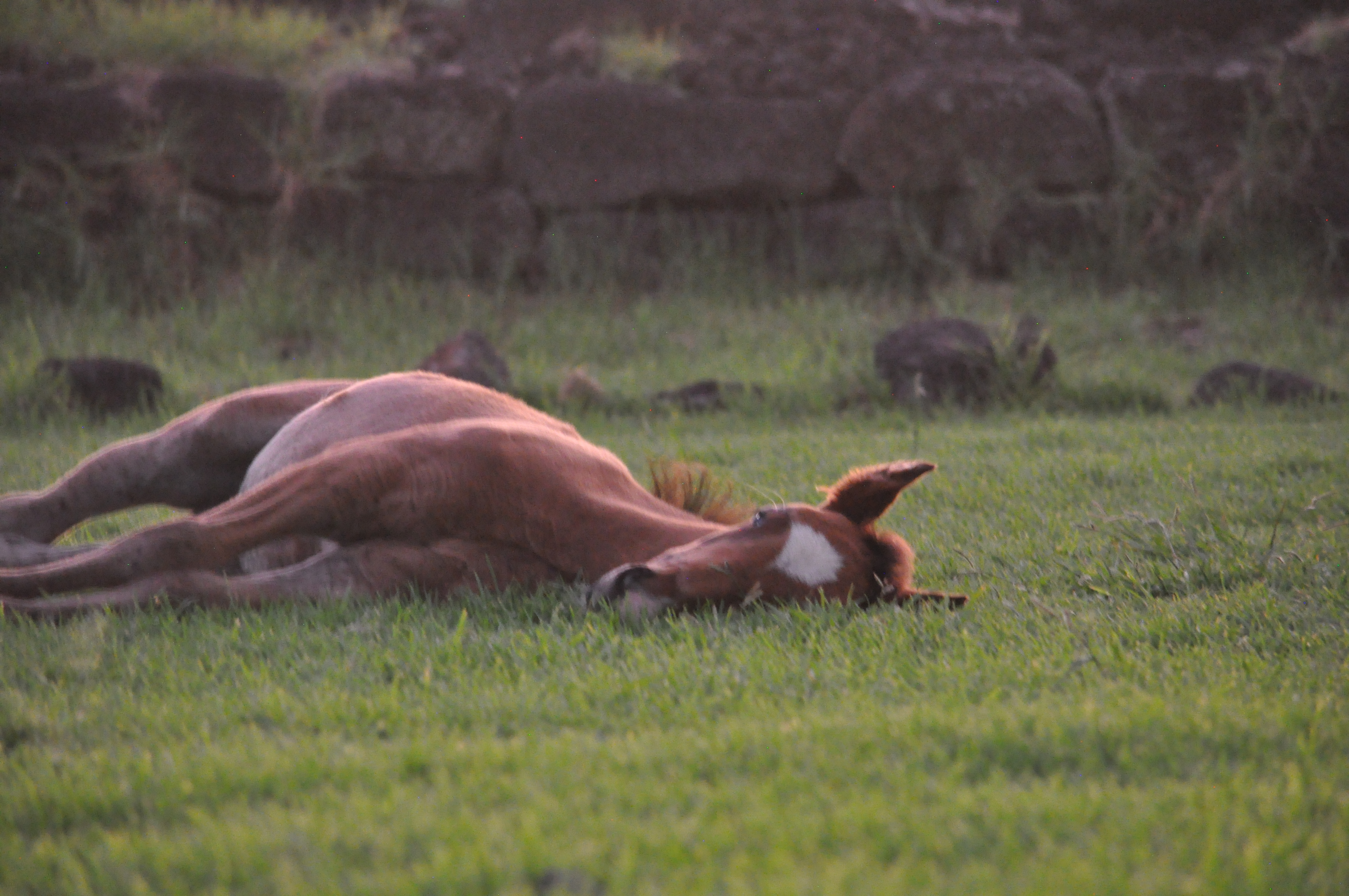
The island has close to 1000 moai. These iconic monolithic statues were believed to be carved between 1250 A.D. and 1500 A.D. from the compressed volcanic ash of the island and are found dotted throughout the landscape. In several areas, they have been restored and sit in groups atop of traditional altars called ahu. In many places though, they are face down, half-carved or broken in fields shared with horses and cows. The moai are full body statues but it is their oversized heads that they are famous for. As we wandered around the island searching out the scattered moai, we entertained ourselves by speculating about the various expressions on their faces – pensive, calm, amused – each one was quite unique.

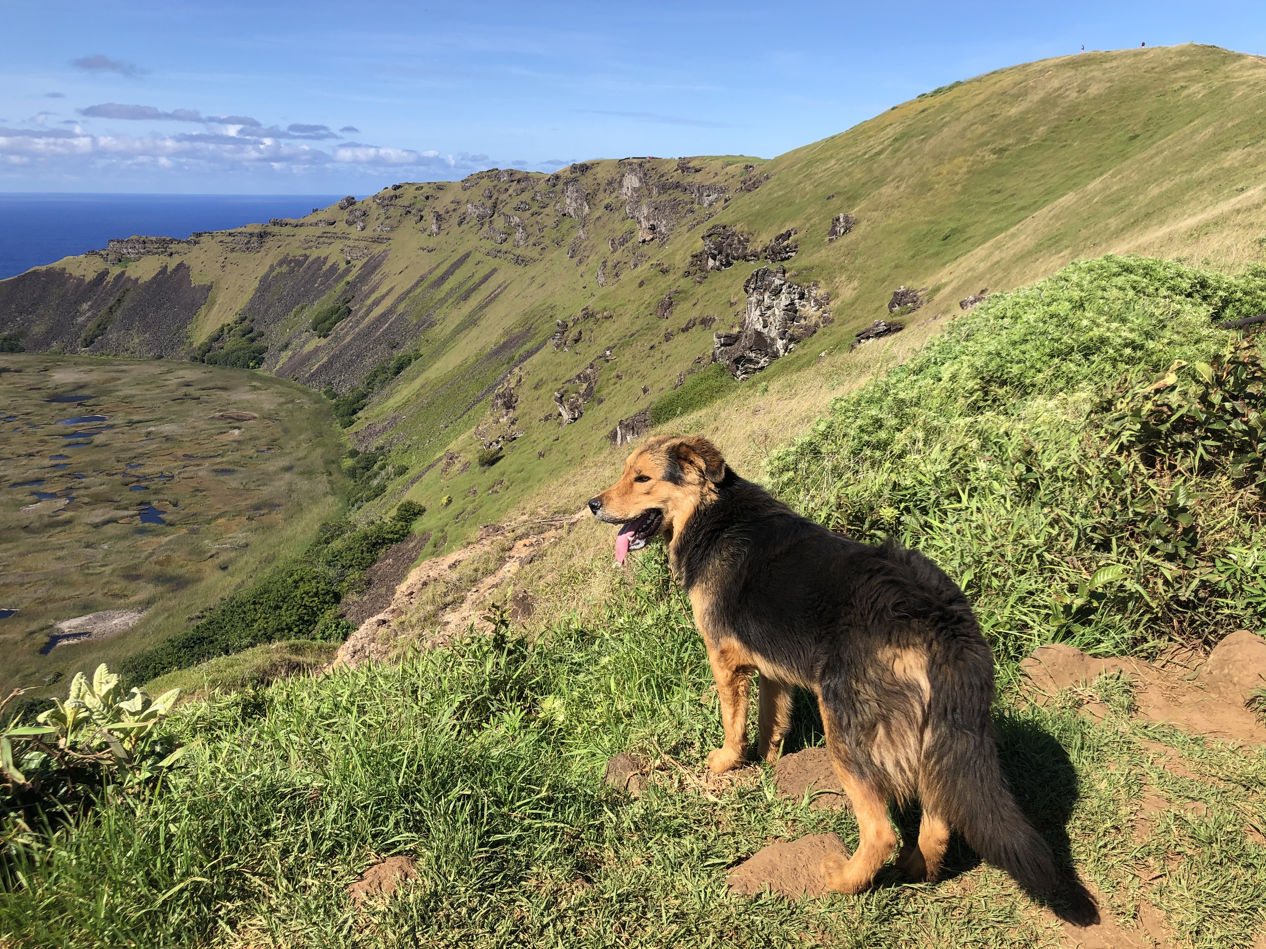
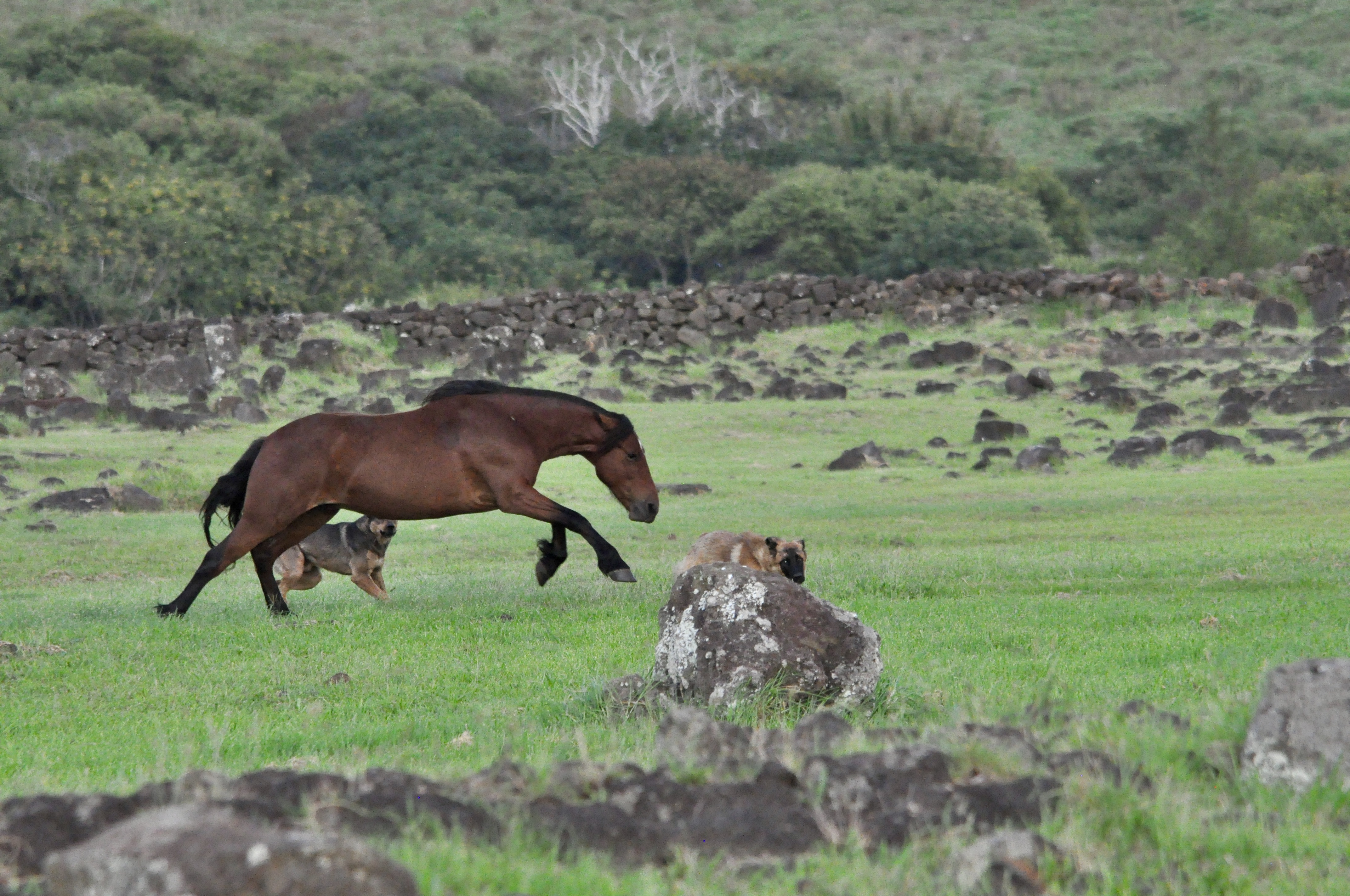
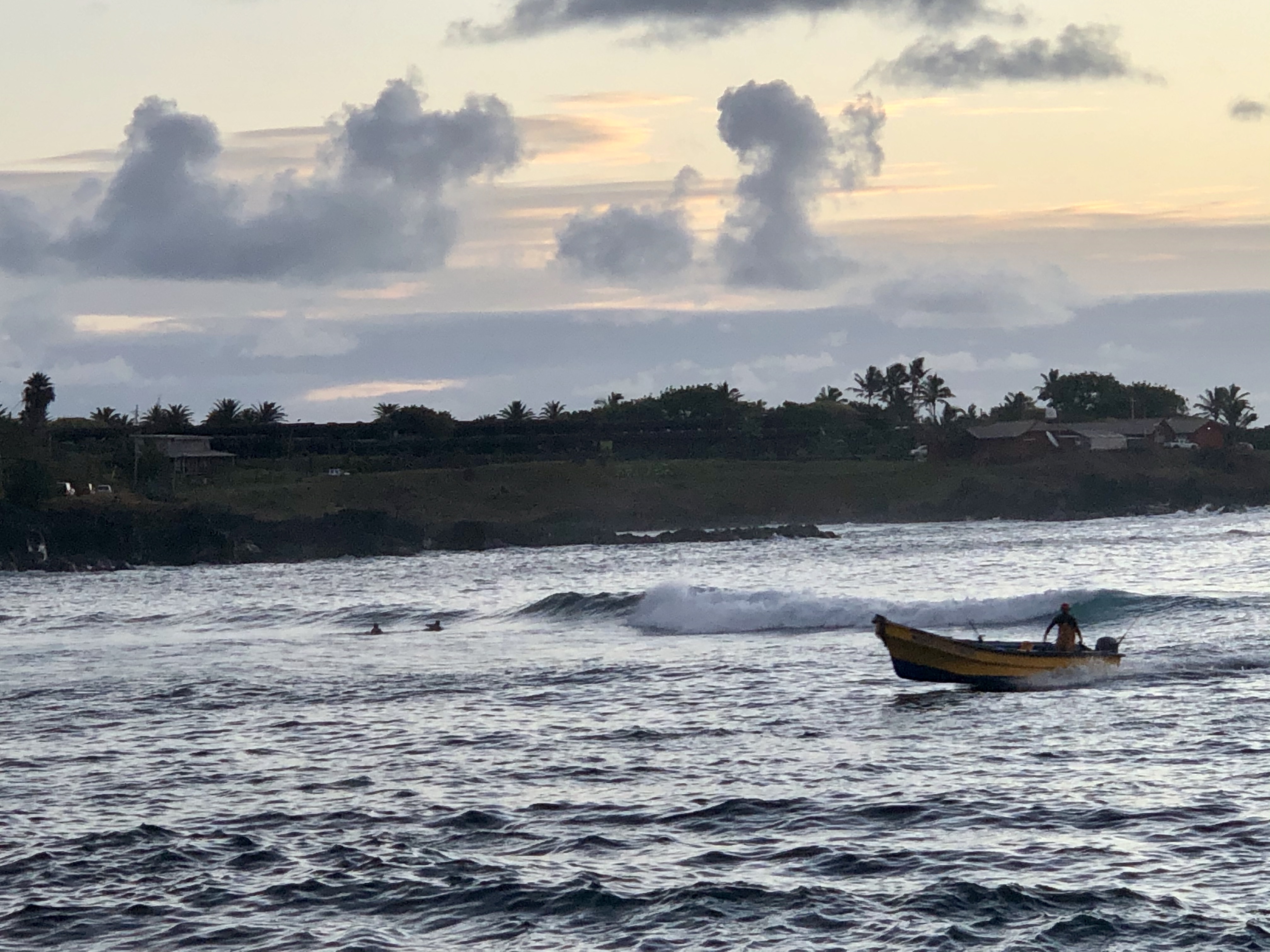
Beyond the moai, we really enjoyed the tropical beauty and laid-back vibe of the island. People were friendly and welcoming and animals roamed free everywhere. We had a very cool dog follow us (herd us?) from the main town of Hanga Roa for over an hour to the hilltop ancient village of Orongo. It felt like he was a bit of a spirit protecting us on our hike. Horses and cows roamed around everywhere as well. We had to have our wits about us while driving as you never knew when you would come upon a bunch of horses walking down the road. Somewhat less popular with us were the chickens and roosters….specifically the roosters….at 5:00 a.m. every morning right outside our window! OK, OK, we get it – the sun is coming up. They were like a really annoying snooze alarm! lol

Rapa Nui is also known for some of the clearest water in the world. We took advantage and spent an afternoon diving. We hadn’t been diving in a while so were a little rusty but the good folks at the dive shop were very patient with us (me especially). We enjoyed two dives with exceptional visibility. The second dive was to a sunken moai (who knew?) which has become part of the reef. We saw many kinds of tropical fish, corals and two different kinds of sea turtles. In all a successful afternoon under the water! It also refreshed our interest in diving….when the world is back to a more normal state, we are going to try to do a little more underwater adventuring.

You must be logged in to post a comment.